Walking in Gower: a complete planning guide
This planning guide draws on Andy Davies' Cicerone guidebook to help you plan a walking trip to a peninsula that, as the author puts it, packs a glittering array of features into a remarkably compact and unspoilt area. Selected in 1956 as the UK's first Area of Outstanding Natural Beauty (now National Landscape), Gower measures 25km by 13km yet holds many walking routes among its beaches, cliffs and inland valleys. How the walks divide by area, the best time to go, getting to and around the peninsula, and where to stay are covered below. (Last updated: July 2026 · Guidebook edition: Third edition, September 2025)
Walking in Gower, quick facts:
- Location: Gower Peninsula, South Wales
- Total walks: 30 circular day walks
- Distance range: 5–21km (3–13 miles) per walk
- Typical duration: 1–6 hours per walk
- Difficulty: low level throughout, with a range of options from easy short strolls to longer day walks; a fit walker will not find any of the routes particularly strenuous
- Terrain: limestone cliffs, sandy beaches, salt marsh, open moorland, rolling farmland and wooded valleys
- Highest point: Rhossili Down (the Beacon), 193m
- Navigation: rights of way generally well waymarked; 1:25,000 OS mapping extracts and full route descriptions in the guidebook; downloadable GPX tracks
- Best season: year-round, with spring for cliff-top wildflowers, summer for coastal walks combined with a swim, and autumn for the woodlands at their best
- Guidebook: Walking in Gower, Andy Davies, 3rd edition, Cicerone Press
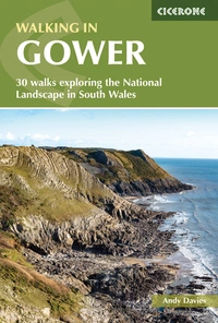
Walking in Gower
30 walks exploring the National Landscape in South Wales
£14.95
Guidebook to walking on the Gower Peninsula in South Wales. Describes 30 circular, low level walks ranging from 3–13 miles (5–21km), taking in a variety of landscapes, including stunning coastal scenery. The selection of routes offer something for all abilities; a fit walker will not find any of them particularly strenuous.
More informationWhat is walking in Gower like?
Walking in Gower is Andy Davies' Cicerone guidebook to the Gower Peninsula, describing 30 circular day walks arranged clockwise around the coast, starting in the south-east at Mumbles and finishing in the north-east at Llanrhidian. All the routes are circular, keep road-walking to a minimum, and are designed to be used alongside the OS Explorer 1:25,000 Gower Sheet 164.
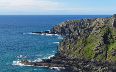
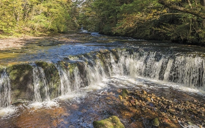
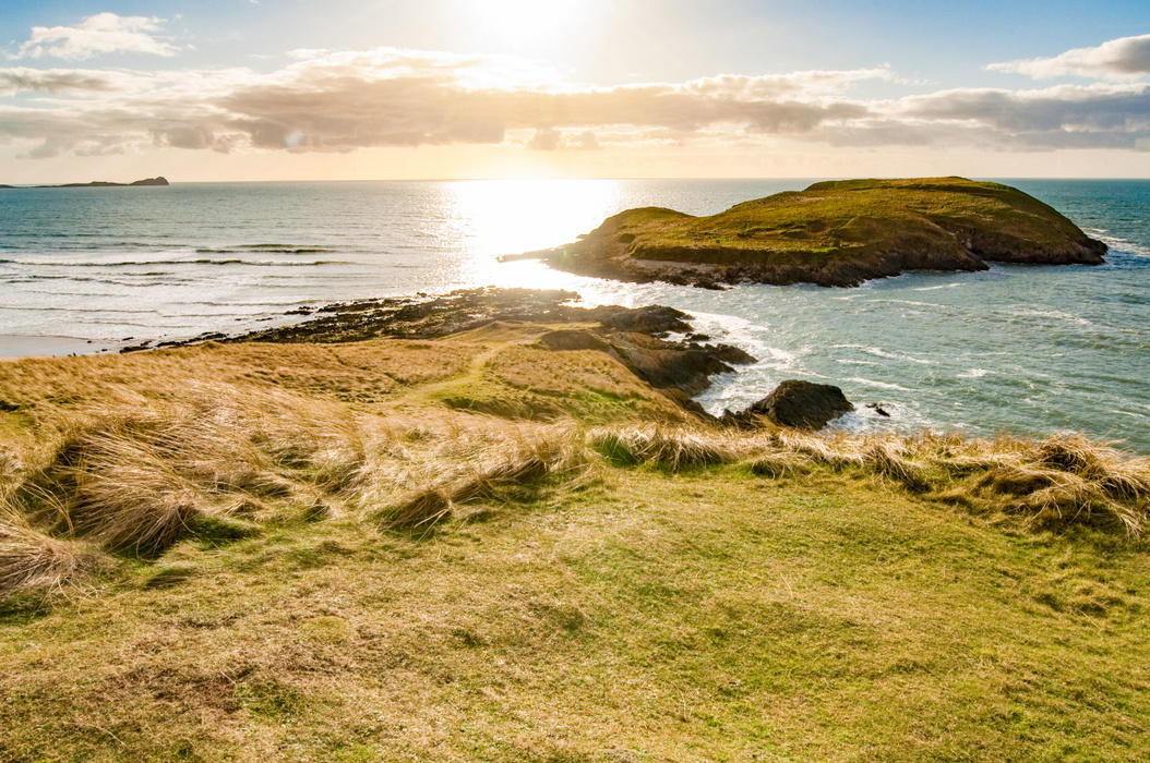
The peninsula is known for its spectacularly steep, rugged coastline and picture-perfect golden sandy beaches, but the guidebook's routes go well beyond the coast path. Many combine a section of coastal path, perhaps visiting a secluded cove or a wide-sweeping beach, with a ridge offering panoramic views or a tranquil stream valley inland, so that a single walk can move from cliff-top exposure to sheltered woodland within a few miles.
Some coastal areas, such as those around Langland, Oxwich and Port Eynon, are already well frequented. Rather than simply retracing the popular routes, the guidebook focuses in the main on the lesser-known parts of Gower where walkers can find peace and solitude, alongside the geology, archaeology and wildlife that give the peninsula its depth. This planning guide answers the most common questions walkers have before setting out. For complete stage-by-stage route descriptions and mapping, see the Cicerone Walking in Gower guidebook.
The 30 walks at a glance
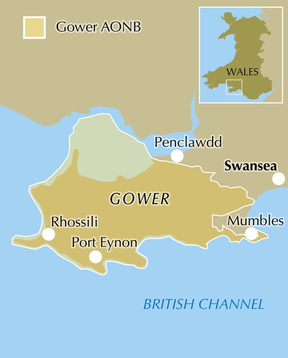
The 30 walks are arranged clockwise from Mumbles to Llanrhidian and roughly follow the shape of the peninsula:
- Mumbles to Bishopston Valley (Walks 1–4): the south-eastern corner, taking in Langland, Caswell and the wooded limestone gorge of Bishopston Valley
- Three Cliffs Bay and Cefn Bryn (Walks 5–11): the heart of the peninsula, combining the iconic Three Cliffs Bay with the open moorland ridge of Cefn Bryn and the Neolithic burial chambers of Parc le Breos
- Oxwich (Walks 12–14): the Oxwich National Nature Reserve and Oxwich Point
- South Gower cliffs, Port Eynon and Rhossili (Walks 15–22): the wild limestone coastline running west to Rhossili Down, Fall Bay, Mewslade Bay and the option of Worm's Head
- Llanmadoc, Llangennith and Broughton Bay (Walks 23–25): the north-western tip, including Burry Holms and Whiteford National Nature Reserve
- Loughor Estuary and Llanrhidian (Walks 26–30): the salt marshes of the north coast, Weobley Castle, Arthur's Stone and Cilifor Top
Which are the best Gower walks to start with?
| Walk | Distance | Time | Why it stands out |
|---|---|---|---|
| The Mumbles, Langland and Caswell | 11.5km (7 miles) | 3hr | Opens the guidebook's clockwise sequence from Mumbles, with easy access by Swansea bus and a gentle introduction to the south-east coast |
| Bishopston Valley | 6.5km (4 miles) | 2hr | A wooded limestone gorge inland, offering a contrast in habitat to the open cliff-top routes elsewhere in the book |
| Three Cliffs Bay, Tor Bay, Oxwich, Nicholaston Woods and Cefn Bryn | 16.5km (10.2 miles) | 4hr 30min | Combines the "standout" Three Cliffs Bay scene with the open moorland ridge of Cefn Bryn |
| Oxwich National Nature Reserve | 4.5km (2.8 miles) to 10.5km (6.5 miles) | 1hr; 2hr 30min with extension | Explores one of Gower's richest wildlife sites, where dune, woodland and salt-marsh habitats meet within a single reserve |
| Rhossili, Fall Bay and Mewslade Bay with Worms Head option | 5.5km (3.3 miles) to 10km (6 miles) | 1hr 30min; 3hr with extension | Includes the tidal extension to Worm's Head, described as an adventure that will not be forgotten |
| Gower Coast NNR, Rhossili Down and Hardings Down | 19.5km (12 miles) | 5hr 30min | Pairs a National Nature Reserve cliff section with the quieter inland ridges |
| Whiteford National Nature Reserve | 10.5km (6.4 miles) | 2hr 30min | Covers the dune and salt-marsh habitat at the mouth of the Loughor Estuary, a stronghold for wintering wading birds |
| Landimore Marsh, Arthur's Stone, Llanrhidian and Weobley Castle | 16km (10 miles) | 4hr 30min | Links the Bronze Age burial chamber of Arthur's Stone with the medieval remains of Weobley Castle in a single north-coast route |
How difficult are the walks, and who are they suitable for?
The routes are low level throughout, ranging from easy short strolls to longer day walks, and the guidebook's own assessment is that a fit walker will not find any of them particularly strenuous. The two main ascents are to the top of Rhossili Down and along Cefn Bryn, and neither is described as taxing. Route finding is generally straightforward, with rights of way that are well marked and, for the most part, provide a good and even walking surface.
Non-coastal sections can vary considerably underfoot depending on recent rainfall, so waterproof boots are recommended outside the drier summer months. With 30 routes ranging from 5km to 21km, the guidebook suits everyone from families looking for a short coastal stroll to walkers wanting a fuller day combining coast, ridge and valley.
When is the best time to walk in Gower?
- Spring: the cliffs and valleys are carpeted in flowers, making this the best season to see Gower's limestone grassland and heathland habitats at their most colourful
- Summer: long days allow coastal walks to be combined with a swim at one of the peninsula's beaches, though the south and north Gower roads can become congested at peak times in the school holidays
- Autumn: the woodlands, such as Bishopston Valley and Park Wood, are at their best
- Winter: wild storms bring dramatic seascapes; winters are seldom severe thanks to the moderating effect of the Atlantic Drift, though the summits of Rhossili Down and Cefn Bryn can feel surprisingly like mountain moorland on a hard, snowy day
Gower is exposed to prevailing south-westerly winds and the weather can change rapidly at any time of year, so it is worth carrying enough clothing, ideally in multiple thin layers, to respond to changing conditions.
What accommodation is available?
Gower is a mature tourist destination well served with hotels, bed and breakfast, self-catering, caravan parks and campsites. The best-located sites book up early, particularly popular spots such as the campsite overlooking Three Cliffs Bay, so advance planning is worthwhile for a summer visit. Mumbles, the largest settlement at the eastern end of the peninsula, makes a good base with the widest choice of accommodation and easy access back onto the coast path. For up-to-date listings, the guidebook points readers to Swansea Bay's visitor website.
Getting to and around Gower
Gower is well served by the M4 motorway from both east and west, and there is a direct Intercity 125 train service from Cardiff, Bristol and London into Swansea, with regular buses from Swansea to the peninsula's main villages. Traveline Cymru (0800 464 0000, traveline.cymru) has up-to-date public transport information.
Once on the peninsula, two main roads run east to west, with minor routes linking them north to south. Both the north and south Gower roads become severely congested during peak times in the summer school holidays, so allow extra time or consider using the bus links noted in the guidebook.
What are the highlights of walking in Gower?
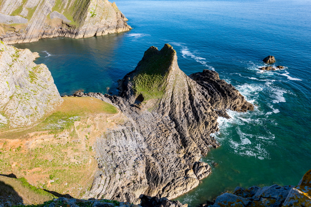
- Rhossili Bay and Down: three miles of sand backed by the highest point on Gower, with the option to continue out to Worm's Head
- Three Cliffs Bay: the "standout picture-postcard scene," with its ruined castle, estuary and sea arch
- Worm's Head: a tidal headland reachable only around low tide, described in the guidebook as an adventure not to be forgotten
- Cefn Bryn: an open moorland ridge running through the centre of the peninsula, with Bronze Age cairns and the Arthur's Stone burial chamber
- Parc le Breos and the limestone caves: Neolithic chambered tombs and cave sites, including the area associated with the Palaeolithic "Red Lady of Paviland" find
- Whiteford and the Loughor Estuary salt marsh: one of the largest salt marshes in Britain, and a major wintering ground for wading birds and wildfowl
Walking in Gower
30 walks exploring the National Landscape in South Wales
£14.95
Guidebook to walking on the Gower Peninsula in South Wales. Describes 30 circular, low level walks ranging from 3–13 miles (5–21km), taking in a variety of landscapes, including stunning coastal scenery. The selection of routes offer something for all abilities; a fit walker will not find any of them particularly strenuous.
More informationPlan your Gower walks with the Cicerone guidebook
Walking in Gower by Andy Davies contains everything you need to plan and complete these 30 routes, from Mumbles round to Llanrhidian.
- 30 circular routes covering the full length of the Gower Peninsula, including sections of the Wales Coast Path
- Clear, step-by-step route descriptions supported by 1:25,000 OS mapping extracts
- Practical information on parking at popular beaches and headlands, bus links from Swansea, and local facilities
- Insight into Gower's limestone geology, prehistoric burial chambers, medieval churches and wildlife habitats
- Downloadable GPX files for every route
- A route summary table to help match walks to your time, fitness and ambition
- Appendix A: local points of interest index
- Appendix B: useful websites
Available as a printed guidebook (£14.95) or digital eBook.
About Andy Davies, guidebook author
Andy has been a professional photographer for over 20 years and specialises in wildlife and landscape photography. He moved to West Wales in 1999 to be immersed in the environment which inspires him and wrote and photographed Coastline Wales in 2008.
He regularly takes his stills and video cameras underwater and is currently working on a number of new books and video projects. He specialises in the production of high definition timelapse video and pursues an active interest in wildlife fine art photography. A recent acquisition is a high quality microscope allowing another world to be explored.
A former university lecturer, he now combines his love of photography and his passion for passing on skills to others in a series of photographic and video workshops in West Wales. He is also an external tutor for Aberystwyth University in outdoor and wildlife photography.
Andy, together with colleague Dave Whittaker, produced a new edition of Walking on the Brecon Beacons in 2009 and wrote the first edition of Walking on Gower in 2012. He works for Aqua-Firma Worldwide as a marine nature conservation and photographic consultant and guide.