Walking in the Yorkshire Dales: North and East (Swaledale, Wensleydale, Nidderdale and the Howgills): a complete planning guide
The Yorkshire Dales is like nowhere else in England. Bestriding the central Pennines, the backbone of the country, this compact upland world of interwoven horizons rewards the walker with something that grander mountain landscapes rarely deliver: an intimacy between the hills and the valleys they enclose. Walking in the Yorkshire Dales: North and East by Dennis and Jan Kelsall is a collection of 43 circular day walks exploring the northern and eastern reaches of the National Park, from the smooth green flanks of the Howgill Fells to the heather moors above Swaledale, the broad pastures of Wensleydale and the limestone gorges of Nidderdale. Walks range from 5 to 19 km (3 to 12 miles), with something for every level of walker. (Last updated: June 2026 · Guidebook edition: 2nd edition, March 2022)
Walking in the Yorkshire Dales: North and East, quick facts:
- Location: Yorkshire Dales National Park and surrounding AONBs, North Yorkshire and Cumbria
- Total routes: 43 circular day walks
- Distance range: 5 to 19 km (3 to 12 miles) per walk
- Typical duration: Half a day to a full day
- Difficulty: Easy to challenging; gentle valley strolls to demanding fell walks
- Terrain: Limestone valleys, grassy Howgill ridges, heather moorland, riverside paths, upland plateau
- Highest point: Great Shunner Fell, 716m
- Navigation: Step-by-step route descriptions supported by 1:50,000 OS map extracts; compass competence recommended for upland routes
- Best season: April to October; many routes accessible year-round in settled conditions
- Guidebook: Walking in the Yorkshire Dales: North and East, Dennis and Jan Kelsall, 2nd edition
Walking in the Yorkshire Dales: North and East
Howgills, Mallerstang, Swaledale, Wensleydale, Coverdale and Nidderdale
£12.95
This guidebook contains 43 circular day walks in the north and east Yorkshire Dales. It explores the dales, hills and moors between Kirkby Stephen and Pateley Bridge. Walking ranges from gentle 3 mile strolls to more strenuous day-long rambles across the Howgills, Wensleydale, Swaledale, Nidderdale, Mallerstang and Coverdale.
More informationWhat is Walking in the Yorkshire Dales: North and East?
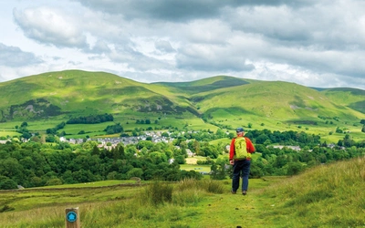
Walking in the Yorkshire Dales: North and East is the second of a two-volume Cicerone guidebook set covering the full extent of the Yorkshire Dales National Park. This volume gathers 43 circular day walks across the northern and eastern dales: the Howgill Fells, the wild valley of Mallerstang, Swaledale and Arkengarthdale, Wensleydale and Coverdale, and Nidderdale. Routes fan out from key Dales towns including Sedbergh, Kirkby Stephen, Hawes, Aysgarth and Pateley Bridge, covering the terrain between Kirkby Stephen in the north and the great limestone formations of Nidderdale in the south-east.
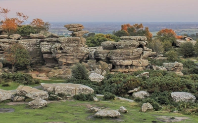
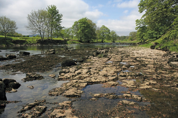
The landscape here is shaped by the Yoredale Series of rocks, a layered sequence of limestones, shales and sandstones that produces the stepped valley profiles, cascading waterfalls and varied vegetation so characteristic of Wensleydale and Swaledale. The Howgills stand apart, their rounded, steeply buttressed summits geologically closer to the Lake District than the rest of the Dales, offering long ridge walks above deep ravines. Nidderdale, excluded from the National Park but designated a National Landscape, brings limestone gorges, stretches of broadleaved woodland and the spectacular rock formations of Brimham Rocks to round out one of the most varied walking collections in northern England.
What sets the northern and eastern Dales apart from the south-west is the density of human history layered into the landscape. Swaledale in particular carries the visible legacy of centuries of lead mining, its flanking hillsides threaded with the ruins of smelt mills and hushing channels that only add to the appeal of exploring the area. The quiet fell-top coffin roads, the Norse-named villages, the isolated field barns of Wensleydale: all of this is walking country where the human story and the natural landscape are genuinely inseparable. This planning guide answers the most common questions walkers have before setting out. For complete route descriptions and mapping, see the Cicerone Walking in the Yorkshire Dales: North and East guidebook.
Walking the Yorkshire Dales: South and West is also available from Cicerone.
How are the walks in the Yorkshire Dales: North and East arranged?
The 43 walks are organised into five geographic chapters, each covering a distinct area of the northern and eastern Dales.
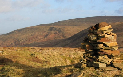
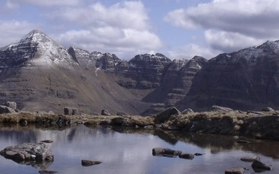
- The Howgill Fells (9 walks): Steep, grassy ridges above deep ravines, with long summit panoramas reward the effort of getting onto the tops.
- Mallerstang (3 walks): A remote north-facing valley with ridge walking on Wild Boar Fell and High Seat above the infant River Eden.
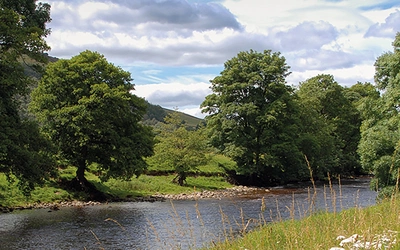
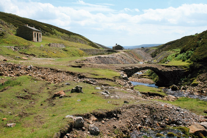
- Swaledale and Arkengarthdale (12 walks): Lead-mining heritage, dramatic waterfalls, Norse-named villages and sweeping open moorland.
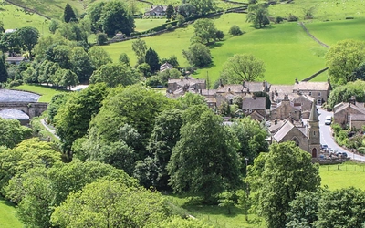
- Wensleydale and Coverdale (13 walks): The broadest and most pastoral of the northern dales, with the famous falls at Aysgarth and Hardraw and the market town of Hawes at its heart.
- Nidderdale (5 walks): Limestone gorges, the striking rock formations of Brimham Rocks, How Stean Gorge and a chain of upland reservoirs.
Eight routes that capture the range of the guidebook:
| Walk | Area | Distance | Time |
|---|---|---|---|
| Winder, Calders and the Calf | Howgill Fells | 15.7km (9¾ miles) | 4hr 45min |
| Wild Boar Fell and Swarth Fell | Mallerstang | 12.9km (8 miles) | 3hrs 30min |
| Gunnerside Gill | Swaledale | 11.3km (7 miles) | 3hrs |
| Great Shunner Fell from Hardraw | Wensleydale | 16.9km (10½ miles) | 4hr 15min |
| Aysgarth Falls | Wensleydale | 6.4km (4 miles) | 1hr 30min |
| Muker, Thwaite and Kisdon Force from Keld | Swaledale | 13.3km (8¼ miles) | 3hr 30min |
| Brimham Rocks | Nidderdale | 8.4km (5¼ miles) | 2hr 15min |
| Cautley Crag and the Calf | Howgill Fells | 11.3km (7 miles) | 3hr 15min |
Who are the walks suitable for?
The collection is genuinely broad in its ambition and covers every level of walking ability. Shorter valley routes, such as the stroll along the River Swale from Gunnerside or the walk to Aysgarth Falls, are accessible to families and newcomers who want to experience the Dales without committing to a full day on the fells. Longer routes across the Howgills or the ridge above Mallerstang are more demanding, requiring a reasonable level of fitness and competence with map and compass.
Dog walkers are well catered for across much of the area, though the northern grouse moors impose seasonal restrictions: dogs may only be taken on designated public footpaths (not open access land) outside of stated periods. Walkers new to upland walking are advised to start with the lower-level valley routes and build confidence before tackling the more exposed fell-top walks, where mist can descend quickly and paths become less distinct.
How difficult is walking in the Yorkshire Dales: North and East?
No walk in the guidebook is technically demanding in the mountaineering sense, but the range from easy to challenging is real. The Dales are hilly rather than mountainous, and total ascent across the 43 walks ranges from around 80m to 855m. Gradients tend to be concentrated: the valley floors are often gentle, but the transition onto the upper moors can be abrupt, particularly on the Howgill Fells where the flanks rise steeply from deep-cut ravines.
Navigation requires attention on the upper moors, where paths can be indistinct or absent, and in poor visibility the terrain can disorientate inexperienced walkers. The authors are direct about this: map and compass competence is expected for the more demanding routes. Each walk is supported by a 1:50,000 OS map extract, but walkers are advised to carry the relevant full OS Explorer sheet (OL30 for the northern and central areas, OL19 for the Howgills, Explorer 298 for Nidderdale).
What accommodation is available in the Yorkshire Dales?
The northern and eastern Dales are well served by accommodation, concentrated in the market towns and larger villages. Hawes (Wensleydale), Reeth (Swaledale) and Pateley Bridge (Nidderdale) are the most practical hubs, each offering a range of bed and breakfast, inn and hotel accommodation within easy reach of multiple walks. Sedbergh is the natural base for the Howgill Fells, and Kirkby Stephen serves Mallerstang and the northern approaches well.
Accommodation thins out in the upper valleys, particularly in Mallerstang, which has no pub and only scattered farmsteads as far south as Nateby. Wild camping is not formally permitted within the National Park without landowner permission, though the CROW Act designates much of the upland as open access land for day use. The Yorkshire Dales National Park accommodation search is available at www.yorkshiredales.org. The guidebook appendix carries further listings.
How do I get to the Yorkshire Dales: North and East?
The Settle-Carlisle railway line is the most useful rail access for the northern Dales, with stations at Ribblehead, Dent, Garsdale and Kirkby Stephen providing access to the western edge of the area. Pateley Bridge and Nidderdale are most practically reached by car from Harrogate or Leeds. Hawes and Reeth have no rail access but are served by seasonal Dales Bus services; the Dales Bus website carries full timetables.
For walkers arriving by car, the road network into the upper dales is narrow, often single-track, and carries farm traffic at all hours. Parking at the walk start points is mostly in designated national park car parks; revenue supports visitor services across the park. Leaving the car behind opens the possibility of linear walks between dales rather than the circular routes that dominate the guidebook, and the authors specifically recommend this approach for walkers who want to appreciate the connections between valleys.
When is the best time to walk in the Yorkshire Dales: North and East?
The Dales can be walked year-round, but the experience varies considerably by season.
- Spring (April to May): The limestone grasslands come alive with buttercup, vetch, rock rose, cranesbill and campion. Hay meadows in Swaledale are at their most flower-rich in late May and June, making this the finest season for colour in the valleys. Rivers run full after winter, which adds to the drama of Aysgarth Falls and Hardraw Force.
- Summer (June to August): Long days and settled weather make this the peak visitor season. Popular starting points such as Aysgarth and Hawes fill up at weekends; routes from Sedbergh and into the upper Swaledale valleys are quieter. Heather on the moors begins to colour in late July.
- Late summer and autumn (late August to October): The heather blazes purple across the upland moors through August and into September, and the autumn colour in Nidderdale's broadleaved woodlands extends the season well into October. Grouse-shooting season (12 August onwards) can bring access restrictions on some moors.
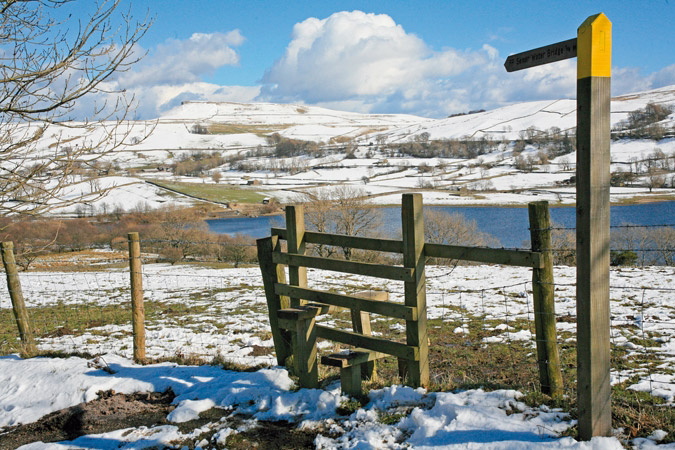
- Winter (November to March): Many routes remain walkable in fine conditions, but the higher fell routes and ridge walks demand full winter kit, navigation confidence, and awareness that conditions can deteriorate rapidly. The valley routes of Nidderdale and lower Wensleydale are often rewarding even in midwinter.
The shoulder seasons of May and September offer the best combination of settled weather, reasonable visitor numbers and outstanding scenery.
What is the lead-mining heritage of Swaledale?
Swaledale is one of the most intensively lead-mined landscapes in Britain, and the evidence is impossible to miss. The flanking hillsides above Gunnerside and Keld are laced with the ruins of dressing floors, smelt mills, hushing channels and waste heaps, some of it dating back to Roman-period exploitation. The industry peaked between the mid-18th and early 19th centuries, before foreign competition and exhausted seams brought it to an end. It has been estimated that over half a million tonnes of metallic lead were extracted from Swaledale alone, with more than half coming solely from the Old Gang mines above Surrender Bridge, which features in Walk 18 of the guidebook.
This industrial history does not diminish the landscape: the authors note that the mossgrown ruins and grassed-over spoil heaps have now assumed an almost natural quality, adding another dimension to the pleasure of exploring the area. Walkers planning the Swaledale chapter routes will find that following the miners' tracks is as much a part of the experience as the fell scenery above.
Walking in the Yorkshire Dales: North and East
Howgills, Mallerstang, Swaledale, Wensleydale, Coverdale and Nidderdale
£12.95
This guidebook contains 43 circular day walks in the north and east Yorkshire Dales. It explores the dales, hills and moors between Kirkby Stephen and Pateley Bridge. Walking ranges from gentle 3 mile strolls to more strenuous day-long rambles across the Howgills, Wensleydale, Swaledale, Nidderdale, Mallerstang and Coverdale.
More informationPlan your walk with the Cicerone guidebook
The Cicerone Walking in the Yorkshire Dales: North and East guidebook by Dennis and Jan Kelsall contains everything you need to plan and walk all 43 circular day walks across the northern and eastern Dales, from the Howgill Fells to Nidderdale.
- 43 circular route descriptions with detailed access notes, parking information, and notes on refreshments along the way
- 1:50,000 OS map extracts for every walk, with step-by-step route descriptions to support navigation on the trail
- Full background chapters on geological history, human settlement, industry and farming in the Dales, and plants and wildlife
- Practical sections covering navigation, clothing and footwear, food and drink, car and public transport access, and using the guide
- Suggestions for combining routes to create longer days out, with notes on the most demanding sections of each walk
- Appendices covering route summaries and further reading
Available as a printed guidebook (£12.95) or digital eBook. A separate guidebook to Walking in the Yorkshire Dales: South and West is also available from Cicerone.
About Dennis and Jan Kelsall, guidebook authors
Both native Lancastrians, Dennis and Jan Kelsall have long held a passion for countryside and hill walking. Since their first Cicerone title was published in 1995, they have written, contributed and illustrated over 50 guides covering some of Britain’s most popular walking areas and have become regular contributors to various outdoor magazines. Their enjoyment of the countryside extends far beyond a love of fresh air, the freedom of open spaces and an appreciation of scenery. Over the years Dennis and Jan have developed a wider interest in the environment, its geology and wildlife, as well as an enthusiasm for delving into the local history that so often provides clues to interpreting the landscape.