The Dales Way: a complete planning guide
The Dales Way is every bit as beautiful, charming and agreeable as it has ever been. This picturesque 79-mile (128km) long-distance walk threads from the spa town of Ilkley through the heart of the Yorkshire Dales National Park, crosses the Pennine watershed, and drops to a satisfying conclusion on the shores of Lake Windermere at Bowness-on-Windermere in the Lake District. Completable in 6 to 8 days, it is widely considered the finest multi-day walking introduction in Britain: not a route march, but a walk to meander and explore. (Last updated: April 2026 · Guidebook edition: Fourth edition, October 2021, reprinted July 2024)
The Dales Way quick facts:
- Distance: 128km (79.5 miles)
- Duration: 6–8 days
- Start: Ilkley, West Yorkshire
- Finish: Bowness-on-Windermere, Cumbria
- Stages: 6 (plus a Watershed Alternative variant on Stage 3)
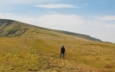
- High point: Cam Fell, on the Pennine watershed (approximately 545m / 1788ft); the Watershed Alternative passes Dent Railway Station at 350m / 1150ft, the highest mainline station in England
- Difficulty: Easy to moderate; ideal introduction to multi-day walking
- Terrain: Riverside paths, pastoral valleys, limestone villages, gentle upland moorland and Lakeland fringe
- Waymark: Dales Way waymarkers throughout; well signposted
- Accommodation: Bed and breakfast throughout; limited camping; some farmhouse accommodation
- Best season: April to early June; September to October
- Guidebook:Walking the Dales Way by Terry Marsh, 4th edition (Cicerone) — includes 1:25,000 OS map booklet
- Map booklet (sold separately):The Dales Way Map Booklet, 2nd edition (Cicerone) — for walkers who already own the guidebook or want a lighter carry
Walking the Dales Way
Ilkley to Bowness-on-Windermere through the Yorkshire Dales
£16.95
SALE
£14.41
Guidebook to walking the Dales Way. This picturesque 79 mile route through the Yorkshire Dales between Ilkley and Bowness-on-Windermere is one of the most gentle long-distance walks in Britain. The route is described in both directions, passing through Wharfedale, Dentdale and the eastern fringe of the Lake District. With 1:25K OS map booklet.
More information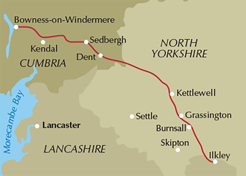
What is the Dales Way?
The Dales Way is a long-distance walking route linking the Yorkshire Dales National Park with the Lake District National Park, running from Ilkley in West Yorkshire to Bowness-on-Windermere in Cumbria. Conceived in the late 1960s through a partnership between the Countryside Commission and the West Riding group of the Ramblers' Association, the route follows the natural grain of the landscape: the valleys of the Wharfe and the Dee, the upland crossing of Cam Fell, and the green fringes of southern Lakeland.
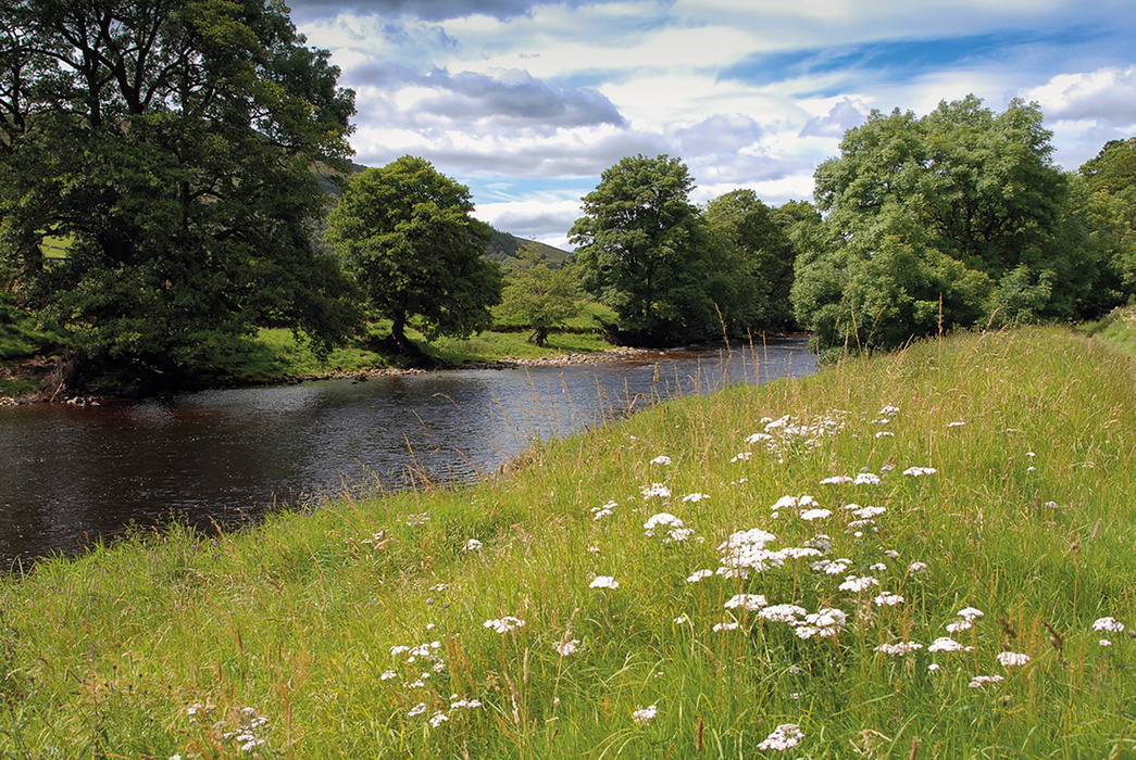
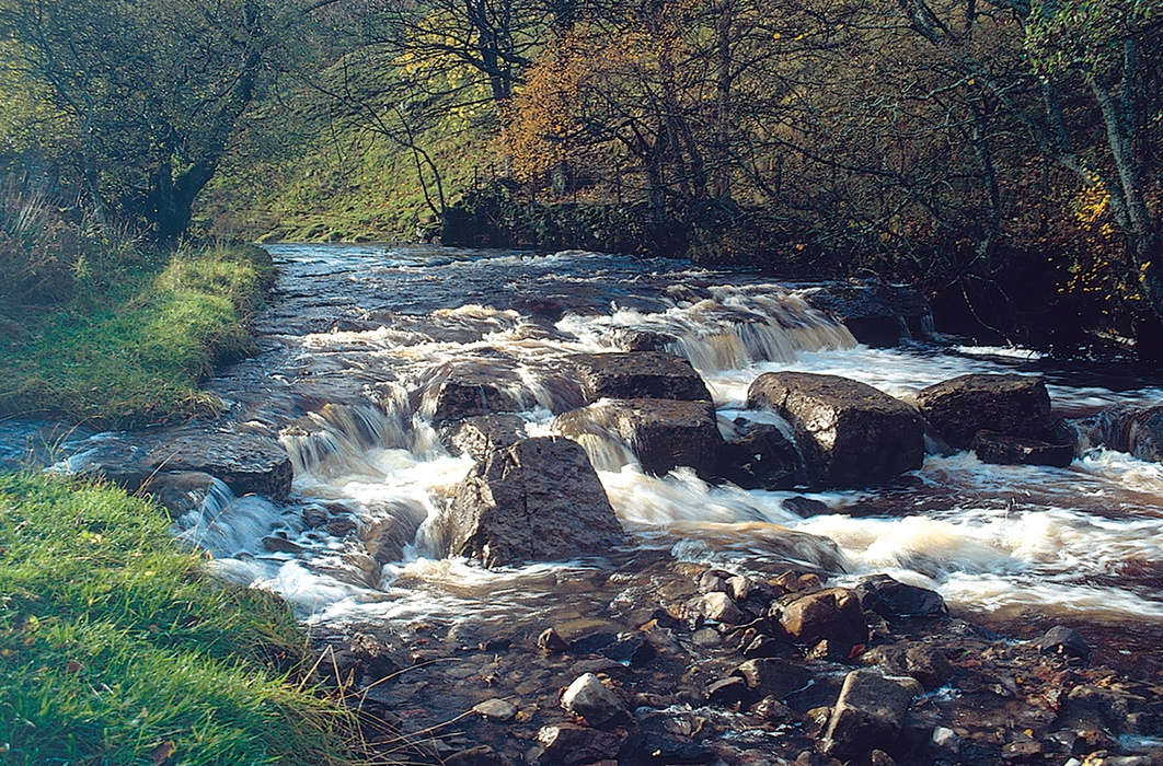
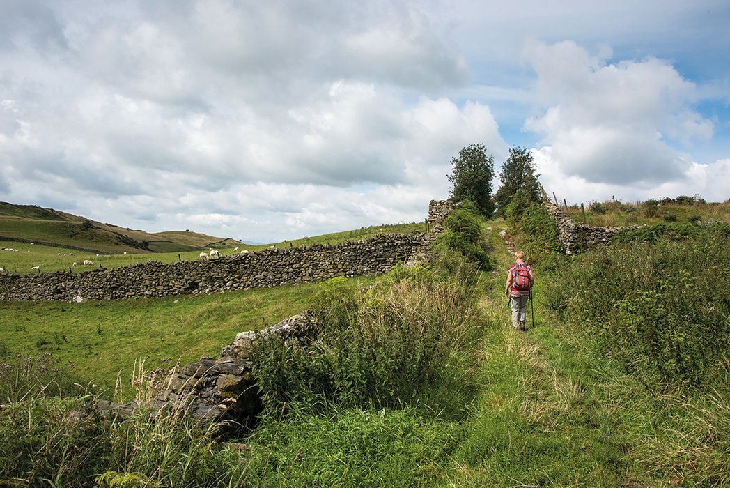
The character of the Dales Way sets it apart from harder northern trails. For the most part it clings close to rivers, meandering as they do, taking in Wharfedale, arguaby the most appealing of the Yorkshire Dales, before crossing the Pennine watershed and descending into the distinctive character of Dentdale. The route passes through some of the finest pastoral scenery in northern England, with limestone villages, packhorse bridges, ancient drove roads, and a succession of farmhouses that have opened their doors to walkers over the decades. Very little of the route falls outside one of the two national parks it connects.
The Dales Way is a monument to cooperative vision, and that vision has aged well. In the words of its own guidebook author, the enchantment of the route has not diminished one iota across 30 years of revisiting. This planning guide covers the most common questions walkers ask before setting out. For complete stage-by-stage route descriptions and 1:25,000 OS mapping, see the Cicerone Walking the Dales Way guidebook.
How long is the Dales Way and what are the stages?
The total distance is 79.5 miles (128km), divided into 6 stages. An optional Watershed Alternative is available on Stage 3.
| Stage | Distance | Ascent/Descent | Time |
|---|---|---|---|
| 1: Ilkley to Burnsall | 13 miles (20.8km) | ↑886ft/270m ↓597ft/182m | 6–6.5hr |
| 2: Burnsall to Buckden | 14 miles (22.5km) | ↑1037ft/316m ↓784ft/239m | 7hr |
| 3: Buckden to Cowgill (Lea Yeat) | 17.5 miles (28km) | ↑1862ft/567m ↓1903ft/580m | 8hr |
| 3A: The Watershed Alternative | (variant of Stage 3) | — | — |
| 4: Cowgill (Lea Yeat) to Millthrop (Sedbergh) | 9.5 miles (14.7km) | ↑430ft/131m ↓778ft/237m | 4hr |
| 5: Millthrop (Sedbergh) to Staveley | 19.5 miles (31km) | ↑1903ft/580m ↓1912ft/583m | 8–9hr |
| 6: Staveley to Bowness-on-Windermere | 6.5 miles (10.5km) | ↑925ft/282m ↓1056ft/322m | 3hr |
| Total | 79.5 miles (128km) | ↑7043ft/2146m ↓7030ft/2143m |
The two most demanding stages are Stage 3 (Buckden to Cowgill), the longest day at 17.5 miles (28km) with nearly 1900ft of ascent, and Stage 5 (Sedbergh to Staveley) at 19.5 miles (31km). Both have some scope for breaking into shorter sections using intermediate accommodation, though this requires adjusting other stages. The short Stage 6 into Bowness is a rewarding final day, giving walkers time to savour the arrival at Lake Windermere.
Who is the Dales Way suitable for?
The Dales Way is the ideal route for anyone wanting to experience multi-day walking for the first time. Its relatively low-level profile means it is sheltered for much of its length by surrounding fells, and walkers are seldom far from help, shelter, or accommodation. It is suitable for:
- Walkers taking their first multi-day route with a rucksack
- Those wanting to complete a long-distance trail in sections over multiple weekends, thanks to good public transport access at many points
- Dog owners (though dogs must be kept under firm control, especially during lambing season from March to May, and through hay meadows in early summer)
- Walkers who want a route rich in cultural, historical, and natural interest without committing to a high-mountain traverse
It is not, however, a route to underestimate. The crossing between Oughtershaw and Dentdale in adverse weather would test experienced walkers, and there are stretches where underfoot conditions can be treacherous. Preparation matters: broken-in boots, appropriate clothing for all conditions, and a realistic daily mileage target are essential.
How difficult is the Dales Way?
The Dales Way is graded easy to moderate. There are no technical sections, no scrambling, and no sustained high-level ridge walking. The route is well waymarked throughout, even in more remote stretches, and follows established public footpaths, bridleways and quiet lanes.
The main physical challenge is the cumulative daily mileage across the full route, particularly on Stages 3 and 5. Walkers new to multi-day hiking are strongly encouraged not to be overambitious with daily targets. The guidebook offers three suggested itineraries ranging from 6 days (averaging 13.5 miles/21km per day) to 8 days (averaging around 10 miles/16km per day). Keeping daily distances manageable is as much about enjoyment as stamina: the interest never lets up, and pushing too hard simply turns the Dales Way into a route march.
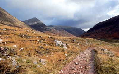
The Watershed Alternative on Stage 3 is a higher-level variant using the Pennine Bridleway. It is marginally longer than the main route and reaches a new high point for the Dales Way, passing Dent Railway Station. It offers a more challenging and rewarding alternative for walkers who want variety.
Can I walk the Dales Way in shorter sections?
Yes. The Dales Way lends itself well to completion in sections, and many walkers choose to tackle it across several weekends or short breaks rather than as a single end-to-end journey. Public transport access is good at both ends and at several intermediate points, making this genuinely practical.
Three natural section-walking bases, each with rail access, are:
- Ilkley to Grassington/Buckden (Stages 1–2): accessible from Bradford and Leeds via Ilkley
- Buckden to Sedbergh (Stages 3–4): Dent Railway Station (on the Watershed Alternative) connects to the Settle–Carlisle line
- Sedbergh to Bowness (Stages 5–6): Windermere station connects to Oxenholme on the West Coast Main Line
The Trek Planner in the guidebook details facilities at all principal halts, making it straightforward to plan your own sectional itinerary.
Which direction should I walk the Dales Way?
The Dales Way is conventionally walked south to north, from Ilkley to Bowness-on-Windermere, and this is the direction described in the main guidebook text. The logic is sound: you walk out of the urban West Riding into increasingly wild and open country, the landscape builds in drama through Wharfedale and Dentdale, and the arrival at Lake Windermere provides a satisfying and scenic conclusion.
The guidebook also provides reverse route summaries for each stage for those who prefer to walk north to south, and this direction is entirely practical.
When is the best time to walk the Dales Way?
The Dales Way can be walked at any time of year, though not all accommodation is open year-round, and some sections are considerably more demanding in winter conditions.
- April to early June: The outstanding season. Flowers are at their most abundant, birdlife is active and prolific, and the valleys are vivid with the freshness of spring. Note that lambing runs from March to May: dogs must be kept under firm control and walkers should respect livestock and hay meadows.
- July to August: Perfectly acceptable walking, with long days and warm temperatures. Accommodation fills quickly in peak summer, particularly in the Lake District end of the route, so booking well in advance is essential.
- September to October: An excellent alternative to spring. Autumn colour transforms the dales, visitor numbers have eased, and the weather often settles into long stable periods ideal for walking.
- November to March: A winter walk is not beyond the bounds of reason for well-equipped and experienced walkers, and adds a wholly different perspective to the landscape. However, the crossing between Oughtershaw and Dentdale in harsh conditions is a serious undertaking. Some accommodation closes, and daylight hours are limited. Check the Dales Way Association website (www.dalesway.org) for any seasonal route updates before setting off.
The shoulder seasons of May and September are the sweet spots: good weather, manageable crowds, and the route at close to its best.
What accommodation is available on the Dales Way?
The Dales Way is well served by bed-and-breakfast accommodation for most of its length, with the notable exception of the stretch between Langstrothdale and Dentdale, where options become thin on the ground. Many farmhouses along the route welcome walkers and will arrange to collect and return guests from the route itself, which makes staying slightly off the line perfectly practical.
There are very few formal campsites along the route, but many farmers will allow small parties to pitch a tent overnight. Permission should always be sought in advance.
Key points to note:
- Not all accommodation is directly adjacent to the Dales Way: always confirm the precise location in relation to the route before booking
- Many accommodation providers do not accept card payments: cash is essential. ATMs are available in Ilkley, Grassington, Dent, Sedbergh, Kendal and Bowness-on-Windermere
- A small number of baggage transfer companies operate on the Dales Way, collecting packs each morning and delivering them to your next stop
Full accommodation listings are in Appendix B of the guidebook. The Dales Way Association (www.dalesway.org) also maintains an online accommodation directory.
Getting to the start and returning from the finish
Getting to Ilkley: Ilkley has regular direct train services from Leeds and Bradford, making it straightforward to reach from most parts of England via Leeds. Long-distance services from London operate to Leeds via King's Cross (LNER) and via Euston (Avanti, through Manchester).
Returning from Bowness-on-Windermere: Windermere station is 1.5 miles (2.5km) from the walk's end at Bowness; a bus service connects the two, or a short taxi ride. From Windermere, trains connect at Oxenholme for London, Manchester and Lancaster. For onward travel to Yorkshire, change at Lancaster for Skipton, Shipley and Leeds.
For section walkers: The Settle–Carlisle Railway provides access to the Dent area (Dent Station is on the Watershed Alternative, Stage 3). Dales Bus services operate seasonally along parts of the route. Full transport planning resources are listed in Appendix A of the guidebook, including Network Rail, National Rail Enquiries, Dales Bus and Cumbria Bus services.
What are the highlights of the Dales Way?
- Wharfedale: The opening stages trace one of the finest river valleys in England, from the Victorian elegance of Ilkley through Bolton Abbey, Burnsall and the limestone villages of Upper Wharfedale to Buckden
- Strid Wood and Bolton Abbey: The dramatic gorge where the River Wharfe is compressed into a narrow channel is one of the most striking natural features on the route
- Hubberholme: The ancient church at Hubberholme, in the upper reaches of Wharfedale, is among the most evocative spots on the entire walk
- Cam Fell and the Pennine watershed: A brief but exhilarating crossing where the Dales Way meets the Pennine Way, with the Yorkshire Three Peaks visible on the horizon
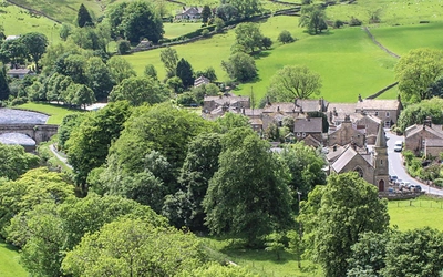
- Dent village: One of the most characterful settlements in the Dales, with its cobbled streets, notable geology and the Settle–Carlisle railway connection nearby
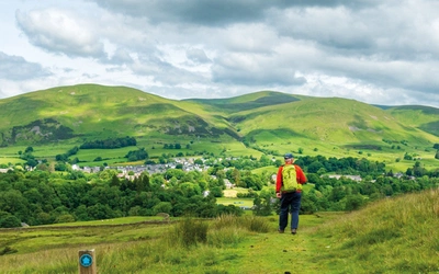
- Sedbergh: The market town at the confluence of several river valleys, a natural resting point before the push into the Lakeland fringe
- Lake Windermere: The arrival at Bowness, bursting rather unexpectedly out onto England's largest lake, is a satisfying and memorable conclusion
Does the Dales Way pass through two national parks?
This is one of the distinctive features of the Dales Way and worth noting when planning. The route connects the Yorkshire Dales National Park and the Lake District National Park, with very little of the walk falling outside one or the other. The route therefore passes through two of England's most celebrated protected landscapes within a single week's walking, a logistical achievement that reflects the foresight of the route's originators.
The Yorkshire Dales was designated a national park in 1954 and the Lake District in 1951. Walking the Dales Way traces the full transition from the limestone valley character of the Dales to the older, wilder Silurian rock landscape of southern Lakeland.
The Walking the Dales Way guidebook
The fourth edition of Terry Marsh's Walking the Dales Way (Cicerone, 2021, reprinted 2024) provides a complete step-by-step description of the route in both directions across 6 stages, with each stage prefaced by key statistics and an overview of the terrain ahead. The guidebook includes a dedicated Trek Planner detailing facilities, accommodation and distances between all principal halts, plus comprehensive appendices covering accommodation, useful contacts and further reading. A separate 1:25,000 OS map booklet showing the full route is included with the guidebook, alongside overview mapping at 1:100,000. The fourth edition also introduces the Watershed Alternative on Stage 3, a higher-level variant using the Pennine Bridleway that passes Dent Railway Station, the highest mainline station in England. Find out more and buy the guidebook on the Cicerone website.
The 1:25,000 OS map booklet is also available to buy separately for walkers who already own the guidebook, want a replacement copy, or simply prefer to carry the maps alone as a lighter option on the trail.

About Terry Marsh, guidebook author:
Dr Terry Marsh is a Lancashire-born writer, photographer and historical geographer who has been writing guidebooks since the mid-1980s. He holds a Master of Arts with Distinction in Lake District Studies and a PhD in Historical Geography, and is a Life Member of the Outdoor Writers and Photographers Guild. Terry has walked every part of the Dales Way multiple times over three decades, and authored the first edition of this Cicerone guidebook in 1992. He is also the author of Cicerone's award-winning guide to the [LINK: Coast to Coast Path -> Cicerone Coast to Coast guidebook page] and Great Mountain Days in the Pennines.