Walking in Cumbria's Eden Valley: a complete planning guide
If Cumbria's beautiful Eden Valley were anywhere but right next to the Lake District, it would be full of tourists. In reality, few venture this far from Cumbria's best-known National Park, leaving walkers to discover for themselves an area with rich natural and human heritage and beautiful, diverse landscapes all to themselves. From its source high on the wild moorlands of the North Pennines to the open spaces of the immense Solway marshes on the Scottish border, the River Eden meanders north for 75 miles, and the 30 walks in this guidebook explore every part of that journey, ranging from 6 to 24km (4 to 15 miles), graded 1 to 5, and best explored from bases such as Kirkby Stephen, Appleby, Penrith and Carlisle. (Last updated: June 2026 · Guidebook edition: 2nd edition, October 2018)
Walking in Cumbria's Eden Valley, quick facts:
- Location: Cumbria's Eden Valley, from the Yorkshire Dales National Park to the Solway Firth, North West England
- Total routes: 30 day walks (mostly circular; 2 linear routes using the Settle–Carlisle railway)
- Distance range: 6–24km (4–15 miles) per walk
- Typical duration: 3–8 hours per walk
- Difficulty: Graded 1–5; easy riverside strolls to demanding, pathless upland hikes
- Terrain: Riversides, limestone uplands, farmland, open moorland, wooded gorges, salt marshes, red sandstone villages
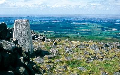
- Highest point: Cross Fell, 893m (highest point on the Pennines)
- Navigation: 1:50,000 OS map extracts for every walk; OS Landranger sheets 85, 86, 90, 91 and 98 cover the whole area; free downloadable GPX files
- Best season: Year-round; snow is possible on the higher Pennine routes from mid-October onwards
- Guidebook: Walking in Cumbria's Eden Valley by Vivienne Crow, 2nd edition
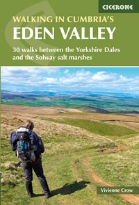
Walking in Cumbria's Eden Valley
30 walks between the Yorkshire Dales and the Solway salt marshes
£12.95
Guidebook to 30 graded walks in Cumbria's Eden Valley. The routes, which range from 3 to 15 miles and are best from bases such as Kirkby Stephen and Appleby, explore the region's diverse landscapes and offer dramatic views, either of the Pennines, Lake District or the Scottish hills. Linear routes link with the Settle-Carlisle railway.
More informationWhat is Walking in Cumbria's Eden Valley?
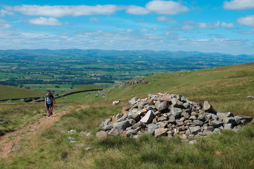
Walking in Cumbria's Eden Valley is a Cicerone guidebook covering 30 day walks through one of northern England's most idyllic and least-visited walking areas. The River Eden rises high on the wild moorlands of the North Pennines, incorporated in 2016 into the Yorkshire Dales National Park, and meanders north for 75 miles before meeting the immense Solway marshes on the Scottish border. In terms of geology, human history, habitats, wildlife and landscape, walkers couldn't wish for more variety within such a compact area.
The landscape alters with every twist and turn of the river. In the upper valley, carboniferous limestone pavements and broken millstone grit escarpments define the scene. Lower down, the glowing new red sandstone that gives the area its distinctive look fills the churches, castles, farms and villages. There are dramatic upland moors around Cross Fell and the breathtaking High Cup, rolling pastures in the middle valley, and the vast Solway salt marshes in the north. And walkers are never short of wildlife company: from the elusive black grouse and persecuted hen harrier on the high moors to the tens of thousands of barnacle geese that descend on the Solway each winter, and the endangered red squirrels that still hold their own in the valley woodlands. For walkers who know the Yorkshire Dales or the Lake District and want something far less frequented, the Eden Valley offers a genuinely different experience.
What sets this guidebook apart is how thoroughly it reflects both the geography and the heritage of the river's entire length. As well as the Eden itself, the walks take in the dales carved by the Lowther, Lyvennet and Gelt, and one route ventures just within the neighbouring catchment of the River Lune. Two routes are designed as linear walks making use of the Settle–Carlisle railway. This planning guide answers the most common questions walkers have before setting out. For complete route descriptions and mapping, see the Cicerone Walking in Cumbria's Eden Valley guidebook.
The 30 routes at a glance
The 30 walks are arranged from source to sea, starting at the head of the Eden in the south and working north to the Solway Firth, making it easy to plan a programme of walks from a single base or to follow the river progressively across multiple visits. The walks cover the full range of the valley's character.
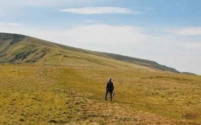
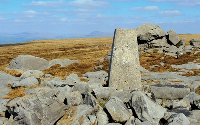
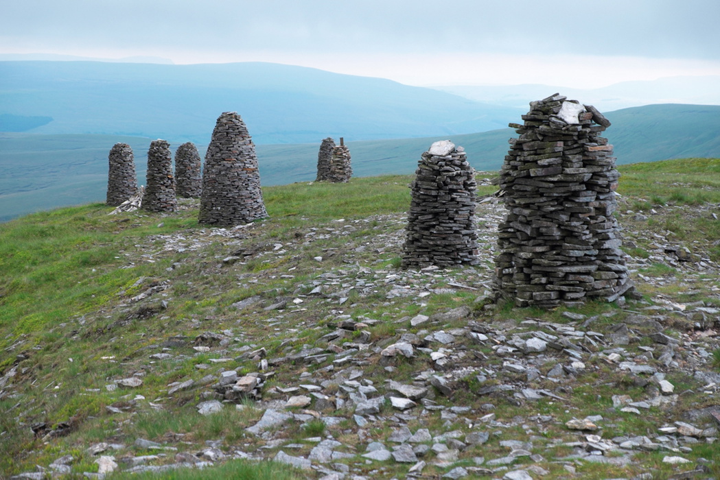
The southern and upper valley routes around Wild Boar Fell, Mallerstang Edge, Nine Standards Rigg and Pendragon Castle are the wildest, with several venturing onto pathless or poorly waymarked moorland.
The middle section, between Kirkby Stephen and Appleby, takes in the limestone pavements of Great Asby Scar, the Orton Fells, and gentler riverside walks beside the Lyvennet and Lowther.
The routes around Dufton tackle the most dramatic scenery in the book: High Cup Nick is covered by two different approaches (Walks 14 and 18), and Walk 19 ascends Cross Fell at 893m, the roof of the Pennines. Walk 20 visits Long Meg and Her Daughters, one of the largest and most atmospheric stone circles in England.
The northern walks, from Kirkoswald through to the Solway plain, shift into completely different terrain: wooded red sandstone gorges, the bird-rich Talkin Tarn, the wooded Gelt valley, and finally the vast coastal marshes at Burgh and Campfield.
| Walk | Distance | Difficulty grade | Time |
|---|---|---|---|
| Nine Standards Rigg | 7 miles (11.5km) | 3 | 3¾hr |
| The Infant Eden and Pendragon Castle | 9 miles (14.5km) | 2 | 4½hr |
| Great Asby Scar | 8¾ miles (14km) | 2-3 | 4½hr |
| High Cup and Scordale | 13¾ miles (22km) | 5 | 8hr |
| Cross Fell | 10¼ miles (16.5km) | 4 | 5¾hr |
| Long Meg and Her Daughters | 4¾ miles (7.5km | 1 | 2hr |
| Talkin Tarn and the Gelt | 7¾ miles (12.5km) | 2 | 4½hr |
| Campfield Marsh and Bowness Common | 6¾ miles (11km) | 1 | 2¾hr |
Who is Walking in Cumbria's Eden Valley suitable for?
The guidebook's grade 1–5 system means there is genuinely something for every level of walker. The routes range from peaceful woodland strolls to serious moorland hikes, and from explorations of the limestone uplands to walks on the Solway marshes.
The lower-graded routes in the mid and lower valley follow clear paths and good riverside tracks and trails, making them accessible regardless of experience. The upper valley and Pennine top routes (grades 4–5) are a different proposition entirely. Several walks venture onto pathless moorland, which can be boggy in places, and require navigational competence and stamina. Walk 15 (Murton Pike) is now only suitable for walkers confident on rough, pathless ground after the loss of its waymarker posts. No scrambling is involved on any route.
Dogs are welcome on most routes. Where walks cross access land that is not on a public right of way, dogs must be kept on leads of no more than 2 metres near sheep, and from 1 March to 31 July on open moorland.
How difficult is the walking in the Eden Valley?
The routes are graded 1 to 5, from easy to strenuous, with the terrain across the book including pathless moorland, farmland, and good riverside tracks and trails. No scrambling is involved on any route.
Specific challenges to be aware of:
- Navigation: The upper valley and Pennine routes require map and compass competence. Walk 15 (Murton Pike) has no remaining waymarker posts and should only be attempted by experienced navigators on rough, pathless ground.
- Boggy ground: The higher moorland routes can be wet underfoot. Gaiters are recommended for the Pennine walks.
- Weather: Cross Fell can receive snow as early as mid-October and retain it well into May. The Eden Valley and North Pennines are home to the Helm Wind, Britain's only named wind, which occurs when a north-easterly airflow hits the Pennine escarpment near Cross Fell and comes hurtling down the western side. The result is a ferocious easterly wind that can be felt all the way from Brough to Brampton. Always check a mountain-specific forecast (the Mountain Weather Information Service at www.mwis.org.uk covers the whole of Cumbria and the western Pennines) before setting out on the higher routes.
- Flooding: Waterside paths may become waterlogged or flooded after periods of exceptional rain. Parts of Burgh Marsh (Walk 29) may also become inundated at times of particularly high tides.
When is the best time to walk in the Eden Valley?
The Eden Valley is walkable year-round, and every season holds its own delights. The mountains of the Lake District protect the valley from the worst of the prevailing south-westerly airflows, making it slightly drier than much of Cumbria. Even when it rains, the cloud does not normally hang around for long.
- Spring (March–May): Upland hay meadows come to life, with more than 30 wildflower species per square metre in the best fields, providing a habitat for insects and birds. Curlews return from the coast to breed on the rough, rushy ground above the valley floor. Limestone walks such as Great Asby Scar are at their finest early in the season.
- Summer (June–August): Long daylight hours make the bigger Pennine routes manageable. The limestone grasslands are full of colour and butterfly species including dark green fritillaries, graylings, common blues and some of England's rarest species such as the Scotch argus. Note that Appleby becomes very busy during the horse fair in early June.
- Autumn (September–October): Heather on the moorland, colour in the wooded gorges around Armathwaite and Wetheral, and the ever-changing quality of the light across the Pennine tops make this a rewarding time to walk the higher routes.
- Winter (November–February): The lower and mid-valley walks remain pleasant on a clear day. The Solway marshes come into their own as the entire population of barnacle geese from the Svalbard archipelago descends on the English and Scottish marshes of the Solway Firth, alongside thousands of other swans, ducks and geese. Snow is possible on the Pennine tops from mid-October, and the higher routes require appropriate experience and equipment when conditions deteriorate.
What accommodation is available in the Eden Valley?
There is a good range of both self-catering and bed and breakfast accommodation throughout the valley, with prices generally slightly lower than in the neighbouring Lake District. The guidebook's Appendix B lists useful contacts for accommodation and tourist information.
Kirkby Stephen is the natural base for the southern and upper valley walks, with B&Bs, inns and a hostel, the latter a regular stopping point for walkers on Wainwright's Coast to Coast walk. It sits on the Settle–Carlisle railway.
Appleby-in-Westmorland is the historic market town at the centre of the valley and makes an excellent base, with B&Bs and hotels. Also served by the Settle–Carlisle line. Note that accommodation books up early around the horse fair in early June.
Dufton has a youth hostel popular with Pennine Way backpackers and is ideally placed for the High Cup and Cross Fell walks.
Penrith and Carlisle offer the widest range of accommodation, give good rail and road access to the northern walks, and are worth visiting in their own right. Carlisle's medieval castle, cathedral and the cleverly designed Tullie House Museum and Art Gallery all have fascinating histories.
Brampton is a useful base for the northernmost walks around Talkin Tarn and the Solway marshes.
Kirkby Stephen and Appleby are probably the best bases overall for walkers relying on public transport, but Crosby Ravensworth, Ravenstonedale, Dufton, Kirkoswald, Wetheral and Brampton are all very pleasant and interesting places to stay.
How do I get to the Eden Valley?
The Eden Valley is surprisingly well served by the national rail network for a rural area.
By rail: The Settle–Carlisle railway is the walker's key artery, with stations at Kirkby Stephen, Appleby-in-Westmorland, Langwathby, Lazonby, Armathwaite and Wetheral giving access to walks throughout the valley. Two of the guidebook's routes (Walk 1 and Walk 7) are designed as linear walks making use of it. The West Coast Main Line, linking London Euston with Glasgow, passes through east Cumbria, with all trains stopping at Carlisle and some stopping at Penrith. The journey time from London to Carlisle is as little as 3hr 15min, and from Glasgow to Carlisle around 1hr 7min. Carlisle, Wetheral and Brampton are also on the line to Newcastle, with a journey time of around 1hr 25min. There are also approximately seven trains a day from Leeds to Carlisle via the scenic Settle–Carlisle line, taking around 2hr 45min.
By coach: National Express runs several daily services from London to Carlisle (journey times roughly 7–9 hours), from Glasgow to Carlisle (2 hours), and from Manchester (3hr 15min).
By road: The M6 motorway runs along the western edge of the valley, providing fast access from the south. Parking information is given for each walk.
Local buses: Outside the main towns, bus services are limited, with many routes operating just once or twice a week. For timetables across all modes, Traveline at www.traveline.info is the best starting point.
What are the highlights of walking in the Eden Valley?
- Cross Fell (Walk 19): At 893m, the highest point on the Pennines and the roof of the North Pennines AONB, with sweeping views to the Lake District, the Scottish hills and County Durham.
- High Cup (Walks 14 and 18): One of the most dramatic geological features in northern England, a vast U-shaped hanging valley with sheer Whin Sill cliffs. Covered by two separate routes from different directions.
- Long Meg and Her Daughters (Walk 20): One of the largest and most atmospheric prehistoric stone circles in England, set against the backdrop of the Pennines.
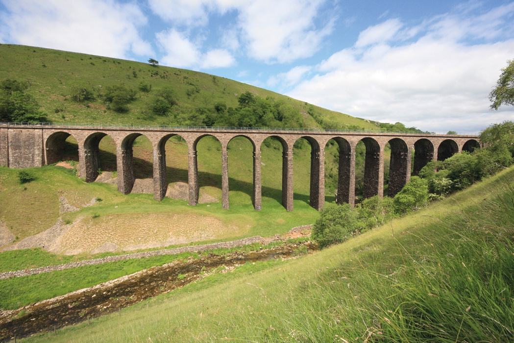
- Smardale Gill (Walk 5): A disused railway threading through a dramatic limestone gorge with an imposing viaduct, managed as a nature reserve by Cumbria Wildlife Trust.
- Pendragon Castle (Walk 6): The haunting ruins of a Norman castle in the upper Eden valley, traditionally associated with Uther Pendragon, father of the legendary King Arthur.
- The Solway marshes (Walks 29 and 30): Vast, bird-rich coastal marshes where the River Eden meets the Solway Firth, and tens of thousands of barnacle geese from the Svalbard archipelago overwinter each year.
What is the Helm Wind, and should it affect my plans?
The North Pennines and Eden Valley are home to Britain's only named wind. Not unlike the famous föhn wind of the Alps, the Helm Wind occurs when a north-easterly airflow hits the Pennine escarpment near Cross Fell. The air climbs the eastern slopes and comes hurtling down the western side, meeting the warmer air from the west. The result is a ferocious easterly wind that can last for days and be felt all the way from Brough to Brampton. A visible sign is the bank of cloud, known as the 'helm cloud', that forms just above the fell tops, sometimes covering Cross Fell entirely.
A particularly strange aspect of the Helm is that just a few miles to the west of the fellside settlements the wind simply dies. It is possible to stand in Penrith without a breath of a breeze while listening to the roar of the Helm to the east. For walkers, the practical implication is simple: check a mountain-specific weather forecast before setting out on any of the Cross Fell or upper Pennine routes, and be prepared to postpone if the Helm is in play.
Walking in Cumbria's Eden Valley
30 walks between the Yorkshire Dales and the Solway salt marshes
£12.95
Guidebook to 30 graded walks in Cumbria's Eden Valley. The routes, which range from 3 to 15 miles and are best from bases such as Kirkby Stephen and Appleby, explore the region's diverse landscapes and offer dramatic views, either of the Pennines, Lake District or the Scottish hills. Linear routes link with the Settle-Carlisle railway.
More informationPlan your walk with the Cicerone guidebook
The Cicerone Walking in Cumbria's Eden Valley guidebook by Vivienne Crow contains everything you need to plan and complete all 30 walks, from the wild upper Eden to the Solway salt marshes.
- 30 fully described routes ranging from 6 to 24km (4 to 15 miles), graded 1 to 5 and arranged from source to sea
- 1:50,000 OS map extracts for every walk; OS Landranger sheets 85, 86, 90, 91 and 98 cover the whole area
- Free downloadable GPX files for all routes, available via the Cicerone website
- Route summary table in Appendix A listing all walks by distance, grade and time for quick reference
- Practical information at each walk including refreshments, public transport options and local accommodation
- Appendix B with useful contacts including local tourist information centres and accommodation providers
- Introductory chapters covering the valley's geology, wildlife and habitats, history, weather, waymarking and access, and guidance on clothing, equipment and safety
- Notes on the Eden Benchmarks, a series of ten millennium sculptures installed beside public paths along the entire length of the River Eden
Available as a printed guidebook (£12.95) and eBook (£12.95).
About Vivienne Crow, guidebook author:
Vivienne Crow is an award-winning outdoor writer and photographer with an all-consuming love of walking and the great outdoors. A journalist since 1990, she went freelance in 2002, focussing her energies on the activities she loves most: hiking, writing, travel and photography.
Based in north Cumbria since 1996, she has put her intimate knowledge of northern England to good use over the years, writing more than 20 popular walking guidebooks. Her words and images also regularly appear on the pages of national and regional magazines as well as on countless websites, visitor leaflets and guides to nature reserves. Vivienne is a member of the Outdoor Writers and Photographers Guild. www.viviennecrow.co.uk