Walking in Zagori: Greece at its most wild and beautiful
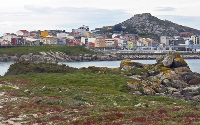
The Zagori and Konitsa regions of mainland Greece are some of the last relatively undiscovered and unspoilt hiking destinations in Europe. Highlights of the area include the famous Vikos Gorge and the alpine tarn of Drakolimni (Dragonlake), along with the picturesque villages, cobblestone paths and stone bridges characteristic of Zagori. However, there are many more hidden beauties lying within these legendary mountains. Here's what you need to know about the walks and treks in these stunning landscapes.
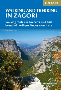
Walking and Trekking in Zagori
Walking routes in Greece's wild and beautiful northern Pindos mountains
£17.95
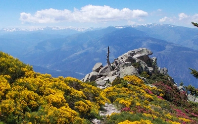
Guidebook to 30 walks and 3 treks centred on Zagori and Konitsa in mainland Greece. From easy strolls to demanding hikes along remote mountainous traverses, including the rugged peaks of Mt Timfi and Mt Smolikas in the Pindos range, Drakolimni Lake, and the dramatic Vikos Gorge. With background information on architecture, history and wildlife.
More information| What? | 30 walks and 3 treks in the Northern Pindos National Park |
| Where? | Zagori, a mountainous region in northwestern Greece |
| Which areas are covered? | Routes are split between five geographical areas covering central Zagori; Vikos Gorge; Mount Timfi; Konitsa and Mount Smolikas; and Valia Calda National Park and Metsovo. |
| How long are the walks? | The day walks vary from 3 to 24km (2–15 miles) and can be enjoyed in 1–8 hours; the treks span 2–3 days. |
| How hard are the walks? | Routes range from easy one-hour strolls on clear and well-waymarked paths suitable for all hikers (Grade 1) to strenuous ascents and rugged non-technical mountainous routes for which a very good level of fitness, route-finding skills and experience in high mountain terrain are required (Grade 4). |
| Best time to go? | The best time to walk the routes is in springtime (end of May - June) and autumn (September - October) when the sun and temperatures are milder and the region quieter. |
| What accommodation is available? | Zagori offers an excellent choice of hotels and family-run guesthouses. Guesthouses offer simple rooms to luxury suites and breakfast is usually included. There are no campsites in the region and camping is officially forbidden. |
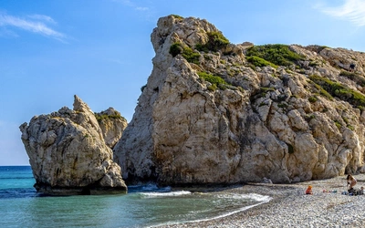
| Highlights? | Highlights of the area include the famous Vikos Gorge and the alpine tarn of Drakolimni (Dragonlake), along with the picturesque villages, cobblestone paths and stone bridges characteristic of Zagori. However, there are many more hidden beauties lying within these legendary mountains and this selection of walks and treks showcases these stunning landscapes. |
| Centres? | Kipi, Dilofo, Tsepelovo, Monodendri, Elafotopos, Papigo, Konitsa, Pades, Metsovo, Vovousa. |
And finally, a personal account of hiking in Zagori...
It’s a mild October afternoon in Athens, but I know the weather in the mountains will soon change. The days are shortening, shepherds are leading flocks to the plains, and bears are preparing for hibernation. I'm still missing the last route for my hiking guide on Zagori, a stunning mountainous region in northwestern Greece. The hike must be completed before the first autumn snow on the rugged heights of Mount Tymphi. The forecast is favourable for the next three days, so it’s time to act.
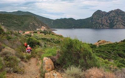
After arranging for two friends to join me—I'm not keen on hiking alone—I pack my gear and set off early the next morning. First stop: Trikala, a charming town in Thessaly, where I pick up my friends and stock up on provisions. We continue our journey to Mt Tymphi, passing through Ioannina, the cultural heart of Epirus, before entering the magical world of Zagori with its thick forests, stunning mountain views, and charming stone villages. Though I’ve seen it all before, I’m once again awestruck by this place.
As darkness falls, we reach Tsepelovo, one of Zagori’s liveliest villages and our starting point. We head straight for the local café in the village square, where we enjoy a glass of tsipouro and sausages from Trikala. With a long hike ahead, we camp just outside the village. The weather is still good but expected to turn soon.
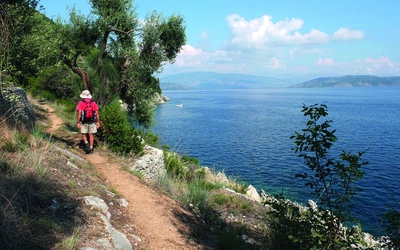
The next morning looks promising—clear skies and a gentle breeze. However, we struggle to find the trailhead, realizing we should have gathered more information beforehand. After some wandering, we get back on track, following a large arrow painted on a boulder. The craggy peaks above us are magnificent in the morning light. We make good progress, enjoying both the hike and each other’s company.
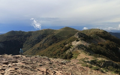
After five hours, we reach the Megala Litharia pass at 2300m, where an exhilarating view unfolds: the pinnacle of Tsouka Rossa with Mt Smolikas and Mt Trapezitsa in the background. The visibility is excellent, revealing even the Albanian hinterland. We decide to climb a nearby peak for more stunning views, then enjoy a picnic with Mt Tymphi as our backdrop.
Before descending to the grassy valley below, we detour to the Tsouka Rossa ridge to take in the 1000m drop to the east. Vrisochori, our destination, looks far away, urging us to continue. The first part of the descent takes us through awe-inspiring sub-alpine terrain, where we hear the whistles of rare Balkan chamois. As we enter a beech forest, a few silly falls and some jokes lift our spirits. Eventually, the sound of gurgling water leads us to the Neraidhovrisi spring, where we rest before continuing to Vrisochori after an 11-hour journey.
Upon arrival, we fail to arrange transport back to Tsepelovo and realize how dependent we are on our phone’s internet connection, which is absent here. With darkness falling, we decide to walk to the next village, Iliochori, where we hope to find help. We arrive just as a storm breaks and take shelter in a local café. The kind owner offers us a place to stay, refusing payment, saying, “I have sons your age who do the same foolish things.”
The next morning, the sun shines again. We find a ride back to Tsepelovo after a visit to the village’s waterfalls to wash off the previous day’s dirt. Refreshed, we’re on the road again, ready for the next adventure.
Aris-Dimitrios Leontaritis
Walking and Trekking in Zagori
Walking routes in Greece's wild and beautiful northern Pindos mountains
£17.95
Guidebook to 30 walks and 3 treks centred on Zagori and Konitsa in mainland Greece. From easy strolls to demanding hikes along remote mountainous traverses, including the rugged peaks of Mt Timfi and Mt Smolikas in the Pindos range, Drakolimni Lake, and the dramatic Vikos Gorge. With background information on architecture, history and wildlife.
More information