Walking through Ireland: discovering the Emerald Isle
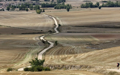
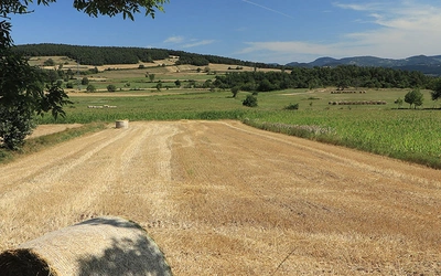
The Emerald Isle is celebrated for its rich history, stunning landscapes, and vibrant culture, characterised by rolling green hills and rugged coastlines. It offers exceptional walking and cycling opportunities that allow visitors to immerse themselves in its natural beauty. With a blend of picturesque scenery and charming towns, Ireland is a perfect destination for those seeking adventure and tranquillity in a timeless setting.
When you think of Ireland, what comes to mind? History, romance, music, shamrocks, castles, Guinness and St. Patrick’s Day? Perhaps it’s the Irish countryside, where rolling green hills stretch endlessly, interrupted only by ancient stone walls, forests, sparkling lakes, and rugged coastlines. It’s a country that abounds with sweeping panoramas, characterful towns and villages, evocative landscapes, remoteness and untouched beauty. A place where nature and history coexist, creating a sense of timelessness. Ireland is a fantastic destination for walking and cycling, offering some incredible long-distance routes that allow you to experience its beauty at a slower, more immersive pace.
Hiking in Ireland
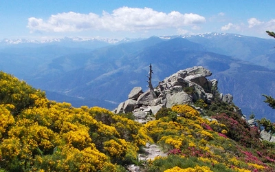
The Kerry Way, one of Ireland’s premier National Waymarked Trails, showcases the stunning Iveragh Peninsula. This circuit from Killarney offers peaceful mountain, moorland, and sea views, with optional side excursions to UNESCO-listed Skellig Michael and Ireland’s highest peak, Carrauntoohil (1,039 m). The route spans approximately 185 km and is typically completed in 9–10 days. Whether you enjoy friendly locals and good food or seek peace and a cosy evening with a book after a day of exploration, the Kerry Way offers an ideal escape that caters to everyone. It's an excellent introduction to long-distance walking and is regarded as one of the most pleasant walks in Europe.
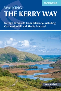
Walking the Kerry Way
Iveragh Peninsula from Killarney, including Carrauntoohill and Skellig Michael
£17.95
Guide to Ireland's 190km Kerry Way. Described anti-clockwise from Killarney, the circular route is presented in 10 stages and offers view of Killarney National Park and the Beara and Dingle peninsulas. Optional side trips include Carrauntoohill, Skellig Michael and Valentia Island.
More informationWalking the Wicklow Way
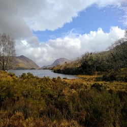
The Wicklow Way, the first long-distance trail established in Ireland, remains one of the most accessible, running 130 km from Dublin into County Wicklow. The route quickly climbs into the Dublin Mountains for extensive views, passing through the moorland heart of the Wicklow Mountains and taking in tranquil lakes and forested glens. Along the way, you’ll encounter historic sites like Glendalough, an ancient monastic site that’s as peaceful as it is historic, and the scenic Military Road on the way to Clonegal, where Huntington Castle can be visited. Known for its variety, the Wicklow Way features heather-clad mountains, peaceful woodlands, and deep glacial valleys, making it a diverse and enriching experience for walkers.
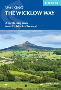
Walking the Wicklow Way
A week-long walk from Dublin to Clonegal
£14.95
A guide to walking Ireland's Wicklow Way, a 146km trail through the scenic Wicklow Mountains from Dublin to Clonegal, County Carlow. The waymarked route is presented in 7 stages, taking in rolling countryside, forest trails and wild mountain landscapes, as well as the historic monastic site of Glendalough. Optional variants are also included.
More informationCycle touring in Ireland
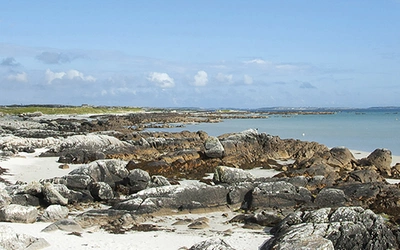
For a more expansive adventure, the Wild Atlantic Way is a must. Spanning over 2,450 km along Ireland’s west coast, this route offers some of the most dramatic scenery in the country. From the stunning cliffs of the west coast to the beaches of Cork, the Wild Atlantic Way is ideal for cyclists eager to experience Ireland’s wild, unspoilt beauty. Quiet roads wind alongside deserted beaches and tiny harbours before climbing over mountain passes and passing countless historic sites. There’s a fantastic maritime heritage to explore, plus windswept cliffs, sandy beaches, and picturesque fishing villages. A land of rock, sand and water awaits you, as do fine hostels, campsites and traditional pubs.
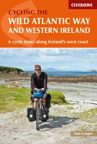
The Wild Atlantic Way and Western Ireland
6 cycle tours along Ireland's west coast
£17.95
Guidebook describing 6 cycling tours in western Ireland, based on the Wild Atlantic Way, the longest signed coastal route in the world. Each takes around 7 to 10 days, or, for the full Wild Atlantic Way experience, the routes can be combined to create a 44-stage, 2450km trip from Derry/Londonderry to Cork.
More informationIn Ireland, walking and cycling aren’t just ways to travel; they’re ways to experience the country. Whether you’re tackling a long-distance trail like the Wicklow Way, exploring the coastal views of the Kerry Way, or cycling along the Wild Atlantic Way, you’ll find that Ireland offers a blend of natural beauty, history, and adventure that’s hard to match elsewhere.