Alta Via 1: a complete planning guide to trekking in the Dolomites
The Alta Via 1 is an 11-day, 115km high-level trekking route through the Dolomites of northeastern Italy, running from Lago di Braies in the north to La Pissa near Belluno in the south. Well waymarked and perfectly suited to first-time alpine trekkers, it is widely regarded as one of the most beautiful multi-day walks in the Alps. (Last updated: March 2026 · Guidebook edition: 5th edition, Jul 2025)
Alta Via 1 quick facts:
- Distance: 115km
- Duration: 11 stages, approximately 2 weeks
- Start: Lago di Braies (Pragser Wildsee), northern Dolomites
- Finish: La Pissa, near Belluno
- Stages: 11
- High point: 2752m
- Difficulty: Grade 2 (moderate alpine)
- Waymarking: '1' in a blue triangle — well marked throughout
- Accommodation: Rifugi (mountain huts) throughout — no wild camping in park sections
- Best season: Mid June to late September
- Guidebook: Alta Via 1 — Trekking in the Dolomites by Gillian Price, 5th edition
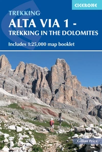
Alta Via 1 - Trekking in the Dolomites
Includes 1:25,000 map booklet
£18.95
Guidebook describing the 115km Alta Via 1, a hut-to-hut long-distance trail through the magnificent Italian Dolomites. Easier than the other AV trails, the route extends from Lago di Braies to La Pissa and is described in 11 stages. It offers majestic mountain vistas, including views of the Marmolada, Pelmo and Civetta. Includes 1:25K map booklet.
More information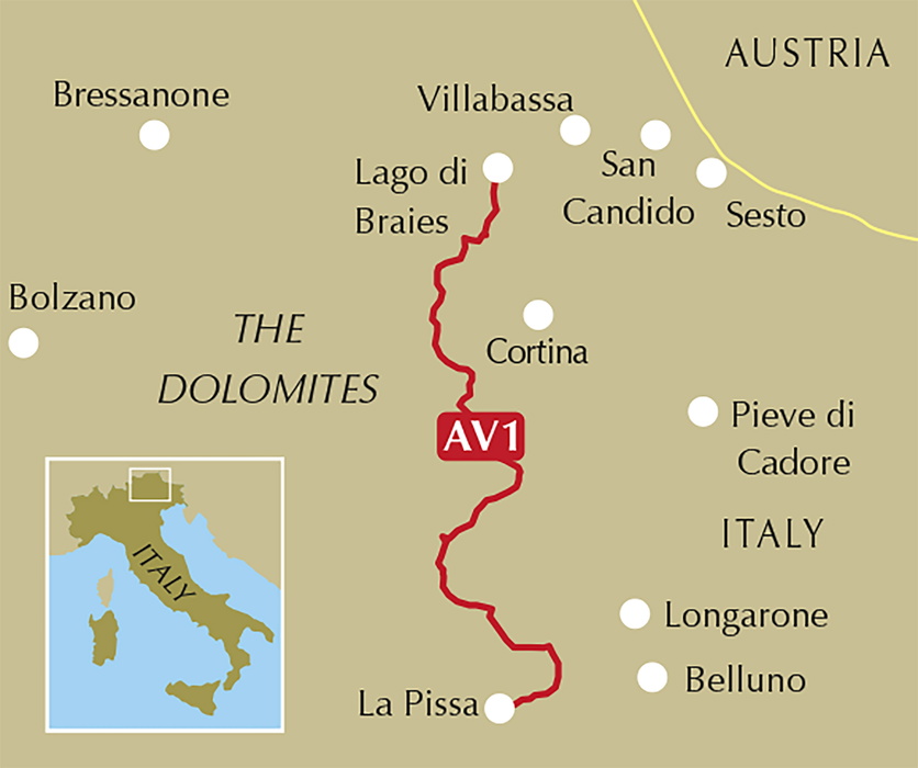
What is the Alta Via 1?
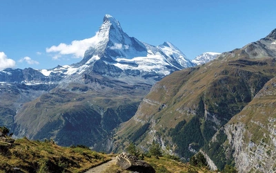
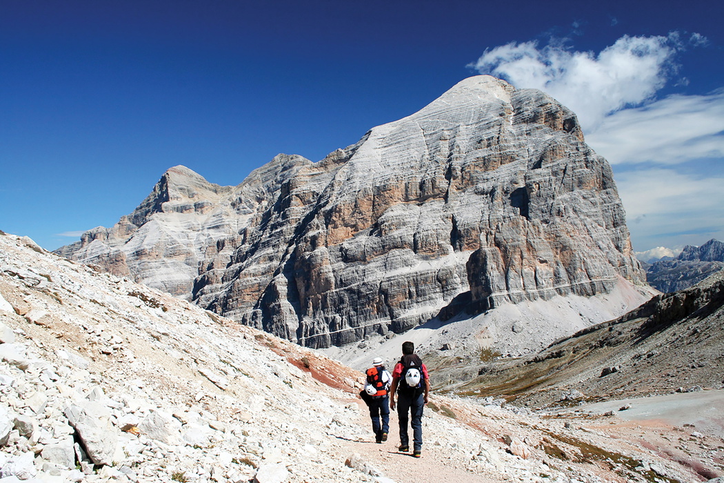
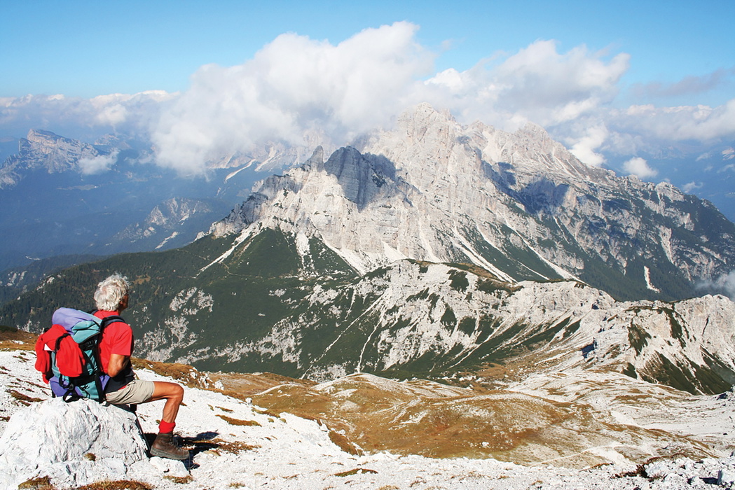
The Alta Via 1 is the most popular of six established Alta Via walking trails that traverse the Dolomites from north to south, maintaining medium to high altitude throughout. Stretching 115km across 11 stages, it begins at the jewel-like lake of Lago di Braies on the northern edge of the Dolomites and threads south through an extraordinary succession of mountain landscapes — the Fanes group, the Lagazuoi, the Tofane, Pelmo, Civetta, Moiazza and the rugged Dolomiti Bellunesi — before finishing near the town of Belluno.
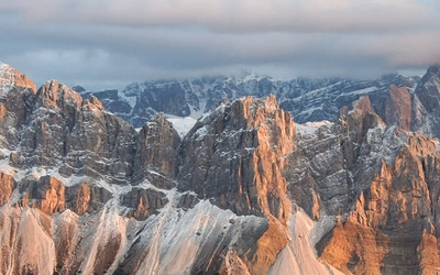
The Dolomites were granted UNESCO World Heritage status in 2009, and for good reason. These are not conventional alpine mountains: they are unique, self-contained rock formations with soaring pyramidal towers, sheer walls, and fortress-like plateaux, sculpted from pale calcium-magnesium carbonate rock that glows with breathtaking orangey-pink hues at sunset, a phenomenon known by the Ladin term enrosadira. An estimated 80% of the Dolomites are visible from the AV1 as it winds through them.
Like the Tour du Mont Blanc, the AV1 is a fully-serviced hut-to-hut trek, but with fewer crowds and a more intimate alpine character. Walkers stay each night in staffed rifugi (mountain huts), which provide meals, beds and a genuinely memorable alpine atmosphere. You travel comparatively light, and the route is well waymarked throughout. For those seeking a greater challenge, the GR20 offers a rougher, more self-sufficient experience.
This planning guide answers the most common questions trekkers have before setting out. For complete stage-by-stage route descriptions, 1:25,000 mapping and accommodation listings, see the Cicerone Alta Via 1 guidebook.
How long is the Alta Via 1?
The Alta Via 1 covers 115km across 11 stages, running north to south from Lago di Braies to La Pissa near Belluno. The route reaches a high point of 2752m and involves significant daily ascent and descent. The terrain is always alpine, never flat, and height gain and loss matters far more than distance in planning your days.
What are the stages of the Alta Via 1?
The route is divided into 11 stages, each concluding at a rifugio with meals and accommodation. These stages correspond to a reasonable day's walking, but they are suggestions rather than obligations. The abundance of huts throughout the Dolomites means you can adjust your daily distances freely, walking more or less as energy and conditions allow.
Timing estimates in the guidebook do not include stops for food, photographs or rest. Always add a couple of hours to any quoted time to be realistic.
| Stage | Time | Distance | Ascent/Descent |
|---|---|---|---|
| Lago di Braies to Rifugio Biella | 3hr 20min | 6km | 870m/60m |
| Rifugio Biella to Rifugio Fanes | 4hr 30min | 13km | 710m/980m |
| Rifugio Fanes to Rifugio Lagazuoi | 5hr 30min | 12.2km | 1150m/450m |
| Rifugio Lagazuoi to Rifugio Nuvolau | 5hr 30min | 12.8km | 1100m/1275m |
| Rifugio Nuvolau to Rifugio Città di Fiume | 5hr | 12.8km | 500m/1200m |
| Rifugio Città di Fiume to Rifugio Coldai | 3hr 30min | 9.3km | 560m/340m |
| Rifugio Coldai to Rifugio Vazzoler | 3hr 30min | 9.8km | 450m/850m |
| Rifugio Vazzoler to Rifugio Carestiato | 3hr 20min | 8.7km | 620m/500m |
| Rifugio Carestiato to Rifugio Pramperet | 4hr 20min | 13.2km | 620m/600m |
| Rifugio Pramperet to Rifugio Pian de Fontana | 3hr | 6.2km | 540m/760m |
| Rifugio Pian de Fontana to La Pissa bus stop | 4hr 15min | 11km | 200m/1400m |
Who is the Alta Via 1 suitable for?
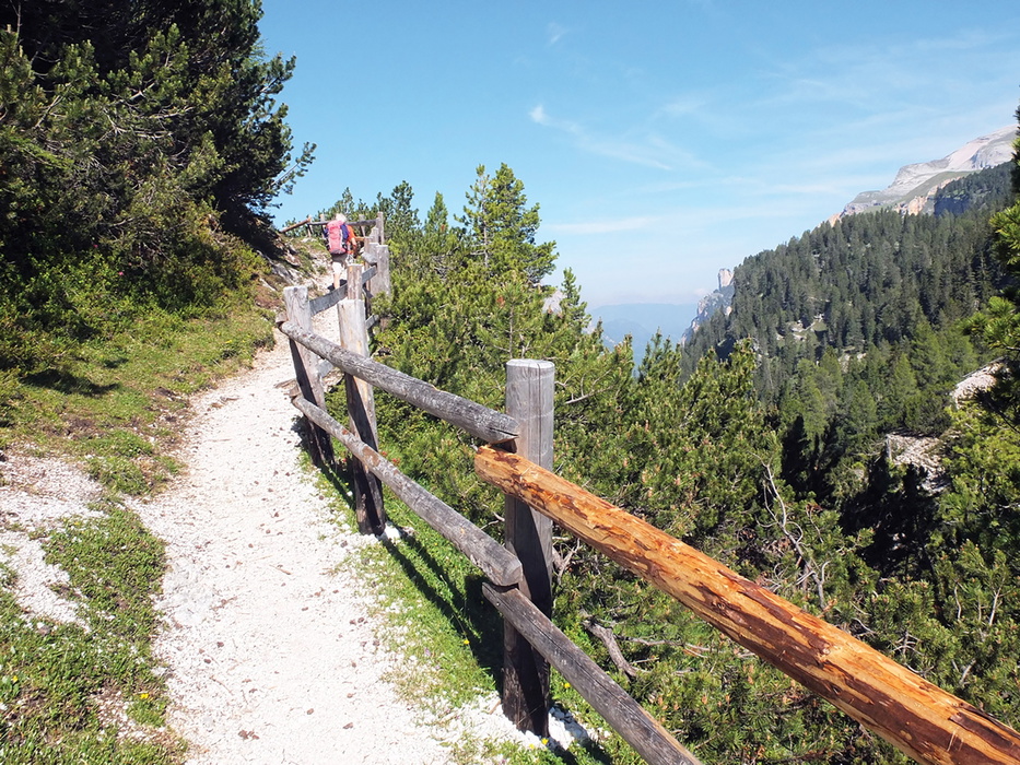
The AV1 is explicitly described in the guidebook as suitable for beginners to alpine trekking and this is one of its great virtues. The route carries an overall Grade 2 rating: a fairly strenuous alpine walk, but not especially difficult or technically demanding. Paths are well trodden and well marked, and rifugi are spaced at manageable intervals throughout.
That said, "suitable for beginners" means beginners to multi-day alpine trekking, not to walking altogether. The terrain is always mountainous; never level, often steep and rocky, occasionally exposed. Walkers should have a reasonable base fitness, appropriate footwear (boots with ankle support and non-slip soles), and the sense to turn back or take an alternative route in poor weather. Afternoon thunderstorms are common in summer; setting out early each day is strongly recommended.
One section — Stage 5 — includes short cable-aided stretches. These are avoidable via a variant route for anyone uncomfortable with exposure.
How difficult is the Alta Via 1?
The AV1 rates Grade 2 overall in the Italian grading system (Escursionistico): a fairly strenuous alpine walk without especially difficult or exposed sections. In practice, this means sustained ascents and descents on good paths, with some rocky terrain at higher altitudes.
For those wanting more challenge, Grade 3 variants are available at two points: the wartime Lagazuoi tunnels in Stage 4, and the Pelmo circuit in Stage 6. These require experience on mountainous terrain, a head for heights and good orientation skills, but are well worth it for confident walkers.
The overall difficulty increases in adverse weather. Even a straightforward path can become treacherous in rain, and high-altitude terrain in thick mist makes navigation difficult. Always check the weather forecast before setting out and remember that hut guardians are the best local source of information.
Can I walk a shorter section of the Alta Via 1?
Yes. The AV1 lends itself well to shorter itineraries, and all the suggested start and finish points below are served by public transport:
- 4 days: Lago di Braies (Stage 1) to Passo Falzarego (Stage 4), then bus to Cortina
- 4 days: Listolade to La Pissa (Stages 8–11)
- 5 days: Passo Falzarego (Stage 4) to Listolade (exit route in Stage 8), bus to Belluno
- 6 days: Lago di Braies (Stage 1) to Passo Staulanza (Stage 6), bus to Longarone
Exit routes from intermediate points are clearly explained in the guidebook's route description, along with transport options.
Which direction should I walk the Alta Via 1?
The route is described in the classic north to south direction — Lago di Braies to La Pissa — and this is the recommended approach. It can be walked south to north by recalculating times in relation to ascent and descent, though waymarking is designed for the northbound direction and the guidebook route descriptions would need to be read in reverse.
When is the best time to walk the Alta Via 1?
The Dolomites summer trekking season runs from mid June to October, when the rifugi are open and winter snow has generally cleared from the paths.
- Mid June to early July: paths clear and huts freshly open; snow may linger on a few higher sections early in the season
- July: can be simply marvellous — warm, long days and the mountain flowers at their peak
- August: busiest period with the most reliable path conditions; recommended for first-time trekkers who want the safest experience, though accommodation books up quickly
- September to October: arguably the finest conditions — crystal-clear skies, no summer humidity or haze, quieter paths. Colours shift from alpine green to early autumn yellows. Huts in the northern Südtirol region stay open into October; those in the southern Dolomites may close in late September
Afternoon thunderstorms are a regular feature of Italian alpine summers throughout the season. Start walking early each day to reach your destination before storms typically build — usually from midday onwards.
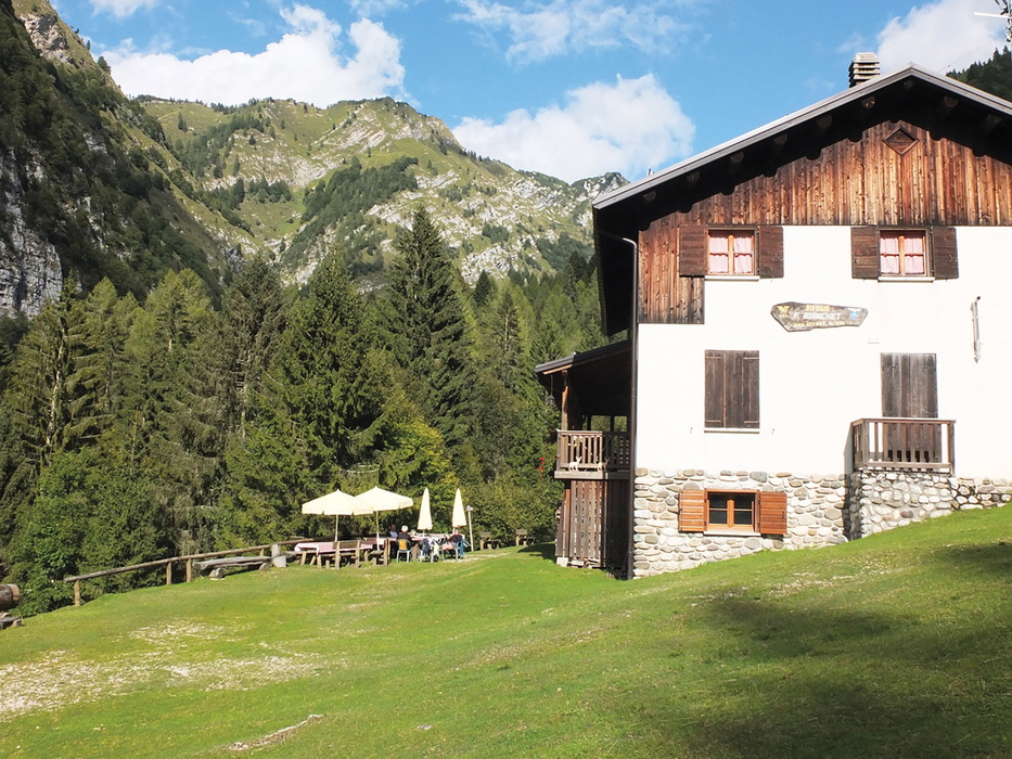
What accommodation is available?
The AV1's greatest practical advantage over other long-distance treks is its network of rifugi (mountain huts) spaced conveniently along the route. An overnight stay in a Dolomites rifugio is as essential a part of the experience as the walking itself.
These staffed hostel-like structures occupy spectacular high-altitude positions and provide communal sleeping quarters (ranging from small bunk rooms to larger dormitories), communal bathrooms, and excellent home-cooked meals served in a timber-lined stube warmed by a traditional tiled stove. Most belong to the Club Alpino Italiano (CAI), though many are run by local families.
Guests leave their boots at the door, change into sandals or hut slippers, and follow the 10pm–6am silence rule. Sleeping sheets or bag liners are required — available for purchase in many huts. Towels are not provided.
Cost: An average of €55 covers mezza pensione (half board: three-course dinner, overnight stay and breakfast), not including drinks. CAI members and affiliated UIAA club members save at least €10 per night.
Booking: Reservation is strongly recommended, especially in July and August when organised groups fill huts well in advance. Most rifugi have websites for online booking; a confirmation email is essential and a deposit is often required. Hut staff will always phone ahead to the next hut on your behalf.
Wild camping is not permitted in the three nature parks traversed by the AV1 (Stages 1–4 and 9–11). Wild camping is permitted in other sections but requires carrying a tent, sleeping bag and cooking equipment — a significant addition to your pack weight on a route that is already physically demanding.
What is the food like on the Alta Via 1?
Food is one of the genuine pleasures of the AV1. Rifugi serve excellent home-cooked meals in a communal dining room, and the cooking reflects the fascinating cultural mix of the Dolomites — part Italian, part Austro-Hungarian, with a strong Südtirol character in the northern stages.
Dinner typically offers a first course of minestrone or barley soup, or pasta with meat or tomato sauce. Specialities worth seeking out include gnocchi di patate con ricotta affumicata (potato dumplings with smoked cheese), Südtirol canederli (bread dumplings with speck, served in consommé), and the Cortina district's casunziei — tender ravioli with a beetroot filling, smothered in poppy seeds. Polenta with goulash, wild mushrooms or melted cheese is common and always filling. Dessert often means Apfelstrudel or Kaiserschmarrn — sliced pancake with sultanas and icing sugar, a meal in itself.
If you need a packed lunch, order your rolls (panini) the evening before. There are no shops along the AV1; the only points where you can resupply or buy provisions require a bus detour — at Rifugio Pederü (Stage 2), Passo Falzarego (Stage 4) and Passo Staulanza (Stage 6). The single ATM on the route is at Passo Falzarego.
Cash: Carry a good supply of euros. Not all rifugi accept cards, and the ATM options are extremely limited — don't rely on being able to withdraw cash en route.
What wildlife might I see on the Alta Via 1?
The Dolomites support a remarkable range of alpine wildlife, and the AV1 traverses three protected nature parks — Fanes-Senes-Braies, Dolomiti d'Ampezzo and Dolomiti Bellunesi — where animal populations are well protected.
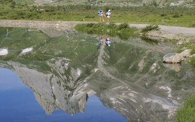
The animals you are most likely to encounter are alpine marmots — sociable, beaver-like creatures that live in underground colonies. They always post a sentry who emits a piercing warning whistle at the approach of walkers or predators. Higher on the rocky slopes, chamois — slender mountain goats with crochet-hook horns — are commonly seen grazing on pasture flats or picking their way across impossibly steep terrain.
Ibex are an exciting sight: stocky animals with impressively thick, grooved horns that can reach a metre long on males. They were successfully reintroduced to the Dolomites in the 1970s from the Gran Paradiso National Park after near extinction. Brown bears are present in the Trentino region in small numbers — currently estimated at 50–60 — and sightings, while still rare, are becoming more common. Wolves have also spread naturally across the Italian Alps from the central Apennines in recent years.
Birdwatchers should watch for the lammergeier (bearded vulture), with its impressive 3-metre wingspan, and the alpine chough — a noisy, acrobatic crow with a bright yellow-orange beak that will appear at any col where walkers stop for a snack.
A note on safety: vipers are present in the southern Dolomites. Tawny brown with a zigzag pattern, they are venomous but attack only in self-defence. If you encounter one sunning itself on a path, step back and give it time to move away. Ticks are also a consideration in wooded areas of the southern stages — wear long trousers, use permethrin repellent on clothing and check yourself carefully after each day's walking.
How do I get to the start and back from the finish?
Getting to Lago di Braies (northern Dolomites):
The AV1 starts at Lago di Braies, accessible by bus from several points. Note that the bus to the lake may require advance booking in midsummer due to the lake's popularity — check at www.prags.bz before travelling.
- By rail from northern Europe/UK: Eurostar to Paris, TGV to Munich, then via Innsbruck and the Brenner Pass to Fortezza/Franzensfeste in Italy. Branch line east to Monguelfo/Welsberg, then SAD bus to Lago di Braies
- By air to Venice (Marco Polo): Direct buses to Cortina d'Ampezzo, then Cortina Express or SAD bus to Dobbiaco/Toblach for the Lago di Braies service
- By air to Treviso: Local bus to Treviso station, train to Calalzo, Dolomiti Bus to Cortina, then as above
- On foot from Villabassa railway station: A 2hr 30min walk via the village of Ferrara — route description and GPX track available at www.cicerone.co.uk/1081
Private passenger and luggage transfers can be arranged through companies including www.transferdolomiti.it and www.dolomititransfer.net.
Getting home from La Pissa:
From the end of the AV1, a 20-minute bus ride reaches Belluno, which has rail services south towards Venice. Trains also run north to Calalzo with ongoing buses to Cortina and Dobbiaco if you need to return to the trek start.
What should I wear and carry?
The AV1 is a fully-serviced trek, which means you can travel considerably lighter than on a wild-camping route. The guidebook's recommended maximum pack weight is 10% of your body weight plus 2kg — weigh your pack on bathroom scales before you leave, and be honest about what you actually need.
Key items include:
- Boots with ankle support and non-slip Vibram-type soles — broken in before the trip
- Waterproofs: jacket, over-trousers and rucksack cover
- Warm layers: fleece, hat and gloves (useful even in summer at altitude and on cabled sections)
- Sleeping sheet or bag liner — silk is ideal for weight
- Small towel and personal toiletries
- High-factor sun cream (UV intensity increases by 10% per 1000m of altitude), sunglasses and hat
- Trekking poles — strongly recommended for steep descents
- Foam ear plugs for dormitory sleeping
- Cash in euros — the only ATM on route is at Passo Falzarego (Stage 4)
- GPX tracks for the route are available free at www.cicerone.co.uk/1081/GPX
What are the route highlights?
The AV1 passes through an extraordinary succession of landscapes and the Dolomites' most celebrated mountain groups. Key highlights include:
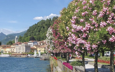
- Lago di Braies — the stunning turquoise lake at the start is one of the most photographed in the Alps, and sets the tone for what follows
- The Fanes group (Stages 1–2) — high plateau country with a remote, otherworldly character and excellent marmot and chamois sightings
- Rifugio Lagazuoi and the wartime tunnels (Stages 3–4) — the Lagazuoi was a contested WWI front line; the tunnels carved through the mountain by Austro-Hungarian forces are an extraordinary optional detour
- Passo Falzarego (Stage 4) — a dramatic high pass with views across to the Tofane group, one of the most iconic Dolomites panoramas
- Pelmo circuit variant (Stage 6) — the throne-shaped Pelmo is one of the most distinctive peaks in the Dolomites; the circuit variant for experienced walkers is one of the route's finest moments
- Civetta (Stages 6–7) — the vast north-west face of Civetta is one of the great walls of the Alps, visible for much of the middle section of the trek
- Enrosadira — the phenomenon of the pale Dolomite rock faces turning deep orangey-pink at sunset can be witnessed from virtually any point on the route; it is most spectacular when seen from a rifugio terrace after a long day's walking
What is the history of the Dolomites?
The Dolomites have an extraordinarily layered history — geological, cultural and military.
Geologically, the mountains date back some 230 million years to when the region was covered by a shallow tropical sea. The sedimentary rock that formed on its floor — incorporating fossilised shells, coral and even dinosaur tracks — was thrust dramatically upward around 65 million years ago as the Alps were created. The characteristic pale rock is calcium magnesium carbonate, identified in 1789 by French mineralogist Déodat de Dolomieu, after whom both the rock and the mountains are named.
Culturally, the Dolomites are a trilingual mosaic. In the northernmost Südtirol/Alto Adige region, 70% of the population is German-speaking; the adjoining Trentino is mostly Italian; and around 5% of the population across both regions speak Ladin, an ancient Rhaeto-Romanic language pre-dating Latin. Place names, maps and signposts can appear in all three versions — the guidebook uses Italian names for consistency.
Militarily, the Dolomites were a tragic WWI front line between the crumbling Austro-Hungarian Empire and the newly unified Italy. Contested borders ran along high mountain ridges; mule tracks were carved up valleys for supply; tunnels were blasted through peaks. The AV1 passes ruins of barracks, trenches and rusting barbed wire throughout — nowhere more strikingly than at the Lagazuoi, where the wartime tunnel system is an optional but unmissable Stage 4 detour.
Plan your trek with the Cicerone guidebook
The Cicerone Alta Via 1 guidebook, written by Gillian Price and now in its fifth edition (2025), provides everything you need to walk the route with confidence:
- Complete stage-by-stage route descriptions for all 11 stages, with grade, distance, total ascent and descent for each
- 1:25,000 mapping in a separate pull-out booklet
- Grade 2 and Grade 3 variants including the Lagazuoi tunnels and Pelmo circuit
- Shorter itinerary options for 4, 5 and 6-day sections
- Full rifugio accommodation listings with booking contact details
- Food and drink guide covering Dolomites specialities and dining customs
- Detailed transport guide covering all approach and exit options
- Wildlife, geology, plants and flowers, and WWI history sections
- Italian–English glossary and emergency procedures
- Free GPX tracks at www.cicerone.co.uk/1081/GPX
Available as a printed guidebook (£18.95) or digital eBook (£18.95).
Alta Via 1 - Trekking in the Dolomites
Includes 1:25,000 map booklet
£18.95
Guidebook describing the 115km Alta Via 1, a hut-to-hut long-distance trail through the magnificent Italian Dolomites. Easier than the other AV trails, the route extends from Lago di Braies to La Pissa and is described in 11 stages. It offers majestic mountain vistas, including views of the Marmolada, Pelmo and Civetta. Includes 1:25K map booklet.
More informationWhat Gillian Price learned walking the AV1 since 1981
Gillian Price first walked the Alta Via 1 in 1981 — equipped, as she recalls, with little more than bin liners as rainskirts against a Dolomites storm. She has since walked the route more times than she can count, revising and updating the Cicerone guidebook through five editions, and the Dolomites remain her favourite mountains and the AV1 her favourite long-distance trek.
What has changed over those four decades is partly practical — the rifugi have been modernised considerably, and the walking infrastructure is better than ever — and partly cultural. UNESCO's 2009 World Heritage designation brought a significant increase in visitor numbers, making responsible and environment-conscious behaviour on the trail more important than ever. The AV1's rifugi network means the route's environmental impact can be managed in ways that wild-camping routes cannot, but this requires walkers to carry rubbish to bins, leave no trace at rest stops, and treat the mountain environment with the care it deserves.
What has not changed is the quality of the experience itself. The levels of excitement and satisfaction, she notes, increase on each repeat — a remark that captures both the richness of the Dolomites landscape and the particular satisfaction of a route that rewards familiarity.
About Gillian Price, guidebook author:
Gillian Price has trekked throughout Asia and the Himalayas, but now lives in Venice and is exploring the mountains and flatter bits of Italy. Starting in the Italian Dolomites, Gillian has written outstanding Cicerone guides to walking all over Italy as well as Corsica and Corfu. An adamant promoter of public transport to minimise environmental impact, Gillian belongs to Mountain Wilderness and is an active member of the Venice branch of CAI, the Italian Alpine Club. Check out her website for more information.