The Walker's Haute Route (Chamonix to Zermatt): a complete planning guide
Chamonix to Zermatt, Mont Blanc to the Matterhorn: two of the greatest names in mountaineering linked by 14 days of high alpine travel. The Walker's Haute Route crosses 215km (134 miles) and 11 passes between the two, taking in the largest collection of 4000m peaks anywhere in the Alps along the way. (Last updated: July 2026 · Guidebook edition: 7th edition, 2022, reprinted 2024)
Trekking Chamonix to Zermatt, quick facts:
- Distance: 215km (134 miles)
- Duration: 12 to 14 days
- Start: Chamonix, France
- Finish: Zermatt, Switzerland
- Stages: 14 (plus 9 alternative stage variants)
- High point: several passes approaching 3000m, though none is crossed by glacier
- Difficulty: demanding, non-technical, best suited to experienced alpine walkers
- Terrain: high mountain passes, alpine meadows, forest trails, glacial valleys and traditional villages
- Waymark: yellow signs (chemin pédestre), red and white paint flashes (chemin de montagne), and blue-white stripes on the more challenging Alpine Route sections
- Accommodation: mountain huts, village gîtes d'étape, hotels and limited campsites
- Best season: mid-July to mid-September
- Guidebook:Trekking Chamonix to Zermatt by Kev Reynolds, 7th edition (Cicerone, 2022), more information
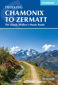
Trekking Chamonix to Zermatt
The classic Walker's Haute Route
£18.95
Guidebook to the Walker's Haute Route from Chamonix to Zermatt. The 225km route typically takes 2 weeks to walk. Described in 14 stages, the route crosses 11 passes between Mont Blanc and the Matterhorn and involves more than 14,000m of ascent and descent. A complete guide for planning and walking the route, with accommodation information
More information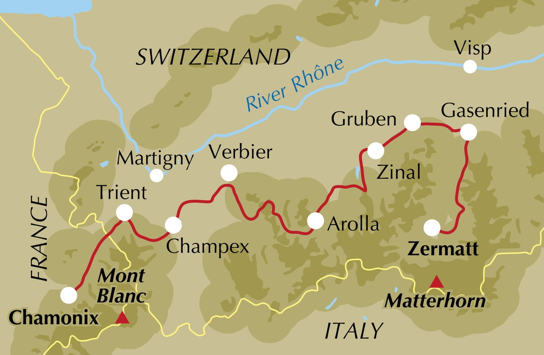
What is the Walker's Haute Route?
The Walker's Haute Route is a 215km trek across the Pennine Alps linking Chamonix, at the foot of Mont Blanc, with Zermatt, in the shadow of the Matterhorn. It is a walker's version of the historic ski-mountaineering Haute Route established in the 1860s, following a line that never quite reaches 3000m on any of its passes, avoids glacier crossings, and demands no technical mountaineering skills, while still delivering some of the most dramatic high mountain views in the Alps.
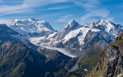
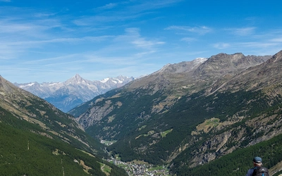
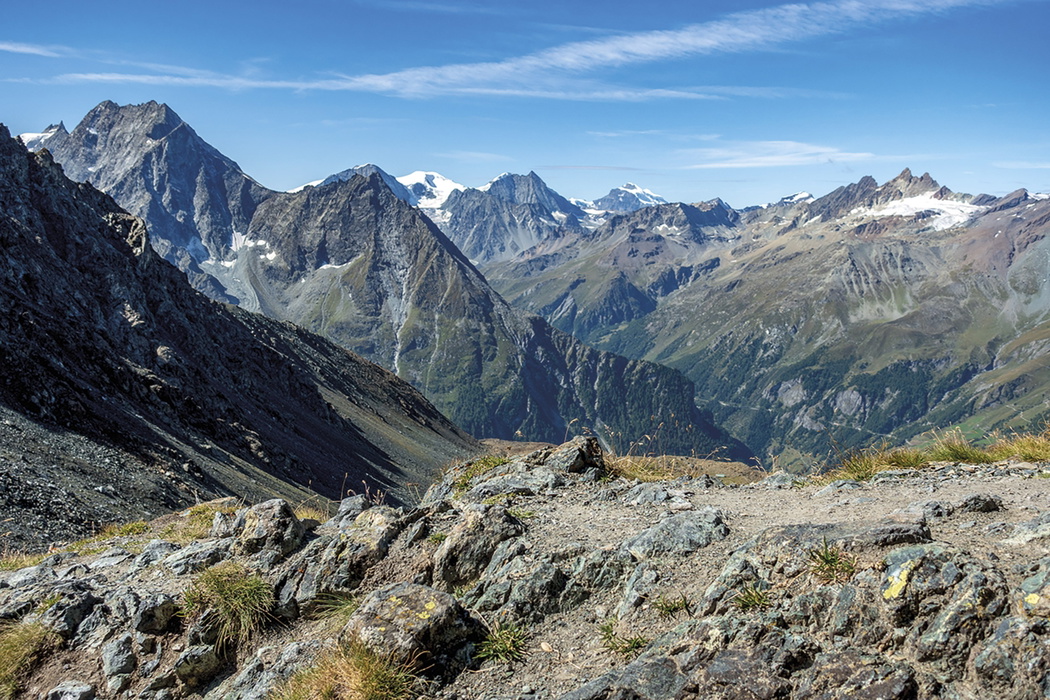
The route crosses the grain of the country, cutting across deep valleys and over 11 passes rather than following any single valley or ridge line. Along the way it passes beneath the Grand Combin, Mont Blanc de Cheilon, Pigne d'Arolla and the Dent Blanche, through the flower-filled valleys of Arolla and Zinal, and beneath the Weisshorn and Dom before the Matterhorn finally comes into view on the approach to Zermatt. Overnight stops range from village hotels to remote mountain huts, so backpacking with tent and stove is a choice rather than a necessity.
More demanding than the popular Tour of Mont Blanc, the Haute Route is longer, gains and loses nearly 14,000m in height, and is often considered a natural step up for walkers who have already completed the TMB. This planning guide answers the most common questions walkers have before setting out. For complete stage-by-stage route descriptions and mapping, see the Cicerone Trekking Chamonix to Zermatt guidebook.
How long is the Walker's Haute Route?
The full route covers 215km (134 miles) in 14 stages, with a total of roughly 13,800m of ascent and 13,220m of descent. Most trekkers allow a fortnight, though fit walkers can condense the route into 12 days by combining some of the shorter stages.
| Stage | Distance | Ascent | Time |
|---|---|---|---|
| Chamonix to Argentière | 9km | 300m | 2hr 15min |
| Argentière to Trient | 15km | 1000m | 5hr 30min |
| Trient to Champex | 16km | 1390m | 7hr |
| Champex to Le Châble | 14.5km | 200m | 4hr 15min |
| Le Châble to Cabane du Mont Fort | 13km | 1660m | 5hr 30min |
| Cabane du Mont Fort to Cabane de Prafleuri | 17km | 1110m | 7hr 30min |
| Cabane de Prafleuri to Arolla | 18km | 740m | 6hr |
| Arolla to La Sage | 11.5km | 520m | 4hr |
| La Sage to Cabane de Moiry | 11.5km | 1680m | 6hr |
| Cabane de Moiry to Zinal | 19.5km | 650m | 7hr |
| Zinal to Gruben | 17km | 1250m | 6hr |
| Gruben to St Niklaus | 18km | 1150m | 7hr |
| St Niklaus to Europa Hut | 12km | 1300m | 5hr |
| Europa Hut to Zermatt | 23km | 850m | 7hr |
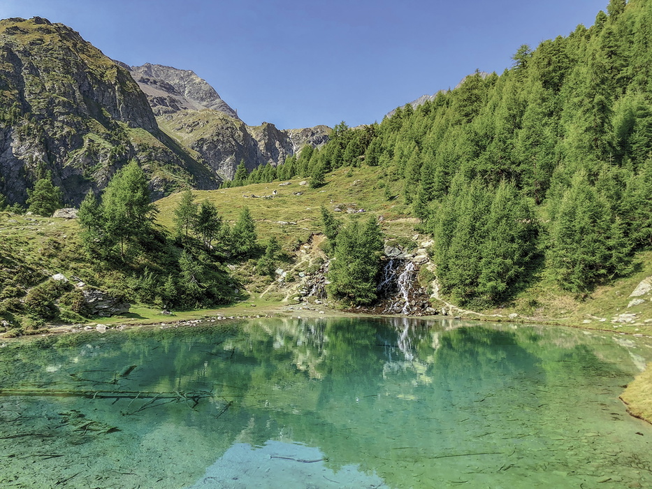
The toughest single day is Cabane du Mont Fort to Cabane de Prafleuri (Stage 6), which crosses three cols in quick succession around the northern flanks of Rosablanche in 7hr 30min. Stage 3, over the Fenêtre d'Arpette, also has a reputation for its steep, rough descent into Champex, one of the more difficult sections named in the guidebook.
Who is the Walker's Haute Route suitable for?
This is a route for experienced mountain walkers with a good level of fitness, comfortable with long days, steep ascents and descents, and some exposed terrain. It is not a route for first-time alpine trekkers, though those who have completed the Tour of Mont Blanc will find it a natural progression. Regular hillwalking at home, ideally carrying a loaded rucksack, is recommended preparation, since several stages gain and lose over 1000m in a single day.
How difficult is the Walker's Haute Route?
The route is graded as demanding but non-technical: no glacier travel or climbing skills are required, and the passes stay just under 3000m. That said, a handful of sections warrant particular care, including the descent from Fenêtre d'Arpette, the Sentier des Chamois above Cabane du Mont Fort, the traverse between Col de Louvie and Col de Prafleuri, the approach to Col de Riedmatten, and the exposed sections of the Europaweg on the final two stages, several of which are protected with fixed cables. Early-season walkers (June to early July) should check conditions and may need an ice axe and crampons for lingering snow on the high passes.
Can I walk a shorter section of the Walker's Haute Route?
Yes. The route splits naturally at several points for those without a full fortnight:
- Chamonix to Arolla (7 stages) makes a satisfying week-long introduction, with a return possible from Arolla by bus and train, saving the second half for another year.
- Arolla to Zermatt (7 stages) can be walked as a standalone second week, reached by bus from Sion or Sierre.
- Finish at St Niklaus (Stage 12) rather than continuing over the Europaweg, taking the valley train on to Zermatt, is a straightforward way to trim the final two, more strenuous stages.
- Stage 12A, the short link between St Niklaus and Gasenried, can also be skipped by bus if time is tight.
Combining the shorter days, particularly Stage 1 and Stage 2 into a single 7 to 8 hour day out of Chamonix, allows fit walkers to cut a full day from the standard 14-day itinerary.
Which direction should I walk the Walker's Haute Route?
The route is designed and waymarked west to east, from Chamonix to Zermatt, and this is the direction described in the guidebook and followed by the great majority of trekkers. Walking Mont Blanc to Matterhorn also has a natural narrative logic, building through the passes towards the dramatic final approach to the Matterhorn above Zermatt. Walking it in reverse is possible but not something the guidebook supports with route description.
When is the best time to walk the Walker's Haute Route?
- Mid-June to early July: mountain huts begin opening, but snow can still linger on the higher passes; ice axe and crampons may be needed and conditions should be checked in advance.
- July to mid-August: the busiest period, with warm days (25 to 30°C even at altitude) and a real chance of afternoon thunderstorms.
- Mid-August to mid-September: generally regarded as the sweet spot, combining settled weather with good availability of hut and hotel beds.
- Mid-September onwards: clear autumn weather and golden larchwoods, but most huts close by the end of September and early snow can restrict the high passes.
What accommodation is available on the Walker's Haute Route?
Accommodation ranges from village hotels to gîtes d'étape (privately run, hostel-style lodgings) and mountain huts belonging to the Swiss Alpine Club or run privately. Huts provide mixed dormitory accommodation and meals, though a sleeping bag liner is required (and usually insisted upon) everywhere. Official campsites exist in some valleys but not all, and wild camping is officially discouraged in Switzerland.
Booking ahead is strongly advised, especially at Col de Balme, Trient and Champex, which are shared with Tour of Mont Blanc trekkers, and at Cabane de Louvie, Cabane de Prafleuri, Cabane de Moiry, and the small villages of La Sage and Gruben, where bed numbers are limited. The guidebook's stage-by-stage listings and Appendix C give full contact details for lodgings along the route.
What are the alternative stages on the Walker's Haute Route?
Alongside the 14 main stages, the guidebook describes 9 alternative stage variants, allowing trekkers to tailor the route to weather, fitness or time available. These include Stage 3A (the gentler Bovine route to Champex, an alternative to the steep Fenêtre d'Arpette), Stage 5A (a link to Cabane de Louvie), Stage 9A and 10A (an option via Col de Torrent and the Moiry Barrage), Stages 11A and 11B (a route via Hôtel Weisshorn and the Meidpass, avoiding the direct Forcletta crossing), Stage 12A (the short link to Gasenried), and Stages 13A/14A and 13B, which offer a valley-based finish through St Niklaus and Täsch as an alternative to the exposed high-level Europaweg. Route summary information for each variant is set out in the guidebook alongside the main stage table.
Getting to and from the Walker's Haute Route
Geneva is the most convenient airport for reaching Chamonix, served from the UK by British Airways, easyJet and Swiss International Air Lines, with onward travel to Chamonix by shuttle minibus, bus or rail via Martigny. Eurostar plus onward rail connections also make a car-free journey from the UK straightforward.
At the end of the trek, return from Zermatt is by train via Visp to Geneva or Lausanne. Zurich airport, reached in three to four hours by train, can offer better flight availability for those without fixed return bookings from Geneva.
What are the highlights of the Walker's Haute Route?
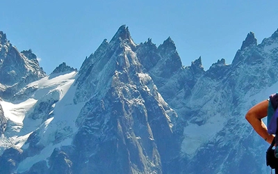
- The Mont Blanc massif and Chamonix's aiguilles at the very start of the trek
- The Grand Combin, rising above the Val de Bagnes
- The icefalls and tarns of the Val de Moiry, and the long views to the Weisshorn from Col de Sorebois
- The wild upper reaches of the Val de Zinal, ringed by glacier-hung peaks
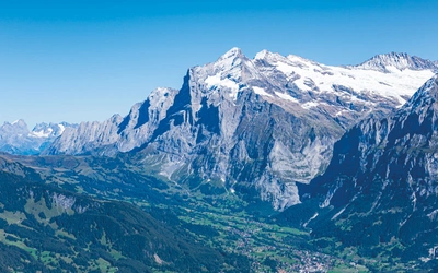
- The Dom and Weisshorn seen across the Mattertal from above Turtmanntal
- The Europaweg's suspension bridge crossing and the first full view of the Matterhorn on the descent into Zermatt
Plan your walk with the Cicerone guidebook
The Trekking Chamonix to Zermatt guidebook by Kev Reynolds contains everything you need to plan and complete the Walker's Haute Route, from Chamonix to Zermatt.
- Full route description across 14 day-long stages, organised west to east
- 9 alternative stage variants, allowing the route to be tailored to time, fitness and weather
- Stage-by-stage distance, ascent/descent and estimated walking time for easy planning
- 1:50,000 mapping and free downloadable GPX tracks for every stage
- At-a-glance information boxes for each stage covering start/finish points, high points, accommodation and refreshment options
- Guidance on fitness, equipment, travel and public transport, mountain safety, and accommodation in huts, village inns and campsites
- Notes on wildlife, plants and local customs encountered along the way
- Practical advice for condensing the route into a 12-day itinerary
Available as a printed guidebook (£18.95) or digital eBook (£18.95).
Trekking Chamonix to Zermatt
The classic Walker's Haute Route
£18.95
Guidebook to the Walker's Haute Route from Chamonix to Zermatt. The 225km route typically takes 2 weeks to walk. Described in 14 stages, the route crosses 11 passes between Mont Blanc and the Matterhorn and involves more than 14,000m of ascent and descent. A complete guide for planning and walking the route, with accommodation information
More informationAbout Kev Reynolds, guidebook author:
Kev Reynolds first visited the Alps in the 1960s, and returned there on numerous occasions to walk, trek or climb, to lead mountain holidays, devise multiday routes or to research a series of guidebooks covering the whole range. A freelance travel writer and lecturer, his long association with Cicerone Press began with his first guidebook to Walks and Climbs in the Pyrenees. He wrote more than a dozen books on Europe's premier mountain range, a series of trekking guides to Nepal, a memoir covering some of his Himalayan journeys (Abode of the Gods) and a collection of short stories and anecdotes harvested from his 50 years of mountain activity (A Walk in the Clouds).
Kev was a member of the Alpine Club and Austrian Alpine Club. He was made an honorary life member of the Outdoor Writers and Photographers Guild; SELVA (La Société d'Étude de la Littérature de Voyage Anglophone), and the British Association of International Mountain Leaders (BAIML). After a lifetime's activity, his enthusiasm for the countryside in general, and mountains in particular, remained undiminished, until his death in 2021. His inspiration and infectious love of the mountains and adventure will continue to inspire generations to come.