An Introduction to Glyndŵr's Way
Glyndŵr’s Way (Llwybr Glyndŵr) is named after the remarkable late-medieval Welsh leader Owain Glyndŵr, and is one of three National Trails in Wales. It links at either end – Knighton and Welshpool – with the Offa’s Dyke Path, and this guide, as well as describing Glyndŵr’s Way, includes two days along the Offa’s Dyke Path to create a circular route.
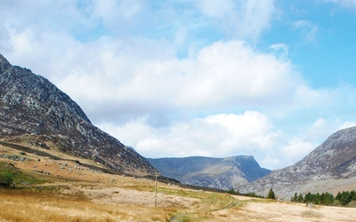
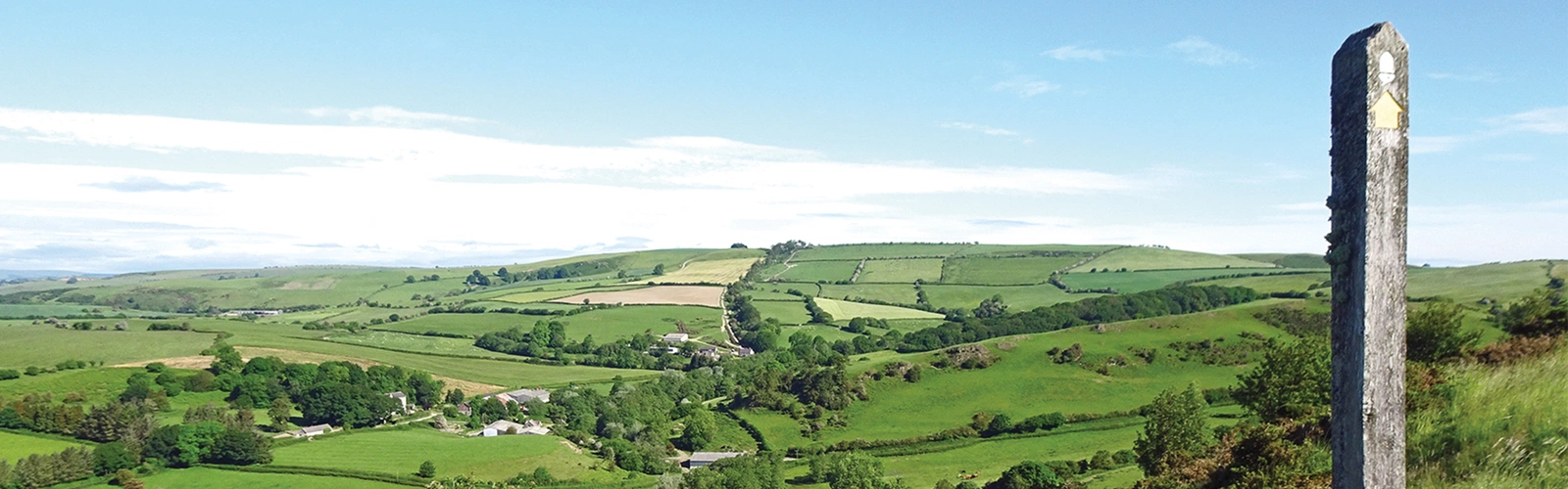
Glyndŵr’s Way is one of the quietest National Trails, exploring sparsely populated countryside, featuring a succession of hills and valleys largely used for sheep-rearing. The route meanders around, with frequent twists and turns, ascents and descents, so that the scenery changes continually. Some of the higher parts feature open moorlands or forestry plantations. There are a handful of towns along the way, with a scattering of small villages and abundant small farms. It takes some walkers a long time before they point their feet towards mid-Wales, but once they do so, they always return to experience more of its quiet, understated charm.

How long is Glyndwr's Way (Llwybr Glyndŵr)
Glyndŵr’s Way sits squarely in mid-Wales, extending from the Welsh–English border at Knighton almost to the coast at Machynlleth, and then back towards England with a finish at Welshpool.
The total route is 217km (135 miles) but this can easily be extended by walking an additional 47km (29 miles) from Welshpool to Knighton along the Offa's Dyke Path, creating a circular journey.
Who was Owain Glyndŵr?
The trail’s namesake is Owain Glyndŵr, a Welsh leader in the late Middle Ages. Any commentary about Owain Glyndŵr quickly becomes a confusing and contradictory mix of history, myth and legend. There is no doubt that he existed, and that he waged war against English forces.
However, it is unlikely that he was gifted with supernatural powers, as was claimed, and no one can say for certain when he died or where he was buried. Like the proverbial old soldier, he just faded away. The Dictionary of Welsh Biography has a detailed description of the significance of the legendary hero.
Why should you walk it?
Glyndŵr’s Way is one of the quietest National Trails, exploring sparsely populated countryside, featuring a succession of hills and valleys largely used for sheep-rearing. The route meanders around, with frequent twists and turns, ascents and descents, so that the scenery changes continually.
How hard is Glyndŵr’s Way?
In a sense, there aren’t ‘hard’ or ‘easy’ days on the trail. Every day includes a number of hills, and ascents and descents may occasionally be steep, but are usually reasonably gentle. Most of the surfaces underfoot are firm and clear, including tracks and minor roads, but sometimes there are pathless fields or occasional boggy moorland paths.
The fact that the terrain changes all the time means that some stretches can be covered quickly, while others prove slower, but overall each stage is likely to take the same amount of time.
When is best to walk Glyndŵr’s Way?
Most walkers will aim for summertime in the hope of warm, sunny days and not too much rain. Bear in mind that some short stretches cross permanently boggy ground, and after prolonged rain some paths and tracks become quite muddy. It is well worth checking daily weather forecasts during your walk.

Useful notes:
Food and Drink
Unless food and drink can be guaranteed around lunchtime, carry a packed lunch and drink. Water from streams along the Glyndŵr’s Way route is not guaranteed to be clean, as it often runs through sheep or cattle pastures, or farmyards. Unless you are prepared to filter, treat or boil water, you should carry enough clean water for each day’s needs.
Camping
If camping, a lightweight tent, sleeping bag and cooking equipment will be sufficient. Most campsites along the way are low-level and sheltered.
Accommodation
There are several hotels, guesthouses and B&Bs in the towns along Glyndŵr’s Way, but these can become fully booked on summer weekends, or whenever there is a local festival or wedding. In the smaller villages, there might only be a couple of lodgings, and if these are already full it could be half a day’s walk to the next available place.
Transport
Bus services are patchy around the course of Glyndŵr’s Way, being fairly regular and frequent in and near towns, and completely absent in some other areas. It is possible to walk for two days without intercepting a single bus route.
Communication
Rural telephone kiosks are quickly vanishing; they seldom accept coins and have to be operated by entering credit/debit card details or an account number. Mobile phone coverage is patchy around mid-Wales, and signals come and go at odd times. The towns have good coverage, but some villages have no signal, and being on high ground is no guarantee that a signal will be available.
Stage Summary and Detailed Breakdown:
This summary follows the Cicerone Guide, written by Paddy Dillon.
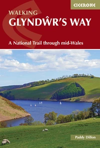
Walking Glyndwr's Way
A National Trail through mid-Wales
£16.95
Guidebook to walking Glyndwr's Way, a long-distance National Trail through mid-Wales. The 135 mile route from Knighton to Welshpool via Machynlleth takes 9 days to walk, and 2 more days (29 miles) to complete the loop down the Offa's Dyke Path to create a circular trail. A lovely trail through quiet hills, forests and rolling countryside.
More information| Stage | Start / Finish | Distance | Time |
|---|---|---|---|
| 1 | Knighton - Felindre | 24km (15 miles) | 8hr |
| 2 | Felindre - Abbey-cwm-hir | 25km (15½ miles) | 8hr |
| 3 | Abbey-cwm-hir - Llanidloes | 25km (15½ miles) | 8hr |
| 4 | Llanidloes - Dylife | 23.5km (14½ miles) | 7hr |
| 5 | Dylife - Machynlleth | 23.5km (14½ miles) | 7hr |
| 6 | Machynlleth - Llanbrynmair | 25.5km (16 miles) | 8hr |
| 7 | Llanbrynmair - Llanwddyn | 29km (18 miles) | 9hr |
| 8 | Llanwddyn - Meifod | 24km (15 miles) | 8hr |
| 9 | Meifod - Welshpool | 17.5km (11 miles) | 5hr 30mins |
Glyndŵr's Way stages:
Stage 1: Knighton - Felindre
- Distance: 24km (15 miles)
Glyndŵr’s Way quickly leaves Knighton, crossing Bailey Hill to reach the little village of Llangunllo. Those who start early will have plenty of time to continue over the sprawling moorlands of Pool Hill, Stanky Hill and Black Mountain.
Stage 2: Felindre - Abbey-cwm-hir
- Distance: 25km (15½ miles)
Farm tracks and field paths cross grassy hills, over and over again, between the villages of Felindre and Llanbadarn Fynydd. The route crosses the shapely hills of Moel Dod, Yr Allt and Ysgŵd-ffordd, before dropping into a wooded valley.
Stage 3: Abbey-cwm-hir - Llanidloes
- Distance: 25km (15½ miles)
After leaving the forested environs of Abbey-cwm-hir, Glyndŵr’s Way crosses the grassy Upper Esgair Hill and passes through the tiny settlement of Bwlch-y-sarnau. The route later zigzags in and out of wooded valleys, then a final road-walk leads straight into Llanidloes – the first town since leaving Knighton.
Stage 4: Llanidloes - Dylife
- Distance: 23.5km (14½ miles)
The reservoir was constructed in the mid-1960s and fills a convoluted valley, so it keeps appearing in view as other hills and valleys are crossed. Somewhere around Dylife, walkers will finish their day before reaching the highest stretch of Glyndŵr’s Way.
Stage 5: Dylife - Machynlleth
- Distance: 23.5km (14½ miles)
Glyndŵr’s Way climbs over a broad moorland gap, passing close to the isolated moorland lake of Glaslyn and the rugged hump of Foel Fadian. Valleys come one after the other during this stage, with a couple of steep climbs between them. There are no services whatsoever until the town of Machynlleth is reached.
Stage 6: Machynlleth - Llanbrynmair
- Distance: 25.5km (16 miles)
The course of Glyndŵr’s Way plays hide and seek with the Dyfi valley for half a day. However, the first stretch from Machynlleth to Penegoes is low level, so views are confined. Later, views northwards from Bryn Wg and Cefn Côch reveal the length of the valley, with mountainous Snowdonia beyond.
Stage 7: Llanbrynmair - Llanwddyn
- Distance: 29km (18 miles)
A fine grassy crest is followed, high above Llanbrynmair, that leads to a forested area high on Panylau Gwynion. After an easy road-walk through the broad valley of Nant yr Eira, the route crosses the boggy slopes of Pen Coed. The extensive plantations of Dyfnant Forest lie ahead, with a couple of scenic breaks. The mighty stone dam of Llyn Efyrnwy is seen at the end of the day.
Stage 8: Llanwddyn - Meifod
- Distance: 24km (15 miles)
A cursory glance at a map suggests that this entire stage follows the Afon Efyrnwy downstream. However, the route runs beside the river only on a couple of occasions, crosses it three times, and generally keeps its distance from the flow. Nearby hills are crossed, notably Allt Dolanog, and there are a succession of ascents and descents. Signposts for the Ann Griffiths Walk will be seen in some places, where it crosses Glyndŵr’s Way or enjoys a stretch in common – notably at Pont Llogel, Dolanog and Pontrobert. This stage finishes at Meifod, at the lowest point on the route since Machynlleth.
Stage 9: Meifod - Welshpool
- Distance: 17.5km (11 miles)
The final stage of Glyndŵr’s Way is short, but remarkably convoluted, featuring a succession of small hills. The last hill, Y Golfa, is a splendid viewpoint, allowing views back into the heart of Wales, as well as across the Severn lowlands to Long Mountain, which is traversed by the Offa’s Dyke Path. The end of the trail is in the busy market town of Welshpool.