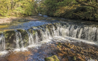
An introduction to the Pembrokeshire Coast Path
Officially opened in 1970, the Pembrokeshire Coast Path offers some of the finest walking in Britain; mile after mile of ever-changing natural beauty, where the juxtaposition of land and sea create a special magic that few long-distance trails can match. Read on for a quick introduction to this wild and beautiful national trail.

The Pembrokeshire Coast Path
NATIONAL TRAIL - Amroth to St Dogmaels
£17.95
This guidebook describes the Pembrokeshire Coast Path National Trail. The scenic long-distance walk from Amroth to St Dogmaels is 180 miles long and takes about 2 weeks to walk, with soaring rugged cliffs, tranquil inlets and broad sandy beaches. Includes planning schedules, accommodation guidance and a 1:25,000 OS map booklet.
More informationWhere is it and how far is it?
This spectacular trail runs for 180 miles (290km) between Amroth near Tenby and St Dogmaels and can be walked in around two weeks by a reasonably fit walker.
Although this trek is not technically challenging, walkers will have climbed a total ascent of about 33,000ft (10,000m) by the end so it is not a modest undertaking. However, this trail is just a short stretch of the 870 mile (1400km) Wales Coast Path.
Why should you walk it?
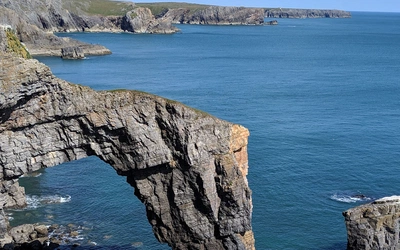
Pembrokeshire is truly beautiful and although it is one of the smallest national parks it arguably has the greatest natural diversity of them all. The Pembrokeshire Coast Path enjoys unspoilt beauty where nature has been allowed to evolve with little interference from mankind. These areas, fed by the warm Gulf Stream waters, have become havens for plants, birds and animals and the diversity of life here was partly the reason for approval as a national park.

When should you go?
Pembrokeshire lays claim to the sunniest spot in Wales and is protected from the extremes of weather by its location so the Coast Path can be walked in any season. However, it is as susceptible to rain as the rest of the UK and the exposed cliff walking can become hazardous in high winds so the usual care and planning is required. The migrating birds and breeding seals of Autumn are a highlight for nature enthusiasts, as are the flowers in Springtime.
Where should you stay?
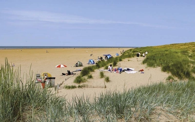
Walkers can choose from campsites and hostels up to boutique B&Bs. Bear in mind that accommodation can be very busy in peak seasons; booking in advance is sensible and some providers operate a two night minimum policy. This can work with walkers' plans, if the accommodation is in a good spot.
Please remember, too, that there is no right to wild camp in Wales as all land is privately owned. Many farmers may not object to a discreet tent being pitched for a night but it is certainly advisable to seek their permission. If you do choose to wild camp, make sure that you are unobtrusive and leave no trace of your stay.
What are the stages of the Pembrokeshire Coast Path?
These are the stages followed in the Cicerone Guide, of which you can receive more information on accommodation, alternative routes, detail on tide timings and more!
Stage 1: Amroth/Skrinkle Haven
Distance miles (km): 14 (22.5)
Total Ascent ft (m): 2660 (810)
Time hr: 5¾
The first miles of the walk provide a splendid introduction to the Coast Path. The walking is relatively easy and there is much to see as the way alternates between woodland, open cliff top and the shoreline, revealing glimpses of a past industrialisation that once imposed a very different character upon the coast.
Stage 2: Skrinkle Haven/Broad Haven
Distance miles (km): 12 (19.5)
Total Ascent ft (m): 2430 (740)
Time hr: 5
The coast has so far retained an almost pastoral quality, bordering a gentle and often wooded countryside. Now, however, it adopts a rugged and predominantly open aspect. The way becomes more taxing, particularly beyond Freshwater East, as erosion by the sea and streams compete with an already undulating coastline to create extreme variations in the height of the path.
Stage 3: Broad Haven/West Angle
Distance miles (km): 16¾ (27)
Total Ascent ft (m): 2560 (780)
Time hr: 6¾
Pick your time to undertake this stretch, for part of it lies across the Army’s Castlemartin training range. Although Range West (between Stack Rocks and Freshwater West) is permanently out of bounds, the stunning coastal route around Range East is generally open at weekends, bank holidays and after 4.30pm on all but two evenings during the week. It is also usually open during the main summer holiday period. At other times you must follow the inland perimeter of the range.
Stage 4 : West Angle/Pembroke
Distance miles (km): 14½ (23.5)
Total Ascent ft (m): 1705 (520)
Time hr: 5½
The way is not taxing and, although perhaps less scenically dramatic than the coastline so far encountered, nevertheless offers as much interest. Low cliffs and inclined slopes follow a long sandstone ridge that parallels the Haven as far as Pembroke Dock. And while its ruddy complexion dominates the landscape, its form is not immediately obvious since it is broken successively by Angle Bay and the estuary of the Pembroke River.
Stage 5: Pembroke/Sandy Haven
Distance miles (km): 16 (26)
Total Ascent ft (m): 1970 (600)
Time hr: 6¼
At Pembroke, or more particularly Pembroke Ferry, the Coast Path is at last able to cross to the northern bank of the Daugleddau and head back downstream to the open sea. This is the only stage of the whole trek containing any significant urban walking. Yet even here, there are many chances to abandon the road. For the most part, the way sticks largely to the coast, has only brief encounters with industry and offers easy and pleasant walking with fine views of the waterway and its seaborne traffic.
Stage 6 : Sandy Haven/Westdale Bay
Distance miles (km): 11¾ (19)
Total Ascent ft (m): 2135 (650)
Time hr: 4¾
On this stage two inlets have to be forded, the first at Sandy Haven (SM 856 074) and the second at Pickleridge (SM 812 070). Both crossings lie within tidal estuaries and are impassable at high tide. Sandy Haven can only be safely crossed within 2½ hours either side of low tide while Pickleridge has a slightly longer window of 3½ hours. Careful timing of arrival at Sandy Haven is necessary to allow sufficient time (up to 2 hours) to walk the intervening 5 miles (8km) to Pickleridge before that crossing becomes impassable.
Those planning a day walk that requires a return journey will need to be doubly vigilant. Missing either means a long wait (of up to 5½ hours) or substantial detours.
Stage 7 : Westdale Bay/Little Haven
Distance miles (km): 14¾ (23.5)
Total Ascent ft (m): 2525 (770)
Time hr: 6
With few descents to the sea, this is a relatively easy stage, yet there is plenty of drama in the scenery passed along the way. The walking is generally undemanding, the path maintaining height and making only infrequent dips that require reascent.
Stage 8 : Little Haven/Solva
Distance miles (km): 11¼ (18)
Total Ascent ft (m): 2430 (740)
Time hr: 5
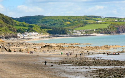
The softer, coal-bearing rocks which underlie the coast to the north of Little Haven have been extensively exploited by streams, and consequently the walking is occasionally strenuous with several steep-sided valleys breaking through the cliffs.
The periodic descents to sea level add further interest and combine to afford a greatly satisfying, if rather strenuous, walk.
Stage 9: Solva/Whitesands Bay
Distance miles (km): 12½ (20)
Total Ascent ft (m): 2165 (660)
Time hr: 5
The increasingly rugged coastal scenery along the northern side of St Bride’s Bay and around the St David’s peninsula sets the scene for much of the remaining trek.
The path from St Non’s to Whitesands Bay, although over relatively low cliffs, is rugged and demands effort. In compensation it affords some wonderful views and, in its short stretch, contains as much variety in both geological formations and flora and fauna as any along the whole route.
Stage 10: Whitesands Bay/Aber Draw
Distance miles (km): 11¼ (18)
Total Ascent ft (m): 2295 (700)
Time hr: 4¾
It is a wild and lonely stretch of coast and there are few trees to break its harsh lines even though the land often is farmed right to the coast. In places the way is steep and occasionally close to the edge of high cliffs, but the walking is good. Although there is a marvellous sense of remoteness, the road is never far away.
Stage 11: Aber Draw/Pwll Deri
Distance miles (km): 9 (14.5)
Total Ascent ft (m): 1510 (460)
Time hr: 3½
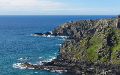
The coast ahead loses none of its ruggedness, and the ‘mountains’ of St David’s Head are replaced by the ever-growing prominence of Garn Fawr. However, although the Coast Path rises to meet it, culminating in an exhilarating high ridge, almost 1½ miles (2km) long that leads to its very foot, there is no necessity to ascend to the summit. The path along this section is good throughout, although there is again an occasional requirement for extra effort.
Stage 12: Pwll Deri/Goodwick Sands
Distance miles (km): 9¼ (15)
Total Ascent ft (m): 2000 (610)
Time hr: 4
This stage follows a wild and deserted coast, preserving the same sense of remoteness and solitude that much of the coast since St David’s has generated. The path is in places rough, and again occasionally demanding on the legs, but clear throughout.
Stage 13: Goodwick Sands/Newport Parrog
Distance miles (km): 11¾ (19)
Total Ascent ft (m): 2725 (830)
Time hr: 5
The next couple of miles skirt the urbanisation of Fishguard and then drop past the Lower Town before once more gaining the open cliffs. The walking then becomes occasionally strenuous as the path descends from the high cliffs to negotiate the mouths of thickly wooded valleys.
Stage 14: Newport Parrog/St Dogmaels
Distance miles (km): 15¼ (24.5)
Total Ascent ft (m): 2985 (910)
Time hr: 6½
The day embodies some of the steepest sections of the whole path, but they are compensated by long stretches of gentle undulation with spectacular views in both directions. In one or two places, the sheer cliffs may give a sense of exposure, demanding care in wet or windy conditions. It is a strenuous but hugely enjoyable walk, and a fitting climax to the expedition.
Where can I find out more?
The Pembrokeshire Coast Path National Park Authority
The Pembrokeshire Coast Path guidebook by Dennis and Jan Kelsall describes the route fully in both directions.
The National Trails guidebook by Paddy Dillon.
The Pembrokeshire Coast Path
NATIONAL TRAIL - Amroth to St Dogmaels
£17.95
This guidebook describes the Pembrokeshire Coast Path National Trail. The scenic long-distance walk from Amroth to St Dogmaels is 180 miles long and takes about 2 weeks to walk, with soaring rugged cliffs, tranquil inlets and broad sandy beaches. Includes planning schedules, accommodation guidance and a 1:25,000 OS map booklet.
More information