An Introduction to Tasmania’s Overland Track
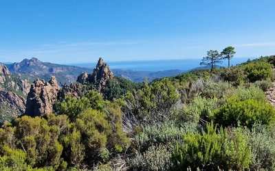
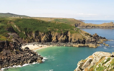
What do you picture when you think of Australia? Sunshine, beaches and a whopping big red rock? Well, there’s a lesser-known Australia, one of glacier-carved valleys, vast moorlands, mossy rainforests, rugged peaks and thundering waterfalls – all teeming with plants and animals found nowhere else on earth. This is Tasmania, the wild island state that’s home to the Overland Track. Here's an introduction to Australia’s most famous hike.
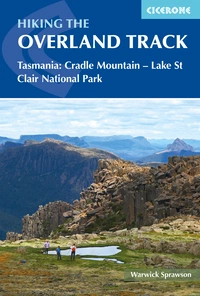
Hiking the Overland Track
Tasmania: Cradle Mountain-Lake St Clair National Park
£17.95
Guidebook to Tasmania's iconic Overland Track. Described over 7 stages, the 80km trail from Cradle Valley to Lake St Clair takes in glacier-carved valleys, vast buttongrass moorlands, mossy rainforests, rugged peaks, thundering waterfalls, alpine meadows and peaceful lakes. Adventurous side trips are also described.
More informationWhere is it and how far is it?
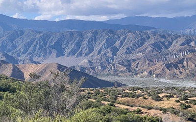
Tasmania – an island two-thirds the size of England – is located southeast of the Australian mainland. Tasmania's Overland Track is an 80km hike through the pristine wilderness of the 160,000-hectare Cradle Mountain-Lake St Clair National Park, part of the much larger Tasmanian World Heritage Area. Located in the central north-west of the island, the hike links Cradle Mountain in the north of the park to Lake St Clair in the south. An abbreviated 63km version of the walk is also popular, which finishes at the top of Lake St Clair. You can then catch a ferry across the lake to Cynthia Bay instead of walking the final leg.
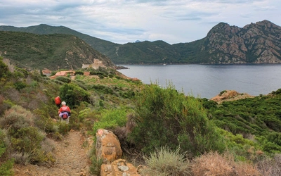
While it’s possible to do the walk in just four or five days, allowing yourself a few more days, ideally eight or nine, gives you time for a rest day if the weather turns bad, and also time to explore some of the Overland’s sidetrips. These sidetrips – tracks heading off from the Overland’s main spine – are the highlight for many walkers: from Pine Valley’s ancient rainforests to climbing Tasmania’s highest peak, Mt Ossa (1617m).
How to travel to Tasmania?
While there are no direct international flights to Tasmania, the island is just a one-hour flight from Melbourne or a two-hour flight from Sydney. Most flights arrive and leave from the Tasmanian towns of Launceston or Hobart. For Overlanders walking north to south – the most common direction – it can be more convenient to fly into Launceston (as it’s closer to Cradle Mountain) and out of Hobart. Both Launceston and Hobart are beautiful colonial-era cities. A regular passenger ferry to northern Tasmania from Melbourne’s Station Pier also exists.
Why walk the Overland Track?
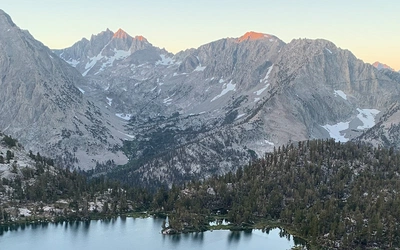
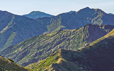
The track traverses some of Australia’s most spectacular mountain scenery, a landscape where the scars of the Ice Age still seem fresh. You’ll follow valleys worn smooth by glaciers, admire (and have the option to climb) dramatic peaks and quench your thirst with the best water you’ve ever tasted – straight out of rushing alpine streams.
The area is a refuge for many native animals that are now extinct or threatened on the Australian mainland, such as the Tasmanian devil and tiger quoll. While these animals are often hard to see, hikers are almost certain to encounter wombats, wallabies, echidnas and possums. Numerous endemic bird species, like the green rosella and yellow-throated honeyeater, also call the track home.
When is the best time to go hiking in Tasmania?
Tasmania has four distinct seasons, although on the Overland, the characteristic rapid changes in weather mean you might experience all of them on the same day. December, January, and February are arguably the best months to hike the Overland. In summer, many plants are flowering, the days are long—making side trips more feasible—and the average maximum temperature is a relatively warm 16.3°C (with a possibility of temperatures in the 30s). March–May can also be a good time to walk the track. Autumn hikers can enjoy the spectacular golds and reds of Australia’s only autumn deciduous tree, the deciduous beech, while fungi also put on a vivid display. The first significant winter snow usually falls in May.
How difficult is the Overland Track?
Around 9000 hikers complete the Overland walk each year, about a quarter of whom are from countries outside Australia. The main track is well-marked and maintained, with boardwalks above the boggiest ground, bridges over creeks and a network of basic huts, all of which make the Overland Trail suitable for hikers of average fitness. Yet there are plenty of challenges for experienced hikers, with steep side trips to mountain peaks and into wilderness areas like The Labyrinth.
What accommodation is available on the Overland Track?
The rustic huts along the track are basic but functional. Electricity, lighting, rubbish bins, cooking equipment, bedding and toilet paper are not provided. The hiking huts have sleeping platforms like giant shelves, rainwater tanks, gas or coal heaters, communal benches and tables, and a nearby composting toilet. Raised wooden platforms are provided near most huts for erecting tents.
How does the Overland Track booking system work?
Despite the track’s fame and popularity, hikers must remember that this area is remote with frequent wild weather. To enjoy the walk – and not just endure it – you must be prepared with the right clothes, information and equipment. During the peak hiking season (1 October to 31 May), hikers must book their departure date and purchase an Overland Track Pass. The Overland Track booking system and the Overland Track Pass were introduced to prevent overcrowding on the track and to help preserve it for future hikers. It is crucial to reserve your desired departure date as early as possible, especially for the popular months of December, January and February, as well as the Easter holidays. Bookings open on 1 July each year.
What's included in the guidebook?
This guidebook offers a comprehensive look at the Overland Track, a stunning 80km (50-mile) trek between Ronny Creek in Cradle Valley and Cynthia Bay on Lake St Clair, situated in Tasmania’s Cradle Mountain-Lake St Clair National Park. Suitable for hikers with average fitness, the route can be completed in 5 to 9 days and is divided into seven stages, ranging from 8 to 17km (5 to 11 miles) in length. Detailed 1:50,000 maps are provided for each stage, along with information on Overland huts, facilities, and advice on permits, planning, and preparation. The guide also includes optional side trips to accessible peaks, including Mt Ossa, and highlights, such as Mt Oakleigh and D’Alton Falls.
Stage Summaries - Tasmania's Overland Track
| Stage | Time | Distance (km) | Description |
|---|---|---|---|
| Stage 1 – Ronny Creek (Cradle Valley) to Waterfall Valley Huts | 3½–5½ | 11.0 | The first day is the most difficult, with exposed sections and a tough climb to Marions Lookout. There’s much to admire on the way though, including patches of rainforest, stunning lakes and incredible alpine meadows. Kitchen Hut, a wooden hut weathered grey by the elements, is a good place for lunch or a break. An alternative is to start the hike at Dove Lake instead of Ronny Creek. This allows you to enjoy the classic view of Cradle Mountain across the lake before rejoining the main Overland Track. |
| Stage 2 – Waterfall Valley Huts to Windermere Hut | 2–3 | 7.7 | A relatively short, level day over exposed buttongrass and heath plains. Lakes are the feature of today, including a chance to visit Lake Will and a walk around the shore of the beautiful, island-studded Lake Windermere. |
| Stage 3 – Windermere Hut to New Pelion Hut | 5–6½ | 15.3 | Allow plenty of time for today’s walk as the second half of the hike is partly through thick myrtle rainforest, where the path becomes rocky, muddy and tangled with roots. |
| Stage 4 – New Pelion Hut to Kia Ora Hut | 3½–4 | 8.6 | Initially the track rises gently through diverse forest, getting steeper as it climbs through rainforest to Pelion Gap (1126m) between Mt Pelion East and Mt Doris. From Pelion Gap there’s the option to take the sidetrip up Mt Ossa, Tasmania’s highest peak (1617m), or a shorter sidetrip to the summit of Mt Pelion East (1466m). From the gap it’s an easy descent through gums and moorland to Kia Ora Hut. |
| Stage 5 – Kia Ora Hut to Bert Nichols Hut | 3½–4½ | 9.8 | A fairly short day, leaving plenty of time to enjoy the scenery along the way, including three spectacular waterfalls. The woodlands near Kia Ora Hut change to rainforest as the track approaches the rustic Du Cane Hut. A few kilometres further on there’s the opportunity to visit two of the waterfalls, D’Alton and Fergusson Falls, on a short sidetrip. About a kilometre on there’s a further sidetrip to Hartnett Falls, perhaps the pick of the three. A long, steady climb leads to Du Cane Gap (1070m), from where it’s a short descent to Bert Nichols Hut. |
| Stage 6 – Bert Nichols Hut to Narcissus Hut | 2¾–3¾ | 10.1 | One of the most beautiful sections on the Overland, the track paralleling the (mostly hidden) Narcissus River all day. The mix of habitats – woodland, wetland, rainforest and moorland – means there’s rich birdlife. The walking is made all the more enjoyable by the level, mostly dry path, which follows a lateral moraine, a ridge of material left behind at the edge of a retreating glacier – the same body of ice that created the valley’s wide ‘U’ shape and helped form Lake St Clair. |
| Stage 7 – Narcissus Hut to Cynthia Bay | 5–7 | 17.2 | Many hikers miss the final day of the Overland, opting to catch the ferry across Lake St Clair to Cynthia Bay. But for those not suffering rainforest fatigue there’s plenty to enjoy on this section, including lovely open woodland at the start and end of the walk and a dense canopy of myrtle beech in between. Echo Point Hut, with its own little beach and jetty, is the most charming sleeping hut on the track and a great place for a break. Although there are a few rooty, muddy sections in the rainforest, it’s generally a level, easy walk around the edge of the lake with the chance to observe the shifting balance between rainforest and woodland. |
| Total distance: | 7 days | 79.7 | - |
Hiking the Overland Track
Tasmania: Cradle Mountain-Lake St Clair National Park
£17.95
Guidebook to Tasmania's iconic Overland Track. Described over 7 stages, the 80km trail from Cradle Valley to Lake St Clair takes in glacier-carved valleys, vast buttongrass moorlands, mossy rainforests, rugged peaks, thundering waterfalls, alpine meadows and peaceful lakes. Adventurous side trips are also described.
More information