An Introduction to The Shropshire Way
The county of Shropshire has been one of England’s best kept secrets for years. It is England’s most rural county with only two large towns –Telford and Shrewsbury, but it is blessed with some of the best hills and ridges outside the national parks. Find out why you should discover the Shropshire Way below.

Where is the Shropshire Way?
The original Shropshire Way was conceived by local Ramblers Association groups in 1978 to link Cheshire’s Sandstone Trail with the Offa’s Dyke Path. However, since its inception the Way had become a confused jumble of paths and it was not uncommon to arrive at a crossroads and have three or four waymarkers pointing in different directions!
In 2015 at the Shrewsbury Ramblers AGM proposals were made to identify a single main route and to re-form the Shropshire Way Association. After consultation a new 180-mile circular route (200 miles including the Whitchurch leg) based on Shrewsbury was devised using the best of the loops in the north and retaining the Sandstone Trail link to Grindley Brook. The southern route used the Clun extension rather than the shorter Long Mynd route. A Shrewsbury link was added for those who wanted either a north or a south circular route.
How long is the trail?
The Shropshire Way is still an easy walk to adapt to your needs, but the full route, including the Whitchurch leg, is 200 miles.
How difficult is the Shropshire Way?
The Shropshire Way is divided into 15 stages and the maximum mileage for a day is just under 15 miles. The shortest day is just over 10 miles. So, depending on the season and your fitness, there should be plenty of time to enjoy a leisurely walk and take in all the sights.
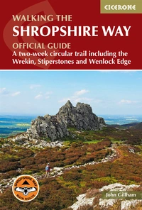
Walking the Shropshire Way
A two-week circular trail including the Wrekin, Stiperstones and Wenlock Edge
£14.95
Guidebook describing a 2 week trail around Shropshire. The 182 mile (290km) route is made up of two loops centred on Shrewsbury and visits Stiperstones, Wenlock Edge, Ironbridge and the Wrekin. Also describes the challenging 20 mile (32km) Stretton Skyline Walk.
More information
What accommodation options are there?
Shrewsbury and Ludlow have accommodation of all types, so finding something suitable will usually be relatively easy unless a major event is taking place. The same cannot be said of rural Shropshire and you should book well in advance. The stages between Ludlow and Wilderhope are particularly difficult and may involve a taxi ride to and from your stage ending.
Is it well waymarked?
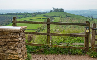
The Shropshire Way is well-signed throughout, with orange waymarkers featuring a buzzard and small black arrowhead pointing in the direction of travel. More historical black and white waymarkers can still be seen in places, including the ones marking old alternative loops. In a very few places these appear to contradict the new waymarkers. In such cases always follow the line marked by the orange waymarkers.

When is the best time to go?
You can walk in Shropshire at any time.
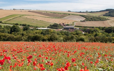
Winter, some of the vegetation will have died back making progress along the paths easier. Woodland paths may however be slippery at this time. Spring is a delightful time when nature is vibrant with new life and colour. If it has been wet over winter, the paths across farmland and in the woods may still be muddy. Summer, when the days have lengthened, the ground will have dried out, although some low-level paths may be overgrown with nettles and occasionally common hogweed. Make sure you take your waterproof leggings at this time for dew-drenched vegetation can soak you quite quickly. Autumn, the nights draw in again, but the flame-colours of the bracken and the woods add great beauty to the landscape. Bilberry leaves have turned red and the heather to dark russet.
Stage Summary - The Shropshire Way
| Stage | Distance | Ascent | Time |
|---|---|---|---|
| 1 | Shrewsbury to Bridges | 14¾ miles (23.8km) | 535m |
| 2 | Bridges to Bishop’s Castle | 11½ miles (18.4km) | 585m |
| 3 | Bishop’s Castle to Clun | 11 miles (17.8km) | 575m |
| 4 | Clun to Craven Arms | 11¼ miles (18km) | 515m |
| 5 | Craven Arms to Ludlow | 10¾ miles (17.4km) | 340m |
| 6 | Ludlow to Wheathill | 10¼ miles (16.5km) | 630m |
| 7 | Wheathill to Wilderhope Manor | 11¼ miles (18.3km) | 495m |
| 8 | Wilderhope to Ironbridge | 12½ miles (20.1km) | 390m |
| 9 | Ironbridge to Wellington | 11 miles (17.6km) | 705m |
| 10 | Wellington to Haughmond | 11¾ miles (19km) | 150m |
| 11 | Haughmond to Wem | 11¾ miles (18.9km) | 160m |
| 12 | Wem to Ellesmere | 14½ miles (23.4km) | 120m |
| 13 | Ellesmere to Llanymynech | 14 miles (22.4km) | 90m |
| 14 | Llanymynech to Nesscliffe | 14¼ miles (23km) | 140m |
| 15 | Nesscliffe to Shrewsbury | 12 miles (19.4km) | 165m |
| Total | 182 miles (295km) | 5760m | 99hr–103hr |
Detailed Stage Breakdown
Stage 1 - Shrewsbury to Bridges
Distance: 14¾ miles (23.8km)
Time: 7hr
The Shropshire Way begins to climb in earnest late in the day with the ascent of Wilderley Hill and it follows the course of the ancient Portway. By now the iconic Stiperstones tors have come into full view. The day is ended with a very pretty descent into the Golden Valley where the path weaves between grassy folds in the hills down to Ratlinghope.
Stage 2 - Bridges to Bishop’s Castle
Distance: 11½ miles (18.4km)
Time: 6–7hr
Today, country lanes lined by hedgerow and flower-decked grass verges lead the route to one of Shropshire’s most iconic ridges, that of the Stiperstones. Here great jagged tors protrude from heather slopes. The Way then deposits its followers back into the valley before whisking them back up to the heights of Linley Hill.
Stage 3 - Bishop’s Castle to Clun
Distance: 11 miles (17.8km)
Time: 6–7hr
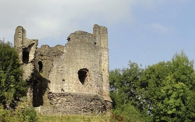
Beyond the town the Way begins on a fine track that heads south across pastured hillsides, then follows the valley of Wood Batch. After passing by the wooded Unk Valley at Churchtown, the Shropshire Way joins forces with the Offa’s Dyke Path, taking an undulating course by the earthworks of the Dyke to Hergan, where they part. Our route takes in the grassy ridge of Cefns and follows it down to Clun Castle.
Stage 4 - Clun to Craven Arms
Distance: 11¼ miles (18km)
Time: 6hr
The day begins on winding country lanes towards afforested hills. The highlight of the day comes early, for those forest tracks lead to the Bury Ditches hillfort, which makes an ideal platform to see far and wide across the Shropshire countryside. After descending to the ancient village of Hopesay there’s a steep but entertaining climb to the top of Hopesay Hill, where you first spy the red rooftops of distant Craven Arms. Paths now traverse a pastoral landscape on an easy-paced finale to the busy little town.
Stage 5 - Craven Arms to Ludlow
Distance: 10¾ miles (17.4km)
Time: 6hr
After you stock up in the bustling little town of Craven Arms, the Shropshire Way will take you across the meadows of the River Onny to historic Stokesay Castle. From there it climbs through woods to the little village of Aldon before tracing two splendid wooded gorges, the Aldon and Brandhill gutters. The middle section is easy, on country lanes and bridleways traversing wide flat fields. There is anticipation as the route closes in on Ludlow, where there’s fascinating history around every corner, from the powerful Norman castle to the town gates and the Buttercross, the official centre of Ludlow.
Stage 6 - Ludlow to Wheathill
Distance: 10¼ miles (16.5km)
Time: 6hr
The Shropshire Way hits the heights again after a couple of days of modest hill and valley walking. After following the River Teme to the edges of the town the route heads across green pastures to an Iron Age fort at Caynham. The ascent is gentle at first, but eventually it traverses former mining and quarrying country. A grassy tramway incline takes the route to the summit of Titterstone Clee Hill, which is topped by white radomes and some rocks known as Giant’s Chair. The views are wide and wonderful and are maintained for most of the descent to Wheathill.
Stage 7 - Wheathill to Wilderhope Manor
Distance: 11¼ miles (18.3km)
Time: 5–6hr
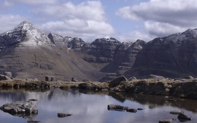
Yesterday the ‘Way’ tackled Shropshire’s third highest hill, today it tackles the highest, Brown Clee Hill. Like Titterstone Clee Hill, the summit is a bit industrial but the views are splendid, taking the gaze right into Wales if the atmosphere is clear enough. The way down uses a wonderful sunken green road giving views across the verdant Corve Valley to the limestone country of Wenlock Edge at day’s end.
Stage 8 - Wilderhope to Ironbridge
Distance: 12½ miles (20.1km)
Time: 6hr
From Wilderhope to Much Wenlock the Shropshire Way discovers Wenlock Edge, a 19-mile/31km wooded limestone escarpment formed over 400 million years ago when Shropshire was under the sea just south of the equator. Much Wenlock is a wonderful and historic country town with a priory that is well worth visiting before resuming the journey to Ironbridge and the Severn Gorge.
Stage 9 - Ironbridge to Wellington
Distance: 11 miles (17.6km)
Time: 6hr
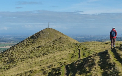
The early part of the day is a fascinating mix of woodland and industrial archaeology as the route dips into Coalbrookdale and follows the Rope Walk up onto a high pastured plateau to remote Little Wenlock. Highlight of the day has to be the iconic Wrekin. The climb through woodland to the summit is steep but the craggy perches on top reward you with views across several counties. Finally, paths over the smaller, thickly wooded Ercall lead to Wellington.
Stage 10 - Wellington to Haughmond
Distance: 11¾ miles (19km)
Time: 6hr
This is an easy section, with just one low hill, that of Haughmond. The way out through the Wellington suburbs is surprisingly pleasant, with good paths taking the route around the nature reserve of Dothill Park, where there are woods and a number of lakes. Haughmond at day’s end is a delightful place with fine views through its trees to Shrewsbury’s spires and the hills of west Shropshire, with the Welsh borders fading into the horizon.
Stage 11 - Haughmond to Wem
Distance: 11¾ miles (18.9km)
Time: 6hr
Today the Shropshire Way starts its journey around north Shropshire; across very rural landscapes, where flatlands are punctuated by small sandstone hills. One of the highlights of the day, the expansive ruins of Haughmond Abbey, comes straight away, followed by the woods and the sandstone cliffs of Grinshill. The day ends in Wem, a quiet country town so typical of north Shropshire.
Stage 12 - Wem to Ellesmere
Distance: 14½ miles (23.4km)
Time: 6hr
The Ellesmere route is highlighted by glacial mosses and meres, fascinating places for flora and fauna. The route also joins the Llangollen branch of the Shropshire Union Canal, which offers a well-paced walk into Ellesmere.
Stage 13 - Ellesmere to Llanymynech
Distance: 14 miles (22.4km)
Time: 6hr
Stage 13 is about canals, and you’ll be walking them for most of the day. But they are interesting canals, winding through pretty countryside, often dominated by the distant Breidden and Llanymynech hills. With no hills to climb you’ll be able to march quite quickly, leaving more time to relax in one of the inns or cafés or to visit the fascinating quarries at Llanymynech.
Stage 14 - Llanymynech to Nesscliffe
Distance: 14¼ miles (23km)
Time: 6hr
Llanymynech is the start of the home run to Shrewsbury. For much of the morning the Shropshire Way follows the flood barrier of the River Vyrnwy, which meanders like a snake on the move. Melverley, the first village encountered, is lovely with its black and white half-timbered church and pretty cottages. The fields beyond are set mainly to crop but for most of the time the walking is easy. Nesscliffe Hill is in sight for some time, getting nearer and nearer. And then you’re on its summit, looking back on your day’s walk.
Stage 15 - Nesscliffe to Shrewsbury
Distance: 12 miles (19.4km)
Time: 5–6hr
The last day and again it’s a leisurely one, across fields, by riverbanks and finally back through historic Shrewsbury. You’ll find that the Shrawardine Castle on the map isn’t Shrawardine Castle and that Shrawardine is a delectable Severnside chocolate box village. From Shelton onwards, the Severn will be your guide as it loops around Shrewsbury to journey’s end by Kingsland Bridge.