The Thames Path National Trail: everything you need to know
The 180-mile Thames Path from London to Gloucestershire is the only long-distance route to follow a river throughout its length from tidal waters, and also the only one to pass through London and major towns.

Where is the start and end point?
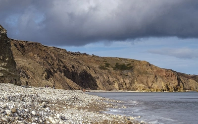
This historic trail starts from the Thames Barrier in Central London and finishes in Gloucestershire at the river's source.
How long is the Thames Path?
The 180-mile (288km) National Trail is divided into 20 stages and can be walked, by walkers of average fitness, in three weeks. Walking the trail can easily take three weeks if you want to explore every town and village. Or you could spend years relishing the experience in a series of short weekend sections as public transport is plentiful. And then, having walked one way you may well be tempted to walk back and enjoy the equally splendid views from the other direction.
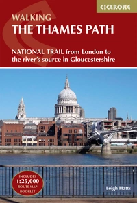
The Thames Path
National Trail from London to the river's source in Gloucestershire
£17.95
SALE
£15.26
A guidebook to walking the Thames Path, a National Trail covering 182 miles between the Woolwich Foot Tunnel and the river's source in Gloucestershire, passing through Windsor, Oxford and rural countryside. Provides full information for this easy riverside route that takes around two weeks to complete. Includes a 1:25K OS map booklet.
More informationWhich is the best direction to walk?
This book is a guide for those who want to walk upstream along the Thames Path from the Woolwich Foot Tunnel, London to Gloucestershire, and is therefore an alternative to the official National Trail guide designed to assist walkers heading from the river’s source downstream to the capital.
How difficult is the route?
It is an easy walk that passes some of London's great sights before heading into the delightful English countryside. It is well marked and maintained, with, as stated before, most of the route being on public footpaths or bridleways.
When is the best time to walk The Thames Path?
The Thames Path is manageable at any time of the year, although the days are shorter in winter, and the number of daylight hours should be considered. Tide times will also need to be checked as there is a flood risk along many sections of the route. Public transport is also good enough that, from much of the path, you can return to London after a day of walking, if this is preferred.
What are the accommodation options?
There are plenty of options along this route so, you can choose according to your budget, the Visit Thames website is a fantastic place to start. However, you can also get the train back to London at the end of each day until Oxford if you live in the area, which could reduce costs.
Are there any alternative routes?
It includes a possible diversion at Culham to visit the attractive village of Sutton Courtenay on the Old Thames. However, London’s left-bank alternative route, designated by Natural England as an afterthought, is not included, as it is felt that long-distance walkers will prefer the original right-bank path, which avoids traffic and affords a fine view of the City of London.
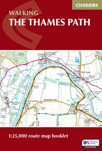
The Thames Path Map Booklet
1:25,000 OS Route Map Booklet
£12.95
Map of the 182 mile (290km) Thames Path National Trail, from the Woolwich Foot Tunnel in London to the river's source near Cirencester in Gloucestershire. This booklet is included with the Cicerone guidebook to the trail, and shows the full route on OS 1:25,000 maps. The easy riverside route takes around two weeks to walk.
More informationStage Summary - The Thames Path
| Stage | Start | Finish | Distance |
|---|---|---|---|
| 1 | Woolwich Foot Tunnel | Tower Bridge | 10½ miles (16.8km) |
| 2 | Tower Bridge | Putney | 10 miles (16km) |
| 3 | Putney | Kingston | 13 miles (20.9km) |
| 4 | Kingston | Chertsey | 11 miles (17.7km) |
| 5 | Chertsey | Staines | 4 miles (6.4km) |
| 6 | Staines | Windsor | 7½ miles (12km) |
| 7 | Windsor | Maidenhead | 6½ miles (10.5km) |
| 8 | Maidenhead | Marlow | 7 miles (11.2km) |
| 9 | Marlow | Henley | 8½ miles (13.6km) |
| 10 | Henley | Reading | 9 miles (14.5km) |
| 11 | Reading | Pangbourne | 7 miles (11.2km) |
| 12 | Pangbourne | Goring | 4 miles (6.4km) |
| 13 | Goring | Wallingford | 7 miles (11.2km) |
| 14 | Wallingford | Dorchester | 5 miles (8km) |
| 15 | Dorchester | Abingdon | 9 miles (14.5km) |
| 16 | Abingdon | Oxford | 9½ miles (15.2km) |
| 17 | Oxford | Newbridge | 13½ miles (21.7km) |
| 18 | Newbridge | Lechlade | 16 miles (25.7km) |
| 19 | Lechlade | Cricklade | 10½ miles (16.8km) |
| 20 | Cricklade | The Source | 12¼ miles (19.7km) |
| Total | 182 miles (292km) | ||