Camping and kayaking in Norway: a packrafting adventure

Combining camping, walking and kayaking, Alex Kendall set out on a packrafting expedition to explore the peninsulas and fjords of Senja island in Norway.

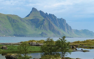
Far away at the top of Europe, where the indented coast of Norway merges into the Arctic Ocean, lies the island of Senja. On a map it looks like a cauliflower steak, laid out in the sea north of the more famous Lofoten islands, a landscape of deep fjords and grey sharp mountain ridges plunging straight into the sea.
It was to this wilderness that three friends and I went on a summer packrafting expedition. Packrafts are a relatively new phenomenon, designed for trips that require a combination of paddling and walking. The rafts themselves are inflatable kayaks which pack down to the size of a large tent, and in which you can store kit when you’re on the water. They seemed ideal to allow us to explore the peninsulas and fjords of Senja.
Into the heart of Arctic Norway
The sea, of course, is a totally different beast to the rivers and lakes we’d been training on in the months before heading out. The cold fjords drop 200m down below the water, the current can rush around headlands, and the Arctic wind could easily prove disastrous for a fjord crossing.
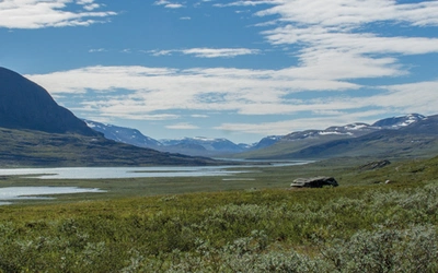
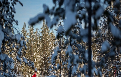
Svartholvatnet is a large inland lake on Senja, a blue highland ribbon surrounded by other lakes and the highest peaks on the island, culminating in the dark knife of Breidtinden at just over 1000m. Our first day took us through a wooded valley to the edge of this lake, where we planned to have a few days’ lake paddling and mountaineering before taking to the waves.
A local peak, Innhesten (916m) looked like an excellent option to kick off our mountaineering objectives, mostly because the slopes didn’t look horrifyingly steep, and it stands in the middle of three lakes, so provides excellent views of the surrounding landscape. After a first tentative packraft across Svartholvatnet we began our ascent. The autumn vegetation was spectacular; flowers dotted the ground between heathers and mosses, and the larder of bilberries and cloudberries forced us to stop and forage repeatedly, it was just too tempting.
Beyond the initial first half an hour thrashing about through scrub, the slopes were rock slabs, loose rock or snow. The surrounding mountains, so long gazed at on the maps from home, began to materialise. Breidtinden looked impossible, a tower of dark rock that gravity should surely have pulled down. On the other side, Stormoa gave the impression someone had tried to build a pyramid out of slate, such was the darkness of the rock.
Approaching the summit, it was clear that Innhesten was no ordinary mountain. From the valley we had seen a structure on top, perhaps a trig point or survey post. Then getting closer a mechanical noise, rising and fading, like something a crashed fighter from Star Wars would make. Cresting the rise before the summit, it finally came into view, a giant rotating tower, grey and dominating. On the side of the mountain, just below the summit, a giant metal door led into the cliff. Later we found out that this structure is part of the NATO early warning system.
We tried to ignore the mechanical groan as we returned our concentration to the wilderness around us, and our first view up Mefjorden out to sea, the jagged peaks of the bordering mountains rising straight from the water like grey ancient sharks’ teeth. But there was something uncomfortable about such an industrial intrusion, with connotations of aggression and war, in such a beautiful and wild place. So as rain sheeted in from the south we returned down the mountain and inflated the packrafts for a more peaceful afternoon crossing the lake of Nedre Hestvatnet.

Settling into expedition life
Carrying full camping kit and all the paraphernalia needed for the boats over uneven,
rough terrain, typically with no path, was reasonably hard. The two
mountain passes we crossed within the first few days were a real
struggle, and the long descents over vegetation-covered boulders made us
long to be back on the water.
With such difficult going, combined with a day of constant
drizzle, it was important to keep up morale. We had decided early on to
make a decent effort to cook good evening meals, and generally make sure
we had enough food.
Reindeer carbonara on the first night was a big hit, followed up with the same reindeer sausage combined with rotmos, an ingenious Norwegian dried food combining sweet potato, parsnip and other root vegetables. Before the trip began we had been warned about the infamous ‘brown cheese’, a speciality of the region, which tastes more like caramel in clay form then cheese. Of course, since Chris wasn’t there for the shopping trip we bought a kilo of the stuff and hid it in his bag.
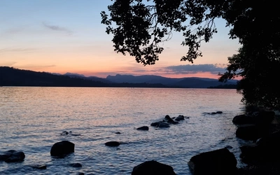
Taking rest days is also important, and in this case any time where we didn’t have to carry full packs was considered a rest. Camping at the far end of Svartholvatnet a few days in, we were surrounded by abandoned Norwegian ski houses, and a short walk away from a tremendous view down to the fjord for sunset. This was the basecamp for an attempt on Breidtinden, whose slopes still looked impossible despite the path on the map.
With promising weather we began the trail up this most imposing of mountains. For the first time we were on a path, marked in the Norwegian way with blue dots. These vanished as the path steepened, becoming highly eroded. By the time we got to the start of the final ridge, the route had turned into a full-on scramble, probably grade 2 by welsh standards. Cloud whipped across the rocks, and the route was denoted by frantic arrows pointing us around obstacles, clinging to slabs above the drop into the cirques below.
A German couple, the first people we’d seen for days, huddled behind a boulder trying to eat lunch before the view disappeared. As it happens I was the only one who wanted to go to the summit, so went up into the cloud and added us into the visitors’ book before scrambling back down. That afternoon we used the calm weather to wash, leaping into the lake with undignified screams as our clothes tried to dry, attached like poorly thought-out Christmas decorations on the tents and shrubs.
Off to the sea in inflatable boats
Despite being a mountain person, it was the sea that had been calling me all through our preparation and our first few days on Senja. The cut-glass reflection of the sunset over Mefjorden, which we’d witnessed from our rest-day camp, was irresistible. The mountains, rising out of the water, were dream-like, but for some reason we were drawn to see them from the waves rather than climb them. It was, I suppose, partly the novelty of having on our backs everything we needed to step off our mountain walking comfort zone and commit ourselves to the unpredictable and magnificent ocean.
Journeying on the sea, principally down the fjords of Mefjorden, Bergsfjorden and Gryllefjorden, was incredible. With some luck coming in the lack of wind, we could bob along over the silky surface of the sea, only paddle-strokes disrupting the mirror. Whether blue skies or overcast, the surrounding mountains appeared as watchful towers, soggy green and rock grey. There was surprisingly little wildlife other than small birds and one seal, but this was out of the main whale season, winter, where they pass the island to the breeding grounds.
Towards the mouth of Bergsfjorden, where the enclosed protective feeling you have paddling while surrounded by peaks, meets the start of the endless sea, are dozens of islands. Some are no bigger than large rocks, coated with guano and with the odd cormorant watching us from the tops. Others are much larger, with vegetation, streams, knolls and beaches. Together they are a protected area, and provide weeks of potential exploration. It was of course too tempting not to try and sleep on one.
We needed to be close enough to land to make a dash if the weather turned bad, but also on an island with enough flat space for the tents, and where we could land the packrafts. Flatholmen, just off the coast from the settlement of Hamn, provided the perfect site. After the customary bum-clenching moment as the packrafts crunched to ground over barnacle-covered rocks, we were free to explore our own little land. The tents were soon up on the flat summit, clothes were drying on the trees, and the island was explored.
On the western side, where the waves from the open sea lapped on the granite slabs of the shore, there was a large amount of driftwood. Half-buried under vegetation were staircases and pallets, maybe the result of some storm a long time ago, or lost from an unfortunate boat. As the sun set and the clouds gathered we piled this up into a giant driftwood fire, sitting around its warmth as darkness fell over the islands. It was one of those moments when you realise that an adventure can be about serenity and quiet, rather than intense physical challenge.

A pilgrimage to Sandsvika
With bad weather forecast, we hiked over two passes and paddled up Gryllefjord to arrive at the secluded beach of Sandsvika. This was the closest we came on this journey to experiencing a lost world. Facing west, the beach itself is backed by grass-coated sand dunes, and higher up ancient gnarled woodland, battered by decades of northern storms. Mountains crown all sides of this idyll, rising into 500-metre high cliffs at either end, rendering any approach along the coast impossible. In the woods on the southern side there is a small lake, and between this and the beach the remains of a building or two. With enough food this would be the place to outlast the years.
Exploring the dunes and one of the low hills ringing the bay, we photographed flowers and insects, falling into clumps of ferns and discovering whale vertebrae in the sand. As we packed to depart, a herd of wild reindeer came out to browse on the vegetation crowding the dunes, not bothered by us at all, taking their rightful place as the centre of the scene.
The long route home
The storm broke that night, sending gusts and drizzle over Gryllefjord. We camped on the outskirts of the village, worried that an increase in wind speed could deny us the ability to cross the fjord, as packrafts are easily battered about by the elements. For the next two nights we rented a house, drying kit and reading while the world turned grey and the water ran down the streets into the sea.
The house, preserved from the 1950’s, had an incredible collection of antique furniture and fittings, which was all very interesting until we realised you couldn’t turn two hobs and a heater on without fusing the building. Gryllefjord itself, as with many of the villages of Senja and the surrounding coast, relies on fishing. Not the romantic vision of the boats setting out into the wild sea, but a modern version, where dozens of fish-farms dot the sheltered parts of the fjords, managed by computer and towed into the harbour to extract the fish. It is this, alongside the infrequent tourism, that allows modern housing, the school and the few cafes and restaurants.
Taking to sea again after the storm was like throwing rubber ducks into a wave machine. We hugged the coast round to Torsken for a few more mountain days, the swell picking up our little packrafts as we paddled relentlessly around the headland, trying to enjoy the fresh air and not feel seasick. After our final paddle, as if to prove it doesn’t always have to be cold and grey, a warm breeze from the east brought fine weather.
We sat out reading books at the site of an old refuge above the village of Torsken, chatted to locals about elk hunting and life on the island, and climbed our final peak, Midtertinden (623m). By then the sea had calmed, and we got one last look out to see, beyond the fjords and mountainous peninsulas, beyond the fishing villages and protected harbours, beyond the thick vegetation of the inner island and the stark slabs of granite. Beyond these recognisable features of northern life there is sea and then only ocean, building in wildness north, with nothing else before the ice of the high Arctic and the North Pole, the islands of Svalbard and the realm of polar bears.
How to packraft – some practical advice
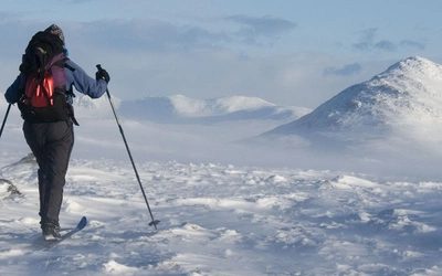
Getting to the stage where we felt comfortable taking inflatable boats onto the northern Norwegian Sea did take some time. One of the group, Rachel, was already an experienced river paddler. As a group we spent one weekend packrafting on rivers, one on a lakes and mountain journey, and took a Sea Kayak course. It is essential to become knowledgeable about sea planning, including using charts, tide tables and wind forecasts to plan your journey.
We were given Sea Kayak advice and training from Mon Active and AcwaTerra, and we hired our packrafts from Back Country in Aviemore, Scotland.