Creating the Sulmona Valley loop in Abruzzo
Stuart Haines, author of Cicerone's Walking in Abruzzo, has created a long-distance footpath in the Apennines of central Italy
L’Anello della Valle Peligna – the Sulmona Valley Loop – in the Italian Appenines is a project for our times. Our difficult times as we slowly recover and seek to rebuild from Covid-19. The tradition of travelling by foot is being rediscovered. The physical and mental challenge is cleansing; the reconnection with the natural world is a reset and a tonic in our detached 21st century lives of fast-paced comforts and pressures.
Since my boyhood I have irresistibly followed trails through the countryside; wandering the long-distance paths of England and wondering what lay beyond the horizon.
The South Downs Way, Offa’s Dyke, the Pennine Way, the Cleveland Way – they drew me in and I made memorable journeys. I left the waymarked trails to discover the paths and byways, the holloways and moorland tracks that link them. I pored over maps and imagined routes used by our ancestors. The network came alive and I traced my own ways, linking places and features in happy multi-day adventures.
Discovering Abruzzo
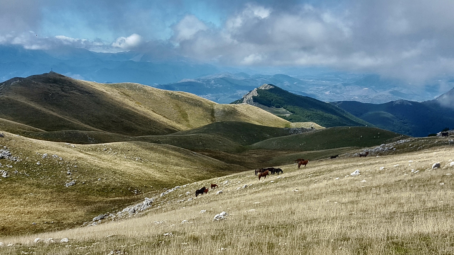
In 2005 I began a new discovery in Abruzzo which, despite its proximity to Rome, is one of Italy’s least known and populated regions. It’s a spectacular, harmonious blend of snowy mountains, grassy plains and forested canyons; of hillside olive groves, vineyards and long, sandy beaches. A land of abandoned castles, hilltop villages and ancient farmsteads.
Abruzzo pulled at my deep instinct to wander, and I found great peace and wonder. Soon after I came here to live. Old habits die hard, there were trails to discover!
So, you step from your front door and off you go, don’t you? Hmm… maybe something so simple is not as accessible as it seems. Perhaps it’s a bit overwhelming – all those paths and peaks and tracks in the woods.
Some help and structure would make a great difference – a guidebook and good maps. I wanted routes where I could lose my cares but not my way, wild and splendid places to discover in the knowledge that I would return safely. But for me, at that point not an Italian reader, there wasn’t a guide and the maps were (and still are) patchy. I decided to record my explorations and write a guidebook.
In 2011, Walking in Abruzzo was published by Cicerone. It did well so I wrote a new edition, a third bigger, and it was published in 2018. I learnt that, when you explore, you discover more. Where was I going next?
The Sulmona Valley
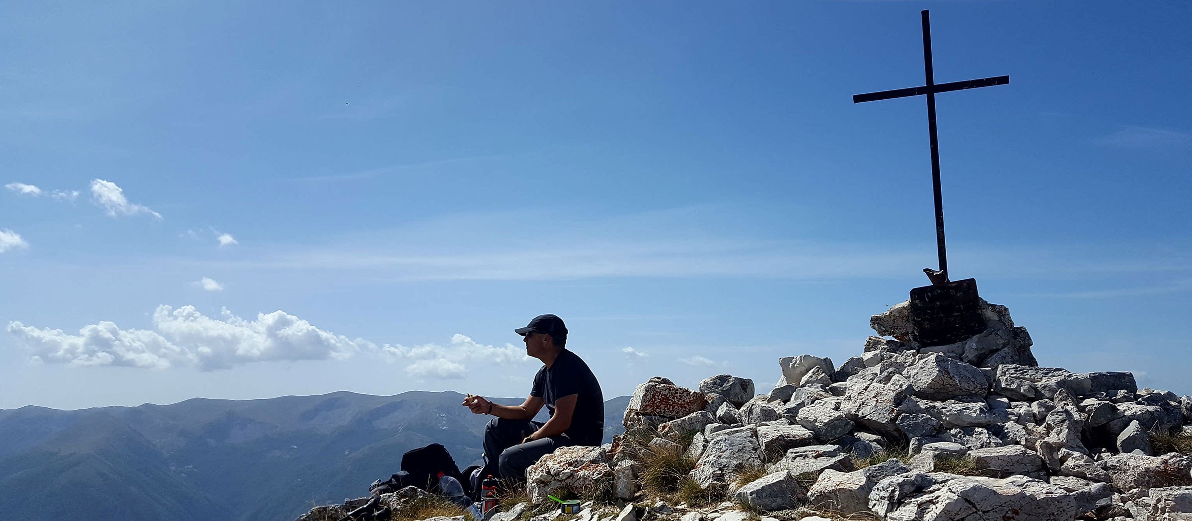
Well, to my own back yard! I live in the Sulmona Valley, in the heart of Abruzzo. It’s a marvellous place – a 100 km2 fertile basin, once the site of a pre-historic lake, and a crossroads encircled by mountains. For years I’ve walked on those sheltering mountains, from peak to peak along high ridges and, as I wandered, the simple idea of making a circular route to run continuously around the perimeter of the basin grew stronger.
A way made from the ancient paths and lanes that have tied the area together since the italic tribe, the Peligni, first arrived thousands of years ago with their sheep, barley and vines. And a long loop, not point to point, with final completion being a return to the beginning.
The sense of a journey between distant places is less but the striking geography demands a circuit, with each section always accessible from the hub of the wheel and each day bringing a new perspective on the multi-faceted valley with the sun in a different quarter.
I talked about it with my friends in the Alpine Club (CAI Sulmona). Of course, I wasn’t alone and it wasn’t a new idea. But no one had documented the tracks, made the idea accessible, described a way. We decided to do it, thinking not only of the path itself but of how it should become a resource both for residents of the valley and for the visitors we hope it will attract.
We feel that low-impact, low-cost projects like this are the heart of a future ‘green tourism’ – slow, sustainable development that reflects the rhythms of the land and a movement that Abruzzo is wonderfully placed to lead on and to benefit from.
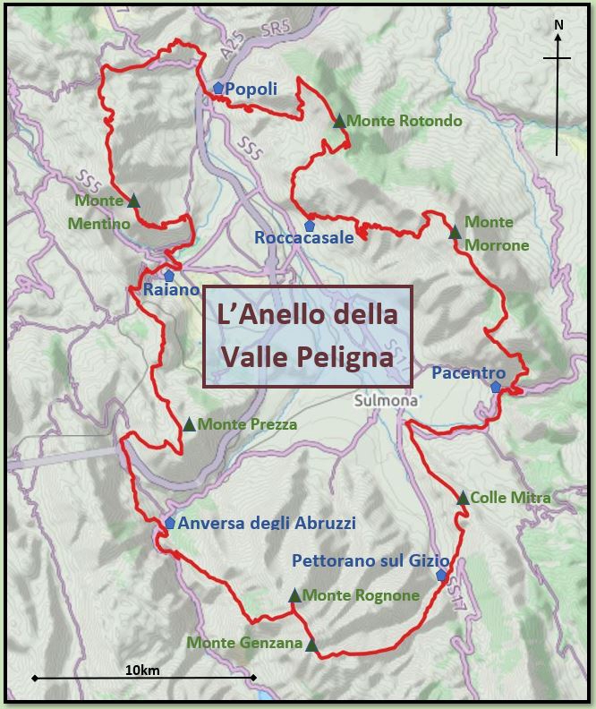
Work began in 2018. We sketched a potential route – the result of our debated knowledge of a hundred tracks and paths; of dozens of mountain tops and of the ancient villages, castles and sites that lie around the perimeter of the valley. We mostly agreed on the way and, throughout 2019, surveyed every metre; to see how things are on the ground. We walked, measured, checked, plotted, photographed and considered the options.
Then the route was settled – a 6 stage/day circuit, 133km long, taking in almost all of the valley skyline and linking the principle villages and castles along the way. Thus, was born the Sulmona Valley Loop – l’AnellodellaValle Peligna.
It’s not always an easy path to walk, mountainous in many places, and most will find its 8700m of total ascent and descent and its daily average of 22km a challenge, but the route is true to our vision – an exhilarating and beautiful adventure that can be accessed, at least in part, by everyone. Full completion will be a memorable and fulfilling achievement but there are fine family days out to be had along the way as well – the trail has much to offer.
The describing phase
You might think that we had done the hard bit. Well, of course, no. Then came the describing phase that we have recently finished. Weeks of design, map-making and writing, in Italian and in English, have resulted in 12 detailed descriptions – one for each stage in Italian and another in English.
These are published now on the Sulmona Valley Loop website, which we also designed and built. And, for the time being, you can download them for free!

We are pleased with what we have created but the major effort still lies ahead. From now our progress will be determined by funding!
I’ve walked and climbed in the mountains all over – in particular, the Alps and the Apennines. Although happy to quit the trail and navigate with a map and compass (let’s say GPS these days) I’m always comforted by a cairn, a painted waymark or a lonely signpost. In fact, I love them! Many people would really love to take to the hills but are not confident to do so without the reassurance of signs and waymarks. Our path will not become widely popular until we mark it and maintain it to the highest standards.
This will take time and money. Right now, we need cash to buy signs, stakes, paint, information boards and to pay, in part, to have them installed. And we plan to publish paper guidebooks and a map for the route – for some not everything has been delegated to the laptop and smartphone…
We must forge relationships with comunes, provincial and regional government, national park authorities, tourist boards, landowners, nature reserves, newspapers, blogs, regional development funds, publishers, societies and other interest groups. You get the picture; it will be complicated and take a while. Working with them as appropriate, we will make funding applications. We don’t need a lot of money really – an investment in a green project like ours is relatively small and will pay back in a long-term, sustainable way. We will raise some ourselves through the sale of route description downloads but it won’t be enough. Until we are funded, further phases are on hold.
Visitor infrastructure is important, too. From the outset, we considered how people, particularly those from outside the area, will walk the circuit. Each stage starts and ends in a village with at least a bar, restaurant and somewhere to sleep.
Each of these villages is connected to Sulmona by bus and, in some cases, train. Our goal was a loop accessible without a car for someone staying in Sulmona and walkable, stage by stage, not necessarily on consecutive days; one here, one there, maybe two or three over a long weekend. Sulmona, itself, is well connected with Roma, Pescara and l’Aquila by rail and with Napoli by coach. Big tick for public transport!
Opportunities are here to create businesses to serve walkers. We’ve heard from people who are keen to establish B&Bs in villages along the way. Bars and restaurants will benefit, some of which have a marginal existence today.
A little boost may make the crucial difference to a community in decline. And who will seize the moment to set up an accommodation booking and luggage pick-up and drop-off service? We’ve modelled the costs and benefits to the valley in preparation for funding applications and even a nay-saying pessimist would, we hope, be smiling!
Spirit and freedom
There are other long point-to-point trails in Abruzzo including the Spirit Trail and the Freedom Trail in the Maiella National Park and the San Tommaso pilgrimage route that runs from Rome to Ortona on the Adriatic coast. The mammoth Sentiero d’Italia, linking Sicily with Slovenia, touches the Sulmona Valley and provides us with about 15km of shared path.
Walkers are also increasingly exploring sections of the five historic sheep droves, tratturi, that were used for centuries for the transumanza, the seasonal migration of flocks between the coastal areas of Puglia and the high summer of pasture of Abruzzo. We want to inspire the development of these and other trails by being an example of how high standards bring long-term benefits.
It’s been great so far and we’re excited about the future. In 2022, CAI Sulmona will celebrate the centenary of its founding. What a perfect memorial we are creating – as someone said, with a bit of license, 100km for 100 years!
Our website has lots more information about the Sulmona Valley Loop, including photo galleries, videos, overviews of each stage and detailed descriptions to download.
