Cycling the North Coast 500: everything you need to know

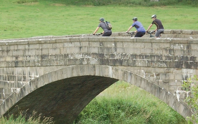
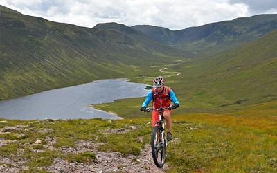
The North Coast 500 cycle route (NC500) is a 500-mile lap of Scotland starting and finishing in Inverness, Cyclists will be treated to mile upon mile of unspoilt wilderness with a varied landscape of craggy mountains, verdant glens, rolling open peat moorland dotted with lochs, and wild rugged coastlines. And if the scenery isn't enough, there are always the many distilleries and micro-breweries on or near the route guaranteed to entice.

What is the NC500? How is the cycle route different?
In 2015, the North Highland Initiative created the North Coast 500 (NC5000), a circular route of just over 500 miles for tourists in cars, motorbikes and campervans. The route was created to bring more tourists into the area and promote the region's businesses and agriculture. Cyclists are often attracted to the route too, but, as it was made for vehicles, there are parts that are on fast, dangerous main roads or incredibly steep ascents. The cycle route described in the guideook addresses some of these problems.
Where does the NC500 go?
The NC500 cycle trail begins and ends in the same place as the typical road NC500: Inverness. Going on to passing through Wester Ross, Sutherland, Caithness, Easter Ross, and the Black Isle, the North Coast 500 takes in the mountains at Torridon, An Teallach and in Assynt and reaches both Durness and John o' Groats, near the northwestern and northeastern extremities of Scotland.
How long is the route?
The recommended route is 538 miles (850km) long, whilst a number of both shorter and longer variants take the total distance from between 475 and 555 miles (764 and 893km).
When is the best time to cycle the NC500?
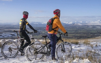
The route is best followed between April and October when the days are longer, the weather is milder and there is little chance of snow. Accommodation is in heavy demand in July and August and if you travel at this time, advance booking is essential even for hostels.
How long will it take?
The route has been broken into 16 stages averaging 33 miles (53km) per stage. A fit cyclist, cycling an average of 53 miles (85km) per day, should be able to complete the ride in 10 days. A more leisurely daily ride of 40 miles (64km) would see the ride accomplished in 13 days. There are a variety of places to stay overnight, making it possible to tailor daily distances to your requirements. A selection of alternative schedules is shown at the beginning of this guide.
What kind of bike is suitable?
As the route is almost entirely on asphalt surfaced roads almost any type of cycle can be used, although touring bikes and hybrids are the most suitable. Racing bikes can be used, provided they can carry your luggage and have gearing suitable for steep climbs. There is no advantage in using a mountain bike (other than its low gearing for climbs) and if you do use one, you should replace the knobbly tyres with road tyres. Front suspension is beneficial as it absorbs much of the vibration. Straight handlebars with bar-ends enable you to vary your position regularly. Make sure your cycle is serviced and lubricated before you start, particularly the brakes, gears and chain.
As important as the bike is your choice of tyres. Slick road tyres are less suitable and knobbly mountain bike tyres are not necessary. What you need is something in between with good tread and a slightly wider profile than you would use for everyday cycling at home.
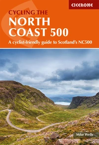
Cycling the North Coast 500
A cyclist-friendly guide to Scotland's NC500
£17.95
Guidebook to cycling the 528 mile NC500 circular cycle route around northern Scotland, starting and finishing in Inverness. Although the scenery is wild, the going is almost entirely on asphalt roads, many of which are quiet with little traffic and can comfortably be cycled within a fortnight.
More informationHow do you get to the start?
The route begins at Inverness Castle, a short ride from Inverness train station. This station has direct links to Edinburgh, Glasgow, and Aberdeen on ScotRail, which allows bikes when bookings are made in advance. From elsewhere in the UK, changes may be required in Edinburgh or Glasgow, although the Caledonian Sleeper runs from London Euston to Inverness, offering sleeping cars. Alternatively, Inverness airport is located to the east of the city and is connected via train by ScotRail.
What about the accommodation?
For most of the route, there is a large variety of accommodation available, from five-star hotels to youth hostels and campsites. These suit a variety of different budgets, the cheapest being camping though this would require carrying more equip,emt on the route. The motorist's route is popular during the summer months so booking in advance is advised.
Route Summary
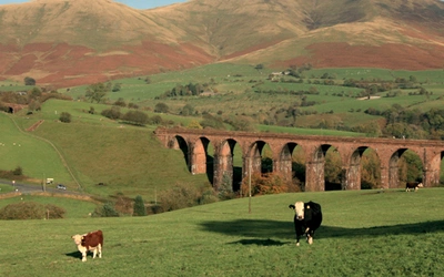
Stages 1 and 2 cross Scotland from east to west following quiet roads at first beside Beauly Firth then ascending very gently through the Black Water valley and Strath Bran before descending along Strath Carron to reach the west coast at Lochcarron. From here the main route turns north up the Atlantic coast (Stage 3), although a very challenging alternative (Stage 3A) can be followed that climbs over the Bealach na Bà pass (626m), the steepest and third-highest road in Scotland.
Continuing up the west coast, Stage 4 passes the dramatic Torridon mountains and undulates past Kinlochewe and Loch Maree before descending to Gairloch. Stage 5 circles the northern part of the Fisherfield peninsula then crosses a low pass over the shoulder of An Teallach and descends through Strath More to Ullapool, the first town since Inverness. On Stage 6 the main route enters the North West Highlands Geopark, turning inland onto a plateau of wild open land dotted with lochs and lochans before passing Ben More Assynt and returning to the coast at the small fishing port of Lochinver. An alternative route, which is closer to the coast, undulates past Stac Pollaidh across the southern part of the Assynt peninsula. Stages 7 and 8, which undulate frequently and sometimes steeply, first circle the Assynt peninsula then descend to go over Kylesku bridge and cross rocky open moorland before descending through the Dionard valley into Durness, close to the extreme northwest corner of Scotland.
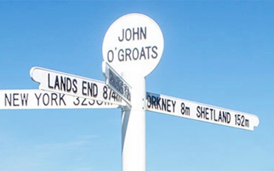
Stages 9–11 follow the rugged north coast from west to east, passing around a number of deep sea lochs and through Thurso to reach John o’ Groats, famous as the most northerly village on the British mainland. From here, there are two ways to return south to Inverness. The main route travels through the centre of the country following the Far North Way, part of the National Cycle Network route NCN1 on quiet minor roads through the Sutherland flow country, an area greatly affected by 19th-century land clearances.
An alternative uses the busy A9 main road along the east coast passing through Wick, Helmsdale, Brora and Dornoch before rejoining the main route at Tain. Between Tain and Inverness, a seasonal ferry (operates June–September) is used to cross a narrow straight at the entrance to Cromarty Firth before the route continues across the highly fertile Black Isle. An alternative route, for use when the ferry is not operating, passes through Dingwall, rejoining the main route before Inverness.
The guidebook
This guidebook describes a cycle-friendly touring route around Scotland’s far north. Starting and finishing in the highland capital, Inverness, the circular route passes through the ancient counties of Wester Ross, Sutherland, Caithness, Easter Ross and Cromarty. The recommended route is 528 miles (850km) long, while several variants (some shorter, some longer) provide for a total distance varying between 475 and 555 miles (764 and 893km).
Featuring clear and concise route description, together with 1:150,000 mapping, gradient profiles, suggested schedules and invaluable practical information - including complete lists of all hostel/bunkhouse accommodation, official campsites and services for cyclists and advice on other accommodation and refreshment opportunities, Cycling the North Coast 500 provides all the information needed to plan and execute a fantastic cycling tour of Scotland.
Useful information: Maps
The best map of the motorists’ route is Nicholson North Coast Journey (1:150,000) (ISBN 98781912046652,) which is a series of strip maps at a scale suitable for cyclists. However, this does not cover the inland Stages 13 and 14.
Cycling the North Coast 500
A cyclist-friendly guide to Scotland's NC500
£17.95
Guidebook to cycling the 528 mile NC500 circular cycle route around northern Scotland, starting and finishing in Inverness. Although the scenery is wild, the going is almost entirely on asphalt roads, many of which are quiet with little traffic and can comfortably be cycled within a fortnight.
More information