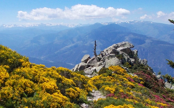
The best UK long-distance walks you can do in a week
Here are eighteen suggestions for some of the best week-long walking holidays. Suitable for beginners, and also more experienced walkers, these hikes cover all parts of the UK.
The British Isles are covered in a fantastic network of footpaths which cross the countryside, providing access to mountains and moorland, coast, valleys, woodland, meadows and rolling hills. If you are new to long-distance walking, then it might be best to choose something not too demanding, as it’s always much better to return from your walking holiday wanting to do more, rather than to hope you never need to repeat the experience!
With this in mind, these suggested routes are roughly graded in terms of difficulty. The long-distance walks below will take between 4 and 10 days to complete, so will fit roughly within a week of holiday and two weekends. You can always tackle longer routes by choosing sections to walk on different trips, to suit the time you have available.
1. HAMPSHIRE TEST WAY
AONBs and Iron Age Forts
Where: Hampshire – from high on the chalk downs of Inkpen Beacon to the Eling Tide Mill near Southampton Water.
How long: 44 miles
How many days: 4-6 days
How hard: suitable for all abilities
Season: year-round
Following the beautiful, crystal clear River Test, the way goes through picturesque villages and fascinating historic sites. It passes close to or through St Mary Bourne, Whitchurch, Stockbridge, King's Somborne, Broughton, Mottisfont, Romsey and ends at Eling Totton.
Fun fact: The River Test is particularly interesting in that it is a crystal clear chalk stream, one of only a handful in the country.
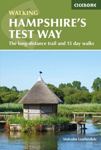
Walking Hampshire's Test Way
The long-distance trail and 15 day walks
£14.95
Guidebook to walking the 71km (44 mile) Test Way in Hampshire from high on the chalk downs of Inkpen Beacon to the Eling Tide Mill near Southampton Water. Following the beautiful, crystal clear River Test, it passes picturesque villages and fascinating historic sites. Also includes 15 day walks to explore this lovely part of pastoral England.
More information2. BORDERS ABBEYS WAY
Ruined medieval abbeys
Where: Begins and ends in Tweedbank, which can be reached within an hour by train from the centre of Edinburgh.
How long: 68 miles
How many days: 4-6 days
How hard: suitable for people with a moderate level of fitness
Season: year-round, but between early spring and the end of autumn you will have more hours of daylight
Taking in 4 of Britain's grandest ruined medieval abbeys, the route is as rich in history as it is in pastoral charm. It passes through the towns of Melrose, Kelso, Jedburgh, Hawick and Selkirk and the villages of Denholm and Newton St Boswells. The route is a well waymarked and is one of Scotland's Great Trails.
Fun fact: Kelso Abbey, founded in 1128, is the oldest abbey you'll pass on the trail.
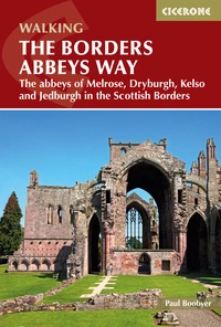
The Borders Abbeys Way
The abbeys of Melrose, Dryburgh, Kelso and Jedburgh in the Scottish Borders
£14.95
Guidebook to the Borders Abbeys Way, a 68 mile circuit in the Scottish Borders, taking in 4 of Britain's grandest ruined medieval abbeys. Beginning and ending in Tweedbank, the route, which is described over 6 stages, is as rich in history as it is in pastoral charm. Relatively flat, it is suitable for people with a moderate level of fitness.
More information3. NORFOLK COAST PATH
Coastal cliffs and beaches
Where: Beginning near Thetford, the route heads north west to near Hunstanton, then follows the heritage coast to Hopton-on-Sea.
How long: 90 miles
How many days: 7 days
How hard: The path is a waymarked National Trail so easy to follow and suitable for all abilities.
Season: year-round
The trail combines the best of inland and coastal walking in Norfolk, and is one that, being well waymarked, largely flat and within easy reach of public transport for most of its length, is ideal for people new to long-distance walks.
Fun fact: The sandy beaches in Norfolk are broken up by groynes – wooden fences that stop beach sand being washed away by long shore drift.
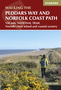
The Peddars Way and Norfolk Coast Path
130 mile national trail - Norfolk's best inland and coastal scenery
£12.95
The 130 mile Peddars Way and Norfolk Coast Path National Trail combines the best of inland and coastal walking, and is ideal for people new to long-distance walks. Beginning near Thetford, the route heads north west to near Hunstanton, then follows the heritage coast to Hopton-on-Sea, taking roughly one week to complete.
More information4. SUFFOLK COAST PATH
Coast, cliffs and heaths AONB
Where: From Lake Lothing in Lowestoft, along Suffolk's stunning Heritage Coast to Landguard Point in Felixstowe.
How long: 60 miles
How many days: 7 days
How hard: Easy walking for those of moderate fitness.
Season: year-round, but spring and autumn best for bird watching
Along the way you will find stunning beaches, glorious heathland, quaint villages and bustling seaside towns such as Aldeburgh and Southwold, and pass through an area of outstanding natural beauty of coast and heathlands.
Fun fact: Landguard Point was the site of the last opposed seaborne invasion of England, by the Dutch in 1667.
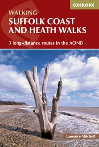
Suffolk Coast and Heath Walks
3 long-distance routes in the AONB: the Suffolk Coast Path, the Stour and Orwell Walk and the Sandlings Walk
£12.95
Guidebook to 3 long-distance routes exploring the varied landscapes of the Suffolk Coast and Heaths AONB. The Suffolk Coast Path covers 55 to 60 miles from Lowestoft to Felixstowe. The Stour and Orwell Walk is 40 miles from Felixstowe to Cattawade near Manningtree, while the Sandlings Walk is 59 miles from Ipswich to Southwold.
More information5. NORTHUMBERLAND COAST PATH
Coastal scenery and birdlife
Where: From Cresswell in the south to Berwick-upon-Tweed in the north.
How long: 62 miles
How many days: 4-6 days
How hard: Suitable for those with a reasonable level of fitness.
Season: spring, summer and autumn (expect snow on high ground in winter)
Described as the cradle of Christianity in England, Northumberland's history is long and varied and the trails reflect this with visits to some magnificent architecture – rambling castles, Norman churches, medieval abbeys – as well as sites of enormous archaeological and geological interest, quiet villages and Sites of Special Scientific Interest.
Fun fact: Earl Grey tea originated in Northumberland – bergamot oil was added to offset the strong taste of lime in the local water.

Walking St Oswald's Way and Northumberland Coast Path
Heavenfield and Cresswell to Holy Island
£16.95
Guide to St Oswald's Way, stretching 97 miles (156km) through Northumberland from Heavenfield near Hadrian's Wall, to Holy Island (Lindisfarne) and taking in almost the whole length of the Northumberland Coast AONB. Includes an option to continue to Berwick-upon-Tweed on the final stage of the Northumberland Coast Path.
More information6. THE SANDLINGS WALK
Suffolk coast and heathlands AONB
Where: From Dunwich to Southwold.
How long: 59 miles
How many days: 7 days
How hard: Easy walking for those of moderate fitness.
Season: year-round, but spring and autumn best for bird watching
The route explores the heathland region that lies immediately inland from the Suffolk coast. With the exception of the first stage, between Ipswich and Woodbridge, the route of the Sandlings Walk lies entirely within the confines of the Suffolk Coast & Heaths AONB.
Fun fact: Eric Arthur Blair based his famous pen name, George Orwell, on the river near his parents’ home in Southwold.
Suffolk Coast and Heath Walks
3 long-distance routes in the AONB: the Suffolk Coast Path, the Stour and Orwell Walk and the Sandlings Walk
£12.95
Guidebook to 3 long-distance routes exploring the varied landscapes of the Suffolk Coast and Heaths AONB. The Suffolk Coast Path covers 55 to 60 miles from Lowestoft to Felixstowe. The Stour and Orwell Walk is 40 miles from Felixstowe to Cattawade near Manningtree, while the Sandlings Walk is 59 miles from Ipswich to Southwold.
More information7. THE RIDGEWAY
Views, Downs and Chiltern Hills AONBs
Where: From Avebury in Wiltshire to Ivinghoe Beacon in Buckinghamshire.
How long: 87 miles
How many days: 7 days
How hard: Suitable for all abilities.
Season: year-round, but spring and autumn have the best conditions
This guide takes you on a journey of discovery to some extraordinary sights, including the UNESCO World Heritage Site of Avebury's Neolithic stone circle and the famous Uffington White Horse. The trail is characterised by the lengthy stretches following an ancient track along the ridge line of the North Wessex Downs, dropping to the River Thames at Goring Gap, and then continuing along the line of the Chiltern Hills. The views are immense in all directions.
Fun fact: The Ridgeway is Britain's oldest trail.
8. COTSWOLD WAY
Views, picturesque villages, historic Bath
Where: Between Chipping Campden and Bath
How long: 102 miles
How many days: 7-10 days
How hard: Suitable for all abilities.
Season: year-round
The trail follows the escarpment down its western ridge with far-reaching views across the Severn Vale towards the Welsh hills. Plunging down regularly to visit honey-coloured villages and old market towns along the way. This is rural southern England at its best.
Fun fact: The trail visit three counties: Gloucestershire, Worcestershire (briefly) and Somerset.
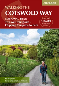
The Cotswold Way
NATIONAL TRAIL Two-way trail guide - Chipping Campden to Bath
£17.95
Guidebook to walking the Cotswold Way National Trail. Between Chipping Campden and Bath, the 102 mile route explores the Cotswolds AONB. Described in both directions over 14 stages, the Cotswold Way can be walked year round and is suitable for beginner trekkers. Includes separate OS 1:25,000 map booklet of the route.
More information9. SOUTH DOWNS WAY
Chalk downs, river valleys, views
Where: Between Winchester and Eastbourne, passing entirely through the South Downs National Park.
How long: 100 miles
How many days: 7-10 days
How hard: Suitable for all abilities.
Season: year-round – this is one of the driest and warmest parts of England
Generally easy underfoot, the Way links many ancient and historical tracks, fine wooded areas, delightful river valleys and lovely villages. Highlights include Beachy Head, the Long Man of Wilmington, Ditchling Beacon, Clayton WIndmills, Butser Hill and Winchester.
Fun fact: Beachy Head is a chalk headland near Eastbourne and is the highest cliff in Britain.
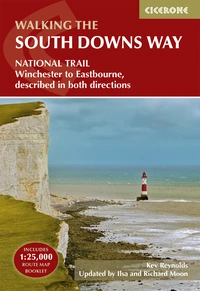
The South Downs Way
Winchester to Eastbourne, described in both directions
£17.95
SALE
£15.26
Guidebook to walking the South Downs Way National Trail, a 100 mile (160km) route between Winchester and Eastbourne through the South Downs National Park, described in both directions over 12 stages. Easy walking on ancient and historical tracks, taking in wooded areas, delightful river valleys and pretty villages. With 1:25K OS map booklet.
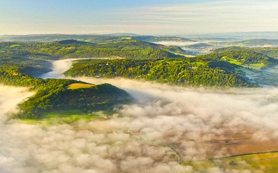
More information10. GREAT GLEN WAY
River, loch, mountain scenery
Where: From Fort William in the south west to Inverness in the north east.
How long: 79 miles
How many days: 5-6 days
How hard: An ideal introduction to long-distance walking.
Season: year-round
The Great Glen is one of Scotland's most remarkable features – a ruler-straight valley along an ancient Highland fault line. The glen is threaded by the scenic Caledonian Canal, linking Loch Lochy and Loch Oich with Loch Ness, and offers walkers a low-level route from coast to coast.
Fun fact: The route follows a geological fault known as the Great Glen Fault, and bisects the Scottish Highlands into the Grampian Mountains to the southeast and the Northwest Highlands to the northwest.
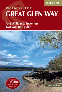
Walking the Great Glen Way
Fort William to Inverness Two-way trail guide
£17.95
Guidebook to walking the Great Glen Way, a 79 mile National Trail along the Caledonia Canal from Fort William to Inverness. Easily walked within a week in all seasons, the Great Glen Way is an ideal introduction to long-distance walking in Scotland. The route is described in both directions, and a separate OS 1:25K mapping booklet is included.
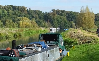
More information11. HADRIAN'S WALL PATH
Roman wall, forts and settlements
Where: Between Bowness-on-Solway and Wallsend, Newcastle.
How long: 84 miles
How many days: 7 days
How hard: Suitable for those with reasonable fitness.
Season: April to October.
Hadrian's Wall is the finest surviving frontier work from any part of the classical Roman empire, recognised as a UNESCO World Heritage Site. As you walk you will find an abundance of historic remains. Not just of the Roman era, but from later centuries, in a pastoral landscape that has seen its fair share of turbulent human interaction and, notably through the mining of coal, industrial change and invention.
Fun fact: Only about 10% of the original wall remains today.
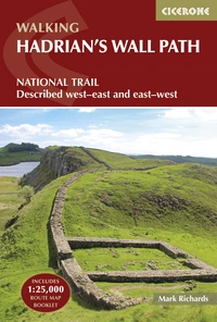
Hadrian's Wall Path
National Trail: Described west-east and east-west
£17.95
SALE
£15.26
Hadrians Wall Path guidebook to walk the 135km (84 mile) National Trail. Described in both directions, the main description is west to east between Bowness-on-Solway and Wallsend, Newcastle, with an extension to South Shields. With extensive historical information related to this World Heritage site and separate 1:25,000 OS map booklet included.
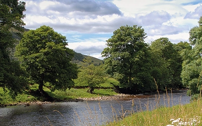
More information12. THE DALES WAY
Riverside, Yorkshire Dales, Lake District
Where: Between Ilkley and Bowness-on-Windermere.
How long: 79 miles
How many days: 6 days
How hard: Ideal for anyone wanting to attempt multi-day walking for the first time.
Season: year-round, but scenically at its best in Spring and Autumn.
The walk is a constant delight as it threads its way through the limestone landscapes of the Dales. The route follows rivers great and small, crossing farmland and a little moorland, before entering the Lake District which is now a World Heritage Site.
Fun fact: Famous children's author Beatrix Potter lived nearby Bowness, directly across the lake at Near Sawrey.
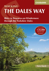
Walking the Dales Way
Ilkley to Bowness-on-Windermere through the Yorkshire Dales
£16.95
SALE
£14.41
Guidebook to walking the Dales Way. This picturesque 79 mile route through the Yorkshire Dales between Ilkley and Bowness-on-Windermere is one of the most gentle long-distance walks in Britain. The route is described in both directions, passing through Wharfedale, Dentdale and the eastern fringe of the Lake District. With 1:25K OS map booklet.
More information13. THE RIBBLE WAY
River paths, quiet tracks and lanes
Where: Following the Ribble valley, from the estuary mouth near Preston to the river's source on Cam Fell in the Yorkshire Dales.
How long: 72 miles
How many days: 5-7 days
How hard: General fitness and stamina are normally sufficient.
Season: year-round
Although not always by the river, the valley route winds through some beautiful countryside, alternating between fields, quiet tracks, lanes and wooded cloughs, with enticing views to the surrounding hills of Pendle, Bowland and the western Dales.
Fun fact: Construction of the famous Ribble viaduct began in 1870 and 1.5 million bricks were used in its construction.
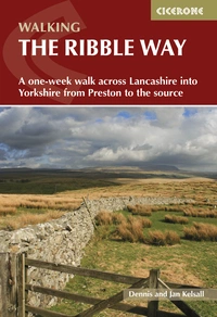
Walking the Ribble Way
A one-week walk across Lancashire into Yorkshire from Preston to the source
£16.95
Guidebook to walking the Ribble Way, a 72 mile route following the Ribble valley, from the estuary mouth near Preston to the river's source on Cam Fell in the Yorkshire Dales. The book contains OS map extracts and full route description split into 7 convenient stages, with suggestions for day walkers.
More information14. THE CUMBRIA WAY
River valleys, low fells, lakes, mountains
Where: Though the heart of the Lake District National Park, from Ulverston in the south to Carlisle in the north.
How long: 73 miles
How many days: 5-8 days
How hard: Suitable for those with some long-distance walking experience.
Season: year-round using B&Bs, or Easter to October using campsites.
One of Britain's prettiest long-distance walks. Undulating paths ease past memorable lakes and low mountain tarns, and through picturesque villages with delightful country pubs and cottages. The official route visits Coniston, Tarn Hows, Great Langdale, Stake Pass, Derwentwater, Back o'Skiddaw and Caldbeck.
Fun fact: The route passes by Tarn Hows, which was bought by Beatrix Potter in 1929, before being bequeathed to the National Trust.
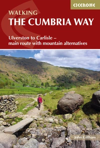
Walking The Cumbria Way
Ulverston to Carlisle - main route with mountain alternatives
£16.95
A guidebook to the 73 mile Cumbria Way, an easy long-distance walk though the heart of the Lake District National Park, from Ulverston in the south to Carlisle in the north, with good transport links to either end. The route is largely low-level but this guide offers alternative mountain days to climb some of the famous fells en route.
More information15. WEST HIGHLAND WAY
Mountain and loch landscapes
Where: From Milngavie near Glasgow to Fort William.
How long: 95 miles
How many days: 6-9 days
How hard: Suitable for those with some long-distance walking experience.
Season: May-June and September-October avoid the worst of the midges.
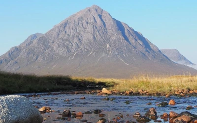
Mainly following tracks, the gradients are nearly always easy, and the scenery grows in grandeur on its way from Milngavie just north of Glasgow along the shores of Loch Lomond, then over the hills passing Crianlarich, Bridge of Orchy, crossing Rannoch Moor to Kingshouse at the foot of the imposing Buachaille Etive Mòr, then over the ‘Devil’s Staircase’ to Kinlochleven, (it’s a climb, but really not difficult!) then on to Fort William, at the foot of Ben Nevis.
Fun fact: Parts of the 1995 blockbuster Braveheart were filmed around the Glencoe and Fort William parts of the route.

The West Highland Way
Scottish Great Trail - Milngavie (Glasgow) to Fort William
£17.95
Guidebook to walking the West Highland Way National Trail, a 96 mile Scottish Great Trail route from Milngavie near Glasgow to Fort William, passing Loch Lomond and crossing Rannoch Moor. Suggested itineraries over 6 to 9 days. Includes accommodation guide and pull-out 1:25K OS map booklet.
More information16. WYE VALLEY WALK
Riverside and hill walking
Where: The valley of the Wye, between Chepstow in the south and Plynlimon.
How long: 136 miles
How many days: 7-10 days
How hard: Good navigational skills and a degree of stamina required.
Season: year-round
The walk passes the historic border towns of Monmouth, Hereford and Hay-on-Wye, as well as the architectural highlights of Tintern Abbey, Goodrich Castle and Hereford Cathedral. Unspoilt scenery full of wildlife interest makes this a classic long-distance route.
Fun fact: The Wye Valley has been inhabited for at least 12,000 years.

The Wye Valley Walk
From Plynlimon to Chepstow
£16.95
The Wye Valley Walk follows the River Wye for 219km (136 miles) through the beautiful and varied landscape of the Welsh borders. Typically taking 10 days to walk, the route starts at the river's source on Plynlimon and follows the Wye valley to Chepstow. The Wye Valley Walk is a perfect mix of river and hill walking, suitable for any reasonably fit walker.
More information17. SNOWDONIA WAY
Mainly low level, mountain scenery
Where: through Eryri (Snowdonia) National Park from Machynlleth to Conwy
How long: 97 miles
How many days: 6-8 days
How hard: Suitable for those with a reasonable fitness.
Season: year-round, but full mountaineering equipment required in winter.
Eryri is famous for its scenery, where the mountains meet the sea in wide sandy bays and estuaries, and where the myths of King Arthur and the stories of the old Welsh princes come to life beside clear mountain lakes and ruined castles.
Fun fact: Snowdonia contains 9 mountain ranges.
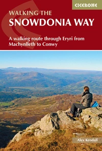
The Snowdonia Way
A walking route through Eryri from Machynlleth to Conwy
£16.95
Guidebook to walking the Snowdonia Way in Wales, a long-distance route through Eryri (Snowdonia) National Park from Machynlleth to Conwy. The low-level route of 97 miles (6 to 8 stages) includes the Pass of Aberglaslyn, the Ogwen Valley and Aber Falls. The mountain route is 122 miles in 9 stages, including Cadair Idris, Yr Wyddfa (Snowdon) and the Glyders.
More information18. THE SKYE TRAIL
Stunning scenery
Where: From Rubha Hunish in the north, the Skye Trail heads along the Trotternish Ridge and past the Cuillin to Broadford in the south.
How long: 80 miles
How many days: 7 days
How hard: Good fitness and excellent navigational skills are required.
Season: spring and summer
As yet unwaymarked and only for experienced walkers and backpackers, this challenging route provides the walker with a tour of Skye's most iconic landforms – including the Trotternish Ridge and the Cuillin Ridge – as well as of its turbulent history, from the Iron Age Forts to the ruins of the Clearance villages.
Fun fact: Skye is derived from the Norse word ski meaning ‘cloud’ and ey, ‘island’.
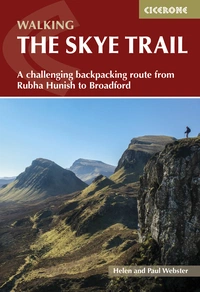
The Skye Trail
A challenging backpacking route from Rubha Hunish to Broadford
£14.95
This guidebook describes The Skye Trail, a challenging week-long trek across the largest island in Scotland's Inner Hebrides, the Isle of Skye. From Rubha Hunish in the north, the Skye Trail heads along the Trotternish Ridge and past the Cuillin to Broadford in the south. Suitable for experienced backpackers and mountain walkers.
More informationThat concludes our recommendations for long-distance walks that can be done in a week. There are countless to explore, each with its own unique character and challenges, whether it be a riverside walk, a mountainous adventure, or an adventure with some historical interest. Enjoy!