Myths, legends and folklore: the spooky tales of the British countryside
The British countryside is steeped in history and folklore—from tales of headless horsemen to ghosts, vampires, goblins, and sea creatures—we have it all. You've heard of the Loch Ness Monster, but what about East Anglia's Black Shuck or the Hairy Hands of Dartmoor? These creatures haunt the landscapes that we walk, so next time you're out on the hills, here are five haunting stories to scare your hiking partner with and the walks to help you find them... if you dare.
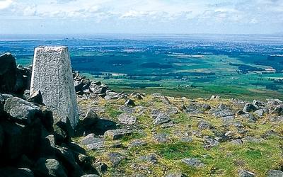
Wander along the coast path where Black Shuck roams
Where? Lowestoft to Felixstowe
Distance: 60 miles (97km)
Legend: The beast of the black dog of Bungay, Black Shuck, is said to roam the coast and the countryside of Suffolk, scouring churches, graveyards and roadsides. In 1577, Black Shuck appeared at the church of St Mary in Bungay during a violent storm, terrifying the locals and causing damage to the church. Nowadays, the damage is thought to have been caused by a lightning strike hitting the church, but the legend of Black Shuck has become an integral part of East Anglia's folklore.
Discover the perfect beginner-friendly long-distance trail, the Suffolk Coast Path from the town of Lowestoft to the port of Felixstowe. The big skies, clean air and wide-open scenery of the Suffolk coast have long cast their spell on visitors, and the area is just a few hours away from London. With its flatter, more accessible terrain, this is a frighteningly good first long-distance trail for many. Apart from the first stage from Lowestoft, this walk lies entirely within the Suffolk Coast and Heaths AONB (National Landscape) and mostly stays close to the coast.
Suffolk Coast and Heath Walks
3 long-distance routes in the AONB: the Suffolk Coast Path, the Stour and Orwell Walk and the Sandlings Walk
£12.95
Guidebook to 3 long-distance routes exploring the varied landscapes of the Suffolk Coast and Heaths AONB. The Suffolk Coast Path covers 55 to 60 miles from Lowestoft to Felixstowe. The Stour and Orwell Walk is 40 miles from Felixstowe to Cattawade near Manningtree, while the Sandlings Walk is 59 miles from Ipswich to Southwold.
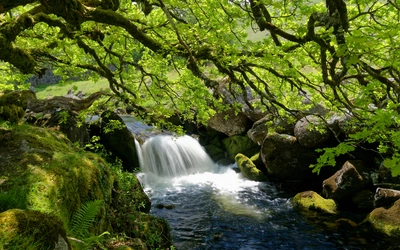
More informationFollow the moorland trail where the Hairy Hands still reach
Where? Postbridge to Bellever Tor
Distance: 11.75km (7¼ miles)
Legend: The South West of England is home to many myths and legends, but none is perhaps as notorious as the Hairy Hands of Dartmoor. Since the 1920s, motorists have claimed the ghostly Hairy Hands have grabbed their steering wheel and attempted to force them off the road whilst travelling down the darkened lanes surrounding Postbridge and Princetown.
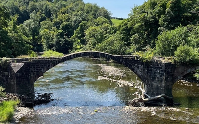
From the Postbridge visitor centre, the route heads up through Bellever Forest, passing several ancient sites, to arrive at Bellever Tor. After admiring the view, it’s off to Laughter Tor and its large standing stone. There is then a choice: for the adventurous, you can head across the East Dart River via stepping stones before passing through Bellever; If the water’s high, the forest path offers a less hair-raising way back. The final leg heads through woods and open moor back to the car park, visiting a well-known and much-photographed clapper bridge on the way. Sounds easy, but only if the Hairy Hands don't catch you first!
Walking on Dartmoor
40 Walks in Dartmoor National Park including a Ten Tors walk
£14.95
Guidebook containing route descriptions for 39 day walks spread across the Dartmoor National Park and its surrounding area, plus a two-day Ten Tors challenge. The graded routes vary in length and difficulty and visit local high points and sites of interest, including Neolithic and Bronze Age remains.
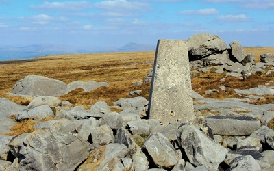
More informationLochside strolls where the Kelpies stir
Where? Beinglas Falls to Beinn a’ Choin
Distance: 25km (16 miles)
Legend: You may have passed a sculpture of the Kelpies when driving on the M9 beyond Edinburgh, but have you ever seen them emerge from a loch? These horse-like creatures feature consistently throughout Scotland's folklore, and some say they deceive travellers by offering them rides over the lochs before luring them into the dangerous depths. Others suggest that they can take the form of a human, so keep your friends close...
Beinn a’ Choin is a straightforward up and down from the RSPB car park at the Garrison of Inversnaid. Done that way, it’s a very ordinary Corbett. However, by perversely starting at the other end, you can make a mountain out of it and have ample time for Kelpie-hunting along the shores of Loch Lomond. A glimpse of a big waterfall, then a long rambling ridge with steep drops to the loch; and finally, the most interesting 13km of the West Highland Way along the shoreline oakwoods. In the darkness of the loch, beware what stares back: the Kelpies are said to watch from beneath the waves, waiting to claim the careless.
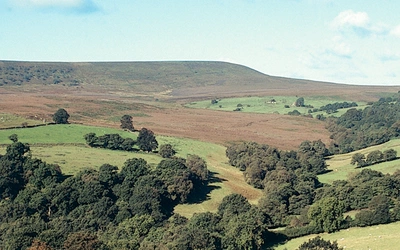
Count Dracula: A long-distance trail to sink your teeth into
Where? Cleveland Way
Distance: 177km (110 miles)
Legend: Whitby, North Yorkshire, is considered one of the most haunted towns in England, and it's easy to see why with its gothic atmosphere, imposing haunted abbey and influence on Bram Stoker's classic, Dracula. To experience the chill and thrill that inspired the iconic vampire story and the ghosts that still haunt Whitby Abbey today, why not head out to the North York Moors or the Cleveland Way, which passes through the town.
Many long-distance walkers tackling the Cleveland Way take their time to explore the haunting town of Whitby, exploring the narrow streets and bustling harbour. Whitby Abbey, perched high above the town, offers yet another distraction. And if your spidey-senses tingle as you climb the 199 steps, don’t worry… It’s only Count Dracula keeping an eye on travellers.
For those looking for a day walk, Sandsend to Robin Hood's Bay (16.5km (10¼ miles) is the perfect section to take in this gothic setting.
The Cleveland Way and the Yorkshire Wolds Way
NATIONAL TRAILS: The North York Moors, Yorkshire Wolds and Yorkshire Coast
£17.95
A walking guidebook to the Cleveland Way and Yorkshire Wolds Way National Trails, plus the Tabular Hills Walk. Crossing the North York Moors National Park, coastal scenery and quiet countryside, the three routes can be joined to create an easy circular route of over 250 miles (400km). Includes an OS 1:25K map booklet of the Cleveland Way.
More informationPendle Hill, where the witches still walk
Where? Pendle Hill, Ribble Valley
Distance: 11km (6¾ miles)
Legend: Like much myth and folklore, the Pendle Witches is based on the area's history. In 1612, ten people (eight women and two men) were accused of witchcraft and executed at the Pendle Hill witch trials, and since then, this hill in the Ribble Valley has become a symbol of fear and superstition. Each was found guilty and sentenced to death in the shadow of Pendle Hill.
Pendle Hill dominates the entire Ribble Valley and is visible all the way from the sea to the source of the river above the iconic Ribblehead Viaduct. Steeped in myth and legend, Pendle is one of the most climbed hills in Lancashire; its summit whispers stories of witches gone by. Reaching the summit usually involves a steep slog up the infamous ‘Steps’ from Barley, but an alternative route is altogether gentler, whilst still a fittingly rewarding challenge which feels like a proper hike! Keep an eye on the horizon, some say you might just glimpse the shadowy figures of the Pendle Witches, still wandering the hill as they did centuries ago.
15 Short Walks in the Ribble Valley
£9.95
Mark Sutcliffe has chosen 15 of the best short walks around Lancashire's Ribble Valley. Each walk comes with easy-to-read Ordnance Survey maps, clear route description and lots of images, plus information on beauty spots and refreshment stops. No challenging terrain or complicated navigation means walks can be enjoyed by everyone.
More informationFind out more about these spooky tales: