


Article


Free Royal Mail 48 postage on UK orders. European postage is £3.50 per item. Worldwide postage is £5.50 per item. If you're not happy with your purchase for any reason, we'll give you a full refund.
More information...
Guidebook to walking the North Downs Way National Trail, a 130 mile (208km) trail between Farnham and Dover, with an optional visit to Canterbury. Following the ancient Pilgrim's Way for much of the way, through pleasant countryside, this is one of the easier National Trails and the walk is described over 11 stages. With 1:25K OS map booklet.
Free Royal Mail 48 postage on UK orders. European postage is £3.50 per item. Worldwide postage is £5.50 per item. If you're not happy with your purchase for any reason, we'll give you a full refund.
More information...
A guidebook to walking the North Downs Way National Trail between the high downland of Farnham, Hampshire and Dover on the Kent coast. Covering 208km (130 miles), this gentle trail takes around 11 days to walk and is an ideal first long-distance hike for beginners.
The route is described from west to east in 11 daily stages between 12 and 22km (8–14 miles) in length. An optional 3-stage detour via Canterbury is also provided.
Overview Map
Map Key
Introduction
The North Downs Way
Walking west to east
Where to stay
Waymarking and accessibility
When to go
Getting there – and back
Using this guide
Along the way
The North Downs Way
Stage 1 Farnham to Guildford
Stage 2 Guildford to the Mole Valley (A24)
Stage 3 Mole Valley to Merstham
Stage 4 Merstham to Westerham Hill
Stage 5 Westerham Hill to Wrotham
Stage 6 Wrotham to the Medway
Stage 7 The Medway to Detling
Stage 8 Detling to Harrietsham
Stage 9 Harrietsham to Boughton Lees
Direct Route to Dover via Wye
Stage 10 Boughton Lees to Etchinghill
Stage 11 Etchinghill to Dover
The Canterbury Loop
Stage 10a Boughton Lees to Canterbury
Stage 11a Canterbury to Shepherdswell
Stage 12a Shepherdswell to Dover
Appendix A Useful contacts
Appendix B Recommended reading
Appendix C Route summary table
November 2024
Thank you to M Marsh for the following updates:
There have been a number of new housing developments built along the route so some descriptions that describe following a path with houses on one side are now following a path *between* houses.
Most of the stiles have been replaced with gates. The only stiles I can remember were one with no step up so it was just a drop in fence level to knee height - not a gate but only nominally a stile - and the 'high iron stile' on p131, which was still there but had an (intentional!) person-sized gap in the hedge right next to it.
September 2021
We have received the following information from reader, Michael King, to whom we are very grateful.
Stage 8; p85 The waymark mentioned near the foot of page 85 has been removed (and apparently burned!). Alternative instructions are "half way across the field, where a minor path joins from the left, turn right 60 degrees and aim for the bottom corner of the field". Incidentally, many of the stiles mentioned have been removed, so these are no longer points of note.
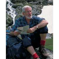
Kev Reynolds was a freelance writer, photojournalist and lecturer. A prolific compiler of guidebooks, his first title for Cicerone Press (Walks & Climbs in the Pyrenees) appeared in 1978; he later produced many more titles for the same publisher. A member of the Outdoor Writers' Guild, the Alpine Club and Austrian Alpine Club, his passion for mountains and the countryside inspired a lifetime's activity, and he regularly travelled throughout Britain to share that enthusiasm through his lectures. Sadly, Kev passed away in 2021. He will be remembered fondly by all who knew him and by many more he inspired through his writing and talks.
View author profile


