The Lea Valley Walk: a complete planning guide
The Lea Valley Walk is a 91km (56-mile) long-distance walking route in southeast England, tracing the River Lea from Leagrave near Luton in Bedfordshire to East India Dock on the River Thames in London. Almost entirely flat, fully waymarked and served throughout by railway stations, it is one of the most accessible long-distance walks in England and one of the least known. (Last updated: March 2026 · Guidebook edition: 4th edition, October 2025)
Lea Valley Walk quick facts:
- Distance: 91km / 56 miles
- Duration: 3–7 days (long weekend to a week; or multiple day trips)
- Start: Leagrave, near Luton, Bedfordshire
- Finish: East India Dock, London (alternative finish: Limehouse Basin)
- Stages: 5 (plus an optional Olympic Park circular)
- Difficulty: Easy, almost entirely flat
- Terrain: Riverside paths, towpaths, urban parkland
- Waymark: Swan symbol throughout
- Best season: Year-round, accessible in all seasons
- Guidebook: The Lea Valley Walk by Leigh Hatts, 4th edition
The Lea Valley Walk
One-week walk from Leagrave to the heart of London
£16.95
Guidebook to the Lea Valley Walk, a 50-mile route from Bedfordshire to the Thames. Described across five stages, the Walk traces the River Lea from Leagrave (near Luton) to East India Dock opposite Greenwich where it joins the Thames Path. Features an alternative finish at Limehouse Basin plus an optional 4-mile tour of the Olympic Park.
More information
What is the Lea Valley Walk, and why haven't you heard of it?
The Lea Valley Walk is one of England's most quietly remarkable long-distance routes: a 91km riverside trail running from the Bedfordshire countryside through Hertfordshire's historic villages, past the Queen Elizabeth Olympic Park and all the way to the Thames. It passes through England's first regional park, crosses land that was once the boundary between Alfred the Great's kingdom and the Danelaw, and ends at a dock that once welcomed ships from across the world. Yet it remains almost entirely unknown outside the regions it passes through.
That obscurity is the route's greatest advantage. While the Thames Path and South Downs Way draw large numbers, the Lea Valley Walk offers a genuinely peaceful experience: wildlife-rich riverbanks, ancient market towns, an Olympic-legacy venue, and London's most unexpected green corridor, with barely another long-distance walker in sight.
The route follows the River Lea (spelt 'Lee' within the Lee Valley Regional Park — both spellings are correct), which rises at Leagrave in Bedfordshire and flows 42 miles to the Thames. The 10,000-acre Lee Valley Regional Park, Britain's first regional park when established by Act of Parliament in 1967, stretches along much of the southern half of the route and contains more water than the Norfolk Broads. It has been referred to as "London's Lake District." King Charles, as Prince of Wales, described it as "a classic example of what could be done with derelict land if impetus and determination were there."
This planning guide answers the most common questions walkers have before setting out. For complete stage-by-stage route descriptions, OS mapping and transport details, see the Cicerone Lea Valley Walk guidebook.
Why should I walk the Lea Valley Walk?
Five reasons this underrated route deserves more attention:
It's the most accessible long-distance walk in England. The route is almost entirely flat, and good walking shoes are sufficient throughout. There are no technical sections, no remote stretches requiring specialist navigation and no need for camping gear. It is genuinely suitable for beginners, families and anyone returning to long-distance walking.
You can do it without a car or without a full week. Railway stations sit at or near every stage start and finish, from Leagrave and Harpenden in the north to Hertford, Broxbourne, Tottenham and London Liverpool Street in the south. The London Oyster Card works on trains as far as Hertford East. Walk it end to end over a long weekend, take a week at a leisurely pace, or complete it in a series of day trips from London over several months.
It passes through 1,400 years of English history. The valley was the boundary between Alfred the Great's kingdom and the Danelaw, the setting for the first English church synod at Hertford in 673, and the route King Harold took to Waltham Abbey before the Battle of Hastings in 1066. The Reformation arguably began here, when the future Archbishop Cranmer first suggested to Henry VIII that he look to English theologians rather than Rome for his divorce. Prime Ministers Melbourne, Palmerston, Salisbury and Balfour all lived in or near the valley.
It runs through the Olympic Valley. The 2012 London Games transformed the southern section of the route. The Olympic White Water Centre sits alongside historic Waltham Abbey halfway down the valley, and the walk finishes through the Queen Elizabeth Olympic Park. An optional additional 6km circular tour of the park is included in the guidebook.
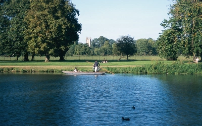
The wildlife is genuinely surprising. Kingfishers are spotted at the source in Leagrave. Water voles appear regularly between Hertford and Waltham Abbey. Over 200 bird species have been recorded in the regional park. The swan, the route's waymark symbol, is a constant companion throughout.
How long is the Lea Valley Walk?
The Lea Valley Walk covers 91km (56 miles) across five stages, from Leagrave near Luton to East India Dock on the Thames. An alternative finish at Limehouse Basin adds 2.7km (1.6 miles) for those who prefer to end with the navigation channel rather than the original intended finish at East India Dock.
| Stage | Route | Distance | Time |
|---|---|---|---|
| 1 | Leagrave to Harpenden | 16.6km (10.3 miles) | 4hr 20min |
| 2 | Harpenden to Hertford | 27.9km (17.3 miles) | 7hr 20min |
| 3 | Hertford to Broxbourne | 14.7km (9.1 miles) | 3hr 40min |
| 4 | Broxbourne to Tottenham Lock | 18.3km (11.3 miles) | 4hr 35min |
| 5 | Tottenham Lock to East India Dock | 13.8km (8.6 miles) | 3hr 15min |
| Total | - | 91.3km (56.6 miles) | 24hr |
| Alt. finish | Bow Locks to Limehouse Basin | 2.7km (1.6 miles) | 45min |
| Bonus | Tour of the Olympic Park | 6.1km (3.7 miles) | 2hr |
Note: Stage 2 (Harpenden to Hertford at 27.9km) is the longest stage and the one most walkers choose to split. The shorter stages at either end of the route make excellent standalone day walks.
Who is the Lea Valley Walk suitable for?
The Lea Valley Walk is one of the few long-distance routes in England genuinely suitable for all abilities. The terrain is almost entirely flat, the paths are well maintained, and the route is never far from a railway station, a pub or a town.
It is an ideal first long-distance walk for anyone who wants to try multi-day walking without committing to mountain terrain or remote country. Families, older walkers, those returning to exercise and anyone with limited time can all complete sections of this route comfortably. Good walking shoes are sufficient throughout.
The one practical note: a gap in food provision can occur between Wheathampstead and Hertford, particularly in winter when some pubs are closed. Carrying a picnic for this section is recommended.
How difficult is the Lea Valley Walk?
The route is rated easy. The Lea Valley Walk follows the river downstream toward London, so the gradient is almost imperceptible for most of the route. The only section with any real ascent is between Harpenden and Hatfield in the northern stages, where the route climbs briefly out of the valley.
After Hertford, the route follows the towpath southward on a flat, well-maintained surface all the way to Limehouse. This section is also accessible for pushchairs.
Can I walk the Lea Valley Walk as day trips?
Yes, and this is one of the route's defining advantages. The frequency of railway stations along the route means it can be walked in sections over multiple weekends without any need to arrange shuttles or return transport.
Key access points with railway stations include:
- Leagrave (start, trains to London St Pancras)
- Harpenden (end of Stage 1, Thameslink to London)
- Hertford (end of Stage 2, Greater Anglia to London Liverpool Street)
- Broxbourne (end of Stage 3, Greater Anglia)
- Tottenham Hale (near end of Stage 4, Victoria line and overground)
- Stratford (near Olympic Park, Elizabeth line, Jubilee line, overground)
The walk is even waymarked from some station platforms on the Hertford East–Liverpool Street line. The London Oyster Card is valid as far as Hertford East, and the London Freedom Pass covers trains as far out as Enfield Lock.
Which direction should I walk the Lea Valley Walk?
The route is described north to south, from Leagrave to East India Dock, and this is the recommended direction for end-to-end walkers. It follows the river downstream towards London and finishes with the most urban and historically layered section. Walking into London rather than away from it also means easier onward transport at the finish.
The route can be walked in either direction for day trips, with no practical difference.
When is the best time to walk the Lea Valley Walk?
The Lea Valley Walk is accessible year-round, one of the few long-distance routes in England where there is no strong seasonal constraint.
- Spring: the valley is at its most beautiful in spring, with birdlife particularly active and wildflowers on the riverbanks
- Summer: long days and warm weather make for enjoyable walking; carry water as refreshment stops between Wheathampstead and Hertford can be sparse in hot weather
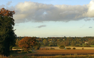
- Autumn: late summer sees harvesting around Wheathampstead; the best autumn tree colours are in Luton's Wardown Park and Brocket Park Estate
- Winter: clearer views are possible and the towpath sections from Hertford southward are walkable in all but the most severe conditions
The main seasonal consideration is pub closures between Wheathampstead and Hertford. Some close in winter, so check opening times before setting out on Stage 2 and carry a packed lunch.
What accommodation is available?
Accommodation along the Lea Valley Walk has reduced significantly in recent years, partly due to the growth of budget hotel chains drawing trade away from smaller establishments. What is available is noted at the relevant points in the guidebook.
For end-to-end walkers, the practical approach most people take is to use the excellent rail connections to return to a single base between stages. London offers easy access to every stage via the Liverpool Street–Hertford East line, making it straightforward to tackle the route over several days from a single base without paying for accommodation at each stage end.
For those who want to stay en route, the key towns — Luton, Harpenden, Hertford, Broxbourne and Waltham Abbey — all have accommodation options. Full details are in the guidebook appendix.
What are the route highlights?
The Lea Valley Walk moves through varied landscapes across its 91km, combining open countryside, historic market towns, wildlife reserves and urban parkland. Key highlights include:
- Luton's Tudor moated pub (Stage 1): one of the most unusual pubs in England, a fine introduction to the heritage threading the whole route.
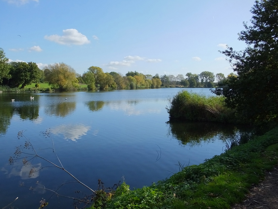
- Lemsford mill and lakes (Stage 1): a picturesque Hertfordshire village cluster that captures the valley's rural character at its best.
- Hertford Castle (Stage 2): a largely intact Norman castle in the county town, worth a stop before the towpath proper begins.
- Ware's gazebos (Stage 3): unique 18th-century riverside summer houses along the Ware waterfront, a curiosity found nowhere else in England.
- Rye House (Stage 3): a fine example of early English brickwork, site of the Rye House Plot of 1683 and home to a celebrated pub.
- Waltham Abbey (Stage 4): King Harold's burial place and one of the most significant Norman churches in England, set in extensive riverside grounds.
- Olympic White Water Centre (Stage 4): the 2012 Olympic venue sits alongside the river and remains in active use, an unexpected sight on a country walk.
- Queen Elizabeth Olympic Park (Stage 5): the southern approach to London passes through the Olympic legacy parkland, which becomes greener and wilder every year; the optional 6km circular tour is included in the guidebook.
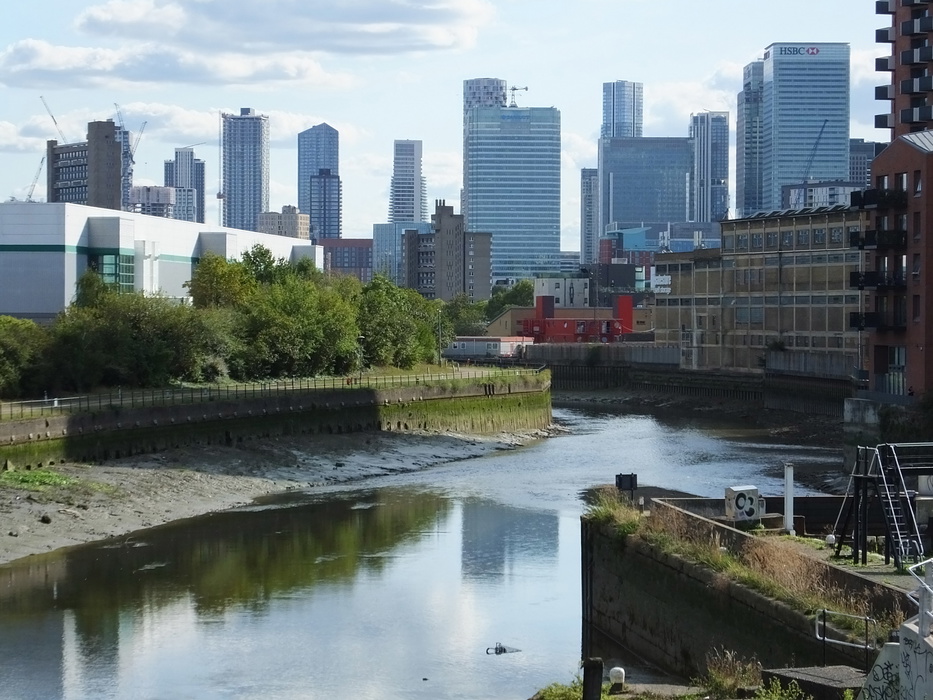
- East India Dock (finish): where the River Lea meets the Thames at a historic dock basin opposite Greenwich, a fittingly dramatic conclusion.
What is the history of the Lea Valley?
Few walking routes in England pass through as much concentrated history as the Lea Valley Walk.
The valley was once the boundary between the kingdom of Alfred the Great to the south and the Danelaw to the north. In 673, the first English church synod at Hertford united the Celtic and Roman Christian traditions, the founding moment of the English national church. King Harold came to Waltham Abbey in 1066 before the Battle of Hastings; his burial there marked the end of the Saxon era. The Reformation arguably began in the valley, when the future Archbishop Cranmer first suggested to Henry VIII at Waltham Abbey that he seek his divorce from English theologians rather than Rome.
A later change of dynasty played out here too: in 1603, James VI of Scotland entered London via the Lea Valley, pausing near Cheshunt to form his English government. He also brought golf to England, which now flourishes in the valley.
Four Prime Ministers lived or grew up in the valley: Melbourne and Palmerston at Brocket Park, Salisbury at Hatfield, and Balfour at Hoddesdon near Broxbourne. The valley also inspired writers including Anthony Trollope, Beatrix Potter and Izaak Walton, whose Compleat Angler is a tribute to the River Lea.
The Romans built Ermine Street through the valley; the Danes rowed up the river in 854. The last horse-drawn barge passed through in the mid-1950s, and the towpath it used is now part of the walking route, linking the ancient Icknield Way in the north to the Thames Path in London.
What wildlife might I see on the Lea Valley Walk?
The Lea Valley is a significant wildlife corridor running from the Bedfordshire countryside to the Thames, and the diversity of habitats along the route supports an impressive range of species.
Kingfishers are spotted at the source in Leagrave and regularly along the northern stages. Water voles, one of Britain's most endangered mammals, appear frequently between Hertford and Waltham Abbey. Over 200 bird species have been recorded within the Lee Valley Regional Park. The swan, the route's waymark symbol, is a near-constant companion throughout — walkers are advised not to feed them bread or sandwich scraps, as the river habitat provides natural food and supplementary feeding disrupts their diet.
In Bedfordshire and Hertfordshire the route passes through fields with cattle, horses and crops. South of Hertford, the nature reserves of the regional park offer wetland habitats, and the Walthamstow Marshes near the end of Stage 4 are one of the last remaining areas of traditional hay meadow in Greater London.
How do I get to the start and back from the finish?
Getting to Leagrave (start): Leagrave has a railway station served by Thameslink from London St Pancras, with frequent trains taking around 30 minutes from central London. This makes the start easily reachable for those walking south to north, or for day walkers joining Stage 1.
Getting home from East India Dock (finish): East India DLR station is a short walk from the finish, with DLR services to Bank, Canary Wharf and Canning Town for connections across London. For those finishing at the alternative Limehouse Basin end, Limehouse DLR station provides the same onward connections.
Transport along the route: Railway stations at or near every stage end make the Lea Valley Walk exceptionally well connected. Greater Anglia operates the Hertford East–Liverpool Street line, serving Hertford, Ware, Broxbourne and intermediate stations. The London Oyster Card is valid as far as Hertford East; the Freedom Pass covers trains to Enfield Lock. The walk is waymarked from some station platforms.
Plan your walk with the Cicerone guidebook
The Cicerone Lea Valley Walk guidebook, written by Leigh Hatts and now in its fourth edition (October 2025), provides everything you need to walk the route with confidence:
- Detailed stage-by-stage route descriptions for all 5 stages
- Stage facilities planner showing every railway station, pub, café and accommodation option along the route
- 1:50,000 OS mapping for all stages
- Alternative finish at Limehouse Basin (Stage 6)
- Bonus 6km circular tour of the Olympic Park
- Full transport information for all access points, including Oyster Card and Freedom Pass coverage
- Historical and heritage notes throughout
- Wildlife guide and seasonal notes
- Downloadable GPX files at www.cicerone.co.uk/1287/GPX
Available as a printed guidebook (£16.95) or digital eBook (£16.95).
The Lea Valley Walk
One-week walk from Leagrave to the heart of London
£16.95
Guidebook to the Lea Valley Walk, a 50-mile route from Bedfordshire to the Thames. Described across five stages, the Walk traces the River Lea from Leagrave (near Luton) to East India Dock opposite Greenwich where it joins the Thames Path. Features an alternative finish at Limehouse Basin plus an optional 4-mile tour of the Olympic Park.
More informationAbout Leigh Hatts, guidebook author:
Leigh Hatts has been walking the Thames towpath and exploring the river and Docklands since 1981, when he worked on the Thames Walk Feasibility Study, which resulted in the Countryside Commission persuading the government to designate the 180-mile route as a national trail. In addition to writing three Thames books, Leigh spent a decade as author of the London Transport Walks Book series. He also devised the 20-mile Bournemouth Coast Path, which now links the South West Coast Path to the Solent Way to create a 652-mile coast route from Minehead to Emsworth. He has written walking books covering Dorset's coast and countryside and the New Forest, and has worked as a reporter for the walkers' magazine TGO.