The Slovene Mountain Trail: a complete planning guide
Slovenia may be one of Europe's smallest countries, but the Slovene Mountain Trail (Slovenska planinska pot, or Transverzala) packs an extraordinary range of landscape into its 550km (342 miles), running from Maribor near the Austrian border all the way to Ankaran on the Adriatic coast. Along the way it crosses the forested Pohorje plateau, the limestone giants of the Kamnik-Savinja and Julian Alps, the flower-strewn ridges of the Karavanke, and the karst hills and olive groves above the sea, all within a country roughly the size of Wales. (Last updated: July 2026 · Guidebook edition: 2nd edition, March 2019, reprinted 2023)
The Slovene Mountain Trail, quick facts:
- Distance: 550km (342 miles)
- Duration: 49 days for the full route, in 12 stages of 3 to 6 days each
- Start: Maribor (near the Austrian border)
- Finish: Ankaran (Adriatic coast)
- Stages: 12, each independently accessible by public transport
- High point: Triglav, 2864m, Slovenia's highest mountain
- Difficulty: Grade 1 to 3 (subjective scale explained below); the hardest sections require mountaineering experience and via ferrata skills
- Terrain: Forested plateaus, high limestone peaks, alpine pasture, karst hills, coastal approach
- Waymark: Red circle with white centre ("target"), often marked with a 1 or TV
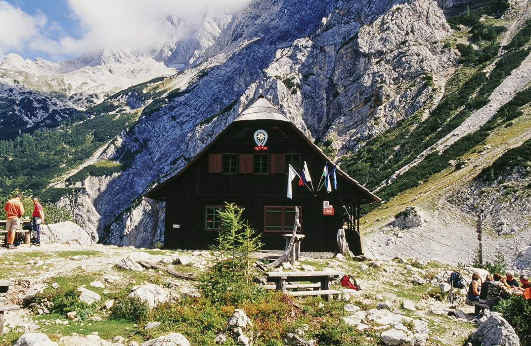
- Accommodation: Mountain huts (dom/koča), with hotels, private rooms and tourist farms in towns
- Best season: Mid-June to end of September
- Guidebook:The Slovene Mountain Trail by Justi Carey and Roy Clark, 2nd edition, Cicerone Press
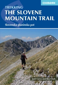
The Slovene Mountain Trail
Slovenska planinska pot
£18.95
Guidebook to trekking the Slovene Mountain Trail or Transverzala, 550km across Slovenia. Beginning at Maribor near the Austrian border to Ankaran on the Adriatic coast, the route is described as a series of 3 to 6-day treks through the region of Pohorje and the limestone mountains of the Karavanke and Kamnik-Savinja and Julian Alps.
More information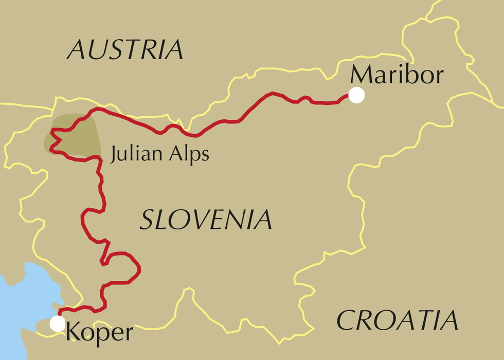
What is the Slovene Mountain Trail?
The Slovene Mountain Trail is Slovenia's national long-distance path, linking Maribor in the northeast to Ankaran on the Adriatic in a continuous line across almost every kind of upland landscape the country has to offer. Conceived in the 1950s by Professor Ivan Šumljak, a Maribor mountaineer who wanted to connect existing paths so that walkers could traverse from one range to the next, it was the first long-distance path anywhere in the Alps, opened officially on 3 April 1954 as the Transverzala.
The route was never designed to be walked in one continuous push. It is broken into 12 stages, each further divided into daily sections between mountain huts, and Slovenes themselves often spend years picking off individual stages rather than completing it all at once. That flexibility is one of the trail's great strengths: because Slovenia is so compact, many high points along the way offer a view back to where you've walked and forward to where you're going, and Triglav itself is visible from an unusually large share of the route long before you reach it.
This planning guide answers the most common questions walkers have before setting out. For complete stage-by-stage route descriptions and mapping, see the Cicerone Slovene Mountain Trail guidebook.
How long is the Slovene Mountain Trail?
The full route covers 550km (342 miles) across 12 stages, with a total trekking time of around 49 days. Each stage is designed to start and finish at a point reachable by public transport, so stages can be walked in any order, linked together, or tackled as standalone multi-day trips.
| Stage | Distance | Ascent | Time |
|---|---|---|---|
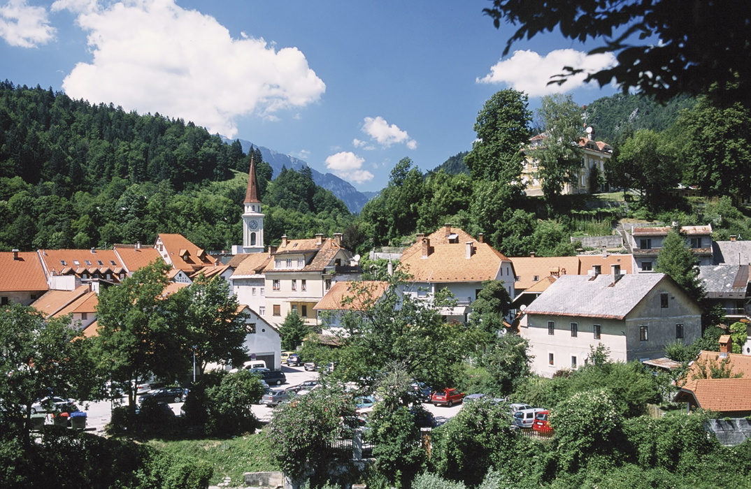
| 1 - Maribor to Slovenj Gradec | 58km (36 miles) | 2420m | 18:30 |
| 2 - Slovenj Gradec to Solčava | 52km (32.3 miles) | 2990m | 20:15 |
| 3 - Solčava to Zgornje Jezersko | 37km (23 miles) | 4935m | 30:45 |
| 4 - Zgornje Jezersko to Tržič | 23km (14.3 miles) | 2100m | 13:45 |
| 5 - Tržič to Dovje/Mojstrana | 48.5km (30.1 miles) | 3710m | 23:00 |
| 6 - Dovje/Mojstrana to Vršič | 38km (23.6 miles) | 4220m | 29:30 |
| 7 - Vršič to Trenta | 19km (11.8 miles) | 1160m | 14:30 |
| 8 - Trenta to Petrovo Brdo | 67.5km (41.9 miles) | 4070m | 33:30 |
| 9 - Petrovo Brdo to Idrija | 44km (27.3 miles) | 2450m | 17:00 |
| 10 - Idrija to Col | 51.5km (32 miles) | 1980m | 19:00 |
| 11 - Col to Matavun | 58.5km (36.3 miles) | 1930m | 17:45 |
| 12 - Matavun to Ankaran | 50.5km (31.4 miles) | 1315m | 15:00 |
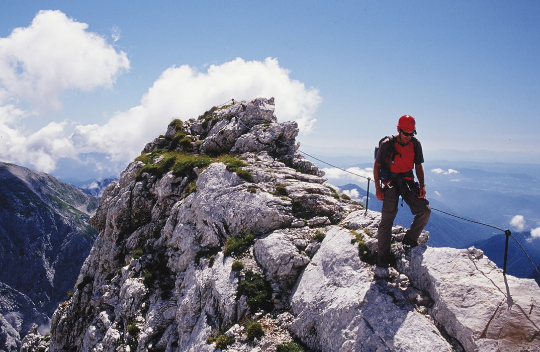
Stage 3 (Solčava to Zgornje Jezersko) and Stage 6 (Dovje/Mojstrana to Vršič, which includes the ascent of Triglav) are the two toughest sections of the whole trail, both graded 3 throughout and demanding real mountaineering experience, a head for exposure, and via ferrata equipment.
How difficult is the Slovene Mountain Trail?
Every day of the route carries a subjective grade from 1 to 3:
- Grade 1: Tracks and lanes with height gain and loss but no technical difficulty, though days can be long
- Grade 2: Significant height gain or loss, rough ground, and some easy scrambling
- Grade 3: Serious, high mountain terrain, long and strenuous, often exposed, with sections of fixed protection such as steel pegs and cables
Grade 3 days, concentrated in Stages 3, 6, 7 and parts of 8, require previous mountaineering or via ferrata experience. A helmet and self-belaying (energy-dissipating) via ferrata kit are strongly recommended for these sections, and walkers should know how to use them before setting out. The grade 1 and 2 stages towards the southern half of the route, such as Petrovo Brdo to Ankaran, are accessible to any reasonably fit hillwalker without technical climbing experience.
Who is the Slovene Mountain Trail suitable for?
The route as a whole suits fit walkers and mountaineers with some alpine experience, rather than complete beginners aiming to walk it end to end. That said, its stage structure means it caters for a wide range of ambition:
- Confident hillwalkers without scrambling experience can enjoy the gentler grade 1 stages, particularly Stage 1 (Pohorje), Stage 9 (Petrovo Brdo to Idrija) and the southern karst stages towards Ankaran
- Those with via ferrata experience and a head for heights can take on the high alpine stages through the Kamnik-Savinja and Julian Alps
- Anyone attempting the full 49-day trek should have genuine multi-day trekking stamina, since even the "easier" graded days can be long, and huts offer no possibility of an early exit
- The route is not recommended for dog walkers or families with young children on the grade 3 sections, given the exposure and fixed protection involved
Can I walk a shorter section of the Slovene Mountain Trail?
Yes. Because every stage begins and ends at a point served by public transport, walkers can choose individual stages or small groups of stages rather than committing to the full 49 days. A few options worth considering:
- Pohorje introduction: Stage 1, Maribor to Slovenj Gradec, is a gentle four-day taste of forested upland walking with no technical difficulty
- Julian Alps highlights: Stage 6, Dovje/Mojstrana to Vršič, takes in the ascent of Triglav itself and is the single most sought-after section, though it demands grade 3 experience throughout
- Karst and coast finale: Stages 11 and 12, Col to Ankaran, offer a gentler, warmer finish through limestone hill country, the mining town of Idrija's surroundings, and olive groves down to the Adriatic
Whichever stages you choose, Cicerone's route descriptions include transport details to reach the start and leave from the finish, so backtracking is never necessary.
Which direction should I walk the Slovene Mountain Trail?
The guidebook describes the route from Maribor to Ankaran, north to south, which is also the traditional and most commonly walked direction. This has practical advantages: it takes you from the gentler Pohorje forests into the high Alps once you've built up fitness and hut rhythm, and finishes with a gradual softening of terrain and climate as you approach the Mediterranean-influenced coast. Walking it in reverse is possible, since waymarking runs both ways, but it would mean tackling the hardest, most exposed grade 3 stages early on without the benefit of easing into the trail.
When is the best time to walk the Slovene Mountain Trail?
- Mid-June to end of September is the main season, when most high routes are snow-free and mountain huts are open and staffed
- Late June and early September tend to be quieter than the peak weeks of July and August, though some higher huts may only open from the third weekend in June
- May and October can work for the lower stages (Stage 1 and Stages 9 to 12), but snow is still possible in the mountains and many huts and tourist facilities will be closed
- July and August afternoons commonly bring thunderstorms in the mountains, which can build within half an hour and are genuinely dangerous on exposed ridges; an early start improves your chances of reaching the next hut before storms arrive
- Winter is not appropriate for trekking any part of this route
What accommodation is available on the Slovene Mountain Trail?
Accommodation along the trail is predominantly in mountain huts (dom or koča), which are graded by proximity to the nearest road, with prices for meals and beds fixed accordingly. Expect:
- Dormitory beds (skupna ležišča) or, where available, private rooms (soba), with bedding provided
- Discounted rates for members of the Slovene Alpine Association (PZS) or clubs with reciprocal agreements
- Basic, filling meals such as jota, ričet and golaž, but limited self-catering facilities beyond eating your own food in the dining room
- Cash-only payment at many huts, so carry sufficient euros, budgeting roughly €50 per person per day in higher huts and €35 in lower ones
- Limited or no washing water at higher huts, since supplies often arrive by helicopter
- Booking a few days ahead recommended, especially around Triglav and in the Julian and Kamnik-Savinja Alps in July and August
In towns at the start and finish of stages, hotels, private rooms, penzions and tourist farms (turistična kmetija) provide a wider range of comfort. See the guidebook's appendices for full hut listings and current telephone numbers.
Getting to and from the Slovene Mountain Trail
Ljubljana is the natural hub for the whole route, with excellent onward bus and rail connections to the trail's stage towns, including Maribor, Kranj, Celje and the smaller centres along the way. Ljubljana's Brnik airport (also called Ljubljana Jože Pučnik Airport) is served by budget and scheduled airlines from the UK, with a flight time of under two hours from London. Because the route is linear, cars are of limited use for point-to-point stages unless you have someone able to collect you; public transport, by contrast, reaches every stage start and finish described in the guidebook.
Is mountain rescue available on the Slovene Mountain Trail?
Unusually for the Alps, mountain rescue in Slovenia is free, unless a walker is found to have been seriously ill-prepared or negligent, in which case charges can be substantial. A network of 17 rescue bases covers the country, and a helicopter with an experienced crew is on standby at Brnik airport during daylight hours from June to September, with an average response time of around 1.5 hours, in line with wider European standards. In an emergency, call the 112 emergency number; mobile coverage extends across much of the trail, though it can drop out in dense forest or certain valleys. The International Distress Signal, six blasts on a whistle or torch flashes at night, answered by three signals, is worth knowing before you set out.
What are the route highlights of the Slovene Mountain Trail?
- The ascent of Triglav (2864m), Slovenia's highest peak and the spiritual high point of the whole trail
- The high mountain karst of the Kriški podi below Razor, with its sinkholes and limestone pavement
- The flower-strewn ridges of the Karavanke, straddling the Slovenia-Austria border
- Bolnica Franja, a hidden World War II partisan hospital reached during Stage 9
- The Škocjan caves (Škocjanske jame) near Matavun, the largest cave system in Europe and a UNESCO World Heritage Site
- The final descent to the Adriatic coast at Ankaran, past vineyards and olive groves, with views back over Socerb castle
Plan your walk with the Cicerone guidebook
The Cicerone Slovene Mountain Trail guidebook by Justi Carey and Roy Clark contains everything you need to plan and complete the route, from Maribor to Ankaran.
- Full stage-by-stage descriptions across all 12 stages and their component days
- Daily information boxes covering distance, height gained and lost, grade, and estimated time
- Sketch maps and route profiles for every stage
- A stamp-collecting tradition explained, along with the o symbol marking where to collect summit and hut stamps
- Appendices covering transport to stage start points, hut telephone numbers, and a full route summary table
- Practical background on Slovenian wildlife, flora, waymarking, food and drink, and language, including useful Slovene words and phrases
- Guidance on mountain safety, equipment, and via ferrata kit for the technical sections
Available as a printed guidebook (£18.95) or digital eBook (£18.95).
The Slovene Mountain Trail
Slovenska planinska pot
£18.95
Guidebook to trekking the Slovene Mountain Trail or Transverzala, 550km across Slovenia. Beginning at Maribor near the Austrian border to Ankaran on the Adriatic coast, the route is described as a series of 3 to 6-day treks through the region of Pohorje and the limestone mountains of the Karavanke and Kamnik-Savinja and Julian Alps.
More informationAbout Justi Carey and Roy Clark, guidebook authors:
Justi Carey and Roy Clark started visiting the British mountains in their teens, a discovery which has shaped their whole lives. Their passion and love for the outdoors has led to travels across the world, taking in Iceland, North America, Jordan and New Zealand, and a deep commitment to the environment, while their continuing interest in being 'out there' has resulted in an enthusiasm for downhill and cross-country skiing, canoeing, cycle touring and horse riding, among other things. After 16 wonderful years in Slovenia, they have recently moved to north-west Ireland for some new adventures.