Walking in Provence – East: a complete planning guide
Janette Norton's Cicerone guidebook covers 30 walks across three very different landscapes in eastern Provence: the red-rock Estérel coast, the wild Alpes de Haute-Provence, and the high Mercantour, where trails stay under snow until summer. Choosing between them is the real planning challenge, and this guide works through it, covering difficulty, timing, best season, and where to base yourself. Cross into Provence, she writes, and the light sharpens and a certain indolence takes hold. (Last updated: July 2026 · Guidebook edition: First edition, November 2014)
Walking in Provence – East, quick facts:
- Location: Eastern Provence, France, covering the Alpes Maritimes, Alpes de Haute-Provence and Mercantour
- Total routes: 30 circular day walks
- Distance range: 4 to 21km (2 to 13 miles)
- Typical duration: 2 to 8 hours per walk
- Difficulty: Graded Easy, Medium or Difficult; suitable for beginners through to experienced walkers
- Terrain: Mediterranean red rock coastline, rocky inland peaks, river gorges, alpine ridges and lakes
- Highest point: Mont Pelat and Mont Mounier, the region's high Mercantour summits
- Navigation: Sketch maps for every route, with downloadable GPX files
- Best season: Year-round on the coast and lower ground; summer and autumn for the high Mercantour trails
- Guidebook:Walking in Provence: East by Janette Norton, first edition (Cicerone Press, 2014)
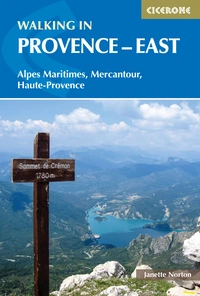
Walking in Provence - East
Alpes Maritimes, Alpes de Haute-Provence, Mercantour
£14.95
Guidebook to 30 varied day walks in the east of Provence in the Alpes Maritimes, Alpes de Haute-Provence and Mercantour, with practical information for the walker. Walks span from the Esterel on the coast to the Mercantour, and include the Verdon Gorge and Geological Reserve of Haute Provence, from bases such as Vence, Grasse and Digne-les-Bains.
More informationWhat is Walking in Provence: East?
Walking in Provence: East is Janette Norton's Cicerone guidebook to 30 circular day walks across the eastern half of Provence, covering the Alpes Maritimes, the Alpes de Haute-Provence and the Mercantour. It stretches from the red-rocked Estérel coastline near Cannes to the high alpine terrain of the Mercantour on the Italian border, taking in the Verdon Gorge and the Geological Reserve of Haute Provence along the way. The book is the companion volume to Walking in Provence: West, and together the two cover the whole of the region.
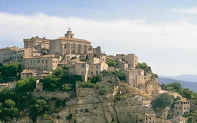
Norton is upfront that walking in Provence is a different experience from walking in, say, the Lake District or the Alps proper: the towns and coast are busy with tourists, but the hills themselves are often empty of anyone but sheep, with no cosy refuge around the next bend and no other walker to ask for directions. What you get instead, in her account, is a landscape thick with history: hilltop villages, medieval abbeys and castles, wayside shrines, old bories and mills, so that a day's walk regularly turns into an accidental history lesson. The routes reflect that diversity too, moving in the space of a single guidebook from a remote plateau or rocky peak to a leafy gorge or an old canal towpath.
This planning guide answers the most common questions walkers have before setting out. For complete route descriptions and sketch maps for all 30 walks, see the Cicerone Walking in Provence: East guidebook.
How does the book divide into regions?
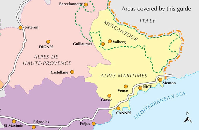
The 30 walks are grouped into three distinct areas, each with its own character.
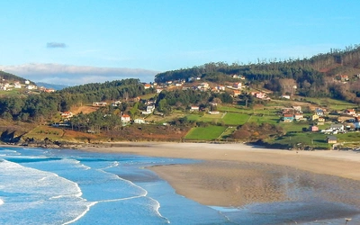
- Alpes Maritimes (Walks 1 to 10): The lowest and mildest of the three regions, where spring arrives early and sunshine is abundant. Some walks start directly on the Mediterranean coast among the brightly coloured rocks of the Estérel; others begin further inland, climbing rocky peaks such as the Baous for spectacular views over both the sea and the Alps.
- Alpes de Haute-Provence (Walks 11 to 20): A higher, wilder and more sparsely populated area. This is where you'll find the dramatic Verdon gorges, the bizarre eroded rock formations of the Geological Reserve of Haute Provence, and remote summits reached from villages where, in Norton's phrase, time has stood still.
- Mercantour (Walks 21 to 30): The most mountainous of the three, a region of high peaks, alpine lakes and gorges where snow often lingers on the trails until early summer. Most walks here start at higher altitude than in the other two areas, ranging from valley-floor routes to high passes marked by historic boundary stones and ascents of the region's highest peaks, home to ibex and chamois.
The 30 walks at a glance
The table below highlights eight of the routes that best represent the range covered in the guidebook. Full distance, ascent and timing figures for all 30 walks are given in Appendix A of the guidebook.
| Walk | Region | Distance (km) | Time (hr:min) |
|---|---|---|---|
| Walk 9: Estérel Circuit and Lac de l'Ecureuil | Alpes Maritimes | 15.9 | 04:20 |
| Walk 6: The Route Napoléon | Alpes Maritimes | 10.9 | 03:15 |
| Walk 12: Walk in the Réserve Géologique | Alpes de Haute-Provence | 4.3 | 01:45 |
| Walk 18: The Verdon Gorge – Sentier Blanc-Martel | Alpes de Haute-Provence | 12.5 | 05:15 |
| Walk 23: Gorges de Daluis | Mercantour | 9.8 | 04:25 |
| Walk 25: Col des Champs from Entraunes | Mercantour | 18.2 | 06:30 |
| Walk 27: Mont Pelat | Mercantour | 15.3 | 07:00 |
| Walk 29: Mont Mounier | Mercantour | 21.0 | 08:00 |
Who is Walking in Provence: East suitable for?
The guidebook is written for beginners and experienced walkers alike, and the 30 walks are graded Easy, Medium or Difficult so you can match a route to your fitness and experience. Easy walks are short with little ascent and can often be completed in half a day; Medium walks generally need most of a day with 400 to 700m of total ascent on well-marked paths; Difficult walks can take up to 8 hours and involve either more than 700m of ascent, rough terrain, exposed sections requiring a head for heights, or route-finding that becomes tricky in poor weather.
No special equipment is needed for any of the walks, but a few things are worth knowing before you choose a route. Norton is candid that walking here is often a solitary pursuit: outside the busy coastal towns, the hills are largely empty, and you shouldn't expect a mountain refuge or a fellow walker to ask for directions. Dog owners should also note that regulations in the Mercantour National Park are strict, and dogs are not permitted there even on a lead.
When is the best time to walk in eastern Provence?
- Winter: Many of the lower Alpes Maritimes walks can be done year-round, and the coast is often mild and sunny even in winter, with almond and mimosa trees in blossom from February.
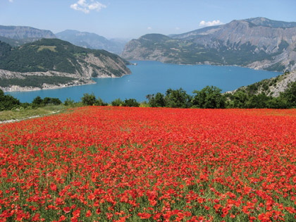
- Spring: Widely considered the most pleasant season, with warm sun, blossoming fruit trees, lavender coming into flower and wildflowers throughout the garrigue.
- Summer: Heat can be intense at lower elevations, so this is the season to head for the higher walks in the Alpes de Haute-Provence or Mercantour instead. Note that walking is banned on certain mountain ranges in the height of summer due to wildfire risk (see below).
- Autumn: Another favoured season, generally sunny with the added draw of changing leaf colour, particularly the larch forests of the Mercantour.
For the high mountains specifically: walks above 1200m are not recommended before May, and those above 2000m may not be accessible until June or even July, depending on snow conditions. Late spring brings the added bonus of marmots emerging from hibernation, and alpine flowers can remain in bloom into late September.
Is there a wildfire risk when walking here in summer?
This is worth planning around specifically. Fire is treated as a serious hazard across Provence, and walking has been banned on certain mountain ranges during the driest summer months as a result. Some past wildfires in the region are believed to have been started by tourists. Before setting out in July or August, check current local restrictions with the relevant Tourist Office (listed in Appendix C of the guidebook), avoid lighting matches or fires of any kind, and treat a hot, dry summer as a reason to favour the higher, cooler Mercantour walks over lower ground.
What accommodation is available?
All three regions offer accommodation ranging from first-class hotels to basic campsites. Because July and August are too hot for comfortable walking, they're also the busiest and most expensive months; spring and autumn offer more availability and lower prices, though booking ahead is still advisable. If you're walking in winter, check ahead that your chosen hotel is open, as some proprietors close for their own holidays during this period.
Options include ordinary hotels (the Logis de France and Châteaux et Hotels de France chains are both represented in the region), self-catering gîtes de France, chambres d'hôtes (the French equivalent of bed and breakfast), gîtes d'étape (basic hostel-style accommodation aimed at walkers and cyclists), and graded campsites. Full local listings are given in Appendix C of the guidebook.
Getting there and back
- By car: From Calais, the most direct route avoids Paris via Reims and Lyon. South of Lyon, take the A7 Autoroute du Soleil and then the A8 via Aix-en-Provence for Cannes and Nice, or the A43/A48 to Grenoble and then the A85 via Gap, Sisteron and Digne-les-Bains. For the Mercantour, continue from Digne-les-Bains via the N85 and N202/D902 to Guillaumes, or in summer take the more scenic route over the Col de la Cayolle (usually closed to traffic between November and May).
- By air: Nice is the nearest airport, with direct flights from various UK airports, and all three regions are reachable by hire car from there.
- By rail: Nice and Digne-les-Bains are both accessible by train; the Mercantour is harder to reach by public transport. Eurostar connects to Lille or Paris, with onward connections to Nice or Marseille, and the scenic Train des Pignes runs from Nice to Digne-les-Bains.
- By bus: Eurolines/National Express services run from London via Lyon, though the journey is long (around 24 hours to Nice). Local buses connect Digne-les-Bains with Marseille and Aix-en-Provence, and a low-cost service runs from Nice to towns across the Alpes Maritimes, including Vence, Guillaumes and Entraunes.
Key bases for the three regions are Vence and Grasse (Alpes Maritimes), Digne-les-Bains and Castellane (Alpes de Haute-Provence), and Guillaumes and the Val d'Entraunes (Mercantour).
Walking in Provence - East
Alpes Maritimes, Alpes de Haute-Provence, Mercantour
£14.95
Guidebook to 30 varied day walks in the east of Provence in the Alpes Maritimes, Alpes de Haute-Provence and Mercantour, with practical information for the walker. Walks span from the Esterel on the coast to the Mercantour, and include the Verdon Gorge and Geological Reserve of Haute Provence, from bases such as Vence, Grasse and Digne-les-Bains.
More informationPlan your eastern Provence walks with the Cicerone guidebook
Walking in Provence: East by Janette Norton contains everything you need to plan and complete these 30 day walks, from the Estérel coast to the high Mercantour peaks.
- Full route descriptions and sketch maps for all 30 circular day walks
- Downloadable GPX files for GPS navigation
- A route summary table (Appendix A) covering distance, ascent and timing for every walk
- Practical appendices on maps, tourist information, market days and a glossary of Provençal words
- Introductory chapters on the history of Provence, its plants and flowers, wildlife, and regional food and markets
- Practical guidance on travelling to Provence, accommodation, and clothing and equipment
- A companion to Walking in Provence: West, covering the remaining regions of Provence
Available as a printed guidebook (£14.95) or digital eBook.
About Janette Norton, guidebook author
Janette Norton lived with her physicist husband, Alan, in the Geneva region for over 30 years, raising four children and working in the marketing field. Her love of mountain walking dated from the time she was a guide in her twenties, and the proximity to her home of the Alps and the Jura enabled her to continue her passion. After her children grew up, she branched out to walk in other areas of France such as Provence, the Cevennes and the Dordogne.