How to hike in Norway on a budget
While Norway offers some of the most pristine alpine landscapes to explore in Europe, it is admittedly not a budget destination. The price tag is not insignificant even for hikers who are prepared to stay in shared, sometimes basic accommodation. Here are our tips for making a Norway walking holiday more affordable.
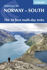
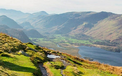
Hiking in Norway - South
The 10 best multi-day treks
£18.95
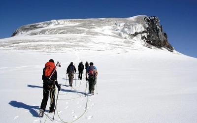
Guidebook describing 10 short treks in southern Norway, plus a handful of variants. The hut-to-hut routes, of 3 to 8 days, cover Jotunheimen, Rondane, Dovrefjell, Trollheimen and Ryfylke, and an ascent of Galdhopiggen, Norway's highest peak at 2469m, is included. Suitable for competent hikers with experience of navigation and mountain weather.
More information1. Take your time and opt for slower transport options
As
with many other destinations, if you have more time to spend, you can
save by choosing your mode of transport into the country. Most people
fly into Oslo, but increasingly long-distance bus companies are offering competitive services into Oslo. Look at comparabus.com for information on the largest European bus companies. Another option for budget travel could be to share a ride via companies like BlaBlaCar.
The earlier you book, the better a deal you can secure. This also applies to internal travel by public transport within Norway, as last-minute train tickets are much more expensive.
2. Save on accommodation by wild camping or bivvying
If you are fit enough and willing to carry a tent, sleeping bag, cooking equipment and food, you can stretch you budget by a long way. Norway’s ‘Allemannsretten’ law allows you to pitch your tent on ‘unfenced land’ as long as you keep a distance from any house (this includes the mountain huts). This ‘right to roam’ comes with some responsibilities, so best to inform yourself before setting out, for example in this article about the right to roam: joys and responsibilities in Norway.
You could even bring your own dried food along if you want to ease weight and cost concerns, but this requires more preparation. Be mindful that the additional weight that you carry slows you down, so plan accordingly. The quality of water in streams and lakes is generally excellent.
Another lighter and faster option would be to go bivvying and use the huts on the trail during daytime for preparing a meal, warming up or drying off if necessary. Day visitors to a mountain cabin pay a reduced fee and are entitled to use the facilities of the hut until their departure time of 18:00. Given the long hours of summer Norwegian daylight, a bivvying hiker could set off at 18:00 and find a spot in between huts for the night. This approach requires additional experience of the outdoors, but is feasible if you are willing to exchange comfort for a higher level of adventure.
3. Join the DNT
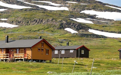
If you plan to stay in huts along Norway’s trails, it’s well worth joining the Norwegian Trekking Association (DNT, Den Norske Turistforening). Membership gives you discounted rates on hut accommodation (though food at serviced and self-serviced huts is not included). A DNT membership is also essential to obtain the universal hut key, which is required to access many huts, making it both a practical and cost-saving choice.
4. Choose your hiking destination within Norway carefully
You can also stretch your budget by choosing your hiking destination. Some well-known
and great hiking areas like Jotunheimen offer mostly fully serviced
huts. Unless you bring your tent, your chances to economise
are limited to such things as not buying alcoholic drinks at dinner or
bringing along your own snacks for the trail.
Other areas, such as Dovrefjell, Trollheimen and Ryfylke, offer a wider range of DNT huts which can be self-service or unserviced. If you can start a trail in a self-service or unserviced hut, you can bring some of your own supplies and prepare your own meals for the first few days. While grocery shopping in Norway will set you back more than is likely in your home country, it is a way to economise, and it offers fresh ingredients for the day.
5. Use a combination of the above tips
It's best to use a combination of these strategies. Hiking with a tent and all supplies is slower but takes you to places where no one is around, making for a special trail experience. You ensure you eat something you enjoy by bringing some supplies when hiking and staying in self-service huts. It also enhances the variety of your diet if you are on the trail for a longer time. In some huts, other hikers might leave perfectly good food behind because they don’t want to carry it out and hope others will enjoy it.
While these tips can go some way, hiking in Norway is not a budget holiday. But there is value in the magnificent, accessible yet challenging nature, combined with the access to warmth and creature comforts at night. It might be a choice you are willing to pay to visit the best hiking spots in Norway.
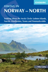
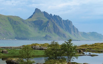
Hiking in Norway - North
Trekking above the Arctic Circle: Lofoten Islands, Narvik, Ofotfjorden, Troms and Finnmarksvidda
£18.95
Guidebook to trekking in Norway above the Arctic Circle, including the Lofoten Islands, the mountains around Narvik and Ofotfjord, Tromso and the Troms region, and Finnmarksvidda in the far north east. Treks range from 48 to 165km in length and take between four and ten days to walk. Includes 1:100,000 maps, itineraries and accommodation guide.
More information