Trekking the Alpine Pass Route across Switzerland
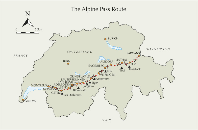
Starting in Sargans and finishing in Montreux on the shore of Lake Geneva, the Alpine Pass Route (APR) makes a complete east-west traverse of Switzerland, taking in some of the most dramatic and best known scenery in the Alps, covering 202 miles and crossing 16 mountain passes.
With a bit of luck the whole route can be packed into a two to three-week holiday, putting it within reach of people with full-time jobs and standard holidays. It splits into 15 manageable stages, suitable for day walks or combining in an epic long-distance Alpine trek.
Characteristic Swiss efficiency means an abundance of signposts and waymarks and you are never far away from civilisation in the form of shops, gasthofs and accommodation or from transport options if you need to bail out or split the route up. Most villages along the way have some form of hotel, gasthof, mountain inn, youth hostel or dormitory. It really depends how much money you wish to spend and what level of discomfort you are willing to put up with.
Official campsites exist in a number of villages along the APR, particularly in the more popular resorts, all with excellent facilities but not for every stage. Off-site camping is officially forbidden but if you are discreet, clean and tidy you won’t get bothered for making a dusk-to-dawn camp.
During September 2014, Jonathan Cook and his walking companion Chris decided to attempt the APR (now know as the Swiss Via Alpina) as a long-distance backpack, carrying a tent and camping all the way. As well as being more of an adventure they hoped that doing it this way would reduce their costs, wary as they were of Switzerland’s reputation as an expensive holiday destination. In the end, their unofficial campsites ranged from a grass patch behind a water treatment plant to a secluded spot in woodland. And they only resorted to a hotel (costing 95CHF) once – after a particularly wet penultimate day – at Col de Mosses.
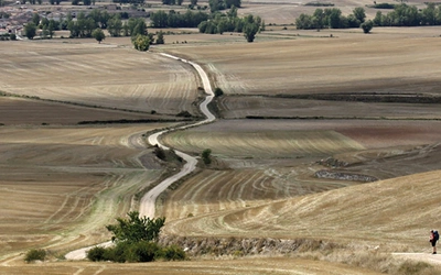
Entering the quiet, back-of-beyond village of Weisstannen to the distinct aroma of cows and silage at the end of our first day, our attention turned to finding a spot to pitch the tent. After a baffling exchange with a local farmer we nervously pitched the tent in one of his fields before finishing the day’s leftovers. Our long day had begun with an early flight from Heathrow followed by a four-hour journey to Sargans before stepping off the train into hot sunshine for a short four-hour walk to Weisstannen. Along the way, we had spent some time in a ‘Chistoph Perret’ hardware store in the village of Mels, explaining in very broken German our need for camping gas. They didn’t have the right type but we carried on with the short steep climb out of Mels, rewarded with views of the mountains back into Liechtenstein, confident that we would track some down the next day.
The next day began easily enough winding our way along the Weisstannental valley floor towards the foot of the Foopass. Along the way we were greeted by cows walking down the road wearing flowered headdresses with enormous rather loud bells around their necks, part of an annual celebration. (The headdresses indicate the cow's importance as a milk producer.)
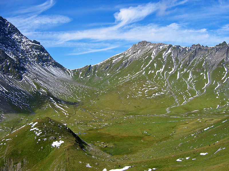
But the true magnitude of the task ahead soon came home as we then tackled the Foopass (2223m), involving 1200m ascent and 1200m of descent down into the secluded valley of Elm. Even in September – the recommended month for walking the route – we had to traverse several large snow patches. Out of season much of the route would surely be impenetrable.
Arriving at Elm some seven hours after we had set off we were both exhausted and could barely lift our arms. The only food shop in the small village closed at 3pm so we were had to buy the cheapest meal we could find at a nearby hotel (frankfurters and chips) and we managed to drink 14CHF of coffee before the hotel kindly sold us a frozen loaf of bread which we hoped would thaw during the night.
Finding somewhere to put the tent proved even more difficult that night but stumbling across a public playground containing a hut with an upper floor saved unpacking the tent in the end. As we settled down for the night, we began to question the wisdom of walking the APR in one go...
Our first wet day was our sixth, which for us was from Brüsti to Engelberg (we split Stages 4 and 5 over three days to make them more manageable). Arriving in Brüsti the afternoon before we took refuge in the cable car hut – a welcome opportunity to dry out some gear, eat ham sandwiches, peanuts and Mars Bars although I was beginning to get fed up of eating cold food as we still hadn’t managed to purchase any gas. As night began to fall we found a spot in the woods close to the cable car station on a slight slope for the tent. It turned out to be the worst night’s sleep of the entire trip with a huge storm during the night which brought a branch down on our tent!
Crossing the Surenenpass in the rain and mist was a miserable affair and I soon discovered that some of my ten-year-old kit, including my coat, was no longer waterproof. Chris’s knee had begun to hurt so we sheltered in a hut for a short while before eventually arriving in Engelberg completely sodden. The campsite we used there had excellent facilities including showers and a drying room – most welcome after six days of hard trekking.
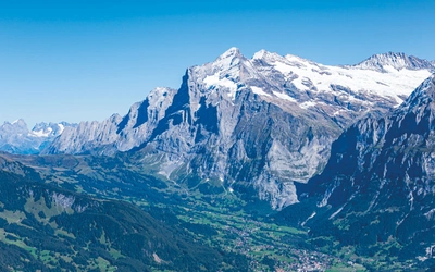
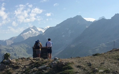
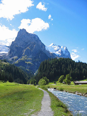
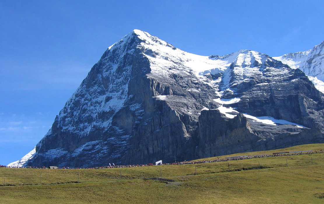
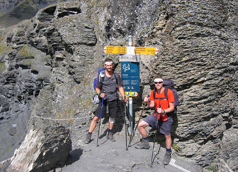
Two days later, we finally found some gas in Meiringen (where Sherlock Holmes met his end at the hands of Professor Moriarty by falling into the Reichenback Falls) and as our evening meals took on a new lease of life, we entered the heart of the Bernese Oberland. Stages 8, 9, 10 and 11 carry the trek directly past some of the most imposing peaks in the Swiss Alps including the infamous North Face of the Eiger. Chris had never been to the Alps before and I took great pleasure in pointing out some of the more famous peaks in and around the area while contemplating the thought of a quick ascent up the Mittellegi Ridge of the Eiger to go with my previous ascents of the Monch and Jungfrau.
These stages also take in the highest passes on the route, with the 2778m Hohtürli on a spur of the Blümlisalp above Kandersteg the highest of them all, and are arguably the most spectacular and toughest stages of the whole route. After walking most of the way on our own it was nice to reach this popular tourist region, and on arriving at the top of the Kleine Scheidegg we were welcomed by a brass band and a circus atmosphere. We later learned, much to our horror, that it was the finish of the Jungfrau Mountain Marathon.
Arriving in Griesalp after a spectacular day’s trekking in glorious sunshine we were both exhausted and again caught out by all the shops being shut on a Sunday. We sat around in the busy square discussing where we might camp before the heavens opened and took refuge under the overhang of the log cabin serving snacks and drinks. We soon began chatting to the attendant in charge who gave us a basket of croissants left over from the day and as much water as we wanted – but the rain continued to fall.
The weather was still terrible as we left Griesalp the following morning and it was evident that it had snowed on higher ground. We battled on for an hour before taking refuge at Bundalp where it began to snow heavily, settling very quickly. After speaking with the proprietor who told us there was over a foot of snow on the Hohtürli Pass we decided it would be safer to go back down to Griesalp and find another way to Kanderstag. In fairly good spirits, knowing we had made the right decision, we headed back down to Griesalp where we took the steepest, and probably the most expensive, Postbus in Europe before catching the train to Kandersteg. We were disappointed not to have crossed the highest pass but you can’t take risks in the mountains.
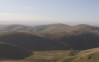
Soon the trip began to draw to an end as we started to drift away from the snow-capped mountains into lush rolling hills in the French-speaking part of the country. On reflection I enjoyed these quieter stages in the lesser-known parts of Switzerland as much as the more popular higher alpine passes. After 16 days of trekking we made our way down the final steps of the ‘Sentier du Télégraphe’ into Montreux where the thunderous roar of traffic on the motorway provided a sobering contrast to many days spent listening to cow bells and mountain streams.
For me there are many memories and every stage was beautiful in its own right, from the lush rolling hills on the borders with Liechtenstein and France to the peaks of the Bernese Oberland, but the stage that lives in my memory the most vividly is Stage 9 from Lauterbrunnen to Griesalp culmintaining in ten hours’ trekking and an ascent of the spectacular Sefinenfurke at 2612m. For this we were blessed with perfect blue skies surrounded by glacier-hung peaks for the majority of the day in all directions. Having ascended the narrow craggy ridge of the Sefinenfurke, turning our backs on the Eiger or Monch for the last time, I will always remember the descent – narrow sections of fixed cable and countless timber steps.
There is also a real sense of achievement to be had in walking across an entire country, being essentially self-sufficient with all your belongings and not knowing from one day to the next where you might find yourself the following night (or what you might be eating!)
Backpacking the entire route may not be to everyone’s taste and, looking back, there were certainly hard moments when we were both wet and hungry, but with hindsight we wouldn't have wanted it any other way. It was an experience which has given us memories that will live with us forever – and a ‘character-building’ one at that.
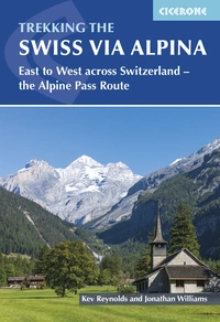
Trekking the Swiss Via Alpina
East to West across Switzerland - the Alpine Pass Route
£18.95
Guidebook to the Swiss Via Alpina, a 400km trek east-west across Switzerland, with options of detouring along the Alpine Pass Route. This demanding 3-week trek crosses 16 passes, including the 2778m Hohtürli, in a total of 19 stages from Sargans to Montreux, as well as a prologue stage from Liechtenstein. Requires good fitness and experience.
More information