An intro to... the Jura Crest Trail
The Jura Crest Trail, one of seven Swiss national long-distance walking trails, delivers one wondrous panorama after another as you ascend, traverse and descend summits and mountain passes along the 310km route. Here’s a quick summary of what you need to know.
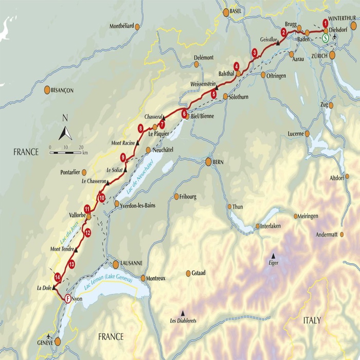
Where is the Jura Crest Trail and how far is it?
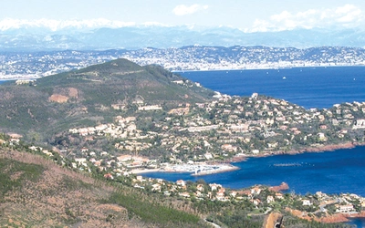
The route extends the length of the Jura mountains, passing through two language regions (German and French) from the small town of Dielsdorf (15km from Zurich) to Nyon (26km from Geneva), situated on the shores of Lake Geneva. With international airports at either end of the trail, alongside the reliable Swiss railway system and local post-bus routes over mountain passes, accessibility is fundamental in providing the day-hiker and weekender with ease of travel throughout.
The day-to-day journey can be a challenge, with up to 32km of trails and 1700m of height gain in one day. With over 13,800m of ascents throughout the 310km journey on easy-to-moderate hiking paths, the trail requires a medium level of fitness. When you take in the immense views of the Jura range, the peaks and ridges of the Alps on the horizon and across the Rhône valley, the sense of achievement more than compensates for the distance and height gained.
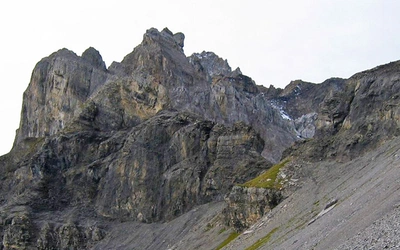
The Jura mountains form a range of ancient folded strata, creating an arc from the Rhine Valley in the north-east to the Rhône valley in the south-west, along the border between Switzerland and France. The route is a rolling showcase of natural features including deep gorges, mountain streams, glistening lakes (including the highest mountain lake in the Jura), tranquil forests, extensive alpine pastures and craggy exposed cliffs.
Accommodation on the Jura Crest Trail
Throughout the 14 stages of the Jura Crest Trail, there are several options to choose from, enabling the hiker to select the most appropriate. Because the Trail is fairly close to civilisation, there is always accommodation available either on, or near, the trail. Throughout the Jura, Club Alpine Suisse (CAS) huts are available as cheaper, self-catering options compared with hotels. With a selection of bed & breakfast, camping and hostel accommodation also available, the choice is fairly extensive.
When should you go?
It is important to choose the right time to walk the Jura Crest Trail, as snow can fall as late as April and as early as October, leaving the highest parts of the trail hidden. This, alongside the high winds that sometimes cross Lake Geneva, can cause the wind chill to drop significantly, especially when traversing the highest parts such as Mont Tendre (1679m). It is a mountainous area, providing microclimates that could rapidly cause adverse weather conditions, as seen throughout the Alps, even though it is considerably lower than most of the mountainous regions of Switzerland.
The best time to hike the Jura High Route is between the months of May and September, but be aware that some mountain buvettes (basic mountain accommodation and restaurants) and hotels do not open until June, with some closing as early as September.
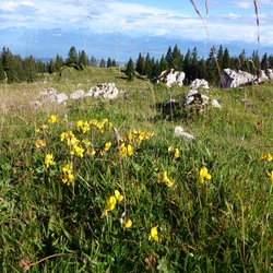
Alpine flowers such as crocus and spring gentians can be seen as early as April on the Jura, depending on the winter temperatures and late snowfall. Wildflowers carpet the hillsides throughout most of the walking season.
Must see:
- Geologic wonders of the Creux du Van (1463m), Aiguille de Baulmes (1559m) and Dent di Vaulion (1483m). The Creux du Van sits above the town of Noiraigue, a perfect example of Jura limestone with an impressive 160m-high vertical rock wall amphitheater within a 1km-wide valley.
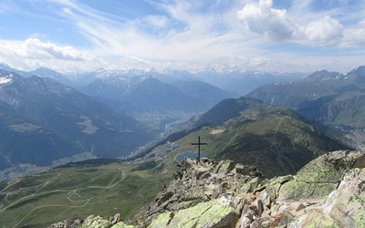
- The ‘Balcon du Alpes’, between Col du Mollendruz near Le Pont and Saint-Cergue, where the trail traverses over the summit of Mont Tendre (1679m), offering stunning views across Lake Geneva and the Mont Blanc massif.
- The medieval hilltop fortress of Regensberg, alongside the historic Roman centres of Brugg and Baden in stage 1, near Zurich, offering extensive opportunities to immerse oneself in the historic and cultural development of Switzerland throughout the ages.
Did you know?
- The Jura Crest Trail is regarded as the Swiss classic long-distance path, with waymakers plotting the route as early as 1905, making it fairly easy to navigate
- The highest summit of the Jura is Month Tendre, standing at 1679m, overlooking Lake Geneva and the Mont Blanc massif
- The route passes by Lac du Joux, the highest mountain lake in the Jura range, as well as the highest mountain lake above 1000m in Switzerland
- The Jura is made up of limestone, perfect growing conditions for up to 950 flowering plant species, which can be seen throughout the months of April to October
- Due to its close proximity to the border of France, the southern Jura was heavily guarded during World War II and many defences can still be seen. Allied prisoners of war, Jews and smugglers made use of hidden routes to cross the Jura mountains, into the safety of Switzerland.