Walking the length of Greece: northern border to southern shore
Far from the bustle of its islands and beaches, Greece has some of the best undiscovered hiking in Europe. Jane Laurie and her husband Alan set out to discover the mountains, lakes and rivers of mainland Greece, as they hiked from the northern border down to the southern port of Kalamata.
At the Delidhimi pass, looking over the Asprorema valley and the wild mountains beyond, we felt a little nervous. ‘Only wolves live in Asprorema now,’ the hunters had warned: we’d passed ferocious local sheepdogs, their wolf-proof collars studded with nails.

That night we camped amid the deserted hamlet by the Asprorema stream. But instead of wolves we were woken by a line of free-range pigs, trotting down to drink, followed by their owner on a motorbike. He and his family lived there all summer long, moving down to the plains before the winter snows. When we told him about the wolves he laughed, invited us home for breakfast, then set us on the right path.
Planning a route through the remoter Greek mountains can be difficult, with little information available on whether footpaths are passable or guesthouses open. Yet the scenery is spectacular, the hiking not too technically demanding, and there’s a long tradition of making strangers welcome. All you need is the flexibility to enjoy the surprises of the trail.
We set off from Florina, in the far north of Greece, in late May, planning to walk to Kalamata in the southern Peloponnese. We had no fixed route and we didn’t know how long it would take. The whole summer and autumn lay ahead of us.
At first we walked through vast beech woods and alpine meadows, alight with the flowers of spring, down to the shores of dreamy Lake Prespa with its squadrons of pelicans. This had been a prohibited area for many years following the Greek Civil War, and tourism is only just starting to get established.

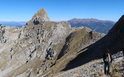
Further south, we followed rough forestry tracks into the remote Grammos mountains, cut off by snow and largely uninhabited in the winter. The peaks were still snow-capped in early June, and there were bear prints in the mud. We climbed up to the Dragon Lake, but the ridge walk was snow-bound and we chose an easier route south.


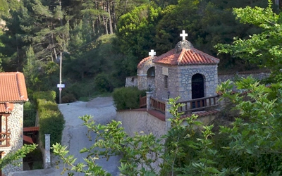
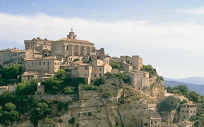
We passed another Dragon Lake below Mount Smolikas, then, skirting a third below Mount Gamila, we wound down towards the Zagoria and the Vikos Gorge, said to be the deepest in the world. This is one of the best known hiking areas in Greece, and the traditional stone villages, cobbled paths and old bridges are maintained and appreciated for the tourist income they bring.
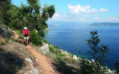
Further on there was less forest and more open country, with some spectacular ridge walks. Sometimes the easiest route was down a river bed, with the water lusciously cool and refreshing on the feet. There was no need to take our boots off: they soon dried out.
We took a long summer break on the beach, and it was autumn by the time we reached the Peloponnese. The walking was easier here, along old railway tracks, through olive groves and down to the sea. It’s a relatively prosperous area, closer to Athens, and has a scattering of boutique hotels.
Walking the whole way without cherry-picking the usual tourist attractions gave us a different perspective on Greece and its history. We passed only one classical site, ancient Gortys, where we camped beside the columns of the temple of Asclepius. Relics of the medieval Byzantine era were more common here, with village churches and monasteries flaunting luminous frescoes. Then there were the monuments of the 19th-century struggle for independence from the Turks, such as the secret school and gunpowder production facilities in the Lousios valley. Perhaps most moving of all were the reminders of the turbulent 20th century: the rusty mortar we picked up on a forest path, the rough stone bunkers up in the mountains, the cave hideout of the left-wing guerrillas, and the memorials to villages burnt by the Germans, their inhabitants slaughtered in reprisals.
We found a warm welcome in the villages and from those we met along the way. Shepherds still take their flocks up to the high pastures for the summer months, although nowadays they transport them in lorries rather than walking all the way from the plains. Many of the mountain villages are deserted in winter, but come to life in the summer, especially in August when the original inhabitants return from the cities. Sometimes there were a handful of permanent residents, retired from city jobs, or, increasingly, those who had fled the economic crisis for a new life of self-sufficiency.

Logistics
We are both over 60 and not super-fit, so we travelled light and took our time. Camping equipment was essential, but we had invested in good lightweight gear, and managed to keep the weight of our packs to just over 6kg each, not including food and water. Wild camping is generally accepted, and even in the villages we were often waved to a good spot to put up our tent.
We had a rough idea of our route before we started, based mainly on places we wanted to see, but we adapted our plans from day to day, depending on the weather, how we felt, and local knowledge of the state of the footpaths. As well as the Cicerone guide we relied on the excellent Anavasi maps, which cover most of the mountain areas, show the footpaths and are GPS compatible.

Although we followed stretches of both the E4 and E6 European long distance footpaths, they are often badly waymarked and impassable, or along tarred roads. National long distance paths can be a better bet, and we followed the well-maintained O3 in the area north of the Vikos Gorge. Some of the best walking at a lower level is along ancient cobbled mule paths (kalderimia), mainly built in the 18th and 19th centuries to link villages together. In the high mountains it was easy to see the rough footpath stretching into the distance, so long as the weather remained fine. Elsewhere we followed dirt tracks used for forestry or shepherding.
Occasionally the only choice was to walk along tarred roads, but even here sheep outnumbered cars and the scenery was as spectacular as ever.
Apart from some steep climbs, and the occasional scree slope, the walking itself was not too demanding, just remote, but at times it was useful to have a good head for heights. The path from Asprorema to Epiniana was the scariest section, hewn into the cliff face by men with ropes and harnesses and with a sheer drop to the river below. ‘Didn’t anyone ever fall off?’ I asked in the village afterwards. ‘No,’ came the answer. ‘I used to take a mule along there from the age of ten!’
How far did we walk? We never counted the kilometres, nor the number of days on the trail. With frequent stops and a zigzag route, we didn’t reach Kalamata until November. It was springtime when we camped among the wild pansies of the northern mountains: by the time we neared the sea, the first autumn cyclamen lined the railway tracks and paths of the Peloponnese. We never saw any wolves.