Hiking the High Scardus Trail: a complete planning guide
Few long-distance trails in Europe deserve the word epic quite like the High Scardus Trail (HST). Running for 314km (195 miles) through the mountainous borderlands of North Macedonia, Kosovo and Albania, the HST crosses eight international borders in 22 stages, from the village of Staro Selo on the edge of the Shar Mountains to the monastery of Saint Naum on the shores of UNESCO-listed Lake Ohrid. It is one of the wildest and least-known long-distance walks on the continent. (Last updated: July 2026 · Guidebook edition: First edition, 2026)
Hiking the High Scardus Trail, quick facts:
- Distance: 314km / 195 miles
- Duration: around 3 weeks (2 weeks for Section 1 alone)
- Start: Staro Selo, North Macedonia
- Finish: Saint Naum Monastery, Lake Ohrid, North Macedonia
- Stages: 22 (plus alternative Stages 9a and 10a, and a day trip to Mt Korab)
- High point: Mt Korab, 2764m (highest peak in both Albania and North Macedonia, reached on an optional day trip)
- Difficulty: Challenging, remote terrain suited to experienced mountain trekkers
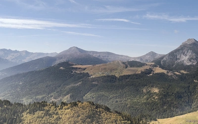
- Terrain: High border ridges, alpine pasture, cirques, glacial valleys and limestone karst
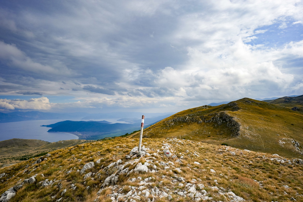
- Waymark: Red and white stripes or bullseye markings (North Macedonia, Kosovo); red and white rectangles and HST signage (Albania)
- Accommodation: Village guesthouses and mountain chalets, with wild camping possible
- Best season: Late June to September
- Guidebook:Hiking the High Scardus Trail, Rudolf Abraham, 1st edition, 2026
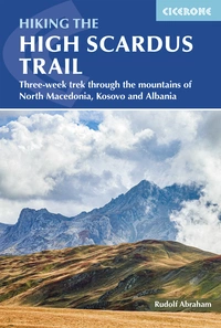
Hiking the High Scardus Trail
Three-week trek through the mountains of North Macedonia, Kosovo and Albania
£18.95
Guidebook to the High Scardus Trail, a long-distance hiking trail through the mountains of the Western Balkans, through the mountainous borderlands of North Macedonia, Kosovo and Albania. The trek covers 314km in 22 daily stages from the village of Staro Selo on the edge of the Sharr Planina national park to the monastery of Saint Naum on the shore of Lake Ohrid. Includes advice on transfers,...
More information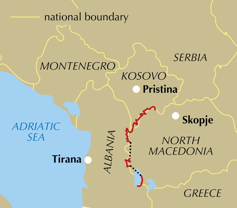
What is the High Scardus Trail?
The High Scardus Trail is a 314km cross-border trek through the mountains of the Western Balkans, following the frontier regions of North Macedonia, Kosovo and Albania. It runs from north to south, opening with a two-week traverse of the Shar Mountains (Shar planina), before continuing across the Korab and Deshat ranges, the Jablanica Mountains, and finally the Galichica range above Lake Ohrid. Along the way, it takes in Mt Korab, at 2764m the highest mountain in both Albania and North Macedonia, and passes through half a dozen national parks before finishing at the historic monastery of Sveti Naum.
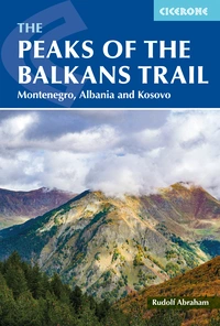
It is often compared to the Peaks of the Balkans Trail (POTB), which shares a similar landscape, the same genuinely warm village hospitality, and was developed by the same organisations. But the HST is longer, point-to-point rather than circular, more remote in places, and sees far fewer hikers, with markedly less accommodation and less clearly established trails. Anyone who has enjoyed the POTB will find the HST a natural, if more demanding, next step.
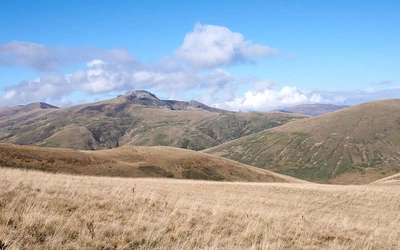
What makes the trail genuinely distinctive is its scale and rawness: the HST passes through what is likely the largest area of intact high-altitude mountain pasture left in Europe, a vast, rolling wilderness of grassland, tarns and shattered rock which in early summer bursts into extraordinary wildflower displays. Established in its current single linear form only a few years ago, it remains a young trail, still evolving in places, which means walkers are now, in a real sense, helping to pioneer the route.
This planning guide answers the most common questions walkers have before setting out. For complete stage-by-stage route descriptions and mapping, see the Cicerone Hiking the High Scardus Trail guidebook.
How long is the High Scardus Trail?
The High Scardus Trail covers 314km (195 miles) in 22 official stages, split into three sections joined by two transfer days (officially numbered Stages 15 and 20, though no walking takes place on these). In terms of actual days on foot, most walkers will be looking at around 20 days of hiking, plus rest days.
- Section 1 (Stages 1–14, 218km): the main, two-week traverse of the Shar, Korab and Deshat mountains across North Macedonia, Kosovo and Albania
- Section 2 (Stages 16–19, 56km): a four-day crossing of the Jablanica Mountains, in North Macedonia and Albania
- Section 3 (Stages 21–22, 40km): a two-day finish across the Galichica Mountains to Lake Ohrid
| Stage | Distance | Ascent/Descent | Time |
|---|---|---|---|
| 1 - Staro selo to Ljuboten Mountain Hut | 6.4km | +730m/-0m | 2hr 20min |
| 2 - Ljuboten Mountain Hut to Brezovica | 12.1km | +825m/-720m | 6hr |
| 3 - Brezovica to Prevallë | 14.3km | +840m/-1050m | 8hr |
| 4 - Prevallë to Gornje Ljubinje | 14.5km | +645m/-1080m | 7hr |
| 5 - Gornje Ljubinje to Kobilica Hut/Vejce | 11.8km | +1130m/-565m | 5hr 30min |
| 6 - Kobilica Hut/Vejce to Veshala | 20.2km | +820m/-1235m | 8hr |
| 7 - Veshala to Brod | 21km | +1450m/-1270m | 8hr |
| 8 - Brod to Restelicë | 21.1km | +950m/-925m | 7hr 30min |
| 9 - Restelicë to Strezimir | 25.9km | +1110m/-1080m | 9hr |
| 9a - Restelicë to Cajë (alternative) | 23.3km | +630m/-1265m | 4hr 30min |
| 10 - Strezimir to Radomirë (via Mt Korab) | 16.4km | +1320m/-1505m | 7hr 30min |
| 10a - Cajë to Radomirë (alternative) | 17.7km | +985m/-1015m | 5hr 15min |
| Day trip - Mt Korab from Radomirë | 17km | +1510m/-1510m | 8hr 30min return |
| 11 - Radomirë to Grama | 11.3km | 905m/-470m | 7hr 30min |
| 12 - Grama to Rabdisht | 17.1km | +1090m/-740m | 8hr |
| 13 - Rabdisht to Stanet e Hinoskes | 11.5km | +980m/-385m | 5hr |
| 14 - Stanet e Hinoskes to Bitushe | 14.5km | +610m/-1135m | 5hr |
| 15 - Transfer: Bitushe to Modrich | - | - | - |
| 16 - Modrich to Jablanica | 11km | +950m/-765m | 5hr 30min |
| 17 - Jablanica to Steblevë | 14.4km | +465m/-450m | 5hr |
| 18 - Steblevë to Qafa e Kryqit | 17.3km | +1140m/-505m | 6hr |
| 19 - Qafa e Kryqit to Vevchani | 12.9km | +475m/-1420m | 5hr 30min |
| 20 - Transfer: Vevchani to Velestovo | - | - | - |
| 21 - Velestovo to Spiridon Mountain Hut | 20.3km | +1230m/-685m | 7hr |
| 22 - Spiridon Mountain Hut to Sveti Naum | 19.5km | +720m/-1630m | 7hr |
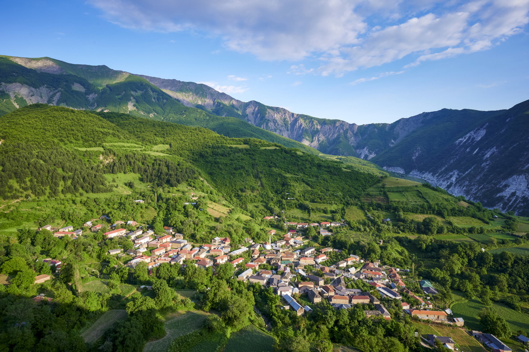
The toughest stage on the trail is Stage 9, from Restelicë to Strezimir, covering 25.9km with over 1100m of ascent and a full 9 hours of walking. It is also the stage most affected by limited accommodation, which is why the guidebook includes the alternative Stages 9a and 10a via the village of Cajë.
Who is the High Scardus Trail suitable for?
The HST is a serious undertaking, aimed at experienced, fit and well-prepared mountain trekkers rather than newcomers to long-distance walking. There are no technical sections requiring scrambling or climbing equipment, but several stages are long (up to 9 hours), involve well over 1000m of ascent, and cross remote high ground where the trail is not always clearly marked. This is not a route for beginners, families or dog walkers, and confident, independent navigation is essential in poor visibility.
How difficult is the High Scardus Trail?
The trail carries no official numerical grade, but the guidebook describes it as challenging, both physically and logistically. Route finding is more difficult than on the better-established Peaks of the Balkans Trail, with waymarking that varies from clear to non-existent depending on the stage, and stretches of high pasture with no visible path at all. Add to this variable mountain weather, sudden storms, and days that can run to 8 or 9 hours, and it becomes clear why the trail is recommended only for those already comfortable in remote alpine terrain. Carrying full GPX tracks for offline use, alongside a paper map, is strongly advised.
Can I walk a shorter section of the High Scardus Trail?
Yes. The trail's three-part structure makes this straightforward, since each section is a self-contained trek in its own right, with transport links at both ends.
- Section 1 only (Stages 1–14, 218km, around 2 weeks): the longest and most classic part of the HST, crossing Shar planina, Korab and Deshat. Start at Staro Selo (reached via Skopje or Tetovo) and finish at Bitushe, from where buses run towards Skopje via Debar.
- Section 2 only (Stages 16–19, 56km, around 4 days): a shorter crossing of the Jablanica Mountains between Modrich and Vevchani, reached by transfer from Bitushe or Velestovo.
- Section 3 only (Stages 21–22, 40km, around 2 days): the shortest option, finishing at the Saint Naum Monastery on Lake Ohrid, an easy add-on for anyone already visiting Ohrid.
Which direction should I walk the High Scardus Trail?
The trail is described north to south in the guidebook and on the official HST website, and this is the recommended direction. It makes practical sense, since the longest and most demanding section (Shar planina) comes first, while Lake Ohrid provides a natural and appealing finale, with good onward transport and a reason to linger for a couple of days afterwards. Walking south to north is possible, and might suit those starting early in the season who want to reach the snow-affected Shar Mountains later in their trip, once more of the snow has melted, but you will need to specify your direction of travel when applying for cross-border permits.
When is the best time to walk the High Scardus Trail?
The hiking season runs from late June to the end of September.
- Late June to early July: wildflowers are at their best, but late snow can still linger on Shar planina, occasionally forcing a detour.
- July and August: the most settled weather, though also the busiest period for mountain pasture and livestock; afternoon storms are possible even in high summer.
- September: widely considered the best month, with excellent walking conditions and the high pastures at their most photogenic.
- Early October onwards: first snowfall can arrive at any point, and mountain settlements begin closing up for winter, sharply reducing accommodation options.
What accommodation is available on the High Scardus Trail?
Most nights are spent in small village guesthouses, simple but with a genuinely warm welcome and home-cooked food, typically costing around €25 per person for bed and breakfast, plus €10 for an evening meal and packed lunch. A handful of stages end at mountain huts or summer camps with basic wooden chalets. In a few places, notably Gornje Ljubinje and Strezimir, accommodation is very limited or requires an awkward transfer, which is why the guidebook includes a fully described alternative route avoiding this bottleneck.
Wild camping is also possible, and is neither formally prohibited nor permitted along most of the route, though it requires carrying significantly more food, since supply points are scarce. Bookings should be made in advance wherever possible, not least because cross-border permits are issued for fixed dates. Full accommodation listings, including options for when guesthouses are full, are given in the guidebook's Appendix A.
Cross-border permits: what do I need?
Because the HST crosses international borders eight times through remote mountain terrain rather than at official road crossings, hikers need a cross-border permit for each of these "green" crossings. Permits can be applied for directly through each country's Ministry of Foreign Affairs, or arranged far more easily through local agencies such as Zbulo, Shar Outdoors or SuperXplorers, for around €5 per hiker per crossing, capped at €50 for a group of up to 20. Applications should be made up to eight weeks, and at least two weeks, before travelling, since permits are issued for a fixed date. Border police do check for permits in practice, and not having one can cause serious problems when leaving the country, particularly if entering and exiting via different countries.
Getting to and from the High Scardus Trail
To the start (Staro Selo): fly into Skopje, North Macedonia, then take a bus to Tetovo (around 40 minutes) followed by a taxi to Staro Selo (around 20km, roughly €20). There is no accommodation in Staro Selo itself, so many walkers base themselves in nearby Vratnica the night before.
From the finish (Sveti Naum): buses and a seasonal ferry run between the Saint Naum Monastery and Ohrid, from where regular buses connect to Skopje (around 3 hours) and Tirana (around 3 hours).
If finishing at Bitushe (Stages 1–14 only): the nearest reliable bus connections run between Skopje and Debar, picked up near the Bigorski Monastery.
Local tour operators can arrange transfers between Skopje Airport and Staro Selo, and handle the two internal transfer stages (Bitushe to Modrich, and Vevchani to Velestovo) as part of a booked trip.
What are the route highlights?
- The two-week traverse of Shar planina, one of the most extensive areas of high-altitude grassland left in Europe
- An optional ascent of Mt Korab (2764m), the highest peak in both Albania and North Macedonia
- Crossing the limestone karst of the Galichica range, with views down to Lake Ohrid
- The historic monastery of Saint Naum, the trail's finish, on the shores of UNESCO-listed Lake Ohrid
- Wild horses, golden eagles and, at a respectful distance, the chance of spotting Balkan lynx and brown bear
- Genuine hospitality in small mountain villages still largely untouched by tourism
Plan your walk with the Cicerone guidebook
The Hiking the High Scardus Trail guidebook by Rudolf Abraham contains everything you need to plan and complete the route, from Staro Selo to Saint Naum.
- 22 detailed stage-by-stage route descriptions, with distances, ascent and descent, and timings for all three sections
- Fully described alternative route (Stages 9a and 10a) for the two stages where accommodation is very limited
- A dedicated day trip description for climbing Mt Korab from Radomirë
- Comprehensive planning advice covering permits, transfers, accommodation and border crossings
- 1:50,000 route maps for every stage
- Downloadable GPX files for offline navigation
- Appendices covering accommodation listings, useful contacts, further reading, and a language and glossary section for Albanian and Macedonian
Available as a printed guidebook or digital eBook, both priced at £18.95: more information and to order.
Hiking the High Scardus Trail
Three-week trek through the mountains of North Macedonia, Kosovo and Albania
£18.95
Guidebook to the High Scardus Trail, a long-distance hiking trail through the mountains of the Western Balkans, through the mountainous borderlands of North Macedonia, Kosovo and Albania. The trek covers 314km in 22 daily stages from the village of Staro Selo on the edge of the Sharr Planina national park to the monastery of Saint Naum on the shore of Lake Ohrid. Includes advice on transfers,...
More informationAbout Rudolf Abraham, guidebook author:
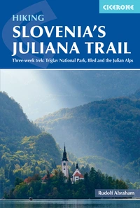
Rudolf Abraham is an award-winning travel writer, photographer and guidebook author specialising in central and southeast Europe. He is the author of over 15 books, including the first English-language hiking guidebooks to the Peaks of the Balkans Trail in Montenegro, Albania and Kosovo, the Juliana Trail in Slovenia and the Alpe Adria Trail in Austria, Slovenia and Italy, and has contributed to many more. His work is published widely in magazines. He first visited the mountainous borderlands of Albania in 2006, having already explored the mountains of Montenegro while living and working in nearby Croatia in the late 1990s, and has been a frequent visitor to this endlessly beautiful and little-known corner of Europe ever since.