In conversation with Jonathan Williams: Trekking Chamonix to Zermatt
Jonathan Williams has been drawn to the high Alps for much of his adult life, and in taking on the eighth edition of Trekking Chamonix to Zermatt – Cicerone's guide to the classic Walker's Haute Route – he has produced what amounts to an entirely new book. We talked to Jonathan about the 215km route he counts as his favourite alpine trek, what's changed in this landmark new edition, and what every walker standing in Chamonix should know before their first steps towards Zermatt.
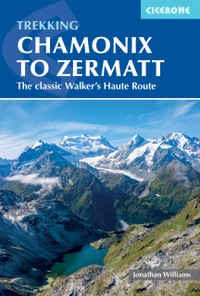
Trekking Chamonix to Zermatt
The classic Walker's Haute Route
£18.95
Guidebook to the Walker's Haute Route from Chamonix to Zermatt. The 215km route typically takes 2 weeks to walk. Described in 14 stages, the route crosses 11 passes between Mont Blanc and the Matterhorn and involves 14,500m of ascent and descent. A complete guide for planning and walking the route, with accommodation information.
More information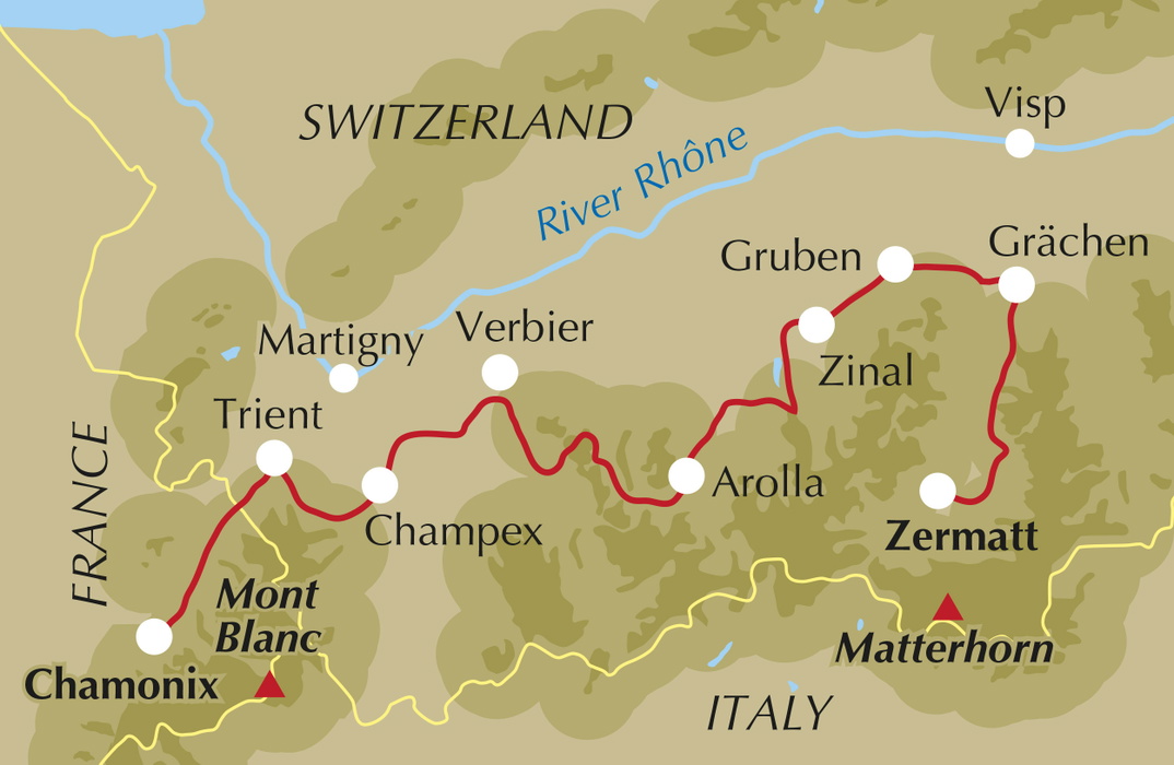
Hi Jonathan! You've said the Haute Route is probably your favourite alpine trek. What is it about this particular route that's kept you coming back over the years?
I have always been interested in what is over the next pass, behind the next mountain, and the Haute Route between Chamonix and Zermatt satisfies that curiosity like no other. There is always a challenge ahead and always something new and dramatic to see when you get there.
But there is also a more personal reason. Lesley Williams introduced me to the Alps by taking me to the Val d'Hérens. She had spent a few weeks there at university studying the glaciers above Arolla and wanted to show me around. I guess it was a test and I seemed to pass it, provisionally at least.
This is now the eighth edition of a guide that Kev Reynolds shaped over many editions. What was it like taking on a book with that history, and how did you approach keeping his voice and his route in it?
The new book is an almost complete rewrite, so I absolutely absolve Kev of responsibility for anything in it. It's Cicerone's eighth edition, but for me it felt like writing a new book, although I had done the last couple of updates when Kev was unable to, so in some respects the book had already begun to evolve. I knew it well, and I knew its many great strengths.
The key for me was retaining the wonder and beauty of the route between two of Europe's top mountaineering centres, the magic and mystery of it. To help with that I've kept many of Kev's charming evocations of the villages and scenes along the way. Only the trekker on the route can truly judge whether I have succeeded.
We have also given the book a full revamp, with more detailed stage planning, stronger timing information, and fuller coverage of facilities and accommodation. The many options are perhaps explained better too, though there are still plenty of possibilities that haven't made the guide.
What's changed in this new edition compared with the previous one, in terms of the route itself, the huts, or the way people are trekking it?
After exploring many options, we concluded that the route as described was hard to beat. It should be, Kev and Cicerone have had seven previous editions to perfect it. What is perhaps new is a stronger emphasis on staying at the Cabane de Louvie, a truly beautiful spot on a lake, looking up to the Rosablanche one way and across the depths of the Val de Bagnes to the magnificent Grand Combin the other.
Since the last edition (which incorporated the new Swiss Route 27 from Grächen onwards in place of the first section of the now defunct Europaweg), this section of the route has solidified, but issues have emerged on the final stages into Zermatt, with long-term closures as rockfall and avalanche protection structures have collapsed.
The biggest changes may be yet to come, driven by the crumbling of higher mountains, melting permafrost and retreating glaciers. These forces were seen dramatically in the Lötschental at Blatten, just across the Rhône valley, when a collapsed glacier caused a vast rockfall that destroyed a village (evacuated well in advance, this being Switzerland). That was in 2025. More recently, just a few weeks ago as I write, the same sequence of events happened on Langtang Lirung, causing flash floods along the Trisuli river and great loss of life.
The Pennine Alps valleys, and especially the Mattertal, are particularly exposed to these risks. As I write there are concerns about a glacier high on the Weisshorn above Randa and Täsch. Changes of this kind are likely to affect the Haute Route in the years ahead.
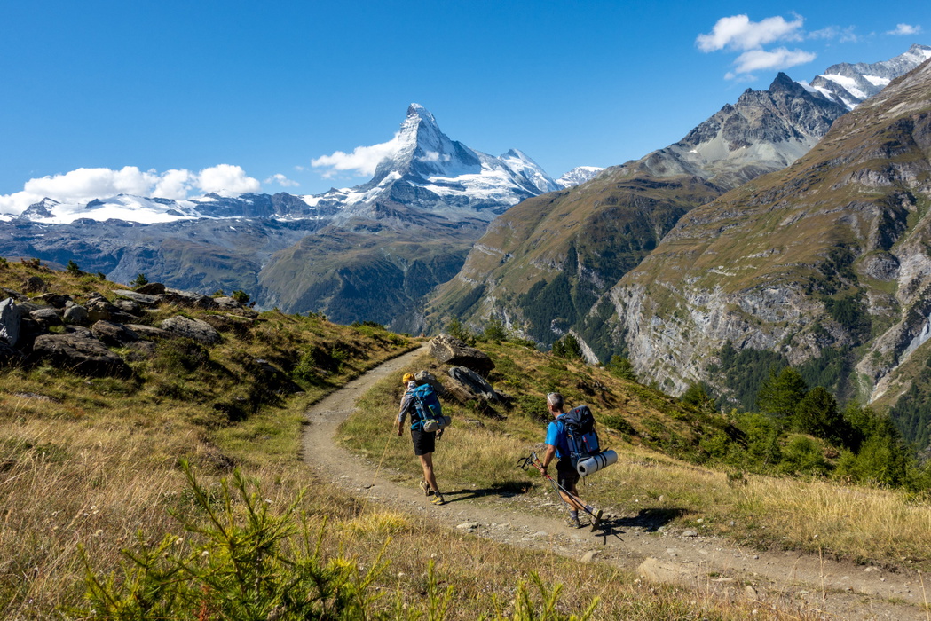
The Europaweg finale, with the Charles Kuonen bridge and the overnight at the Europahütte, is one of the most dramatic ways to finish any alpine trek. What makes this ending so special, and what should walkers know before they commit to the high route rather than the valley alternative?
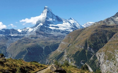
The high route into Zermatt is much, much better than the valley alternative, with tough walking, intimate views of the Weisshorn and Zinalrothorn and, as you approach Zermatt, the Breithorn and Matterhorn and a great hut for the final night on the trail. The 500-metre suspension bridge (Hängebrücke) is a memorable experience. The two options can also be combined, with a start in the valley and a climb later to get the views, if time is limited.
The main drawback of the higher route right now is a closure between the bridge and Täschalp, where rock and avalanche protection has collapsed. The signed diversion adds a couple of extra hours and 500m of descent and re-ascent, making for a long final day. That said, there are a great many possible routes between St Niklaus and Zermatt, and the high line remains the finest of them.
With nine alternative stages built into the route – the Fenêtre d'Arpette, the Cabane des Dix, the Cabane de Moiry, the Meidpass – how would you advise a first-time Haute Route walker to choose between the main line and the variants?
There are a few practical issues to consider first, namely the weather and closures (the Switzerland Mobility app is useful here). MeteoSuisse is an excellent weather resource, and the huts will always be able to advise on the route ahead. And do you have enough days, or do you need to push on through Zinal and then to Gruben in the Turtmanntal? Beyond the practicalities, it comes down to personal preference. Most trekkers will be strong enough to tackle the alternatives, and I would strongly recommend the Cabane des Dix, the Cabane de Moiry, and the Fenêtre d'Arpette if conditions allow.
You describe the Fenêtre d'Arpette as a good early test of a trekker's readiness for the rest of the route. What makes that crossing, so early in the trek, such a telling moment?
It's definitely one of the tougher stages, with a 1,200m climb and descent. The ascent is steep, almost requiring a touch of scrambling near the top. The descent begins over very steep and quite 'mobile' scree for the first 100m, then crosses an awkward boulder field. After that it can feel like a long way down to the Arpette relais, and Champex a further 40 minutes beyond. If you cope well, you are set for the rest of the route. If you struggle, consider taking a couple of easier stages first to find your feet.
The book compares the Haute Route to the Tour of Mont Blanc several times, noting that Chamonix to Zermatt is "a step up". For someone who's done the TMB and is considering this route next, what should they expect to be different – or harder?
Three things, really. The days are longer, say 2km more at 17km/day. There is more daily climbing, at 1,200m on average, compared with c.950m for the TMB. And the terrain underfoot is rockier and steeper. More subjectively, the Haute Route heads into much more remote terrain, the Grand Désert, the Col de Riedmatten for example, and whilst there will be plenty of trekkers on the route, it's much quieter than the TMB, which may affect how some trekkers perceive the route.
Booking accommodation is clearly important on this route, from CAS huts to gîtes shared with TMB trekkers in Trient. What's your best advice for someone planning their itinerary and bookings for the first time?
Start by mapping out each day – where you're starting from, where you're heading, how long it will take – and decide where to stay each night. Tie this in with your travel plans for getting to and from the Alps. Then book ahead for the busier spots: Trient, Louvie, Prafleuri, Moiry, the Hotel Weisshorn and Europahütte in particular. Some huts in France and the nearby parts of Switzerland are best booked through autourdemontblanc.com, whilst Club Alpin Suisse (CAS) huts are often booked through a central site, hut-reservation.org, which also shows spaces available.
For everything else, my approach is to draft a booking email with names, numbers, contact details, and the relevant dates and stages, then use a translation app to produce a solid French or German version. English is widely spoken in huts and valley hotels, but it's good manners to communicate in the local language where you can. Phoning ahead is perfectly possible, though it usually still requires an email confirmation. If all goes smoothly, it's usually possible to book an entire trek in around three hours, with a little follow-up for deposits and queries over the next day or two.
Keep a good record of your plan and contact details in case you need to change anything due to delays, bad weather, or needing a day off the trail. On the Haute Route it's always possible to reroute around the mountains – the bus and rail app SBB Mobile is your friend.
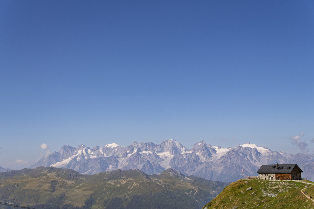
If you had to pick one stage or one view along the whole 215km that captures what makes this trek special, what would it be?
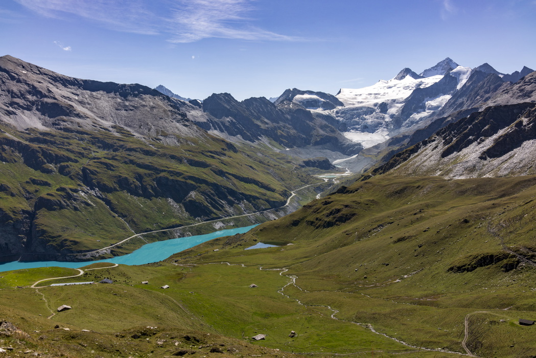
Just one, gosh. Let's go with the stage to the Cabane de Moiry. Starting from the tiny village of La Sage, you climb steadily over the Col du Tsaté with views back to the Pigne d'Arolla and Mont Blanc de Cheilon, and the path runs close under the Grand Cornier and Dent Blanche. At the pass look down over the blue or green Lac de Moiry (depending on the sunshine, glacial run-off and your eyesight). Drop down to the valley floor, then climb the narrow arête before it steepens sharply to the Cabane, which looks down on the tumultuous Moiry icefall through a full-length picture window. The hut is modern, takes just a handful of guests, and is incredibly comfortable.
What role does the Cicerone app and GPX data play for people walking this route today, compared with when you first did it?
The Cicerone app makes a great complement to the book. There is less detail in the app, but the magic blue dot on the red line is a reassuring companion on the trail. It's not a route that you will get lost on, the signs and turns are clear, but it's reassuring all the same. Future iterations of the app will add more features, in particular trek planning, making it even easier to sort your plans for the route.
For someone standing in Chamonix about to start the walk to Zermatt, what's the one thing you'd want them to know before they set off?
It's a challenge, but relish it in every way – the views, the fellow trekkers, the hard bits, the easier bits. Take care and have a great trek.
Thank you.
Trekking Chamonix to Zermatt
The classic Walker's Haute Route
£18.95
Guidebook to the Walker's Haute Route from Chamonix to Zermatt. The 215km route typically takes 2 weeks to walk. Described in 14 stages, the route crosses 11 passes between Mont Blanc and the Matterhorn and involves 14,500m of ascent and descent. A complete guide for planning and walking the route, with accommodation information.
More informationJonathan Williams was Cicerone’s publisher and managing director for nearly 25 years, working with authors and leading the development of the range. In his new life as an author, he, together with Lesley Williams, have made the Swiss and French Alps their special subject and explored treks and walks throughout the mountains. Based between the Lake District and the Yorkshire Dales, they enjoy spending days in the hills and months in the mountains, and have written or updated several Cicerone guidebooks for Switzerland.