Scottish Borders – seven day walks through history

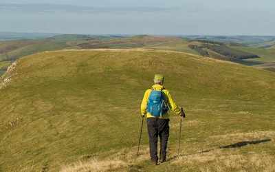
Away from the crowds, the Scottish Borders offer a wide variety of walking, from gentle riverbanks to wild moorland above the 600m mark. What used to be the historic battleground between Scotland and England is now Scotland's Top Short Break Destination and a perfect place for walkers of all experience levels. Cicerone author Ronald Turnbull follows seven historic wanderers on seven very different day walks.
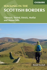
Walking in the Scottish Borders
Cheviots, Tweed, Ettrick, Moffat and Manor hills
£12.95
Guidebook presenting 45 day walks and one long distance route in the Scottish Borders. The day walks cover five areas: the Cheviots, Tweeddale, the Ettrick Hills, Moffat Hills and Manor Hills. The walks are a mixture of high and low-level routes and can be fully customised using multiple variants.
More informationThe Border Country has a shaggy character all its own, bloodstained in its history but mostly smooth underfoot. If you're bored of the borders (as Dr Johnson didn't say) then you're bored of life.
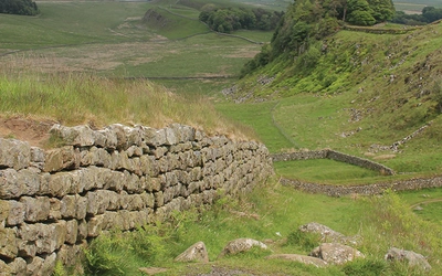
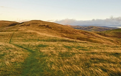
It's an area of four ranges of gentle, grassy topped hills, with 60 of them topping the 2000ft or 600m mark. It's the little green glens winding into those hills. It's the riversides of the Tweed and its tributaries, the Teviot, Yarrow and Ettrick. It's the wide valley on either side: wide enough that a 103km circular path, the Borders Abbeys Way, is entirely contained within it. And it's some small but rocky little mountains, volcanic plugs like Eildon and Ruberslaw, rising out of the plains.
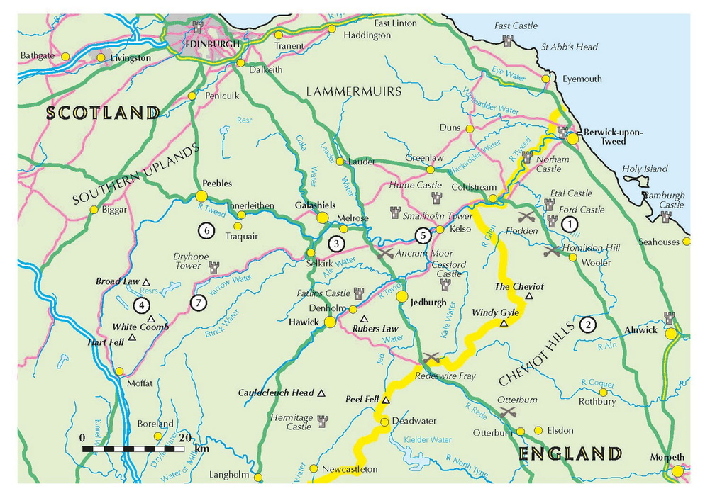
The following walks are all in the Cicerone guide Walking in the Scottish Borders, but are numbered to correspond to the map below.
(1) Bronze Agers: Ford to Roughting Linn
A country walk – plus ancient art
Start: Ford village NT 949 376
Distance: 11km with 200m of ascent
Route: Ford Moss, Goatscraig Hill, Roughting Linn waterfall and cup-and-ring marked rock
The first folk into Scotland after the Ice Age were hunter-gatherers, and long walks were absolutely what it was all about. Any route in this book was probably pretty busy in the Bronze Age. Clennel Street, with its mock-Roman name actually given in Victorian times, is taken as the most ancient trackway still surviving.
But Bronze Age history is guesswork, and none of it is set in stone. Well, apart from one bit. Nobody knows why they carved all their cup-and-ring marks into the sandstone outcrops. But they did, and most spectacularly at Roughting Linn, near the village of Ford.
The village is interesting in various non-Bronze-Age ways. The 15th-century castle, circled by the wide River Tilt. The 20th-century narrow-gauge railway. The early pre-Raphaelite village hall, painted with biblical scenes, that's well worth the £3.50 entry fee. Not to mention the 21st-century café at the village post office.
The walk takes in a raised swamp nature reserve, the remains of an early coal mine and a small sandstone hilltop. The little waterfall gorge of Roughting Lynn – either it is a religious site linked with the nearby rock markings, or else it isn't. A fine spot anyway to linger while you wait for low evening sunbeams over the nearby rock art.
(2) Iron Agers: Five Forts Walk
Low, grassy hills in a lovely mountain valley
Start: Breamish valley east of Ingram NU 007 163
Distance: 7.5km with 300m of ascent
Route: Brough Law, Cochrane Pike, Ingram Hill
For the guys in the Iron Age, the Cheviot range was just about ideal. The winding valleys are flanked on either side by steep-sided little hills, and about half of them have a hill fort on top. Many, like Yeavering Bell and Homildon Hill, still show the fallen remains of the original stone ramparts.
Brough Law, at the entrance to the Breamish Valley, also has some stonework remnants. It's the start of a gentle, grassy walk over the moorland. You'll pass four more iron age sites, a Bronze Age burial cairn and the traces of Medieval field systems. The going is gentle, but the paths are fainter than they would have been in the busy first century BC. Also the waymarks are rather widely spaced, so the walk needs careful map reading.
As with all ancient sites, it's best to time your visit carefully. Ideal is 2300 years ago. 'Ah, Daddy, I can really see the fort thingie now, with its earthwork and wooden palisade. And yes those must be the actual Votodani tribesmen rushing towards us so quick. They're certainly waving their bloodstained spears in an authentic iron-agey way!' Failing that, late evening light or light snowfall will help.
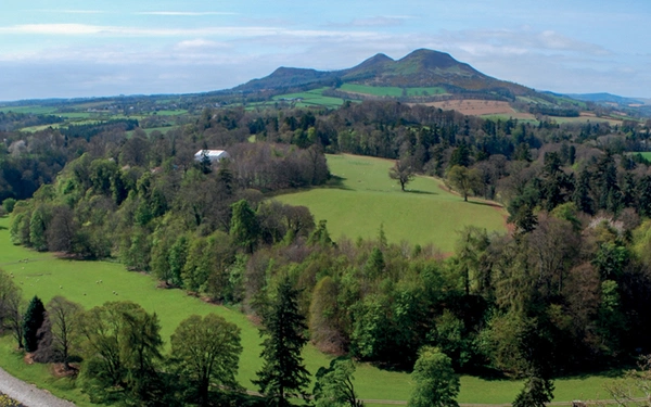
(3) St Cuthbert's corpse: Eildon Hills
Rugged little hills above Melrose
Start: Melrose Abbey NT 547 341
Distance: 9km with 450m of ascent
Route: Newstead, Eildon Hill North, St Cuthbert's Way
Cuthbert, Abbot of Lindisfarne, was one of the long-striding Christian missionaries of the 7th century. And he didn't stop his hiking just on account of being dead… When the Norsemen came raiding, his dead body was spirited away by monks, and toured Northumberland and across to the west coast of England before settling to rest at Durham Cathedral.
Long-distance path St Cuthbert's Way traces some of his wanderings, both on foot and in his coffin. Starting from Melrose, his first monastic posting, it crosses small hills and moorland and eventually the tidal mudflats of the North Sea to arrive at Lindisfarne itself.
The best Cuthbert-inspired hillclimb, however, is right at the beginning. Both the beginning of St Cuthbert's Way, and of Cuthbert's own monastic life. Only 422m high, the Eildon hills are splendid for their size: steep and a wee bit craggy, with outstanding views in all directions and the Queen of Elfland, the Romans, and another bunch of Iron-agers sharing your hill experience.
The hills look down on Melrose, and a walk along the Tweed makes a great warm-up to the walk.
(4) Covenanters on the Run: Gameshope circuit
Pathless, grassy hill circuit
Start: Talla Linnfoots NT 134 203
Distance: 18km with 950m of ascent
Route: Garelet Hill, Gameshope Loch, Donald's Cleuch Head; out-and-back to White Coomb; back by Molls Cleuch Dod
With all the delights of the great rivers, woodlands and ancient abbeys, sometimes you just need to take to the hills. And this is especially the case if you happen to be a Presbyterian preacher of the 1680s, on the run from the authorities.
The Rev Donald Cargill, all he'd done was point out the errors of certain officials in one of his sermons. Oh, and also condemn them to an eternity burning in Hell. Those officials did just happen to be King Charles II, the King's brother James, and several Privy Councillors.
So that's one reason why the Rev Donald was lurking in the long, lonely Gameshope glen at the northern edge of the Moffat hills. The other reasons being the long, grassy ridges on either side, speckled with bog cotton and cloudberry flowers, under the wide Southern Upland skies. You can walk for half a day above the stream-carved hollows, to arrive on White Coomb above the grey waters of Loch Skeen; then spend the other half of the day back along the other grassy ridgeline.
(5) Earl of Hertford: Kelso to Roxburgh
Banks of a big river
Start: Kelso NT 727 339
Distance: 12.5km with 150m of ascent
Route: Roxburgh Castle (ruins), Roxburgh village and viaduct
When the Earl of Hertford came for his short break in the Borders in 1543, he planned to visit each of the five fine Medieval abbeys dotted across the Tweed valley. He also planned to burn them down. Bizarrely, the English believed that by destroying the infrastructure and making the Borders uninhabitable, the Scots would be persuaded to marry the infant Mary Queen of Scots to the English Prince Edward, thus in effect giving away the kingdom.
Unsurprisingly, what today would be a war crime only made the Scots more determined, and Mary ended up marrying someone else entirely. Well, three other people as it happened.
The five ruined abbeys are linked by the 65-mile Borders Abbeys Way. But starting from the one at Kelso, you can enjoy a hill-free ramble up River Teviot. Smooth, easy paths also take in a ruined castle and an airy viaduct high above the river.
(6) Cows: Manors from Peebles
High hill paths and a quiet valley
Start: Glen Road, Peebles NT 259 392
Distance: 18.5km with 700m of ascent
Route: Kirkhope Law, Birkscairn Hill, Dun Rig, Glen Sax
Among the long-distance paths, the Cross Border Drove Road is the one for you if you happen to be walking along with a whole lot of cows. In the lawless 16th century, high hill pathways were used for bringing home the cattle you'd just stolen from your neighbours. The stories of raids, the hot trod in pursuit, and revenge raids in the following autumn: these are told in the Border Ballads collected by Sir Walter Scott 250 years afterwards. By which time the old thief's roads were in use again, as the drovers with their small, black Highland cattle headed south for the markets of England.
Today that historic atmosphere has sadly vanished. It would be so much more authentic to enjoy the trackway high above Glen Sax with its surface trampled to black mud and scented with cowpats.
The historic cow-path, disappointingly clean of cowpats, runs gently up the ridgeline of the Manor Hills, with ever widening views along the Tweed. Two minutes of black peat hag gives a brief taste of the authentic flavour, before a descent to the stream and woodlands of gentle Glen Sax.
(7) James Hogg: Loch of the Lowes
Two lochs, a little hill, and a classic café
Start: Loch of the Lowes NT 238 204
Distance: 11.5km with 450m of ascent
Route: Loch of the Lowes, Peniestone Knowe, Southern Upland Way
Where the pools are bright and deep,
Where the grey trout lies asleep,
Up the river and over the lea,
That's the way for Billy and me.
(James Hogg)
The old hill path above Loch of the Lowes was used by poet James Hogg, the Ettrick Shepherd, on his way home after hob-nobbing with Sir Walter Scott at Tibbie Shiels Inn. After 200 years of excellent service, Tibbie's has closed. Happily, the little Glen Café, right at the loch corner, has opened instead.
James Hogg's path leads easily up onto Peniestone Knowe, a modest hill that's not often visited. For the descent there's the even smoother Southern Upland Way. Sadly, a poet in a drunken state will probably not be encountered on either leg of the journey.
Walking in the Scottish Borders
Cheviots, Tweed, Ettrick, Moffat and Manor hills
£12.95
Guidebook presenting 45 day walks and one long distance route in the Scottish Borders. The day walks cover five areas: the Cheviots, Tweeddale, the Ettrick Hills, Moffat Hills and Manor Hills. The walks are a mixture of high and low-level routes and can be fully customised using multiple variants.
More information