Walking in the Cotswolds: a complete planning guide
Quintessential England. Chocolate-box pretty. Gentle, undulating hills. It's almost as if there's a law against describing the Cotswolds without the clichés. But get to know these stout, gutsy hills and you'll find places of satisfying remoteness, authentic wildness and real drama. There are steep gradients to do battle with, 200-metre-plus climbs, and on the Edge the weather can treat you like you've insulted its mother. This is, after all, the landscape that shaped Edward Wilson, who died a hero beside Captain Scott in Antarctica, and that seduced William Morris, Laurie Lee and WH Davies. Cosy and idyllic it is not — or at least, not only. Walking in the Cotswolds by Damian Hall, a local who knows these hills intimately, covers the region with 30 circular day walks across Gloucestershire and Wiltshire, ranging from 9 to 19km (6–12 miles) and taking between 3 and 6 hours. (Last updated: June 2026 · Guidebook edition: 2nd edition, January 2024)
Quick facts
- Location: Gloucestershire and Wiltshire, Cotswolds National Landscape, South West England
- Total routes: 30 circular day walks
- Distance range: 9–19km (6–12 miles) per walk
- Typical duration: 3–6 hours per walk
- Difficulty: Grade 1–3 (easy to strenuous)
- Terrain: Limestone escarpment, rolling plateau, beech woodland, deep valleys, historic villages, hillforts and ancient monuments
- Highest point: Cleeve Common, around 330m
- Navigation: 1:50,000 OS map extract included for each walk; Explorer 1:25,000 maps recommended for off-route exploring
- Best season: Year-round; autumn for blazing beech colour, winter for crisp quiet trails, spring for wildflowers and lambs, summer for long days (choose southern walks to avoid northern crowds)
- Guidebook: Walking in the Cotswolds by Damian Hall, 2nd edition, 2024
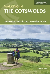
Walking in the Cotswolds
30 circular walks in the Cotswolds AONB
£14.95
Guidebook to 30 circular walks in the Cotswolds AONB, including Leckhampton Hill, Painswick Beacon and Crickley Hill and sections of the Cotswold Way. Includes information about history, geology and wildlife encountered along the routes.
More informationWhat is Walking in the Cotswolds?
Walking in the Cotswolds is a Cicerone guidebook covering 30 of the finest circular day walks across the Cotswolds National Landscape, from the northern fringes near Chipping Campden and Bredon Hill down through the heart of the limestone escarpment to Bath and Bradford-on-Avon in the south. Written by Damian Hall, an athlete, author and long-time Cotswolds resident who grew up in Nailsworth, it reads less like a route guide and more like a love letter to a landscape he knows inside out.
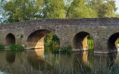
The routes cover the full length of the hill chain: from the open, windswept high wold with its big skies and sudden valley drops, through the steep, view-laden limestone Edge with its ancient hillforts and Jurassic grasslands, down through the secretive valleys around Stroud and Nailsworth to the broader river landscapes of the south around Bath and Bradford-on-Avon. Fourteen of the 30 walks incorporate sections of the Cotswold Way National Trail, together covering roughly two-thirds of the trail and all of its finest sections.
Unlike most Cotswolds walking books, this one refuses to be a heritage tour. These are, as Hall puts it, simply the 30 best walks in the Cotswolds: routes chosen for the quality of the walking itself. They happen to pass ancient long barrows, Roman villas, enigmatic stone circles and honey-hued wool towns along the way, but the views and the terrain come first. This planning guide answers the most common questions walkers have before setting out. For complete route descriptions and mapping, see the Cicerone Walking in the Cotswolds guidebook.
The 30 routes at a glance
The walks span the full 145km (90-mile) length of the hill chain, and the guidebook organises them broadly from north to south.
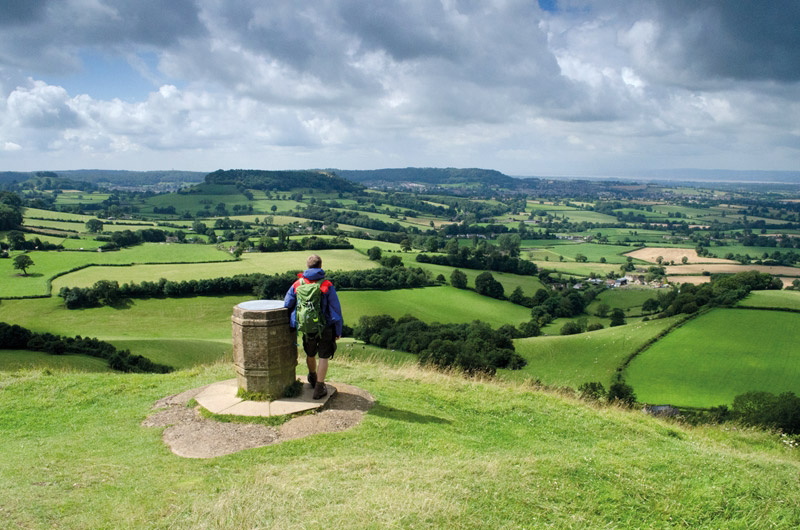
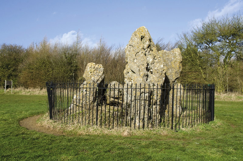
The north Cotswolds (Walks 1–8) takes in the broad, undulating high wold: Broadway Tower, Bredon Hill, the Rollright Stones, Winchcombe with its views of Sudeley Castle, and the wide pastoral landscapes around Bourton-on-the-Water and the Slaughters. Walking here tends to feel open and spacious, with rivers such as the Windrush and Coln cutting deep green valleys through the plateau.
The central scarp and Five Valleys (Walks 9–21) is the heart of the book and the most dramatic section of the Cotswolds. Walks here include Leckhampton Hill and Crickley Hill, the hillforts of Painswick Beacon and Uley Bury, Laurie Lee's Slad Valley, Haresfield Beacon, and the golden commons at Minchinhampton and Rodborough. This is where the Edge is at its most commanding, with views west to the Malverns, the Forest of Dean and the mountains of Wales.
The south Cotswolds (Walks 22–30) covers the gentler but still rewarding southern end of the chain: Wotton-under-Edge, the Swainswick Valley, Little Solsbury Hill, the Bath Skyline, and the castle walk at Bradford-on-Avon. Landscapes here are more sheltered and intimate, with fewer big escarpment views but fine river valleys and strong historical character.
A selection of key routes from the summary table:
| Walk | Distance | Difficulty grade | Time |
|---|---|---|---|
| Bredon Hill | 15km (9 miles | 3 | 4hrs |
| Winchcombe, Hailes Abbey and Sudeley Castle | 19km (12 miles) | 3 | 6hrs |
| Winchcombe, Cleeve Common and Belas Knap | 12.5km (8 miles) | 2 | 3.5hrs |
| Leckhampton Hill and Crickley Hill | 16.5km (10 miles) | 3 | 5hrs |
| Laurie Lee’s Slad Valley | 11km (7 miles) | 3 | 5hrs |
| Haresfield Beacon | 10km (6 miles) | 1 | 3hrs |
| Minchinhampton and Rodborough Commons | 15km (9 miles) | 2 | 4hrs |
| Bath Skyline | 9.5km (6 miles) | 1 | 3hrs |
Who is Walking in the Cotswolds suitable for?
The collection is genuinely accessible across a wide range of abilities. Shorter, lower-gradient walks such as Walk 4 (Long Compton and the Rollright Stones) or Walk 8 (Bourton-on-the-Water and the Slaughters) suit families, beginners and walkers who prefer a gentler day out. The grading system is honest: a grade 1 walk means roughly three hours and a modest climb; a grade 3 means a longer, more demanding outing.
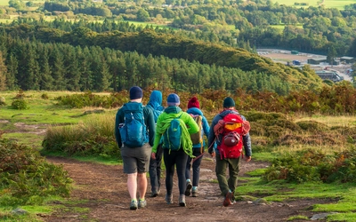
Hall's selection leans deliberately toward the Edge, where the best views and most rewarding terrain are found. Most walks involve at least one significant climb to reach the scarp, and several include 200-metre-plus ascents. Walkers expecting flat ambling should look to the northern plateau walks; those wanting a proper workout will find it on the escarpment.
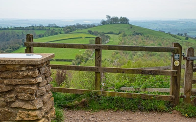
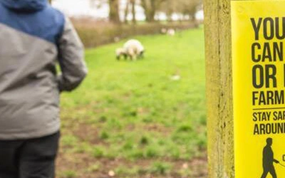
Dogs are well catered for across most of the walks, though livestock are common and leads will be needed frequently. Navigation is generally straightforward: the Cotswolds is well signposted and, as Hall notes, nowhere is wilderness enough to stay lost for long.
How difficult are the Cotswolds walks?
The walks are graded 1 to 3, with grade 1 being easy (shorter routes, limited ascent) and grade 3 being strenuous (longer distances, more significant climbing). Terrain difficulty is broadly consistent across the book: limestone paths, woodland tracks likely to be muddy in wet weather, old droveways, green lanes and occasional quiet lanes. What varies is fitness demand.
The most challenging walks are those that spend extended time on or near the Edge, particularly in the central section around Leckhampton Hill (Walk 9), Painswick Beacon (Walks 11 and 13), Haresfield Beacon (Walk 16) and Uley Bury (Walk 22). These routes involve the steepest gradients and the most exposed conditions; on a winter's day with wind off the south-west, the Edge earns its dramatic billing.
Navigation across the 30 walks is not technically demanding. Each walk comes with a 1:50,000 OS map extract, and national trail sections (marked with the acorn symbol) are well waymarked. For anyone who wants greater map detail or plans to explore off-route, the 1:25,000 Explorer maps are a worthwhile addition.
When is the best time to walk in the Cotswolds?
You can visit any time of year, and each season makes a persuasive case.
- Spring (March–May): The valleys come alive with daffodils, bluebells (April to June), wild garlic and the first orchids. Lambs are everywhere. Green-winged and early purple orchids peak in late April and May on the limestone grasslands. Crowds are lower than summer.
- Summer (June–August): Long days and warm weather make this peak season, particularly in the northern Cotswolds and Bath. For a quieter experience, the southern walks around Nailsworth, Stroud and Bradford-on-Avon see noticeably fewer visitors. Rare butterflies, including the chalkhill blue and Duke of Burgundy, are on the wing on the limestone grasslands.
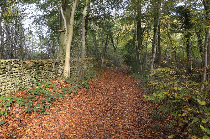
- Autumn (September–October): The standout season for the Edge and the beech woodlands. Because of the escarpment's altitude and aspect, autumn colour can arrive a full month earlier here than in the Vale below. September and October deliver the most dramatic woodland walking. Crowds drop sharply after the school holidays.
- Winter (November–February): Cold, crisp and peaceful. The deciduous woodland opens up to reveal bigger views, trail traffic is minimal, and accommodation prices fall. The Edge in frost or snow is genuinely spectacular. Paths can be muddy and some field paths heavy going after prolonged rain, but nothing here is impassable.
What accommodation is available for walking in the Cotswolds?
Tourism is the Cotswolds' biggest industry now, and the infrastructure shows: there is accommodation at every price point, from luxury B&Bs and boutique hotels, self-catering cottages and family-run campsites. Many village pubs offer B&B rooms.
For a quieter base, the southern Cotswolds towns of Painswick, Nailsworth, Winchcombe, Stroud and Bradford-on-Avon are good choices: smaller, less visited than the northern honeypots, and with a more authentic feel. The northern towns of Chipping Campden, Broadway and Bourton-on-the-Water are more heavily touristed, particularly in summer. Bath is a superb base for the southern walks but books out well in advance.
There is limited youth hostel provision specifically located for these walks; the hostel at Stow-on-the-Wold may suit walkers based in the north. For a comprehensive accommodation search, the official tourism website at www.cotswolds.com is a practical first stop. Book well ahead for summer visits, especially in the northern Cotswolds and Bath.
Getting to and around the Cotswolds
Getting into the Cotswolds by public transport is manageable; getting around it is harder. Bath, Stroud, Cam and Dursley, Gloucester, Cheltenham and Moreton-in-Marsh all have train stations and, with some bus connections, give access to a good number of the routes.
Onward public transport within the Cotswolds can be patchy, and for a long weekend of walking Hall recommends choosing a single base and exploring the walks around it thoroughly, rather than trying to travel between the northern and southern ends of the chain. The Cotswolds stretch for 145km (90 miles) and cross-country public transport does not always reflect that scale.
For car-based walkers, Painswick, Nailsworth and Winchcombe offer quieter, more scenic alternatives to the major towns. Most walks include parking information at the start point. For transport planning, Traveline (www.traveline.info) covers bus and train options across the region.
What are the highlights of walking in the Cotswolds?
- The Edge at Cleeve Common and Leckhampton Hill: The thickest sections of exposed Jurassic limestone in the country, with wide views west across the Severn Vale to the Malverns and Wales
- The hillforts: Uley Bury, Painswick Beacon, Crickley Hill and Haresfield Beacon sit in commanding positions along the scarp, with Iron Age earthworks still dramatically intact
- Belas Knap (Walk 6): A Neolithic long barrows set high above Winchcombe with views across the north Cotswolds
- Laurie Lee's Slad Valley (Walk 15): The valley that shaped Cider With Rosie, still intimate and overgrown and largely unchanged
- The beech woodland in autumn: The escarpment's beech woods turn earlier than almost anywhere else in England; the section above Cranham (Walk 11) and around Painswick (Walk 13) are among the finest
- The Cotswold Way sections: Fourteen of the 30 walks follow sections of the national trail, including stretches above Cheltenham and Bath
Walking in the Cotswolds
30 circular walks in the Cotswolds AONB
£14.95
Guidebook to 30 circular walks in the Cotswolds AONB, including Leckhampton Hill, Painswick Beacon and Crickley Hill and sections of the Cotswold Way. Includes information about history, geology and wildlife encountered along the routes.
More informationPlan your walk with the Cicerone guidebook
The Cicerone Walking in the Cotswolds by Damian Hall is the definitive guide to these 30 routes, written by someone who has been walking them since childhood. It covers:
- 30 circular day walks ranging from 9 to 19km (6–12 miles), each graded 1–3
- 1:50,000 OS map extracts for every route, with the route clearly marked
- Detailed route descriptions with careful attention given to woodland sections and multi-field crossings where concentration is needed
- Information on local pubs, cafés, tea rooms and public transport for each walk
- Background chapters on geology, landscape, plants and wildlife, and the history of human settlement in the Cotswolds
- Suggested shortcuts on longer walks and extension options on shorter ones
- Appendices covering the route summary table, long- and medium-distance walks in the Cotswolds, bibliography, and useful websites
- Free route updates available online
About Damian Hall, guidebook author
Damian Hall is an athlete, author and activist who grew up in Nailsworth and still lives in the Cotswolds. Before he was competing in the world's toughest ultramarathons such as the Spine Race, UTMB and the Barkley Marathons, he completed many of the world's famous long-distance walking trails, such as Everest Base Camp trek, the Inca Trail and Australia's Six Foot Track, where a hungry possum stole his walking boot.
He mainly works as a running coach now, but has written regularly about outdoor, travel and fitness for The Guardian, The Telegraph, Runner's World, Country Walking, Rough Guides and others. His books include Cicerone's Walking in the Cotswolds, In It For The Long Run, We Can't Run Away from This, and the official Pennine Way guide.
He is a co-founder of The Green Runners and he has a tea problem. More at www.ultradamo.com.