Walking in Worcestershire: a complete planning guide
Worcestershire is a county of gentle rolling countryside, winding rivers, and distinctive hill ranges that rise above fertile lowlands. Bordered in part by the Malvern Hills, the Clent Hills, the Lickey Hills, and the Cotswolds, and threaded by the Rivers Severn and Avon as well as historic canals, it offers some of England's most rewarding easy-going walking. From orchard country and hop fields to cathedral cities and quiet market towns, Worcestershire blends natural beauty with layers of history reaching back over half a million years. The 31 routes in Julia and Mike Goodfellow-Smith's guidebook range from a short 3.6km stroll around the Old Hills to the full 31.3km first stage of the Worcestershire Way, covering 28 day walks and three multi-day trails across the whole county. (Last updated: June 2026 · Guidebook edition: 1st edition, 2026)
Walking in Worcestershire, quick facts:
- Location: Worcestershire, English Midlands
- Total routes: 28 day walks plus three multi-day trails (31 routes in total)
- Day walk distance range: 3.6km to 27.4km (2.2 to 17 miles) per walk
- Day walk duration range:1hr to 8hr per walk
- Multi-day trails: Worcester to Birmingham Canal Walk (4 stages, Walk 29), North Worcestershire Path (2 stages, Walk 30), Worcestershire Way (2 stages, Walk 31)
- Difficulty: Routes are not graded; terrain and ascent information provided for each walk
- Terrain: Rolling lowland pasture, river and canal towpaths, nature reserves, ancient hill forts, orchard country, market town streets, and the Malvern Hills
- Highest point: Worcestershire Beacon, 425m (1390ft), Malvern Hills
- Navigation: Well-waymarked throughout; GPX files available to download
- Best season: Year-round; spring for orchards and bluebells, summer for meadows and butterflies, autumn for woodland colour, winter for the Malvern Hills and canal paths
- Main bases: Great Malvern, Upton upon Severn, Worcester, Bewdley, Pershore, Evesham
- Guidebook:Walking in Worcestershire by Julia and Mike Goodfellow-Smith, 1st edition
Walking in Worcestershire
31 walks including the Worcestershire Way and Malvern Hills
£14.95
Guidebook to walking in the county of Worcestershire, including 28 day walks for all abilities from 4 to 17 miles, plus three multi-day long-distance trails. Featuring the North Worcestershire Path, Wychavon Way, Worcestershire Way, Malvern Hills and Birmingham Canal, explore the county’s rolling hills, meandering rivers and fascinating history with easy-going hiking for all seasons.
More information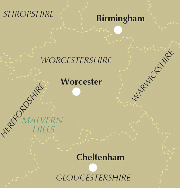
What is Walking in Worcestershire?
Walking in Worcestershire by Julia and Mike Goodfellow-Smith is a comprehensive walking guide to one of England's most varied and underwalked counties. The 31 routes are organised by district, working across the county from the Teme Valley and Abberley in the west, through the Malvern Hills and Severn Plain, across the Vale of Evesham and the Cotswold fringe, and into the northern hills and canal country approaching Birmingham. Three multi-day trails complete the picture: a four-stage canal walk from Worcester to Birmingham, the two-stage North Worcestershire Path, and the two-stage Worcestershire Way from Bewdley to Great Malvern.
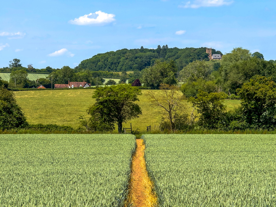
The county rewards walkers with a remarkable variety of landscapes. Watery plains laced with rivers and canals give way to the sharp ridge of the Malvern Hills, the only place in the county where the walking feels genuinely upland. Across the south, the Vale of Evesham opens up into orchard and fruit-growing country, while the northern reaches around Kidderminster and Bromsgrove offer ancient woodland at Wyre Forest and the breezy summits of the Clent and Lickey Hills. Throughout, the county's rich history is never far away, from Roman salt-making at Droitwich and Iron Age hill forts at British Camp to the battlefield at Worcester and the grand landscape gardens of Croome Park.
The guidebook is the first Cicerone guide dedicated to Worcestershire and covers every corner of the county. For complete route descriptions and GPX files for all 31 routes, see the Cicerone Walking in Worcestershire guidebook.
The walks at a glance
The guidebook organises the 28 day walks by district, with three multi-day trails at the end. Routes are not graded, but each walk description includes terrain, ascent, and distance information to help walkers assess suitability.
| Area | Walks | Distance range | Time range |
|---|---|---|---|
| West Worcestershire: Teme Valley, Abberley and Martley | 1–4 | 7.9–18.6km | 2hr 30min–5hr 30min |
| Malvern Hills and surrounds | 5–11 | 7.8–15.7km | 2hr 15min–6hr 30min |
| Severn Plain: Upton upon Severn and Worcester | 12–15 | 3.6–19.9km | 1hr–5hr 15min |
| Vale of Evesham and Cotswold fringe | 16–23 | 9.2–27.4km | 2hr 30min–8hr |
| North Worcestershire: Droitwich, Redditch and the northern hills | 24–28 | 7–16.2km | 1hr 45min–4hr 30min |
| Walk 29: Worcester to Birmingham Canal Walk (4 stages) | — | 17.8–19.2km per stage | 2hr 45min–5hr per stage |
| Walk 30: North Worcestershire Path (2 stages) | — | 27.2–30.2km per stage | 8hr–9hr 30min per stage |
| Walk 31: Worcestershire Way (2 stages) | — | 17.8–31.3km per stage | 6hr–11hr per stage |
West Worcestershire (Walks 1–4) covers the quietest and most rural part of the county, including a circuit of the attractive market town of Tenbury Wells, a longer walk through the Teme Valley at Eardiston, and circular routes from Abberley and Martley through rolling farmland and wooded hillsides.
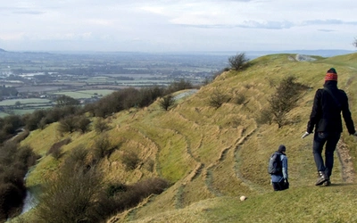
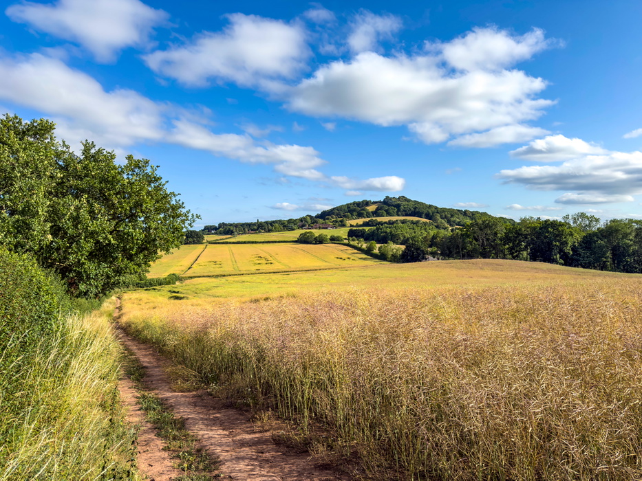
Malvern Hills and surrounds (Walks 5–11) is the most dramatic section, covering seven routes in and around the Malvern Hills. The headline walk is Walk 6, the 15.7km end-to-end traverse of the hills from Chase End Hill to the North Quarry car park, with 980m of ascent — the most demanding day walk in the book. Shorter alternatives include Walk 7 (Great Malvern and Worcestershire Beacon, 8.1km) and the nature reserve walks at Knapp and Papermill (Walk 5) and St Wulstan's (Walk 8). Walk 9 covers the southern hills and Walk 10 explores Castlemorton Common.
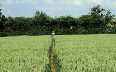
Severn Plain (Walks 12–15) covers the flat riverside country around Upton upon Severn and Worcester, including the short and gentle Old Hills circuit (Walk 14, 3.6km, the shortest in the book) and the longer River Severn and Croome Park route (Walk 13, 19.9km). Walk 15 takes in Worcester's rivers and the Civil War battlefield site.
Vale of Evesham and Cotswold fringe (Walks 16–23) is the most varied chapter, ranging from the gentle Pershore circuit (Walk 16, 10km) to the full-day Pershore to Broadway traverse on the Wychavon Way (Walk 17, 27.4km). This section also includes Bredon Hill (Walks 18 and 19), the handsome Cotswold village of Broadway (Walk 20), Evesham and the River Avon (Walk 21), and a specialist butterfly trail at Grafton Flyford (Walk 23).
North Worcestershire (Walks 24–28) covers Droitwich Spa and Hanbury Hall (Walk 24, 16.2km), the industrial heritage of Bordesley Abbey and Arrow Lake (Walk 25), the Lickey Hills and Worcester and Birmingham Canal (Walk 26), the Clent Hills (Walk 27), and Wyre Forest (Walk 28).
Who is Walking in Worcestershire suitable for?
Walking in Worcestershire covers an unusually wide range of abilities. The shortest walk, Old Hills (Walk 14, 3.6km, 65m ascent), is suitable for beginners and families and fits comfortably into a couple of hours. Several other routes in the Severn Plain and Vale of Evesham sections are similarly gentle, with minimal ascent and clear paths.
At the other end of the scale, the Malvern Hills end-to-end (Walk 6, 15.7km, 980m ascent) and the Eardiston and Teme Valley circuit (Walk 2, 18.6km, 410m ascent) are full, demanding days for fit and experienced walkers. The multi-day trails involve long daily stages — the first stage of the Worcestershire Way is 31.3km with 1065m of ascent — and are best tackled in sections by those building up to longer days.
The guidebook does not use a grading system, but each walk description includes terrain, ascent, descent, and any specific warnings such as stiles, overgrown sections, or livestock, so walkers can make their own assessment.
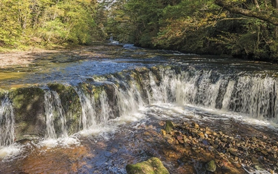
A note on conditions: low-lying land in Worcestershire can become waterlogged in winter, making some routes muddy. The Malvern Hills and canal paths are better suited to winter walking, as paths are well made and remain passable year-round.
When is the best time to walk in Worcestershire?
Worcestershire is a county for all seasons, and different parts of the county come into their own at different times of year.
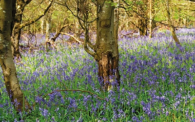
- Spring (March to May) is the finest time for the orchard country of the Vale of Evesham, when the blossom is at its best. Woodlands are carpeted with Native Bluebells, Wood Anemones, and Ramsons (Wild Garlic), and the hedgerows are starting to fill out. For wildflower enthusiasts, the Knapp and Papermill Nature Reserve (Walk 5) is particularly rewarding at this time.
- Summer (June to August) brings the meadows into full bloom, with butterflies and bees working the flowers and Skylarks singing overhead. June and July are the best months to spot Glow-worms at St Wulstan's Nature Reserve (Walk 8) and the Knapp and Papermill Reserve (Walk 5). The longer days make the bigger walks, including the Malvern Hills end-to-end, more manageable.
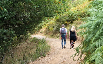
- Autumn (September to November) is the season for woodland colour in Wyre Forest (Walk 28) and the mixed native woods across the hills. The orchards of the Vale of Evesham bear their fruit, and the Pershore Plum Festival celebrates the harvest. Bird life is particularly active, with Red Kites quartering the lowlands and Peregrine Falcons visible on the tower of Pershore Abbey (Walk 16).
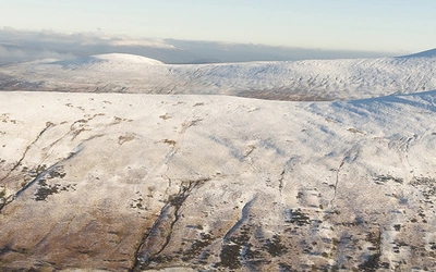
- Winter (December to February) is the season for the Malvern Hills and the canal walks, where paths are well made and remain passable when low-lying routes are muddy. The hills can attract snow, which makes them appear more dramatic, and crisp clear days offer exceptional views from the ridge. The four-stage canal walk (Walk 29) is a reliable winter choice throughout.
What accommodation is available in Worcestershire?
Worcestershire has a good range of accommodation across the county, from country house hotels and coaching inns to B&Bs and self-catering cottages. The best bases for access to the widest range of walks are Great Malvern, Upton upon Severn, Worcester, Bewdley, Pershore, and Evesham, all of which have several walks within easy reach.
Great Malvern is the most natural walking base, with direct access to the Malvern Hills, a railway station, and a good range of accommodation. Worcester is the largest city and the best transport hub, with a mainline railway station and access to the canal walks. Bewdley is the most attractive small town in the north of the county, well placed for the Wyre Forest and the Worcestershire Way.
For walkers tackling the multi-day trails, the canal walk (Walk 29) has overnight stops designed around Droitwich, Bromsgrove, and Alvechurch, all with railway stations. The North Worcestershire Path stages overnight at Hagley, and the Worcestershire Way overnight at Knightwick. Accommodation in these smaller places is more limited and booking ahead is advisable.
How do I get to Worcestershire?
Worcestershire is well served by trains from London and Birmingham. Great Malvern, Worcester, Pershore, Evesham, and Droitwich all have stations, and many of the day walks and all four stages of the canal walk start and finish at railway stations. The M5 motorway bisects the county from north to south, with a network of roads extending from each of the main urban areas.
Public transport is less frequent in the more rural parts of the county, particularly in the west around Tenbury Wells and Abberley. Where walks can be accessed by public transport, details are given in the route information box, though services are liable to change and checking online before relying on them is recommended.
What are the highlights of walking in Worcestershire?
- Malvern Hills end to end (Walk 6) is the finest day walk in the county: a 15.7km traverse of the full ridge from Chase End Hill to the North Quarry car park, taking in Worcestershire Beacon at 425m and offering views across ten counties on a clear day.
- Wyre Forest (Walk 28) is one of the largest ancient oak woodlands in England, managed as a National Nature Reserve and covering over 6000 acres on the Worcestershire-Shropshire border. The 8.6km circuit from the visitor centre offers a taste of a genuinely wild and atmospheric landscape.
- Croome Park (Walk 13) is a 19.9km circuit around the National Trust landscape garden designed by Capability Brown for the sixth Earl of Coventry, with lakes, a Gothick church, and views across the Severn Plain to the Malvern Hills.
- Broadway Tower and village (Walk 20) explores the Cotswold fringe at its most photogenic: the handsome high street of Broadway and the hilltop folly of Broadway Tower, with views said to reach as far as thirteen counties.
- Worcester to Birmingham Canal Walk (Walk 29) is a four-stage canal walk along one of England's most scenic waterways, linking Worcester's historic city centre to Birmingham New Street through a sequence of locks, canal towns, and countryside that changes character with each stage. Every stage starts and finishes at a railway station.
- The Worcestershire Way (Walk 31) is the county's long-distance trail, running 49.1km from Bewdley to Great Malvern in two stages through the Wyre Forest, along the River Severn, and over the Malvern Hills.
Plan your walk with the Cicerone guidebook
The Cicerone Walking in Worcestershire guidebook by Julia and Mike Goodfellow-Smith contains everything you need to plan and complete all 31 routes across the county.
- 28 day walks organised by district, ranging from 3.6km to 27.4km, plus three multi-day trails
- Full route descriptions for all 31 walks, with terrain, ascent, and distance information for each
- Route summary table listing all 31 routes by distance, time, ascent, descent, start, and finish
- GPX files available to download at cicerone.co.uk/1244 and via the Cicerone app for GPS-enabled offline navigation
- Background sections covering Worcestershire's geology, landscape, history, culture, plants, and animals
- Practical information on accommodation, public transport, parking, and refreshments for each walk
- Free route updates available at cicerone.co.uk/1244/updates
Available as a printed guidebook (£14.95) or digital eBook (£14.95).
Walking in Worcestershire
31 walks including the Worcestershire Way and Malvern Hills
£14.95
Guidebook to walking in the county of Worcestershire, including 28 day walks for all abilities from 4 to 17 miles, plus three multi-day long-distance trails. Featuring the North Worcestershire Path, Wychavon Way, Worcestershire Way, Malvern Hills and Birmingham Canal, explore the county’s rolling hills, meandering rivers and fascinating history with easy-going hiking for all seasons.
More informationAbout the authors
Julia Goodfellow-Smith's love of walking is one of the reasons she chose Malvern as her home. During the coronavirus lockdowns of spring 2020 she walked over 1000km, mainly from her front door, and came to know the hills and surrounding area intimately. In her books, Julia aims to share her love of walking and help others to explore with confidence and enjoy for themselves some of the best routes, landscapes, and views. Julia co-wrote Walking in Worcestershire with Mike Goodfellow-Smith.