Walking in the Lake District: a complete planning guide
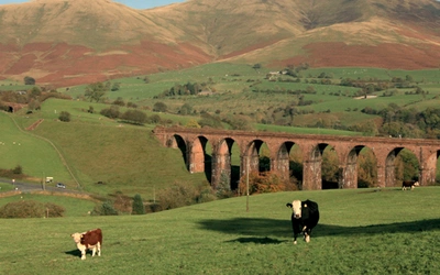
Fifty fells, fifty Great Mountain Days: that is the promise behind Mark Richards' Best Walks in the Lake District. Ranging from a gentle introduction on Lingmoor Fell to the long wild traverse of Steeple, Scoat Fell and Pillar, these 6 to 23km (4 to 14 mile) routes are built to fill a single day with the full character of Lakeland, whether that means firm ridge paths, a touch of scrambling, or hours of solitude on a fell most visitors never reach. This guide answers the practical questions walkers ask before choosing a route from the book. (Last updated: July 2026 · Guidebook edition: 2nd edition, June 2026)
Best Walks in the Lake District, quick facts:
- Location: Lake District National Park, Cumbria
- Total routes: 50 circular day walks, described by the author as "Great Mountain Days"
- Distance range: 6–23km (4–14 miles) per walk
- Typical duration: 5–10 hours
- Difficulty: Graded 1 to 3 on the guide's own scale, from straightforward map-reading routes to rougher walks with optional scrambling; suited to walkers with a reasonable level of fitness and some hillwalking experience
- Terrain: Fell ridges, rocky summits, valley paths, tarns and becks; 16 of the 50 walks include a brief scrambling option
- Highest point: Scafell Pike, England's highest mountain, featured on Walks 11 and 14
- Navigation: 1:40,000 Harvey Superwalker mapping (or four Ordnance Survey OL sheets), hand-drawn fellscape diagrams, and clear step-by-step route descriptions
- Best season: Year-round, though spring to autumn gives the most reliable conditions; winter routes demand appropriate skills and equipment
- Guidebook: Best Walks in the Lake District: 50 Great Mountain Days, Mark Richards, photography by Grey O'Dwyer, foreword by Sir Chris Bonington, 2nd edition, June 2026
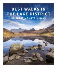
Best Walks in the Lake District
50 Great Mountain Days
£19.95
SALE
£16.96
The 50 best walks in the Lake District, including Scafell Pike, Helvellyn, Skiddaw, Blencathra and other lesser-known but wonderful hill walks. Each route is a Great Mountain Day, a rewarding and potentially challenging route exploring the natural beauty of Lakeland. Includes stunning photography, 1:40,000 Harvey maps and hand-drawn fellscapes for every route.
More information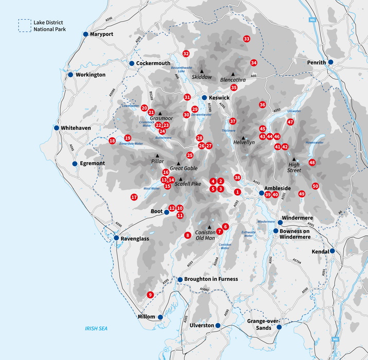
What is Best Walks in the Lake District?
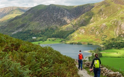
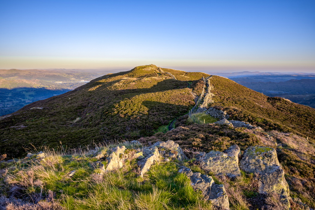
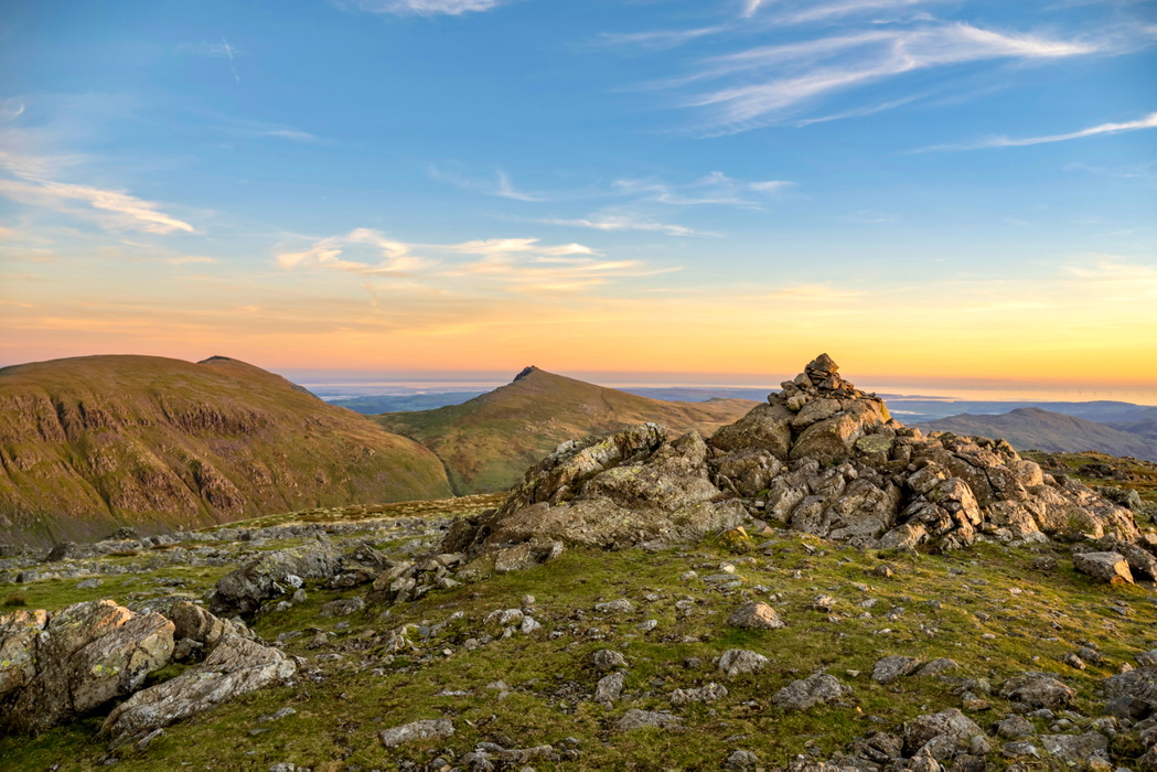
Best Walks in the Lake District is Mark Richards' large-format collection of 50 circular day walks across the Lake District fells, arranged in a clockwise spiral that starts among the Langdale Pikes and works south to Coniston and Eskdale, west into Wasdale and Ennerdale, north through Buttermere and Borrowdale, over to Skiddaw and Blencathra, and finally east via Helvellyn and Ullswater to end in the quieter dale of Longsleddale. Richards calls each route a "Great Mountain Day": not simply a walk, but a full day's engagement with a fell environment that has, in his words, "all the characteristics of true mountains" and deserves the same respect.
What sets this guide apart from a generic route list is the breadth of its selection. Alongside the famous names, Scafell Pike, Helvellyn, Great Gable, Blencathra and the Langdale Pikes, it deliberately makes room for quieter fells such as Black Combe, Mellbreak and the Buckbarrow, Seatallan and Middle Fell round, on the grounds that a satisfying mountain day does not always require the busiest path. The book also carries a foreword by Sir Chris Bonington, contemporary photography throughout by Grey O'Dwyer, and Richards' own hand-drawn fellscape diagrams for every route, a signature feature carried over from his decades of Lakeland guidebook writing.
This planning guide answers the most common questions walkers have before choosing a route. For complete stage-by-stage descriptions and mapping for all 50 walks, see the Best Walks in the Lake District guidebook.
How does the guidebook divide up the Lake District?
The 50 walks are not grouped by difficulty or theme but follow the geography, moving in one continuous clockwise arc around the National Park. Broadly, they fall into these areas:
- Langdale and Coniston (Walks 1–8): From Lingmoor Fell and the Langdale Pikes south to Wetherlam and the Coniston and Duddon fells
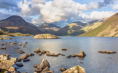
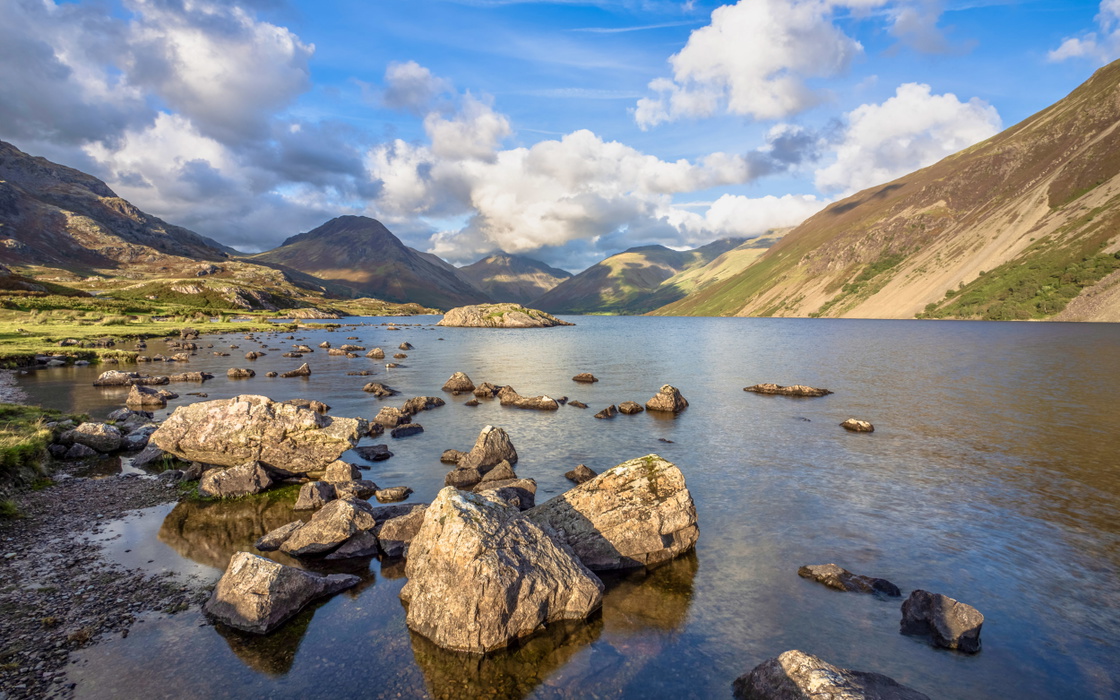
- Eskdale and Wasdale (Walks 9–17): Black Combe, Harter Fell, Scafell Pike, Scafell, and the ring of fells around Wasdale Head, including Pillar, Great Gable and Kirk Fell
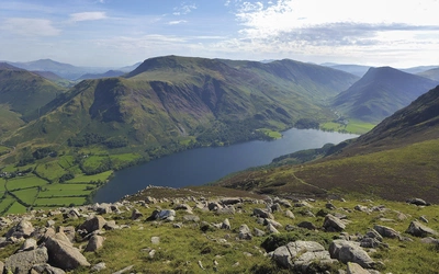
- Ennerdale and Buttermere (Walks 18–24): Haycock, Steeple, Mellbreak, the Grasmoor massif, and the High Stile and Buttermere fells
- Borrowdale and the northern fells (Walks 25–35): Great Gable and the Gable Girdle, Glaramara, the Newlands and Coledale Horseshoes, Skiddaw, Blencathra and Carrock Fell
- Helvellyn, Ambleside and Ullswater (Walks 36–48): The Dodds, Helvellyn from both north and south, the Fairfield and Scandale Horseshoes, and the Martindale and Riggindale skylines above Ullswater
- Kentmere and Longsleddale (Walks 49–50): The Ill Bell ridge and a final pair of fells above Longsleddale, where Lakeland gives way to the softer Pennine country
Three routes in the book are true horseshoes in the classic sense, the Fairfield, Newlands and Coledale rounds, though as the author points out, nearly every walk in the collection strings together more than one summit and returns to its start, so most have a horseshoe shape in practice.
The widest spread of distance and difficulty falls in Eskdale, Wasdale, Ennerdale and Buttermere, where the guide's longest and most committing Grade 3 days are concentrated. The Langdale, Coniston and Kentmere areas offer the narrowest range, making them a reliable starting point for readers working up to the harder walks further west.
Which Lake District walks are in the book?
| Walk | Distance | Height gain | Highlights |
|---|---|---|---|
| 1 - Lingmoor Fell | 13km (8.1 miles) | 615m (2020ft) | Exploring Great and Little Langdale via a heather ridge, Blea Tarn, a valley way and a picturesque footbridge |
| 2 - Pavey Ark and Harrison Stickle | 6.3km (3.9 miles) | 715m (2345ft) | Up Stickle Ghyll’s cascades to Stickle Tarn, with optional scramble of Jack’s Rake |
| 3 - Loft Crag and Pike o’Stickle | 11km (6.8 miles) | 730m (2395ft) | From Dungeon Ghyll to two summits, descent via Stake Pass and Mickledore |
| 4 - Bowfell and Rossett Pike | 15km (9.3 miles) | 965m (3165ft) | Ascending via The Band with option of the Climbers’ Traverse, finishing via Rossett Gill or Pike |
| 5 - Pike o’Blisco and Crinkle Crags | 12km (7.5 miles) | 1030m (3380ft) | Pitched path to an early summit, via Red Tarn to five ‘Crinkles’ on this classic Lakeland ridge walk |
| 6 - Wetherlam | 13.2km (8.2 miles) | 1090m (3575ft) | Coniston’s quieter side via Yewdale Fells, industrial workings of slate and copper and the fine Wetherlam Edge |
| 7 - Dow Crag and Coniston Old Man | 9.7km (6 miles) | 780m (2560ft) | Walna Scar Road to Coniston Old Man, with optional shortcut via Goat’s Water |
| 8 - Dow Crag, Brim Fell, Swirl How and Grey Friar | 18km (11.2 miles) | 1115m (3660ft) | Climbing the East Duddon skyline, with four fells, Seathwaite Tarn and the secret Wallowbarrow Gorge |
| 9 - Black Combe | 9km (5.6 miles) | 600m (1970ft) | Grassy paths over Lakeland’s southernmost fell |
| 10 - Harter Fell (Eskdale) and Hard Knott | 13.3km (8.3 miles) | 845m (2770ft) | A packhorse bridge to two rocky fells, with option of exploring a Roman fort |
| 11 - Scafell Pike and Esk Pike | 19.2km (11.9 miles) | 1170m (3840ft) | Long day in wildest Lakeland to England’s highest summit |
| 12 - Scafell and Slight Side | 14.5km (9 miles) | 1030m (3380ft) | Steady stages and easy scrambling to Scafell, with great views over the western Lake District |
| 13 - Illgill Head and Whin Rigg | 13.4km (8.3 miles) | 755m (2475ft) | Wasdale Screes from on high, along Wastwater’s stony apron |
| 14 - Great End, Scafell Pike and Lingmell | 13.5km (8.4 miles) | 1115m (3660ft) | Magnificent skyline traverse of Great End, Scafell Pike and Lingmell, with optional shortcut via the Corridor Route |
| 15 - Pillar, Scoat Fell, Red Pike and Yewbarrow | 16.2km (10.1 miles) | 1215m (3985ft) | Mosedale Horseshoe claiming Pillar and Red Pike, with optional scramble to Yewbarrow |
| 16 - Kirk Fell and Great Gable | 9.2km (5.7 miles) | 1035m (3395ft) | Abrupt ascent onto Kirk Fell, over Great Gable’s craggy stature, and down the scree path |
| 17 - Buckbarrow, Seatallan and Middle Fell | 13.4km (8.3 miles) | 805m (2640ft) | Green pasture ways, scarp banks and open fell tops, culminating in Seatallan |
| 18 - Crag Fell, Caw Fell and Haycock | 19.2km (11.9 miles) | 990m (3250ft) | Up to Crag Fell and along the Ennerdale fence to Haycock, with heather in descent |
| 19 - Steeple, Scoat Fell and Pillar | 22.1km (13.7 miles) | 1080m (3545ft) | A heathery rise onto Steeple, skyline traverse over Pillar and a long, dale-floor return |
| 20 - Mellbreak | 11.9km (7.4 miles) | 585m (1920ft) | Steep climb onto a long saddleback of heather, returning along Crummock Water’s quiet shores |
| 21 - The Grasmoor Massif | 16.7km (10.4 miles) | 1290m (4230ft) | Fine ridges on a high traverse of the northern massif rising above Crummock Water: Whiteside, Hopegill Head, Grasmoor, Wandope and Whiteless Pike |
| 22 - High Crag, High Stile and Red Pike | 11.6km (7.2 miles) | 875m (2870ft) | A sublime trio of peaks, with commanding views over Ennerdale and Buttermere |
| 23 - Haystacks | 12.6km (7.8 miles) | 650m (2135ft) | A magnificent tangle of rough fell over Haystacks, plus the beauty of Buttermere lake |
| 24 - Fleetwith Pike, Dale Head, Hindscarth and Robinson | 16.6km (10.3 miles) | 1280m (4200ft) | Steep ridgeline ascent to the noble peaks of Buttermere’s northern skyline |
| 25 - Green Gable and the Gable Girdle | 10km (6.2 miles) | 830m (2725ft) | Rocky tour via Gillercomb to Great Gable, the highlight a part-scramble across the lower portion of Great Napes |
| 26 - Rosthwaite Fell and Glaramara | 11km (6.8 miles) | 835m (2740ft) | Irregular ridge to Glaramara before skipping down Thornythwaite Fell |
| 27 - Eagle Crag, High Raise and Ullscarf | 14.7km (9.1 miles) | 910m (2985ft) | Eagle and Sergeant’s Crags, the central plateau of High Raise and Ullscarf before descending by Dock Tarn |
| 28 - High Spy, King’s How and Brund Fell | 12.6km (7.8 miles) | 1015m (3330ft) | Unlocking the jaws of Borrowdale, with Castle Crag an inner shorter option |
| 29 - The Newlands Round | 17.9km (11.1 miles) | 1165m (3820ft) | Off the Derwentwater launch from Keswick to climb five scenic fells: Catbells, Maiden Moor, High Spy, Dale Head and Hindscarth |
| 30 - Robinson, Knott Rigg and Ard Crags | 13.2km (8.2 miles) | 1000m (3280ft) | Another Newlands round, pitching up mighty Robinson and back along the lovely Knott Rigg/Ard Crags ridge |
| 31 - The Coledale Horseshoe | 15.3km (9.5 miles) | 1305m (4280ft) | A fine run of summits including Grisedale Pike, Hopegill Head, Crag Hill and the option of Causey Pike |
| 32 - The Mighty Skiddaw | 15.5km (9.6 miles) | 955m (3135ft) | The fine Ullock Pike ridge to prime Lakeland viewpoint Skiddaw Little Man, then Skiddaw itself with long views into Dumfries and Galloway |
| 33 - Carrock Fell and High Pike | 9.6km (6 miles) | 525m (1720ft) | Pasture tracks up two fells with a prehistoric ringwork and evidence of mineral mining |
| 34 - Bowscale Fell, Blencathra and Souther Fell | 14.4km (8.9 miles) | 905m (2970ft) | Grassy paths to Blencathra, option of descending Sharp Edge (*Grade 3), exclusive to experienced hill-goers |
| 35 - Blencathra Direct | 6.7km (4.2 miles) | 755m (2475ft) | Hall’s Fell ridge ascent can be tricky in adverse weather, descending by pleasant, heather-clad Doddick Fell |
| 36 - Doing the Dodds | 19.1km (11.9 miles) | 875m (2870ft) | Along the Old Coach Road to a great lasso of five summits: Clough Head, Great Dodd, Watson’s Dodd, Stybarrow Dodd and Hart Side |
| 37 - Raise, White Side and Helvellyn | 13.8km (8.6 miles) | 1040m (3410ft) | Helvellyn from the north on largely firm trails via Sticks Pass, the highest pass in Lakeland, finishing via Thirlmere |
| 38 - The Easedale Round | 14.5km (9 miles) | 900m (2955ft) | Helm Crag and Calf Crags ridge to Codale Head and Sergeant Man, returning to Grasmere by Easedale Tarn |
| 39 - The Fairfield Horseshoe | 17km (10.6 miles) | 1045m (3430ft) | Anti-clockwise round, the way fell-runners prefer, to Low Pike, High Pike, Dove Crag, Hart Crag, Fairfield, Great Rigg, Heron Pike and Nab Scar |
| 40 - The Scandale Horseshoe | 14.5km (9 miles) | 1015m (3330ft) | Red Screes, High Bakestones and the chiselled High and Low Pike ridge, with the option of returning down |
| 41 - Caudale Moor | 14.3km (8.9 miles) | 730m (2395ft) | From lakeside stroll to climbing Kirkstone Pass and Stoney Cove Pike, finishing down Caudale Moor’s north ridge |
| 42 - Dove Crag, Hart Crag and Hartsop above How | 10.6km (6.6 miles) | 755m (2475ft) | Up wooded Dovedale to Houndshope Cove and Dove Crag, returning with views into secretive Deepdale |
| 43 - Fairfield and St Sunday Crag | 14.1km (8.8 miles) | 965m (3165ft) | Seldom-seen Deepdale hides the fine Greenhow End approach to Fairfield |
| 44 - Dollywaggon Pike, Nethermost Pike, Helvellyn and Catstycam | 17km (10.6 miles) | 1000m (3280ft) | Helvellyn range’s southern end via Grisedale, with optional ridge ascents to Nethermost and Dollywaggon Pikes |
| 45 - The Glenridding Skyline | 16.2km (10.1 miles) | 1205m (3955ft) | All Helvellyn’s ridge options from Glenridding, centred on Striding Edge, finishing with Stybarrow Dodd and Sheffield Pike |
| 46 - Place Fell | 12km (7.5 miles) | 700m (2295ft) | Good paths to summit Place Fell, no finer viewing station for comprehending Helvellyn |
| 47 - The Martindale Skyline | 17.6km (10.9 miles) | 960m (3150ft) | Ridgeway walk to High Raise, Rampsgill Head, High Street, The Knott, Rest Dodd, Angletarn Pikes and Beda Head |
| 48 - The Riggindale Horseshoe | 11.5km (7.1 miles) | 810m (2655ft) | The ridges of Mardale: up Rough Crag to High Street, returning via Rampsgill Head and Kidsty Pike |
| 49 - The Ill Bell range | 19km (11.8 miles) | 1015m (3330ft) | Kentmere’s famous Ill Bell skyline via Yoke, Ill Bell, Froswick, Thornthwaite Crag, Mardale Ill Bell and the ancient Nan Bield Pass |
| 50 - Shipman Knotts, Kentmere Pike and Harter Fell (Mardale) | 12.7km (7.9 miles) | 685m (2245ft) | Fine ridge wander to two fine summits, returning via the craggy upper reaches of Longsleddale |
Which walks suit beginners, families or car-free days?
The guidebook itself flags a handful of routes as good entry points or practical choices beyond a car:
- First fellwalking adventures: Walk 1, Lingmoor Fell, is highlighted as an easily accessed, straightforward traverse with a marvellous view, reachable by bus from Ambleside
- Car-free options: Walk 33 (Carrock Fell and High Pike), Walk 46 (Place Fell, reached from Glenridding by bus or lake steamer), Walk 25 (Green Gable, from Seatoller via the Keswick bus), Walk 28 (a Borrowdale wander taking in High Spy, King's How and Brund Fell, reached by bus to Rosthwaite), and Walk 37 (Helvellyn from the west via Legburthwaite, on the year-round 555 service)
- Steady climbs with big rewards: The author separately singles out Walk 17 (Seatallan) and Walk 46 (Place Fell) as routes with secure paths and richly rewarding views, notably west towards the Helvellyn range, for walkers not yet ready for steeper ground
How difficult are the walks?
Every route is graded 1 to 3 on the guidebook's own scale. Grade 1 routes are devoid of serious hazard, need only straightforward map-reading, and take up to 6 hours. Grade 2 routes are more committing, calling for a full 8-hour day and a willingness to be remote from valley bases. Grade 3 routes are rougher and tougher, with the possibility of mild scrambling, and demand composure and a good head for heights on the optional harder sections.
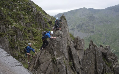
Sixteen of the 50 walks include a genuine, though generally brief, scrambling encounter: Walks 2, 3, 5, 7, 10, 12, 13, 14, 15, 16, 27, 30, 34, 35, 43 and 44. Almost all of these also offer a walking-only alternative for those who would rather avoid the scramble. One notable exception is flagged explicitly in the route summary table: the descent of Sharp Edge on Walk 34 is rated Grade 3 in its own right and is described as suitable only for experienced hill-goers, distinct from the Grade 1 rating of the main walk.
When is the best time to walk in the Lake District?
The fells are walkable throughout the year, but conditions vary sharply by season:
- Spring and autumn offer the most reliable underfoot conditions and clearer light, and are generally considered the sweet spot for the higher, more exposed routes in the book
- Summer brings the longest days, useful for the bigger Grade 2 and 3 outings such as Walk 19 (Steeple, Scoat Fell and Pillar) or Walk 49 (the Ill Bell range), though popular fells such as Scafell Pike and Helvellyn are busiest at this time
- Winter walking is entirely possible, and several of the author's own photographs in the book were taken in snow and ice, but the guidebook is explicit that winter conditions demand appropriate skills, equipment and route judgement, particularly on the Grade 3 scrambling sections
Whatever the season, the guide stresses checking the mountain forecast the night before and again on the morning of the walk, using the Met Office mountain forecast and the Mountain Weather Information Service (MWIS), since Lakeland weather is notoriously changeable.
What accommodation is available?
The walks are based around established Lake District centres rather than a single trailhead, so accommodation choice depends on which area of the book you are working through. Key bases include Ambleside, Grasmere, Keswick, Patterdale, Seatoller, Boot, Coniston, Ennerdale and Wasdale, each with a range of B&Bs, inns, campsites and, in the busier centres, hotels. Basing yourself in one of these towns for a few days makes it possible to pick off several neighbouring walks without moving accommodation, particularly around Ambleside (for the Langdale and Fairfield walks), Keswick (for the northern and Borrowdale fells) and Patterdale (for the Helvellyn and Ullswater walks). The guidebook does not include a dedicated accommodation appendix in the way a long-distance trail guide would, so it is worth booking centrally in your chosen base and checking availability directly with each town's tourist information service.
Getting there and back
Many of the walks can be reached without a car. The book's introductory essay by the Lake District National Park Authority's CEO makes a direct case for using public transport where possible, given how narrow the road network is and how limited open-country parking can be. In practice:
- Windermere is the nearest railway station for the southern and central walks (Langdale, Coniston, Ambleside, Grasmere)
- Penrith serves the northern and eastern fells (Ullswater, Helvellyn from the east, the Dodds) via connecting bus services
- Regular bus routes cover several trailheads directly, including the 555 (Ambleside–Keswick corridor, useful for Legburthwaite and Grasmere) and the 78 (Keswick to Seatoller and Rosthwaite, serving the Borrowdale walks)
- Lake steamers on Ullswater provide an alternative approach to Glenridding and Patterdale-based walks such as Walk 46, Place Fell
Where a car is unavoidable, the guide asks walkers to use formal car parks rather than roadside verges, both to keep routes open for emergency vehicles and because parking fees contribute directly to the upkeep of the fells through schemes such as Fix the Fells.
What are the route highlights?
- Scafell Pike and Esk Pike (Walk 11): England's highest summit, reached on a long day from Brotherilkeld through the wildest part of the National Park
- The Fairfield Horseshoe (Walk 39): A classic anti-clockwise ridge round from Ambleside taking in Dove Crag, Hart Crag, Fairfield and Heron Pike
- The Newlands Round (Walk 29): Five scenic fells above Derwentwater, including Catbells, Maiden Moor and Dale Head
- The Coledale Horseshoe (Walk 31): A fine run of summits from Braithwaite including Grisedale Pike and Hopegill Head
- Green Gable and the Gable Girdle (Walk 25): Singled out by the author himself as his pick for a single unmissable day, crossing the dramatic base of Great Napes
- Sharp Edge on Blencathra (Walk 34): One of the best-known optional scrambles in the Lake District, described in the guide as exclusive to experienced hill-goers
How does Fix the Fells relate to these walks?
The guidebook devotes a dedicated chapter to Fix the Fells, the partnership behind the upkeep of the paths described in every route. With around 18 million visitors a year and increasingly severe rainfall events, the fells' thin peaty soils and steep gradients are particularly vulnerable to erosion, and Fix the Fells' team of rangers and volunteers maintains 344 upland paths across the National Park using techniques from stone drains to sub-soil inversion. The guide encourages readers to support this work directly through a voluntary donation, noting that Fix the Fells currently raises over £750,000 a year to keep the paths in this book walkable.
Plan your walk with the Cicerone guidebook
The Best Walks in the Lake District guidebook by Mark Richards contains everything you need to choose and complete your own Great Mountain Day, from a first outing on Lingmoor Fell to the long wild days above Wasdale and Ennerdale.
- 50 fully described circular routes, each graded 1 to 3 for difficulty
- A route summary table covering distance, height gain, time and grade for every walk at a glance
- 1:40,000 Harvey Superwalker mapping (or four equivalent Ordnance Survey OL sheets)
- Mark Richards' signature hand-drawn fellscape diagrams for every route
- Foreword by Sir Chris Bonington and contemporary photography throughout by Grey O'Dwyer
- A dedicated "Best for" section highlighting routes suited to beginners, families and car-free days
- GPX files for every walk, available as a free download to registered guidebook owners
- Practical safety, weather and equipment advice, plus a chapter on the Fix the Fells conservation partnership
Available as a printed guidebook (£19.95) or digital eBook (£19.95). The routes are also available as a Cicerone app guide.
Best Walks in the Lake District
50 Great Mountain Days
£19.95
SALE
£16.96
The 50 best walks in the Lake District, including Scafell Pike, Helvellyn, Skiddaw, Blencathra and other lesser-known but wonderful hill walks. Each route is a Great Mountain Day, a rewarding and potentially challenging route exploring the natural beauty of Lakeland. Includes stunning photography, 1:40,000 Harvey maps and hand-drawn fellscapes for every route.
More informationAbout Mark Richards, guidebook author:
Mark was brought up to be a farmer in the Oxfordshire Cotswolds, yet it was his mother's roots in the Yorkshire Dales that influenced him most growing up, instilling a romantic desire to explore fell country as he got older. A love of pen drawing and the works of Alfred Wainwright played into his creative life. Indeed, he was fortunate enough to spend a dozen weekends as a house guest walking with the master guide writer, leading to a life-time's passion for his own brand of pictorial guides. His first guide was The Cotswold Way (published in 1973), and since 1980, when Cicerone Press commissioned a trio of guides to the Peak District, his attention has turned northwards to the Lake District and Hadrian's Wall. Mark also presents the popular Cumbrian podcast countrystride.co.uk, with regular monthly episodes, and Hefted, a Substack newsletter.