Walking in the North York Moors: a complete planning guide
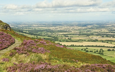
The moors of the North York Moors National Park are of no great height, yet they offer a wonderful sense of spaciousness, with extensive views opening out under a big sky. Deep, verdant dales and a remarkable cliff coastline add further variety. This planning guide draws on Paddy Dillon's Cicerone guidebook, describing 50 walks across seven regions and almost 725km (450 miles) in total, to help you plan your own trip to the area. (Last updated: July 2026 · Guidebook edition: 2nd edition, 2024 reprint)
Walking in the North York Moors, quick facts
- Location: North York Moors National Park, North Yorkshire, England
- Total routes: 50 walks: 35 day walks plus 15 longer routes, including the Lyke Wake Walk in four stages
- Distance range: Day walks 7–22km (4–14 miles); longer routes up to 65km (40 miles) for the full Lyke Wake Walk
- Typical duration: 2–7 hours for day walks
- Difficulty: Easy to strenuous, with routes suited to beginners, families and experienced walkers
- Terrain: Heather moorland, wooded dales, coastal cliffs, quiet lanes and historic villages
- Highest point: Round Hill, Urra Moor, 454m, the highest point in the North York Moors
- Navigation: 1:50,000 Ordnance Survey mapping for every route, plus downloadable GPX files
- Best season: Year-round, with spring and autumn favoured for quieter paths and settled weather
- Guidebook: The North York Moors, Paddy Dillon, 2nd edition, Cicerone Press.
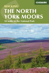
The North York Moors
50 walks in the National Park
£14.95
Guidebook describing 50 varied walks in England's beautiful North York Moors National Park. Showcasing the region's sweeping moorlands, sheltered valleys, woodlands and cliff coasts, routes range from short and easy low-level walks to long and strenuous routes across the high moors, including the Lyke Wake Walk.
More informationWhat is The North York Moors guidebook?
The North York Moors is Paddy Dillon's Cicerone guide to 50 walking routes across the North York Moors National Park, England's largest continuous expanse of heather moorland. The walks range from short, accessible paths through wooded valleys to long and exposed treks across the high moors, and the book includes a staged, four-day presentation of the classic Lyke Wake Walk for anyone who wants to cross the park's full width.
The routes are organised into seven regions: the Tabular Hills, Hambleton Hills, Cleveland Hills, Northern Moors, High Moors, Eastern Moors and Cleveland Coast. This structure mirrors the real character of the national park, from the deep, verdant dales and hoary stone villages inland to the dramatic cliff coastline of the North Yorkshire and Cleveland Heritage Coast. The long-distance Cleveland Way wraps itself around the moors and coast, and while this guidebook's 50 routes explore the park's charm, history, heritage and wildlife more widely, walkers wanting to follow that trail specifically should look to Cicerone's dedicated The Cleveland Way and the Yorkshire Wolds Way guidebook. Despite its wild appearance, this is also a working landscape: the heather moorland is actively managed for grouse shooting, and centuries of quarrying for alum, jet and ironstone have left their mark across the park, giving the walks a strong seam of industrial and social history alongside the scenery.
Paddy Dillon drafts his route descriptions on a tablet while actually walking, which gives the directions an unusual level of precision, written at the exact point on the ground where the reader will need them. This planning guide answers the most common questions walkers have before setting out. For complete stage-by-stage route descriptions and mapping, see the Cicerone The North York Moors guidebook.
How do the 50 walks divide across the North York Moors?
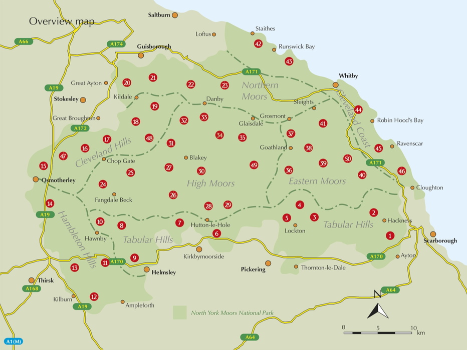
The book's 50 routes are grouped into seven geographic regions, plus a dedicated section for the Lyke Wake Walk:
- The Tabular Hills (Walks 1–10): Rolling, flat-topped hills and wooded valleys in the south of the park, including Forge Valley and the Hole of Horcum.
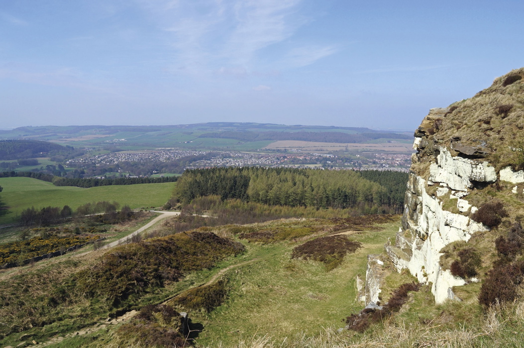
- The Hambleton Hills (Walks 11–14): The park's western edge, home to Rievaulx Abbey, Byland Abbey and the Sutton Bank escarpment with its famous White Horse.
- The Cleveland Hills (Walks 15–19): A prominent northern ridge overlooking the Vale of Mowbray, including Cringle Moor and Hasty Bank.
- The Northern Moors (Walks 20–23): Lower moorland fringes around Great Ayton and Guisborough, including Roseberry Topping, often nicknamed the Yorkshire Matterhorn.
- The High Moors (Walks 24–35): The remote heart of the national park, including Rosedale, Farndale and the old Rosedale Ironstone Railway.
- The Eastern Moors (Walks 36–41): Goathland and the moors around Wheeldale and Sleights, including Mallyan Spout waterfall.
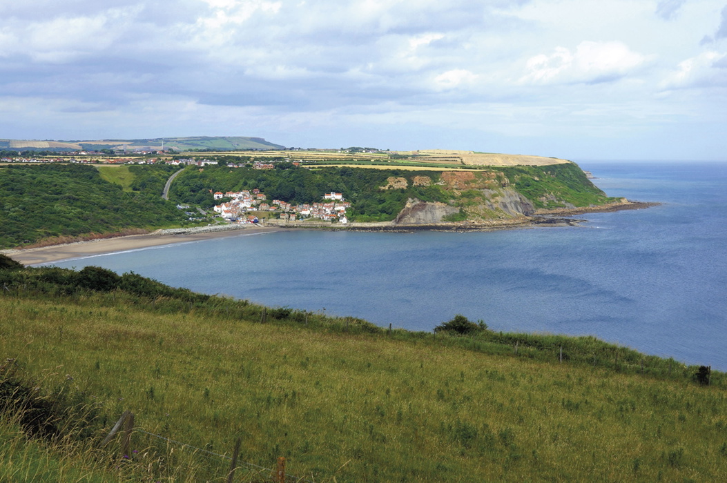
- The Cleveland Coast (Walks 42–46): The cliff coastline from Runswick Bay to Hayburn Wyke, taking in Whitby and Robin Hood's Bay.
- The Lyke Wake Walk (Walks 47–50): The classic east–west crossing of the moors, split into four stages for a multi-day challenge.
| Walk | Distance | Area | Why it stands out |
|---|---|---|---|
| Levisham and the Hole of Horcum | 10km (6¼ miles) | Tabular Hills | Circles the Hole of Horcum, a huge natural amphitheatre gouged from the moor edge, one of the park's best-known landscape features |
| Sutton Bank, Gormire Lake and the White Horse | 13.5km (8½ miles) | Hambleton Hills | Takes in the Sutton Bank escarpment, Gormire Lake and the chalk-cut Kilburn White Horse, with sweeping views over the Vale of York |
| Chop Gate, Urra Moor, Hasty Bank and Cold Moor | 14km (8¾ miles) | Cleveland Hills | Crosses Urra Moor to Round Hill, the highest point in the North York Moors at 454m, and passes the Wainstones rock outcrop |
| Great Ayton, Easby Moor and Roseberry Topping | 10.5km (6½ miles) | Northern Moors | Climbs Roseberry Topping, the distinctive cone-shaped hill long associated with a young Captain Cook |
| Rosedale Ironstone Railway around Rosedale Head | 17.5km (10½ miles) | High Moors | Follows the trackbed of the old ironstone railway that once carried Rosedale ore to the Middlesbrough blast furnace |
| Goathland, Simon Howe, Wheeldale and Mallyan Spout | 14.5km (9 miles) | Eastern Moors | Combines open moorland at Wheeldale with Mallyan Spout, one of the park's best-known waterfalls |
| Whitby, Saltwick Bay, Robin Hood's Bay and Hawsker | 21km (13 miles) | Cleveland Coast | Links two of the coast's best-known towns along the cliff path of the North Yorkshire and Cleveland Heritage Coast |
| Osmotherley, Carlton Bank, Cringle Moor and Hasty Bank | 17.5km (11 miles) | Lyke Wake Walk, Stage 1 | Opens the four-day Lyke Wake Walk crossing, following the Cleveland Hills ridge west to east |
Who is The North York Moors guidebook suitable for?
The book is built for a wide range of walkers. Many of the day walks in the Tabular Hills, Hambleton Hills and around the dale villages are on good paths through sheltered valleys and require no special equipment, making them suitable for beginners and families. The longer, higher routes across the Cleveland Hills, High Moors and Eastern Moors are a different proposition: these cross exposed, largely featureless moorland where good navigation is genuinely required, and walkers need to be equipped for changeable weather with little shelter available. The four-stage Lyke Wake Walk is aimed squarely at experienced, self-sufficient long-distance walkers looking for a genuine multi-day challenge.
How difficult are the walks?
Individual routes range from easy to strenuous, spanning 4 to 13½ miles. Terrain varies from gentle woodland and valley paths to exposed high moorland, so difficulty depends heavily on which region you choose. The lower-level walks in the Tabular Hills and around the dales are the easiest introduction to the park. The Cleveland Hills, High Moors and Eastern Moors routes are longer and more strenuous, crossing open moorland where paths can be indistinct and navigation skills matter. The Lyke Wake Walk, split into four stages, is the most demanding option in the book, an end-to-end crossing of the national park's high moors from west to east.
When is the best time to walk in the North York Moors?
- Spring and autumn are the favoured seasons, offering good weather with far fewer visitors than summer.
- Summer brings the moors into bloom, with the heather flushing purple across the high ground, but this is also the busiest season, and long heatwaves can leave the wider views hazy.
- Winter sharply reduces accommodation and transport options, and the exposed moorland offers little shelter from wind or rain. Clear winter days, however, can bring exceptional visibility, and snow transforms the high moors into something quite different.
What accommodation is available?
Accommodation is generally abundant around the North York Moors, though it is worth booking ahead, especially in peak summer and around the coastal resorts. Budget options lean heavily on campsites, as youth hostels are thin on the ground, with the surviving hostels at Whitby, Boggle Hole, Scarborough, Lockton, Helmsley and Osmotherley. B&Bs, guest houses and hotels are well represented in the coastal towns, though choice thins out in some of the quieter inland dales. The guidebook's Appendix B lists useful contacts, and the national park's own tourist information centres at Scarborough and Whitby can help with last-minute vacancies during busy periods.
Getting to and around the North York Moors
The nearest practical airports are Leeds Bradford and Teesside, with good rail links also available from the London airports and Manchester Airport. Scarborough has the best year-round rail connections, while Whitby can be reached directly by rail from Middlesbrough. National Express and Yorkshire Coastliner buses run daily services to Scarborough and Whitby, and Arriva buses cover the northern part of the park and the coast between Staithes, Whitby and Scarborough.
Within the park, the seasonal Moorsbus network is particularly useful for walkers, linking popular towns and villages with more remote start points on summer Saturdays, Sundays and Bank Holiday Mondays. As Paddy Dillon notes in the guidebook, timetables and the villages served can change from year to year, so it is worth checking the current schedule before relying on it. The Esk Valley line also runs daily Northern trains between Middlesbrough and Whitby, opening up a series of walks in the northern part of the park, and the seasonal steam-hauled North Yorkshire Moors Railway between Pickering and Goathland adds a further option for walkers who want a scenic approach to their route.
What are the route highlights?
- The Hole of Horcum, a vast natural amphitheatre on the edge of Levisham Moor
- Roseberry Topping, the distinctive cone-shaped summit above Great Ayton
- Rievaulx and Byland Abbeys, medieval monastic ruins in the Hambleton Hills
- The cliff coastline between Whitby and Robin Hood's Bay
- Mallyan Spout waterfall near Goathland
- The trackbed of the old Rosedale Ironstone Railway across the High Moors
The North York Moors
50 walks in the National Park
£14.95
Guidebook describing 50 varied walks in England's beautiful North York Moors National Park. Showcasing the region's sweeping moorlands, sheltered valleys, woodlands and cliff coasts, routes range from short and easy low-level walks to long and strenuous routes across the high moors, including the Lyke Wake Walk.
More informationPlan your North York Moors walk with the Cicerone guidebook
Fifty walks and a four-day crossing of the moors demand more detail than any single web page can hold. The Cicerone The North York Moors guidebook by Paddy Dillon contains precise route descriptions for every walk, worked out on the ground as he went.
- Detailed descriptions of all 50 walks across the seven regions of the national park
1:50,000 Ordnance Survey map extracts for every route - Downloadable GPX files for all routes, free to guidebook owners
- Practical information on terrain, refreshments, transport and accommodation for each walk
- A staged, four-day presentation of the classic Lyke Wake Walk
- Background on the park's history, industry and wildlife, including the alum, jet and ironstone industries and the management of the heather moorland for grouse shooting
- A route summary table (Appendix A) with distance, ascent and timing for every walk
- A useful contacts appendix covering accommodation, transport and visitor information
Available as a printed guidebook (£14.95) or digital eBook.
About Paddy Dillon, guidebook author
Paddy Dillon is a prolific walker and guidebook writer, with over 100 guidebooks to his name and contributions to 40 other titles. He has written for several outdoor magazines and other publications and has appeared on radio and television.
Paddy uses a tablet computer to write as he walks. His descriptions are therefore precise, having been written at the very point at which the reader uses them.
Paddy is an indefatigable long-distance walker who has walked all of Britain's National Trails and several European trails. He has also walked in Nepal, China, Korea and the Rocky Mountains of Canada and the US.