Walking in the North Pennines: a complete planning guide
This is a region of superlatives: once the world's greatest producer of lead, home to England's most powerful waterfalls, and holder of several records for extreme weather. For years the North Pennines was overlooked when national parks were being drawn up, surrounded on all sides by more popular neighbours, yet nowhere else in England is the land so consistently high, wild and remote. This planning guide brings together what you need before setting out, whether your walk follows an old, level railway trackbed or climbs the pathless, tussocky moorland of Cross Fell, at 893m the highest point in the Pennines. (Last updated: July 2026 · Guidebook edition: 3rd edition, reprinted October 2025)
Walking in the North Pennines, quick facts:
- Location: North Pennines National Landscape, spanning Cumbria, County Durham and Northumberland
- Total routes: 50 day walks
- Distance range: 9–24km (6–15 miles) per route
- Difficulty: Moderate to challenging, depending on route
- Terrain: Open moorland, grassy fells, riverside paths, stone tracks and upland plateaus
- Highest point: Cross Fell, 893m (2930ft)
- Navigation: OS 1:50,000 mapping recommended; GPX files downloadable for every route
- Best season: April to October, though the guidebook notes the region is walkable all year, with weather the main variable
- Guidebook: Walking in the North Pennines by Paddy Dillon, 3rd edition (reprinted October 2025), Cicerone Press
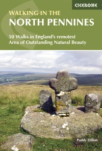
Walking in the North Pennines
50 Walks in England's remotest Area of Outstanding Natural Beauty
£12.95
This guidebook describes 50 day walks across the North Pennines, England's remotest Area of Outstanding Natural Beauty taking in parts of Cumbria, County Durham and Northumberland. Most of the routes are circular and they range from 5 to 14 miles, with something to suit all abilities. Route descriptions are accompanied by 1:50K OS mapping.
More informationWhat is Walking in the North Pennines?
Walking in the North Pennines is Paddy Dillon's guidebook to the North Pennines National Landscape, an upland region so consistently high, wild and remote that it was passed over entirely when England and Wales were drawing up their national parks. It was eventually designated an Area of Outstanding Natural Beauty in June 1988, becoming the 38th such designation in the country and, at 2000km² (772 square miles), the largest at the time. Since 2024 it has carried the National Landscape title. The boundary runs clockwise through Hexham, Consett, Barnard Castle, Kirkby Stephen, Appleby and Brampton, each acting as a gateway to the region, with the counties of Cumbria, Durham and Northumberland each claiming roughly a third share.
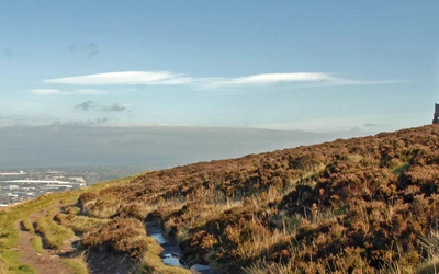
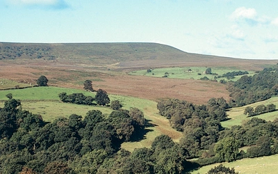
Walkers arriving from the more manicured Yorkshire Dales are often struck by how much wilder the North Pennines feels by comparison. The terrain swings between two moods: broad, bleak, blanket-bog moorland on the high tops, and gentler, greener dales below, most notably Teesdale and Weardale. Almost 30 per cent of England's blanket bog lies within the National Landscape, and 40 per cent of the country's upland hay meadows are found in the upper dales. The Pennine Way has run through the region since 1965, but for decades before and since, the North Pennines has remained one of England's quieter, less-visited landscapes.
The region's geology sets it apart further still. It was designated Britain's first Geopark in 2003 and became a UNESCO Global Geopark in 2015, recognition of a landscape shaped by 450-million-year-old Ordovician bedrock, Carboniferous limestone, and the dramatic Whin Sill, a sheet of dolerite that forms the cliffs at High Cup, Cronkley Scar and the waterfall steps of the River Tees. This planning guide answers the most common questions walkers have before setting out. For complete stage-by-stage route descriptions and mapping, see the Cicerone Walking in the North Pennines guidebook.
What are the best walking areas in the North Pennines?
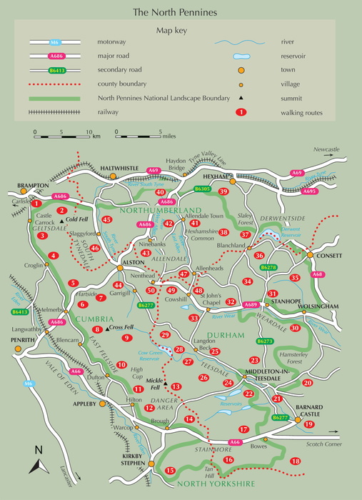
The North Pennines split into 13 distinct walking areas, from Geltsdale and the East Fellside in the west to Weardale, Allendale and the Dale-Heads in the east. Each has its own character: Teesdale for waterfalls, Weardale for industrial heritage, the East Fellside for the region's highest and wildest ground.
- Geltsdale (Walks 1-4): Brampton, Talkin, Croglin and Cold Fell, on the western fringe
- The East Fellside (Walks 5-10): Hartside, Cross Fell, Knock Fell and High Cup, where the Vale of Eden meets the Pennine escarpment
- Warcop Range (Walks 11-13): Murton Pike and Mickle Fell
- Stainmore (Walks 14-17): Nine Standards, the Tan Hill Inn and Sleightholme Moor
- Lower Teesdale (Walks 18-21): Barnard Castle, Brignall Banks and Romaldkirk
- Middle Teesdale (Walks 22-24): the Tees Railway Walk and Grassholme
- Upper Teesdale (Walks 25-29): Low Force, High Force, Cronkley Fell and Cow Green
- Weardale (Walks 30-34): Wolsingham, Stanhope, Rookhope and Chapelfell Top
- Derwentside (Walks 35-37): the Waskerley Way, Edmundbyers and Blanchland
- Devil's Water (Walks 38-39): Hexham's southern approaches
- Allendale (Walks 40-43): Allen Banks, Staward Gorge and Hexhamshire Common
- South Tynedale (Walks 44-46): Alston, Garrigill and Slaggyford
- The Dale-Heads (Walks 47-50): Allenheads, Killhope and Nenthead, at the head of Weardale
Eight routes to plan around
If you're planning around a handful of standout days rather than working through the guidebook area by area, these eight are worth prioritising.
| Route | Area | Distance | Why it stands out |
|---|---|---|---|
| Dufton, Great Rundale and High Cup | East Fellside | 16km (10 miles) | Leads to High Cup Nick, where the Whin Sill forms one of the most dramatic glacial valleys in England |
| Blencarn, Cross Fell and Kirkland | East Fellside | 17.5 or 22.5km (11 or 14 miles) | Climbs Cross Fell, the highest point in the Pennines at 893m, close to the weather station on Great Dun Fell that has logged record-breaking conditions |
| Low Force and High Force | Upper Teesdale | 13km (8 miles) | Follows the Tees past two of the region's best-known waterfalls, both created where the Whin Sill steps across the riverbed |
| Cow Green and Widdybank Fell | Upper Teesdale | 12km 7½ miles) | Crosses ground colonised by the rare Teesdale Assemblage of arctic-alpine plants, including spring gentian, on soil derived from the Whin Sill's "sugar limestone" |
| Cowshill and Killhope | The Dale-Heads | 13km (8 miles) | Passes Killhope, one of the best-preserved lead-mining sites from the region's era as the world's greatest lead producer |
| Allen Banks and Staward Gorge | Allendale | 14km (8¾ miles) | Explores one of the last surviving fragments of the North Pennines' original wildwood, and home to England's most northerly dormouse colony |
| Waskerley Way, Parkhead to Consett | Derwentside | 17km (10½ miles) | Follows a former railway trackbed, one of the level, easy-access routes that contrast with the region's open moorland walks |
| Kirkby Stephen and Nine Standards | Stainmore | 14km (8¾ miles) | Shares ground with the Pennine Way, the long-distance trail that first opened the North Pennines up to a wider audience of walkers from 1965 |
Who is Walking in the North Pennines suitable for, and how difficult is it?
The guidebook's own difficulty note describes a variety of terrain, from riverside strolls and old railway trackbeds to rugged, pathless moorland, with walks up to 14 miles (23km) but nothing technically difficult. The routes are graded to suit a wide range of abilities: shorter, lower-level walks along dismantled railways and dale paths are accessible to less experienced walkers, while routes onto the high moorland plateau, particularly around Cross Fell, Mickle Fell and the pathless sections of the East Fellside, demand more stamina and confident navigation.
The guidebook is explicit that map-reading ability is essential, not optional, because of how quickly conditions change on open moorland. This is not a region with a dense network of waymarked paths; much of the high ground was only opened up through the Countryside and Rights of Way Act 2000, which designated large areas as access land rather than formal rights of way. Walkers should carry OS Landranger sheets 86, 87, 91 and 92 (with one route straying onto sheet 88), or the more detailed OS Explorer sheets OL5, OL19, OL31, OL43, 307 and 315 for a full picture of access land.
What is the Helm Wind?
The North Pennines is home to the only named wind in Britain. The Helm Wind is tightly defined: it requires a northeasterly airflow of at least 25kph (a "moderate breeze" on the Beaufort Scale) that tracks in off the North Sea, rises across Hexhamshire Common, the moors above Nenthead, and finally Cross Fell and its neighbours at close to 900m, before running out of high ground and dropping suddenly down the East Fellside.
Two visible cloud features confirm it. The Helm Cap forms above the East Fellside as the rising air cools and its moisture condenses. Further out over the Vale of Eden, the cold air mass collides with warmer air already sitting in the valley, curling back on itself to form a thin, twisting band of cloud called the Helm Bar, which appears to hover in place no matter how hard the wind is blowing at ground level. Locally, the Helm Wind is said never to cross the Eden: its force is spent entirely on the East Fellside slope, which is why villages below were traditionally built with their backs to it. Walkers tackling the East Fellside routes, including the approach to Cross Fell, should treat a forecast northeasterly with respect.
When is the best time to walk in the North Pennines?
- Spring (April–May): Upper Teesdale's arctic-alpine flora, including spring gentian and mountain pansy, is best seen on the "sugar limestone" of Cronkley Fell and Widdybank Fell. This is also when black grouse perform their mating displays.
- Early summer (June–July): Hay meadows in Upper Teesdale and Weardale are left uncut later than elsewhere, so wildflowers have longer to seed; this is also when ground-nesting birds such as curlew, snipe and lapwing are most active on the moors, and dogs may be restricted on some access land.
- Late summer (August–September): Heather moorland is at its purple best. The grouse-shooting season runs from 12 August to 10 December, and some access land may be closed on shooting days, so check with the Open Access Contact Centre before setting out.
- Winter: The guidebook is candid that the North Pennines is walkable all year, but this is a region famous for extreme and fast-changing weather, with a weather station on Great Dun Fell recording some of the highest and coldest conditions in England. Deep blanket bog, sodden even in a heatwave, is often easiest to cross during a hard frost, when it freezes solid.
What accommodation is available?
Settlement across the North Pennines is sparse, especially in the northern dales, with the notable exception of Alston in South Tynedale, the largest town actually inside the National Landscape boundary. Stanhope and Middleton-in-Teesdale sit just outside the boundary and function as key bases for Weardale and Teesdale respectively. Other useful centres ring the edge of the region: Hexham, Consett, Barnard Castle, Kirkby Stephen, Appleby and Brampton.
Because facilities are thinly spread, it is worth planning accommodation and refreshment stops in advance rather than relying on passing trade, particularly on the longer moorland routes. The guidebook's Appendix B lists useful contacts, and a network of tourist information centres and heritage visitor centres, several themed around the lead-mining industry, can help with local recommendations. Each walk description in the guidebook includes a Refreshments heading summarising pubs and cafés on that specific route.
Getting there and back
By air: Newcastle Airport has the best connections, linked to Newcastle Central Station by Metro. Teesside International Airport is smaller but connects to Darlington via the Stagecoach number 6 bus. Leeds Bradford Airport connects via Transdev Flyer buses to Leeds, from where the Settle to Carlisle line reaches the Vale of Eden.
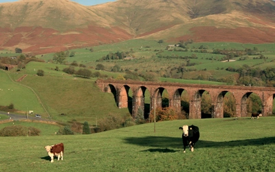
By rail: No railway penetrates the North Pennines itself, but lines almost encircle it. CrossCountry and LNER serve Darlington, Durham and Newcastle from the south, while Avanti West Coast reaches Carlisle from London Euston. The Settle to Carlisle line, run by Northern, serves Kirkby Stephen, Appleby and Langwathby along the Vale of Eden. Two short heritage lines run inside the region itself: the Weardale Railway between Wolsingham, Frosterley and Stanhope, and the narrow-gauge South Tynedale Railway between Alston and Kirkhaugh.
By road and bus: National Express runs to Newcastle and Carlisle from London Victoria. Within the region, bus travel requires patience: very few services connect one dale to the next, so Bus Times (bustimes.org) or Traveline are essential planning tools. Local operators include Stagecoach, Fellrunner (East Fellside), Telfords and Wrights Bros (Alston area), Go North East (Allendale), Weardale Travel (Weardale and Teesdale) and Hodgsons and JH Coaches (Teesdale and cross-country links). The guidebook notes that most of its routes were researched using these local bus services, so public transport access is genuinely viable for much of the region, just not for linking dales in a single day.
What are the route highlights?
- High Force and Cauldron Snout (waterfalls created where the Whin Sill steps across the River Tees)
- High Cup Nick (a dramatic glacial valley on the East Fellside, rimmed by Whin Sill cliffs)
- Cross Fell (the highest point in the Pennines at 893m, overlooked by the record-breaking weather station on Great Dun Fell)
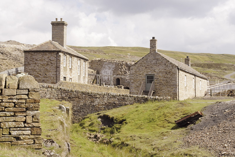
- Killhope (a preserved lead-mining site recalling the region's era as the world's greatest lead producer)
- The Teesdale Assemblage (rare arctic-alpine plant communities on Cronkley Fell and Widdybank Fell)
- Frosterley Marble (a fossil-rich, polishable limestone unique to Weardale)
Walking in the North Pennines
50 Walks in England's remotest Area of Outstanding Natural Beauty
£12.95
This guidebook describes 50 day walks across the North Pennines, England's remotest Area of Outstanding Natural Beauty taking in parts of Cumbria, County Durham and Northumberland. Most of the routes are circular and they range from 5 to 14 miles, with something to suit all abilities. Route descriptions are accompanied by 1:50K OS mapping.
More informationPlan your North Pennines walks with the Cicerone guidebook
Walking in the North Pennines by Paddy Dillon contains everything you need to plan and complete 50 day walks across the region, from Geltsdale in the west to the Dale-Heads above Weardale.
- 50 circular and linear day walks, ranging from 9–24km (6–15 miles)
- OS 1:50,000 mapping extracts for every route, with downloadable GPX files
- Practical route headings for Start/Finish, Distance, Terrain, Maps, Refreshments and Transport
- A detailed introduction covering the region's geology, landscape, mining heritage, weather and wildlife
- Appendix A: a full route summary table to help you choose the right walks for your ability and time
- Appendix B: useful contacts for tourist information, transport and access enquiries
- Coverage of access land, the Countryside and Rights of Way Act 2000, and grouse-shooting season closures
Available as a printed guidebook (£12.95) or digital eBook.
About Paddy Dillon, guidebook author
Paddy Dillon is a prolific walker and guidebook writer, with over 100 guidebooks to his name and contributions to 40 other titles. He has written for several outdoor magazines and other publications and has appeared on radio and television.
Paddy uses a tablet computer to write as he walks. His descriptions are therefore precise, having been written at the very point at which the reader uses them.
Paddy is an indefatigable long-distance walker who has walked all of Britain's National Trails and several European trails. He has also walked in Nepal, China, Korea and the Rocky Mountains of Canada and the US.