Walking in the Yorkshire Dales South and West: a complete planning guide
Where the Pennine Way drops south into Craven, the sombre mill valleys give way to something altogether brighter: rolling green hills broken by rugged scars of white limestone, rising to a distant higher ground dissected by deepening valleys. This is the southern and western Yorkshire Dales, where the Great Scar Limestone underlies some of the most dramatic karst scenery in England. Malham Cove, Gordale Scar, rivers that vanish into the ground and reappear miles later as if nothing had happened. The landscape here does things you do not expect. Walking in the Yorkshire Dales: South and West by Dennis and Jan Kelsall brings together 44 circular day walks from 5.6 to 21 km (3.5 to 13 miles) plus the Yorkshire Three Peaks Challenge at 37 km (23 miles) across Wharfedale, Littondale, Malhamdale, Ribblesdale and Dentdale. (Last updated: June 2026 · Guidebook edition: 2nd edition, updated March 2022)
Walking in the Yorkshire Dales: South and West, quick facts:
- Location: South and West Yorkshire Dales National Park
- Total routes: 44 circular day walks plus the Yorkshire Three Peaks Challenge
- Distance range: 5.6–21 km (3.5–13 miles) per walk; Three Peaks Challenge 37 km (23 miles)
- Typical duration: 2–5 hours per day walk
- Difficulty: Gentle valley walks to more demanding upland routes; suitable for novices to experienced walkers
- Terrain: Great Scar Limestone outcrops, upland moors, river valleys, dramatic gorges, woodlands and waterfalls
- Highest point: Whernside, 736m (2415ft)
- Navigation: 1:50,000 OS map extracts and full route descriptions provided for each walk
- Best season: Year-round; appropriate equipment essential on high ground in winter
- Guidebook: Walking in the Yorkshire Dales: South and West by Dennis and Jan Kelsall, 2nd edition
Walking in the Yorkshire Dales: South and West
Wharfedale, Littondale, Malhamdale, Dentdale and Ribblesdale
£14.95
Part of a 2-book set, this guidebook describes 44 walks in the southern and western Yorkshire Dales, including the famous 23 mile Three Peaks circuit over Pen-y-Ghent, Whernside and Ingleborough. The other, mostly circular routes of 3½ to 13 miles cover the scenic region between Sedbergh, Kirkby Lonsdale, Settle, Skipton and Grassington.
More informationWhat is Walking in the Yorkshire Dales: South and West?
Walking in the Yorkshire Dales: South and West is a collection of 44 circular day walks covering the southern and western catchments of the Yorkshire Dales National Park: Wharfedale, Littondale, Malhamdale, Ribblesdale and Dentdale. It forms the first of a two-volume set, the companion volume covering the northern and eastern Dales. The walks range from gentle riverside strolls of under an hour to full-day upland treks, and include the famous 23-mile (37km) Yorkshire Three Peaks Challenge over Pen-y-ghent, Whernside and Ingleborough.
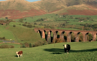
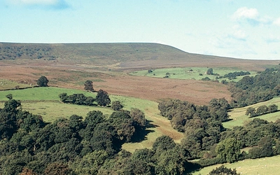
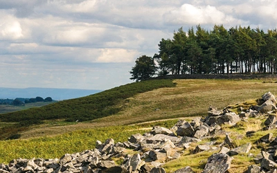
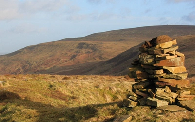
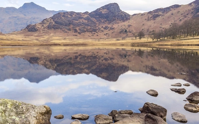
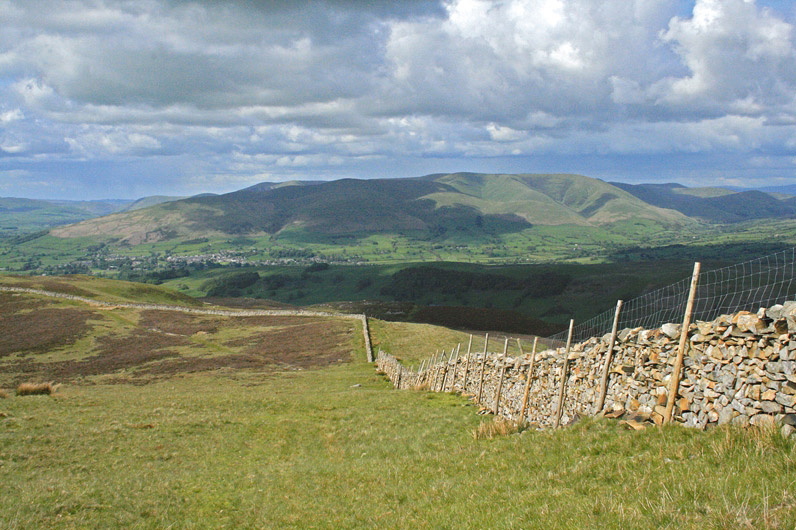
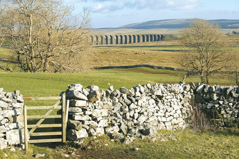
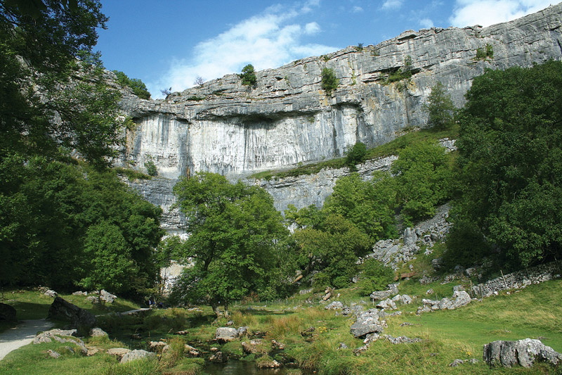
The southern and western Dales are, above all, limestone country. The area is dominated by the Great Scar Limestone, whose presence gives rise to some of the most spectacular karst scenery in England: the soaring cliff of Malham Cove, the towering walls of Gordale Scar, the pothole of Gaping Gill, the dissolving and reappearing rivers of Littondale, the broad expanse of limestone pavement above Malham Tarn. Higher and further north, this gives way to the Yoredale Series, the distinctive stepped terracing of the northern fells, while to the south-east the darker millstones and sandstones of the South Pennines fringe the National Park. Each valley has a character subtly different from its neighbours: the intimacy of Dentdale, with its hedgerows and westward views to the Cumbrian mountains; the youthful exuberance of upper Langstrothdale; the grand, open plateau walking of the Three Peaks country.
What gives this collection its particular appeal is the balance it strikes between accessibility and genuine remoteness. Many of the most celebrated sites in the Dales lie within this volume, yet even on the busiest summer weekend the authors know, as they put it, that you "need not wander far to experience a sense of quiet and freedom." This planning guide answers the most common questions walkers have before setting out. For complete route descriptions and mapping, see the Cicerone Walking in the Yorkshire Dales: South and West guidebook.
How the south and west Yorkshire Dales divides: the 44 routes at a glance
The guidebook organises its 44 walks into six geographic chapters, each covering a distinct valley or area of the southern and western Dales. The Three Peaks Challenge, at 37 km (23 miles), sits in the Ribblesdale chapter and is distinct in scale and ambition from the rest.
| Chapter | Area | Number of walks |
|---|---|---|
| 1 | Lower Wharfedale and Barden Moor | 6 |
| 2 | Upper Wharfdale | 7 |
| 3 | Littondale | 4 |
| 4 | Malhamdale | 7 |
| 5 | Dentdale and the Western Outliers | 8 |
| 6 | Around Ribblesdale (including Yorkshire Three Peaks) | 12 |
The structure broadly follows the landscape from south-east to north-west, beginning in the accessible lower reaches of Wharfedale around Bolton Abbey and Grassington, before climbing into the remoter upper valleys and across the limestone uplands of the Three Peaks country. Routes in the western chapters, particularly around Dentdale and the outlying fells, tend to visit quieter and less frequented ground.
Who is this guidebook suitable for and how difficult are the walks?
Walking in the Yorkshire Dales: South and West is designed for the full range of walkers, from those new to countryside walking to experienced ramblers seeking off-the-beaten-track routes. The guidebook itself makes clear that it offers "something for everyone, from gentle valley and hillside walks to more demanding upland romps."
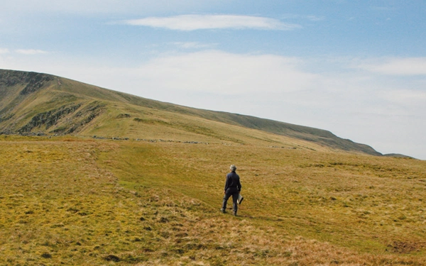
For most of the 44 circular walks, the terrain is hilly rather than mountainous. Height gains across the collection range from around 190m to 730m, and any steep sections are generally brief. Beyond the Three Peaks, none of the routes is technically demanding, and in good weather most pose few navigational difficulties.
Where walkers should be more careful is on the upper moors and high fells, where paths can be vague or absent, weather can deteriorate rapidly, and a basic understanding of map and compass use is genuinely useful. The Dentdale outliers and some of the remote Littondale and upper Wharfedale walks involve more sustained upland walking where the consequences of poor visibility are greater.
Dogs are welcome on most routes, but should be kept on a close lead near livestock and during the bird-breeding season from 1 March to 31 July. On grouse moors including Barden Moor and Barden Fell, dogs are not permitted at any time other than on designated public rights of way.
What is the Yorkshire Three Peaks Challenge and how difficult is it?
The Yorkshire Three Peaks is a single-day walking challenge that takes in the summits of Pen-y-ghent (694m), Whernside (736m) and Ingleborough (723m) in a circuit of approximately 37 km (23 miles) with around 1600m of ascent. Most participants begin and end at the café in Horton-in-Ribblesdale. The challenge, by convention, is to complete the circuit in under 12 hours, though there is no requirement to attempt it to a time limit.
The Three Peaks is included as Walk 44 in the guidebook and is by some distance the most demanding route in the collection. The paths on the most popular sections are heavily eroded in places and extensive paving has been laid to manage the impact of very high footfall. Despite this, the Three Peaks remains a fine and rewarding walk in its own right. Pen-y-ghent in particular, approached from the south along the Pennine Way, has, as the guidebook notes, "all the expectancy and sense of achievement of a real mountaineering peak."
The Three Peaks should not be underestimated. Full waterproofs, warm layers, adequate food and water, map and compass are essential. The route requires a full day and good fitness.
When is the best time to walk in the Yorkshire Dales: South and West?
The guidebook recommends year-round walking, and the southern and western Dales genuinely reward visits in every season, though the character of the landscape changes considerably.
- Spring (March to May): The limestone grasslands come into flower, with an extraordinary variety of small flowers across the pastures: buttercups, rock rose, cranesbill and campion. The hay meadows begin to green up, and birds are most active across the moors and valleys. Longer days make for greater flexibility. Note that bird-breeding restrictions on access land apply from 1 March to 31 July.
- Summer (June to August): The hay meadows are at their finest in June. Long days allow for the more demanding full-day routes, and the Three Peaks is at its most popular. The park draws around 9.5 million visitors annually, and the most famous sites (Malham Cove, Gordale, Bolton Abbey) are busiest in July and August. Even so, venturing slightly off the popular routes reliably brings solitude.
- Autumn (September to October): September is often the best month of the walking year in the Dales. The heather moorland blazes purple well into September; visitor numbers begin to fall; the air is generally clear. Deciduous woodland around Wharfedale, Grass Wood and the valley bottoms provides good colour from October.
- Winter (November to February): The Dales in winter can be stunning and the shorter walks to valley features and limestone landmarks are perfectly manageable on clear days. High routes and moorland walks require full winter kit, sound navigation and appropriate experience. Snow and ice on the tops should be taken seriously. Days are short, so timing is important.
What accommodation is available for walking in the southern and western Dales?
The south and west of the Yorkshire Dales National Park is well served by accommodation for day walkers. The main centres for the walks in this guidebook include Skipton, Settle, Grassington, Malham, Kirkby Lonsdale, Sedbergh, Dent and Clapham, and most offer a range of bed and breakfast, inn and hotel accommodation. The national park has a good reputation for food, and pubs, cafés and tea rooms are noted for individual walks throughout the guidebook.
The area is compact enough that most of the walks can be reached on day visits from a single base, though staying at different centres across a week allows a fuller exploration of the separate valleys. Grassington makes a good base for Wharfedale and Malhamdale routes; Settle or Horton-in-Ribblesdale for the Three Peaks and Ribblesdale walks; Dent or Sedbergh for the western outliers.
Camping is available throughout the area, particularly near the popular walking centres. Full accommodation listings are in Appendix 2 of the guidebook and via the Yorkshire Dales National Park accommodation directory.
How do I get to the Yorkshire Dales: South and West?
The southern and western Dales are among the better-served parts of the national park for public transport, and the guidebook actively encourages walkers to leave the car behind.
By rail: The Settle–Carlisle line is the most useful rail route, with stations at Skipton, Settle, Horton-in-Ribblesdale, Ribblehead, Dent Head and Garsdale. Leeds and Bradford offer good national connections to Skipton, from which buses extend into Wharfedale and Malhamdale.
By bus: Regular bus services run into most of the main dales, with additional services at weekends and during summer. Full details are available from the Travel Dales website (www.traveldales.org.uk), which covers public transport options across the whole national park.
By car: Most walks start from recognised car parks, details of which are given at the head of each route. The revenue from national park car parks supports services for visitors. The guidebook notes that the roads of the Dales were "never intended for today's traffic volumes" and urges considerate parking where no car park is available.
What makes walking in the south and west Yorkshire Dales special?
The geology of the area is the source of much that makes it distinctive. The Great Scar Limestone, which underlies and outcrops across the south-western corner of the national park, produces a landscape found nowhere else in England at this scale: the great white cliff of Malham Cove, cut by meltwater at the end of the last ice age; the massive walls of Gordale Scar; the limestone pavements above Malham Tarn with their deep grikes sheltering an astonishing variety of plant life; the countless potholes, cave systems and disappearing rivers of the karst. The Yorkshire Three Peaks, Pen-y-ghent, Whernside and Ingleborough, rise in stepped Yoredale terracing above the head of Ribblesdale and collectively form the most celebrated walking challenge in the north of England.
But the quality of walking here is not simply a matter of landmark destinations. The interplay between upland and valley is what gives the Dales their enduring character: walled pastures climbing the lower slopes, isolated field barns, the settlement pattern of compact villages and individual farmsteads that has scarcely changed in outline over centuries. Wharfedale, which the guidebook describes as perhaps more than any other encapsulating "the spirit of the Dales", runs for some 30 miles (48km) from Cam Fell to Bolton Abbey, passing through terrain of extraordinary variety. Dentdale, west-facing and hedged rather than walled, feels subtly different again, looking out not onto lowland plains but the mountains of Cumbria.
For the walker new to the Dales, this volume provides an invaluable introduction. For those who know the area well, the guidebook offers routes into less frequented corners alongside the established favourites. Either way, there is, as the authors put it, "something for everyone from the very first step."
South and West or North and East: which Yorkshire Dales guidebook do I need?
Walking in the Yorkshire Dales: South and West and its companion volume, Walking in the Yorkshire Dales: North and East, together cover the full Yorkshire Dales National Park. Both are written by Dennis and Jan Kelsall and follow the same structure, so the choice comes down to where you want to walk.
Choose South and West if:
- Your base is Grassington, Settle, Skipton, Malham, Horton-in-Ribblesdale, Dent or Sedbergh
- You want to walk in Wharfedale, Malhamdale, Ribblesdale, Littondale or Dentdale
- The Yorkshire Three Peaks (Pen-y-ghent, Whernside and Ingleborough) is on your list
- You are drawn to the Great Scar Limestone scenery: Malham Cove, Gordale Scar, limestone pavements, karst valleys
Choose North and East if:
- Your base is Hawes, Leyburn, Reeth, Pateley Bridge or Kirkby Stephen
- You want to walk in Swaledale, Wensleydale, Nidderdale, Coverdale or Mallerstang
- The Howgill Fells or the landscapes of the eastern Dales are your priority
- You want to explore Aysgarth Falls, Brimham Rocks or the valleys of the northern park
If you want both halves of the Dales, the two volumes are designed to work together as a set. Between them they cover 87 circular day walks across the entire national park, making them a comprehensive walking library for anyone who returns to the Dales regularly.
Plan your walk with the Cicerone guidebook
The Cicerone Walking in the Yorkshire Dales: South and West guidebook by Dennis and Jan Kelsall contains everything you need to plan and walk all 44 circular day walks and the Yorkshire Three Peaks Challenge across Wharfedale, Littondale, Malhamdale, Ribblesdale and Dentdale.
- 44 circular day walk descriptions plus the Yorkshire Three Peaks Challenge, with start and finish locations, parking and public transport details, and notes on local pubs, cafés and tea rooms
- 1:50,000 OS map extracts for every walk, showing the general outline of the route
- Estimated walking times based on Naismith's Rule, with practical notes on terrain and navigation for each routeBackground information on the geology, history, farming, plants and wildlife of the southern and western Dales, included throughout
- the walk descriptions
- Full practicalities section covering navigation, clothing, food and drink, transport and access land
- Appendix 1: route summaries and suggestions for combining walks into longer itineraries
- Appendix 2: where to find out more, including transport, accommodation and visitor information
Part of a two-volume set: the companion guide Walking in the Yorkshire Dales: North and East covers Swaledale, Wensleydale, the Howgills, Mallerstang, Coverdale and Nidderdale.
Available as a printed guidebook (£12.95) or digital eBook.
Walking in the Yorkshire Dales: South and West
Wharfedale, Littondale, Malhamdale, Dentdale and Ribblesdale
£14.95
Part of a 2-book set, this guidebook describes 44 walks in the southern and western Yorkshire Dales, including the famous 23 mile Three Peaks circuit over Pen-y-Ghent, Whernside and Ingleborough. The other, mostly circular routes of 3½ to 13 miles cover the scenic region between Sedbergh, Kirkby Lonsdale, Settle, Skipton and Grassington.
More informationAbout Dennis and Jan Kelsall, guidebook authors
Both native Lancastrians, Dennis and Jan Kelsall have long held a passion for countryside and hill walking. Since their first Cicerone title was published in 1995, they have written, contributed and illustrated over 50 guides covering some of Britain’s most popular walking areas and have become regular contributors to various outdoor magazines. Their enjoyment of the countryside extends far beyond a love of fresh air, the freedom of open spaces and an appreciation of scenery. Over the years Dennis and Jan have developed a wider interest in the environment, its geology and wildlife, as well as an enthusiasm for delving into the local history that so often provides clues to interpreting the landscape.