Walking in the Chilterns: a complete planning guide
Inspired by Steve Davison's Cicerone guidebook, this planning guide provides everything you need to know about walking in the Chiltern Hills, from where to stay and the best time to go, to choosing the right route from the 35 day walks on offer in the guidebook. The Chilterns are definitely "hilly," though they never trouble the map's higher contours: instead there's beech and oak woodland giving way to open chalk grassland, flint-walled villages and quiet chalk streams, all within easy reach of London yet full of genuine peace and tranquillity. (Last updated: July 2026 · Guidebook edition: 2nd edition, reprinted December 2025)
Walking in the Chilterns, quick facts
- Location: Chiltern Hills National Landscape (formerly AONB), Oxfordshire, Buckinghamshire, Hertfordshire and Bedfordshire
- Total routes: 35 circular day walks
- Distance range: 6–19km (4–12 miles)
- Typical duration: 2–6 hours per walk
- Difficulty: Easy to moderate; suitable for most walkers
- Terrain: Woodland tracks, chalk escarpments, river valleys and rural paths, with occasional steep but short climbs and descents
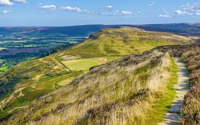
- Highest point: Haddington Hill, 267m (though Coombe Hill at 260m and Beacon Hill near Ivinghoe at 249m offer the more prominent, panoramic viewpoints)
- Navigation: OS 1:50,000 Landranger extracts reproduced at 1:40,000; GPX files provided for every walk
- Best season: Year-round; spring and early summer for wildflowers, autumn for colour, winter for clear long-distance views
- Guidebook:Walking in the Chilterns, Steve Davison, 2nd edition (Cicerone)
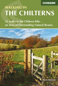
Walking in the Chilterns
35 walks in the Chiltern hills - an Area of Outstanding Natural Beauty
£14.95
This guidebook to Walking in the Chilterns offers 35 of the best walks in the Chilterns Area of Outstanding Natural Beauty. The Chiltern Hills is a peaceful walking destination of chalk hills and ancient woodlands within easy reach of London. The walks in this guidebook range from 4 to 12 miles and are suitable for most walkers. GPX files available to help with navigation.
More informationWhat is the Chilterns like for walking?
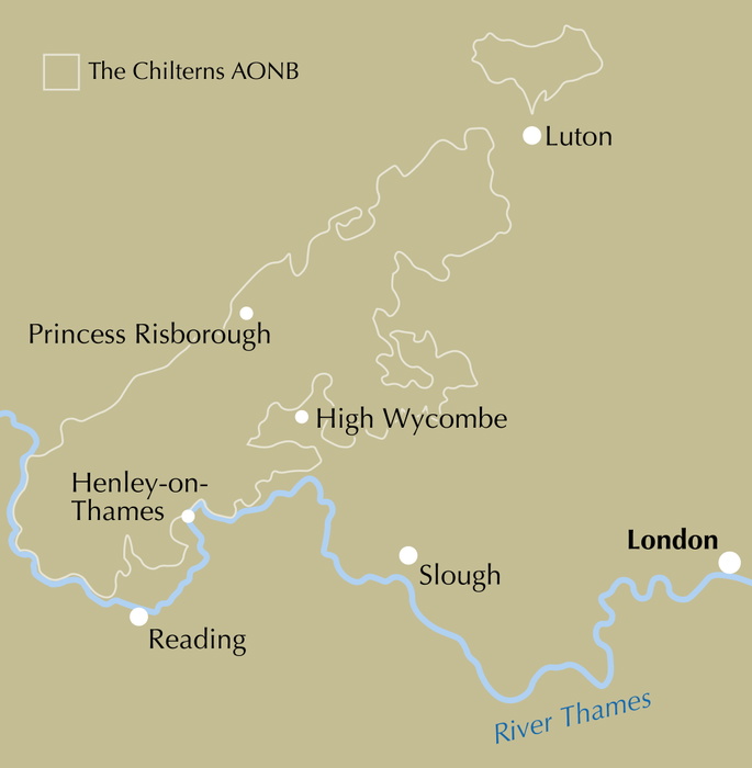
The Chilterns is a chalk upland running for roughly 70km from the Thames at the Goring Gap in Oxfordshire, through Buckinghamshire, to Dunstable and Luton in Bedfordshire and Hertfordshire, and it is one of England's most accessible walking destinations, being within easy reach of London while remaining genuinely peaceful underfoot. Around a fifth of the National Landscape is covered by ancient beech and oak woodland, which gives way along the northern scarp to open chalk grassland at spots like Ivinghoe Hills and Dunstable Downs, so a day out here moves between wooded valleys, flint-walled villages and panoramic viewpoints in a way few other lowland destinations can match.
Chalk streams rise from the spring-line below the downs, historic churches and Iron Age hill forts sit along many of the routes, and the landscape itself has drawn writers and artists for centuries, including the WWI poet Rupert Brooke. Despite half a million people living within 3km of its boundary, the Chilterns retain a genuine sense of peace: birdsong in the ancient woods, skylarks over open grassland, and long views from the escarpment on a clear day.
Steve Davison's Cicerone guidebook, Walking in the Chilterns, is built to help walkers plan a visit to this area, covering 35 circular day walks grouped into six geographic sections running broadly south to north and east to west across the hills, from the Thames-side villages around Goring and Henley to the open chalk grassland north of Luton. This planning guide answers the most common questions walkers have before setting out. For complete stage-by-stage route descriptions and mapping, see the Cicerone Walking in the Chilterns guidebook.
How the Chilterns walks divide
The guidebook's 35 walks are organised into six geographic sections, each covering a distinct stretch of the Chilterns:
- North of Luton (Walks 1–3): open chalk grassland at Sharpenhoe Clappers, Barton Hills and Pegsdon Hills
- Dunstable to Berkhamsted (Walks 4–9): the Dunstable Downs, Ivinghoe Beacon, the Grand Union Canal and Ashridge, including Berkhamsted's Norman castle
- Wendover to Stokenchurch (Walks 10–17): the highest ground in the guide, including Coombe Hill, Whiteleaf Hill and the Iron Age earthworks at Cholesbury
- Amersham to High Wycombe (Walks 18–21): river valleys including the Chess, plus Hughenden and West Wycombe
- Watlington and Nettlebed (Walks 22–30): Watlington Hill, Grim's Ditch and the clay country around Nettlebed
- Along the Thames (Walks 31–35): riverside walking between Hambleden, Henley-on-Thames and Goring
8 walks in the Chiltern Hills
| Walk | Distance (km (miles)) | Time (hrs) | Why it stands out |
|---|---|---|---|
| Ivinghoe Beacon, Ivinghoe and Pitstone | 13 or 8.4 (8 or 5¼) | 3¾ or 2½ | Open chalk grassland walking to Beacon Hill (249m), one of the guide's best panoramic viewpoints |
| Berkhamsted, Nettleden and Little Gaddesden | 16.9 or 12.5 (10½ or 7¾) | 5 or 3½ | Takes in Berkhamsted's Norman motte and bailey castle and Ashridge estate |
| Cholesbury and Hawridge | 8.1 (5) | 2½ | Passes the earthworks of an Iron Age hill fort |
| Wendover, Ellesborough, Chequers and Coombe Hill | 12 (7½) | 3½ | Climbs to Coombe Hill (260m), one of the most prominent viewpoints in the Chilterns |
| Whiteleaf Hill and Great Kimble | 8 (5) | 2½ | Visits a Neolithic burial mound at Whiteleaf Hill |
| Grand Union Canal and Tring Park | 12.8 (8) | 3½ | Canal-side walking through Tring Park, home to the area's edible dormice |
| Nettlebed and Nuffield | 14.6 or 12.8 (9 or 8) | 4 or 3½ | Passes through Nettlebed's historic brick and tile-making country and Grim's Ditch |
| Hambleden, Medmenham and the River Thames | 13.6 (8½) | 3¾ | Follows the Thames past sites of former Roman villas in the river valley |
Distance, ascent and timing for each of the 35 walks are given in full in Appendix A of the guidebook.
Who is Walking in the Chilterns suitable for?
The guide is aimed at "most walkers," in the author's own words, rather than specialists. Distances run from a short 6km (4-mile) ramble up to a fuller 19km (12-mile) day, so there's a genuine range for family outings, gentle half-days and longer, more demanding routes within the same guidebook. Terrain stays low-level throughout, with the highest point reached, Haddington Hill, standing at just 267m, though some routes include short, steep climbs onto the escarpment.
Confident dog walkers are well catered for, and the well-signposted network of footpaths, bridleways and byways across the Chilterns makes route-finding generally straightforward. That said, some paths through the beech woodland are narrow and less distinct, so less experienced navigators should carry the relevant OS Explorer map and expect to concentrate a little more closely in wooded sections.
How difficult are the walks?
There's no formal grading system applied across the 35 walks; instead, difficulty is signalled through distance and duration, from 2-hour, 6km outings to full 6-hour, 19km days. The terrain itself is consistently gentle by British hill-walking standards: even the guide's highest points, Haddington Hill (267m), Coombe Hill (260m) and Beacon Hill (249m), are modest climbs, though the northern escarpment routes do involve some short, sharp ascents and descents. Walkers should still budget for the guidebook's own timing method, which allows 10 minutes for every 100m of ascent on top of a 4km/hour walking pace, and treat this as a minimum rather than a leisurely estimate.
When is the best time to walk in the Chilterns?
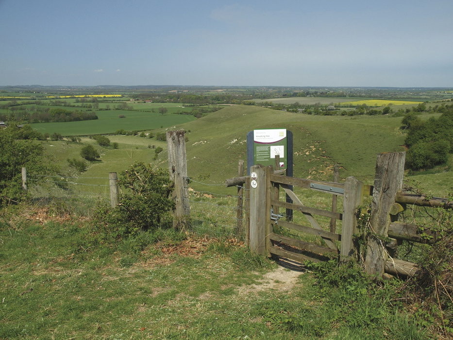
- Spring and early summer: New growth in the ancient beech woods, wildflowers and abundant birdsong; bluebells carpet the woodland floor in late spring
- Summer: Warm and generally dry, but also the busiest period on popular viewpoints like Ivinghoe Beacon and Coombe Hill
- Autumn: Often considered the best walking conditions, with the beech and oak woodland turning russet, gold and brown
- Winter: Rain can make some routes muddy underfoot, but a clear, frosty day gives some of the best long-distance views from the escarpment
What accommodation is available?
The Chilterns' proximity to London and its network of market towns and villages means a reasonable spread of village inns, B&Bs and country hotels along the routes, alongside youth hostels and campsites further afield. Accommodation is not concentrated around a single trail centre in the way it might be on a long-distance path, so most walkers base themselves in one of the area's well-connected towns, such as Amersham, Wendover, Tring or Henley-on-Thames, and drive or take the train out to individual walks. Full contact details for tourist information services are listed in Appendix B of the guidebook.
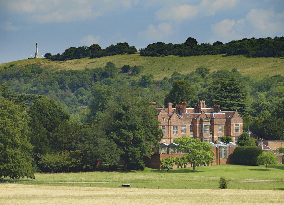
Getting there and back
Being so close to London, the Chilterns are well served by rail. Stations giving direct access to routes in the guide include Goring-on-Thames, Henley-on-Thames, High Wycombe and Princes Risborough, Little Chalfont, Amersham, Great Missenden and Wendover, Berkhamsted and Tring, and Luton and Hitchin further north, all with regular services from London and connections to the Midlands, West of England and South Wales. Where a walk can be reached by train, the nearest station is given in that walk's information box, and brief bus details are included where relevant. Drivers should note that some rural car parks are limited, and should always park considerately and avoid blocking access routes.
Where can I see red kites in the Chilterns?
Red kites are one of the signature sights of a Chilterns walk. They were successfully reintroduced to the area between 1989 and 1994, and numbers have steadily increased since, so most walkers heading onto the open escarpment or along the wooded valleys can expect to see several circling overhead on a typical outing. Buzzards share the same skies and are often mistaken for kites, but the two are straightforward to tell apart: buzzards have broader wings and a rounded tail, while red kites have a distinctive forked tail and chestnut-red plumage, along with a high-pitched whistling call.
Beyond red kites, the Chilterns' mix of ancient woodland, chalk grassland and river valleys supports a wide range of wildlife worth watching for on a walk: roe, fallow and muntjac deer, foxes, and badgers at dusk, along with an edible dormouse population around Tring Park. Riverside stretches bring the chance of a kingfisher, otter or water vole, while the open chalk grassland is good ground for butterflies, orchids and birds such as the skylark and yellowhammer. Anyone keen to identify what they see is best served by carrying a pocket guidebook and a pair of binoculars.
Walking in the Chilterns
35 walks in the Chiltern hills - an Area of Outstanding Natural Beauty
£14.95
This guidebook to Walking in the Chilterns offers 35 of the best walks in the Chilterns Area of Outstanding Natural Beauty. The Chiltern Hills is a peaceful walking destination of chalk hills and ancient woodlands within easy reach of London. The walks in this guidebook range from 4 to 12 miles and are suitable for most walkers. GPX files available to help with navigation.
More informationPlan your Chilterns walks with the Cicerone guidebook
The Cicerone Walking in the Chilterns guidebook by Steve Davison contains everything you need to plan and complete all 35 walks, from the chalk grassland north of Luton to the riverside paths along the Thames.
- 35 day walks across the Chiltern Hills National Landscape, from short woodland rambles to more demanding escarpment routes
- Step-by-step route descriptions supported by OS 1:50,000 map extracts reproduced at 1:40,000 for clarity
- GPX files provided for every walk, to assist digital navigation in all seasons
- Practical detail on refreshment stops, public transport and points of interest woven into each route
- A route summary table (Appendix A) giving distance, ascent and timing for all 35 walks
- Useful contacts for accommodation and transport information (Appendix B)
- Coverage of key panoramic viewpoints including Ivinghoe Beacon, Coombe Hill, Whiteleaf Hill and Watlington Hill
Available as a printed guidebook (£14.95) or digital eBook.
About Steve Davison, guidebook author
Steve Davison is a writer and photographer who has written a number of books, including several guidebooks published by Cicerone. He has also written articles for a range of outdoor magazines and other publications. A keen hill walker for most of his life, with interests in nature, geology and the countryside, Steve is a qualified Mountain Leader and has also previously worked as a part-time outdoor education instructor. He is a member of the Outdoor Writers and Photographers Guild.