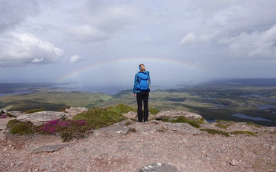
Where Seabirds Land: Walking on Orkney

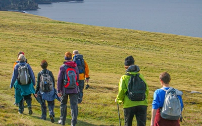
The Orkney Islands are a magical place to visit. For many people coming to these beautiful islands the chief appeal is the extraordinary number of internationally important Neolithic archaeological sites, while others visit Orkney for the many poignant reminders of our wartime history, or to rediscover their own Viking heritage. When Cicerone author Alex Kendall travelled to Orkney to walk among its world-famous ancient sites, he experienced Scottish coastal walking at its best and the company of its ever-present wildlife.
Walking on the Orkney and Shetland Isles
80 walks in the Northern Isles
£16.95
Discover 80 routes on the Orkney, Shetland and Fair Isles. Day walks include routes on Hoy, Rousay, Foula, Yell and Unst as well as the mainlands. Walks range from 1 to 16 miles and provide options for walkers of all abilities. Information on interesting sites, getting there and getting around the islands included.
More information
Mull Head
At midnight, the sky was still light as we drove off the ferry in Kirkwall, Orkney’s capital, after an evening sailing from Aberdeen. This bewitching light signalled summer in the far north. By morning, the stillness was replaced by low mist and lashing rain. So despite the Sunday morning drizzle, we drove to the Deerness peninsula.
Towards the end of Deerness peninsula, signs point to The Gloup, a dramatic blow-hole formed by the collapse of a sea cave. Here, you can glimpse the island's foundations: 400 million-year-old Old Red Sandstone, layered from inches to meters thick. Walking up the coast to Mull Head, we first heard the constant calls of seabirds, a theme in the Northern Isles. Fulmars huddled on low cliffs, nesting on their eggs as fog obscured the next headland. Along this coast is the Brough of Deerness, almost an island. Scrambling up with the help of chains, you reach a flat, grassy area barely 100 meters wide. Aerial surveys reveal this brough was once a Norse village, though only a small chapel remains above the vegetation.
In the bay, eiders bobbed, and a grey seal poked its head above the waves. Male eiders are black and white with an olive-green patch near their heads, while females are camouflage brown. They line their nests with eiderdown, a super-insulating feather. Their call, an “ooh,” sounds like mild surprise.
The fog limited our view, so we focused on the fulmars along the cliff-hugging path. Fulmars, named for their habit of spitting at predators, have sooty grey coloring and a darker "eye-liner." Unlike other gulls, they have a less menacing expression. They were breeding, taking turns on the egg or heading out to sea for food. As the fog lifted, we returned to the visitor centre, which offered an excellent exhibition on the Mull Head nature reserve and a much-needed shelter for lunch.

Maes Howe and Brodgar
By-passed by roads and nearly destroyed by a farmer using dynamite, the ancient standing stones between the Loch of Harray and the Loch of Stenness in western Orkney mainland are a remarkable sight. Surrounded by water and low hills, with the higher hills of Hoy to the south partially obscured by a rainy haze, the landscape is striking.
The historical significance of this place is immense. The Stones of Stenness, erected 5500 years ago, mark the beginnings of using giant rocks to signify something important—perhaps a meeting place, a religious site, or art. Constructing these few stones is estimated to have taken 50,000 man-hours, making the nearby and much larger Ring of Brodgar an even more epic undertaking.
Between the Stones of Stenness and the Ring of Brodgar, ongoing excavations at the Ness of Brodgar are uncovering what might have been a Neolithic city. We ended our visit with a tour of Maes Howe, believed to be a tomb despite the absence of bones. The site bears the marks of thousands of years, interrupted by Viking raids and Victorian treasure hunting. Inside the fenced area around the mound, sheep grazed on the ancient site, oblivious to the commotion.
Yesnaby
Arriving at Yesnaby the next day, the fog had gone, to be replaced by drifting high clouds with dashes of blue. The coast here consists of cliffs tens of metres high punctuated by small inlets, which in the Northern Isles are called geos, or sometimes nousts. As opposites to the geos, there are also frequent stacks and rocky headlands that are on their way to becoming islands.
We walked over to one of these nearly-islands, the Brough of Bigging, to watch the waves crash against the rest of the coast and look out for more sea birds. Large dark brown shapes materialised overhead and then disappeared behind some rocks. The other birds were not too happy, and it was clear when the shapes returned, gliding effortlessly in the air, that these were skuas. Known as the pirates of the sky, they are often found bullying other birds, from typical nastiness such as egg stealing, to the revolting habit of forcing gulls to choke up their last meal so they can eat it. Putting yourself in their position, though, it’s a strategy that seems to work, and with the often-foul weather of Atlantic islands, you make a living any way you can.
Walking north along the coast, enjoying the view of an actual horizon rather than yesterday’s fog, we examined the rocky coast as we went. The land angled down towards the sea before the final vertical drop into the water, and in several places sheets of the sandstone had slipped down, like peeling layers of skin. In the frequent geos the sandstone could be seen on the cliffs, alternating in thickness but with protruding layers sometimes no more than a few inches thick. However delicate this looked, there would invariably be fulmars nesting there, looking partially asleep and staying still enough to stop their eggs rolling around. I got the feeling that if you left a book by the sea, you’d come back to find fulmars nesting between the pages.

Skara Brae
The further north you get in the UK, the more Norse it is, as our association with our Viking past becomes recent history (Orkney became part of Scotland only in the 15th century, well after the invasion of Edward I and the eras of Robert the Bruce and William Wallace). This history can be seen on maps with some excellent names, very different to the rest of Britain. Just north of Yesnaby we walked past the wonderful Howalee, Stinkna Geo and Hole o’ Row, to name a few.
The coast soon turns east into the Bay of Skaill, which immediately feels more sheltered, the sands of the beach a welcoming landing point. This is where the village of Skara Brae is found, unearthed in the mid-19th century by a storm. It has been dated to around 5000 years old. Now equipped with a modern visitor centre, this is a real insight into the lives of people who followed the retreating ice north after the Ice Age.
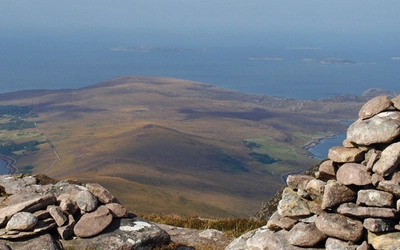
I left the group to look round the site while I walked back rapidly to Yesnaby to retrieve the minibus. The wind had picked up and rain squalls were approaching from the south-east, but the view over the water was still clear, back down south past Hoy to the mainland of Scotland, the hills of Sutherland clear on the horizon. The path continues past Yesnaby all the way south to Stromness, providing a route of more than 20 miles along the western coast of Orkney mainland, surely one of the most attractive low-level days out in the whole of Scotland.

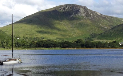
The Isle of Hoy
Orkney's 70 islands, ranging from the mainland with towns and farms to tiny rocks, are almost too complex to explore thoroughly. For walkers, Hoy tops the list, offering coastal paths and hills.
We crossed to Hoy in the morning, passing Scapa Flow, where British fleet ships were stationed during both world wars and where the German High Seas fleet scuttled its ships in 1919. Seven ships remain, now prime sites for wreck divers.
Hoy's heather-covered hills resemble the Scottish mainland, contrasting with Orkney’s low, green farmland. At Rack Wick, a bay in the south with views of Scotland across the wild Pentland Firth, these steep hills surround the area. Rack Wick is a starting point for walkers and climbers, with the famous sea stack, the Old Man of Hoy, nearby. The sun was out, and it was warm despite the sea breeze. The path to the Old Man crosses Moor Fea, enters Stourdale, and ends with a waterfall plunging onto the rocky beach. Stourdale is dwarfed by the grandeur of Atlantic waves, sheer cliffs, and the Old Man of Hoy peeking over the headland.
Watching climbers tackle the Old Man filled me with respect but not a desire to join them. Though I had hoped to see climbers in action, the sea stack stood solitary, drying its sandstone layers in the sun. Despite the Old Man's fame, the towering cliffs to the north truly dominate the scene. Rising nearly 350 meters at St John’s Head, these cliffs stretch for about 3 miles, adorned with vegetation, cracks, hollows, and bird nests, displaying incredible colours from earthy reds to yellows and purples.
We walked part of these cliffs but had to return the same way to catch our boat. At the beach, terns dive-bombed us, defending their nests in the dunes. On the return ferry to Orkney mainland, most passengers watched for wildlife. Despite not spotting any eagles, the joy lies in knowing such wildlife thrives in the UK. And after all, there are always fulmars!
15 Short Walks on the Orkney Islands
£9.95
Discover 15 of the best short walks on the Orkney Islands. Each walk comes with easy-to-read Ordnance Survey maps, clear route description and lots of images, plus information on local beauty spots and tasty refreshment stops. No challenging terrain or complicated navigation means walks can be enjoyed by everyone.
More information