Five best short walks on the Pembrokeshire coast: castles, lily ponds and island views
One of Britain's finest stretches of coastline, the Pembrokeshire Coast National Park takes in 186 miles of sea cliffs, sheltered coves, Iron Age hillforts and medieval towns. The south of the county packs some of its finest walking into a compact area, with routes easily completed in under three hours. These five short walks are taken from the Cicerone guidebook 15 Short Walks in Pembrokeshire: Tenby and the South by Dennis and Jan Kelsall. Date updated: June 2026. Guidebook updated: February 2024.
From Saundersfoot's wooded clifftops to the lily-fringed lakes of Bosherston and the dune-backed sands of Marloes, each route reflects a different side of southern Pembrokeshire. All are suitable for families and casual walkers, with clear Ordnance Survey mapping and practical information on parking, public transport and refreshment stops throughout.
For longer routes and full coast path coverage, Cicerone also publishes Walking in Pembrokeshire and the Pembrokeshire Coast Path guidebook.
How to get to Pembrokeshire?
Pembrokeshire is well served by rail from Cardiff and London Paddington, with stations at Tenby, Saundersfoot and Pembroke Dock. The A477 and A478 are the main road routes into the area. Local bus services connect most of the walk start points, though Runwayskiln (Walk 5) has no public transport and requires a car. Car hire is available in Tenby and Haverfordwest, with Tenby being a good base for most of the walks in the guidebook.
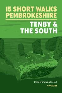
15 Short Walks in Pembrokeshire: Tenby and the south
£9.95
Discover 15 of the best short walks in south Pembrokeshire, including Tenby. Each walk comes with easy-to-read Ordnance Survey maps, clear route description and lots of images, plus information on beauty spots and refreshment stops. No challenging terrain or complicated navigation means walks can be enjoyed by everyone.
More information"The countryside is chequered with a myriad of small fields and enclosures bound by herb-rich boundaries of stone, earth and hedge. Such dramatic beauty and an amazing abundance of wildlife, particularly in flowers, birds, insects and sea life, all contributed to the coast’s designation as a National Park in 1952."
— Dennis and Jan Kelsall
Saundersfoot and Monkstone Beach
Summary: A popular holiday resort, Saundersfoot is the base for this coastal woodland walk to Monkstone Beach
Start/finish: Saundersfoot harbour slipway
Time: 2hr 15min
Distance: 5km (3 miles)
Climb: 220m
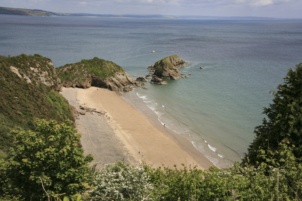
The route rises over wooded cliffs to Monkstone Point, with an optional detour around the headland. Monkstone's sheltered beach lies tucked below the clifftop, reached by a good though steep stepped path, one of the more sheltered spots for swimming on this stretch of the Pembrokeshire coast. This is a there-and-back route, so the wooded clifftop views are enjoyed in both directions.
The state of the tide can govern how you begin and end the walk, so check tide tables before setting out. The beach is at its quietest in the early morning, before the summer crowds arrive in Saundersfoot.
Best time to visit: Late spring and summer for the best coastal light and the fullest leaf canopy on the woodland section.

Tenby
Summary: A strategic port since the days of the Vikings, Tenby is well worth exploring on this gentle town centre walk
Start/finish: Tenby South Beach
Time: 1hr
Distance: 3km (2 miles)
Climb: 60m
The route wanders through the old town, onto the harbour and around Castle Hill, seeking out corners that reflect Tenby's intriguing past. Starting at South Beach and climbing into the walled medieval town, this short walk covers more than a thousand years of history in under two miles.
Among the places you might visit are St Mary's Church, the Merchant's House, the town museum and St Catherine's Island fort, accessible at low tide. Or you can simply enjoy the ambience of this lively, well-preserved resort. Tenby's medieval town walls, enclosing much of the old town, are among the most complete surviving in Wales.
Best time to visit: Year-round. The town trail is enjoyable in any weather, making it a reliable option on days when the coastal walks are too exposed. The town is busiest in high summer; an early-morning visit is rewarded with quieter streets and better light on the harbour.
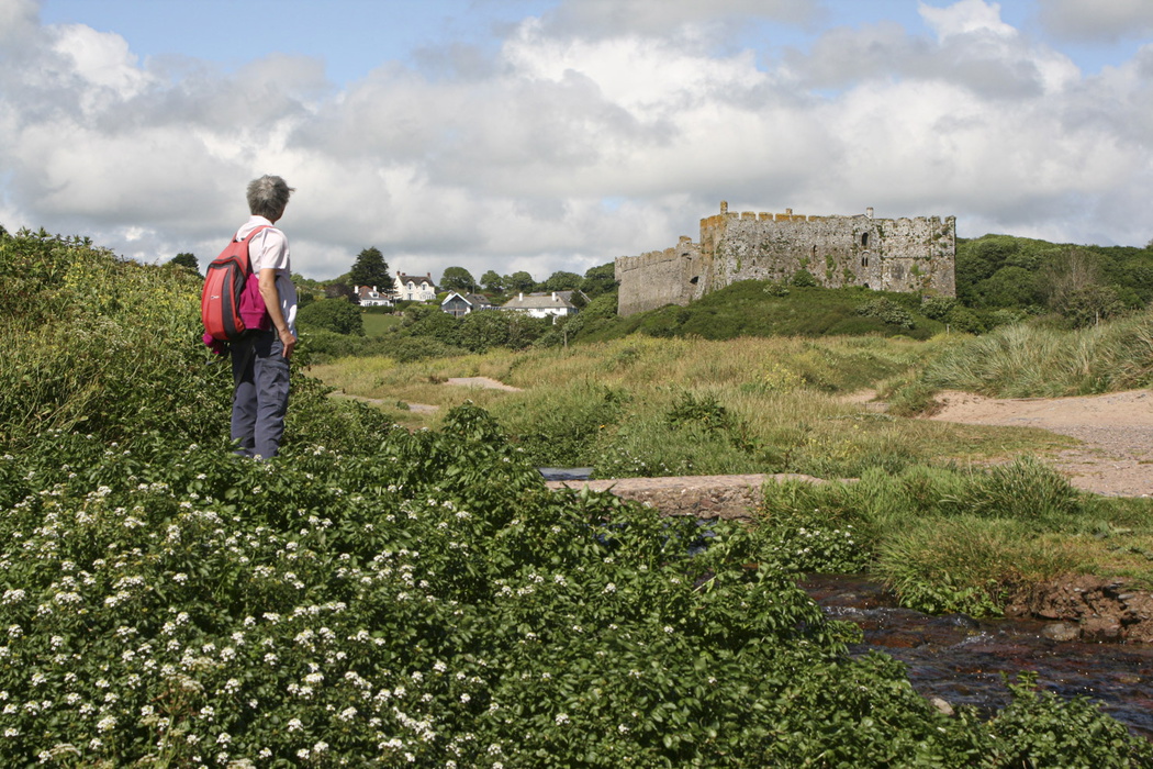
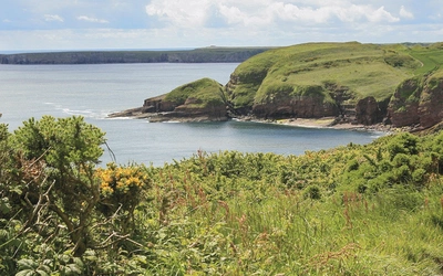
Manorbier
Summary: A circular ramble featuring a Stone Age dolmen, unusual cliff formations and an impressive castle
Start/finish: Manorbier Beach car park
Time: 1hr 30min
Distance: 4km (2½ miles)
Climb: 170m
The path gently gains height along low cliffs behind Manorbier's beach and around Priest's Nose, later dipping across a fold to round a small promontory overlooking Presipe Bay. Leaving the coast, the way climbs inland to Hill Farm, picking up a track beyond that leads to the village, where there is both a tea room and a pub.
The final stretch follows the lane beneath the walls of Manorbier Castle, built at the end of the 11th century by Otto de Barri, one of the knights who accompanied William the Conqueror. The medieval chronicler Giraldus Cambrensis, born at Manorbier, famously described it as "the pleasantest spot in Wales". The castle was later slighted by Cromwell's forces during the Civil War, and largely abandoned until restoration began in the 19th century.
Best time to visit: Spring for wildflowers on the clifftops and the best light on the castle walls. The castle closes for the winter season and may close on certain days in summer for private events; check the Manorbier Castle website before visiting.
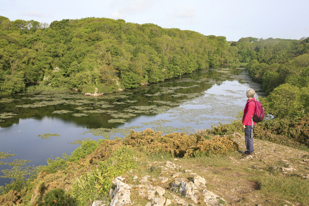
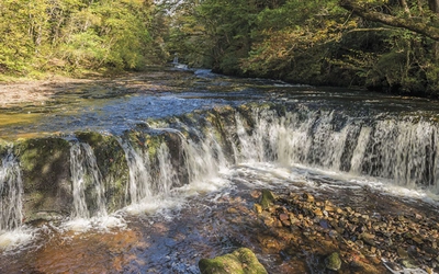
Stackpole Quay, Barafundle Bay and the Lily Ponds
Summary: An exciting cliff-top walk linking sheltered beaches and the famous Bosherston Lily Ponds
Start/finish: Stackpole Quay car park
Time: 2hr 45min
Distance: 8km (5 miles)
Climb: 165m
Although a longer walk, this route is not demanding, with only a couple of short uphill stretches along the way. The cliff-top views are spectacular and contrast well with the wooded shores of the Bosherston lakes passed later on, while the final return follows a good track across the fields.
Stackpole Quay is a National Trust harbour, and the clifftop path south leads to Barafundle Bay, one of the highlights of the Pembrokeshire coast. Beyond Barafundle, the route turns inland to the Bosherston Lily Ponds. There is usually wildlife to see, both from the cliffs and by the lakes, so keep your eyes open.
Best time to visit: June for the Bosherston water lilies at their peak. The clifftop section is good year-round for seabirds.
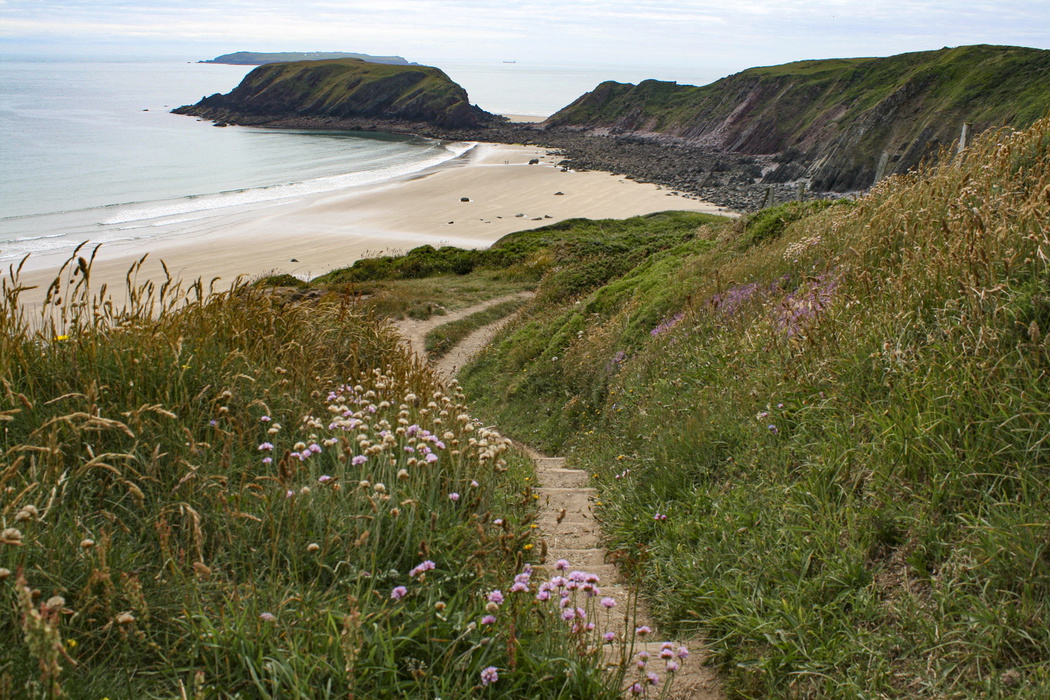
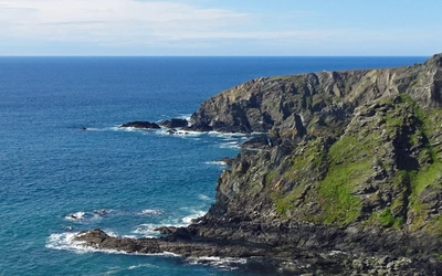
Runwayskiln and Marloes Sands
Summary: Marloes Sands is one of Pembrokeshire's finest beaches, and there is much to see along this clifftop ramble
Start/finish: Runwayskiln car park
Time: 1hr 30min
Distance: 4km (2½ miles)
Climb: 120m
The route begins across fields past the Marloes Mere wetland reserve before reaching the coast at the impressive embankments of an Iron Age fort. From the clifftops, there are splendid views to Gateholm and Skokholm Islands, with Skomer Island, one of Britain's most important seabird reserves, visible further offshore on a clear day.
There is an opportunity to spend time on the beach before climbing back to the car park. The red-tinged sandstone is at its best at low tide, when the full sweep of the bay is exposed.
Note: Runwayskiln has no public transport. A car is essential for this walk.
Best time to visit: Late spring and early summer for seabirds on the offshore islands and wildflowers on the clifftops. Avoid in strong westerly winds, when the clifftop path is very exposed.
15 Short Walks in Pembrokeshire: Tenby and the south
£9.95
Discover 15 of the best short walks in south Pembrokeshire, including Tenby. Each walk comes with easy-to-read Ordnance Survey maps, clear route description and lots of images, plus information on beauty spots and refreshment stops. No challenging terrain or complicated navigation means walks can be enjoyed by everyone.
More informationYou'll find all these routes (and 10 more) in our guide to 15 Short Walks in Pembrokeshire: Tenby and the South, which contains clear route descriptions, OS mapping, plus facilities, parking and highlights for every route. Each route has been carefully selected to showcase the best of the area. No challenging terrain or complicated navigation means the walks can be enjoyed by everyone.
About Dennis and Jan Kelsall, authors of 15 Short Walks in Pembrokeshire: Tenby and the South
Dennis and Jan Kelsall have long held a passion for the countryside and hill walking. Since their first Cicerone title was published in 1995, they have written, contributed to, and illustrated over 50 guides to some of Britain's most popular walking areas and have become regular contributors to various outdoor magazines. Their enjoyment of the countryside extends far beyond a love of fresh air, open spaces and scenery. Over the years, Dennis and Jan have developed a wider interest in the environment, its geology and wildlife, as well as an enthusiasm for delving into local history, which so often provides clues to interpreting the landscape.