The Robert Louis Stevenson Trail (GR70): a complete planning guide
In September 1878, Robert Louis Stevenson set off from Le Monastier-sur-Gazeille with a stubborn donkey called Modestine, on a 12-day journey through the Cévennes that would become Travels with a Donkey in the Cévennes, one of the founding texts of outdoor travel writing. Today the GR70, better known as the Robert Louis Stevenson Trail, follows his route as closely as possible for 272km (169 miles) from Le-Puy-en-Velay to Alès, taking most walkers 10 to 14 days to complete. It remains one of France's most rewarding long-distance trails, blending gentle volcanic farmland, chestnut forests and limestone gorges with a genuine sense of literary pilgrimage. (Last updated: July 2026 · Guidebook edition: 3rd edition, 2021, reprinted 2025)
The Robert Louis Stevenson Trail (GR70), quick facts:
- Distance: 272km / 169 miles
- Duration: 10–14 days (12 recommended stages)
- Start: Le-Puy-en-Velay
- Finish: Alès
- Stages: 12 (with one alternative split on Stage 5)
- High point: Pic de Finiels, Mont Lozère, 1699m
- Difficulty: Moderate to challenging
- Terrain: Volcanic hills, farmland, chestnut forest, granite and schist uplands, limestone gorges
- Waymark: Red and white GR stripes
- Accommodation: Gîtes d'étape, auberges, chambres d'hôtes and campsites
- Best season: May to October
- Guidebook:Trekking the Robert Louis Stevenson Trail by Nike Werstroh and Jacint Mig, 3rd edition, Cicerone
- App: The guidebook has been optimised for mobile in our app.
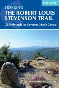
Trekking the Robert Louis Stevenson Trail
The GR70 through the Cevennes/Massif Central
£18.95
Guidebook to the GR70 through France's Velay and Cévennes regions, which follows in the footsteps of author Stevenson and his faithful donkey, Modestine. At 272km, this long-distance trail from Le Puy to Ales is ideal for people new to walking holidays, and promises an interesting journey with an historical and literary flavour.
More information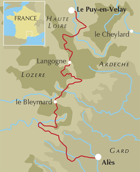
What is the Robert Louis Stevenson Trail?
The Robert Louis Stevenson Trail, waymarked as the GR70, is a 272km long-distance walk through the Velay and Cévennes regions of southern France, tracing the route the Scottish writer took with his donkey Modestine in 1878. It runs from Le-Puy-en-Velay, in the shadow of its volcanic plugs and pilgrim cathedral, south through the Lozère to the market town of Alès on the edge of the Cévennes National Park. Unlike many long-distance trails, its appeal rests as much on story as on scenery: every stage carries an echo of Stevenson's own journal, and walkers who bring a copy of Travels with a Donkey will recognise the hamlets, rivers and hillsides he described almost 150 years ago.
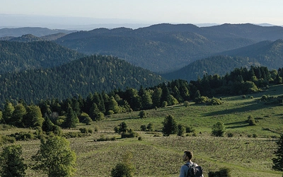
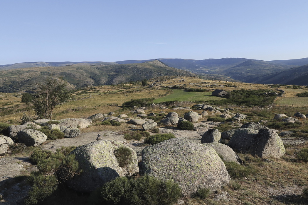
The landscape shifts noticeably as the trail heads south. The first days cross the Velay's gently rolling puys (extinct volcanic hills) and gorse-covered farmland, before the trail climbs into the granite and schist uplands of the Cévennes proper, where wooded hillsides fall away into deep river gorges. Chestnut trees, once the staple crop of this poor upland region, dominate the woods around Florac, and the trail's highest point, Pic de Finiels on Mont Lozère, brings a brief taste of open, treeless moorland before the descent back into farmland. This planning guide answers the most common questions walkers have before setting out. For complete stage-by-stage route descriptions and mapping, see the Cicerone Trekking the Robert Louis Stevenson Trail guidebook.
How long is the Robert Louis Stevenson Trail?
The GR70 covers 272km (169 miles) and is walked in 12 stages, each between 16.5km and 30km. Most walkers complete the full route, including the approach walk from Le-Puy-en-Velay and the extension to Alès, in 12 to 14 days. Purists following Stevenson's own itinerary can start at Le Monastier-sur-Gazeille and finish at St-Jean-du-Gard, shaving off both end sections.
| Stage | Distance | Ascent/Descent | Time |
|---|---|---|---|
| 1 Le-Puy-en-Velay to Le Monastier-sur-Gazeille | 19km | 640m/390m | 5hr 30min–6hr |
| 2 Le Monastier-sur-Gazeille to Le Bouchet-St-Nicolas | 24km | 785m/495m | 6hr–6hr 30min |
| 3 Le Bouchet-St-Nicolas to Langogne | 28.5km | 395m/690m | 7hr 30min |
| 4 Langogne to Cheylard-l'Évêque | 16.5km | 445m/235m | 4hr |
| 5 Cheylard-l'Évêque to La Bastide-Puylaurent | 20km/27km | 405m–675m/500m–770m | 5hr 30min–7hr 30min |
| 6 La Bastide-Puylaurent to Le Bleymard | 30km | 900m/850m | 7hr 30min–8hr |
| 7 Le Bleymard to Le Pont-de-Montvert | 21km | 670m/820m | 6hr |
| 8 Le Pont-de-Montvert to Florac | 30km | 820m/1180m | 7hr 30min–8hr |
| 9 Florac to Cassagnas | 18.5km | 645m/485m | 4hr 30min |
| 10 Cassagnas to St-Germain-de-Calberte | 16km | 480m/660m | 4hr |
| 11 St-Germain-de-Calberte to St-Jean-du-Gard | 23km | 745m/1055m | 6hr |
| 12 St-Jean-du-Gard to Alès | 25.5km | 950m/1010m | 7hr 30min–8hr |
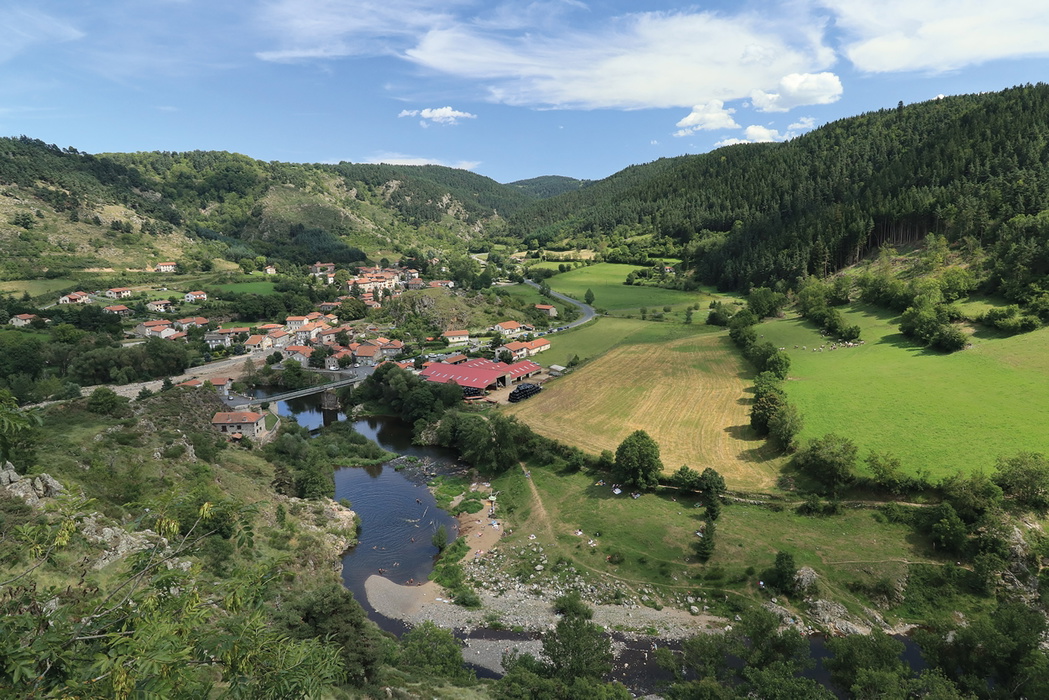
Stage 8, Le Pont-de-Montvert to Florac, is the trail's toughest test: 30km with 820m of ascent and 1180m of descent, and no settlements en route where it can be broken up, so it has to be walked in one go. Stage 6, also 30km with nearly 900m of ascent, runs it a close second for the longest day on the trail.
Who is the Robert Louis Stevenson Trail suitable for?
The GR70 is well suited to first-time long-distance walkers as well as experienced trekkers looking for a route with a strong narrative thread. The terrain is mostly easy underfoot, on tracks and quiet paths rather than technical mountain ground, and the trail is consistently well waymarked. That said, several stages are long and involve sustained climbing and descent, so a reasonable level of fitness is needed, particularly for Stages 6 and 8. Dog walkers and those hiring a donkey to carry gear are catered for, and accommodation hosts along the route are used to walkers of all experience levels.
How difficult is it?
Cicerone rates the trail as moderate to challenging: most of the walking is on easy, well-graded terrain, but the combination of distance, some long days and hilly sections in the Cévennes means it should not be underestimated by complete beginners to multi-day trekking. Navigation is straightforward thanks to the trail's red and white GR waymarking, though the guidebook notes that distances given on some trailside signs can be inaccurate, so it's worth trusting the guidebook's timings over the signposts.
Can I walk a shorter section?
Yes. The GR70 lends itself well to partial itineraries thanks to train and bus links at several points along the way. Popular shorter options include:
- Le Monastier-sur-Gazeille to St-Jean-du-Gard (Stevenson's own original route, skipping the modern Le-Puy and Alès extensions)
- Langogne to Florac, covering the heart of the Cévennes and Mont Lozère, with trains back to Langogne
- Florac to Alès, the southern half of the trail through the National Park, with bus connections from Florac and St-Jean-du-Gard back to Alès
Trains run from Langogne back to Le Puy, and buses connect La Bastide-Puylaurent, Langogne, Alès and Nîmes, making it easy to build a shorter trip around the sections that most interest you.
When is the best time to walk the Robert Louis Stevenson Trail?
- May and June: Wildflowers colour the meadows and the trail is at its greenest, though some accommodation may only just be opening for the season.
- July and August: The busiest and hottest months. Blackberries ripen along the paths, but walkers should aim to avoid the hottest part of the day and book accommodation well ahead.
- September and October: The shoulder season sweet spot, with sweet chestnuts being harvested across the Cévennes and cooler, more comfortable walking temperatures. This is also when Stevenson himself made the journey.
- Winter (November to April): Not recommended. Most gîtes, auberges and campsites close over the winter months, and the guidebook advises walking only from around Easter to October.
What accommodation is available?
Walkers can expect a night-by-night mix of gîtes d'étape (dormitory-style accommodation, often with a shared kitchen), auberges, chambres d'hôtes (similar to a bed and breakfast, frequently offering home-cooked evening meals), small hotels and campsites. Many places offer a table d'hôte, a set communal evening meal, which is one of the trail's social highlights. Booking ahead is strongly recommended, especially through the middle section of the trail where some villages have only one or two places to stay; the annually updated 'Travels in the Cévennes' booklet, available from the Chemin Stevenson association, lists accommodation along the route in detail. Wild camping is not permitted within the Cévennes National Park, though official campsites are dotted along the trail. Full listings are provided in the guidebook's appendices.
Getting there and back
The nearest airport to the start is Lyon, served from the UK by easyJet and British Airways, with a tram and train connection on to Le-Puy-en-Velay (around 2hr 10min–2hr 30min from the airport). Eurostar to Paris followed by TGV to Lyon is an alternative route out. At the finish, Alès has train connections back to Lyon via Nîmes (roughly 2hr–2hr 30min), and flights are also available into and out of Nîmes. Walkers wanting to shorten the trip can start from Le Monastier-sur-Gazeille (reached by bus or taxi from Le Puy) or finish at St-Jean-du-Gard, taking a bus on to Alès, just as Stevenson did.
What are the route highlights?
- The volcanic hills and Château de Bouzols above Le-Puy-en-Velay on Stage 1
- The Château de Beaufort viewpoint over Goudet on Stage 2
- Mont Lozère and its summit, Pic de Finiels, the trail's high point at 1699m
- The river gorges and chestnut woods around Florac
- The Camisard history of the Cévennes, woven through the later stages
- Villages that appear almost unchanged from Stevenson's own descriptions, including Le Bouchet-St-Nicolas and Chasseradès
Why follow in Robert Louis Stevenson's footsteps?
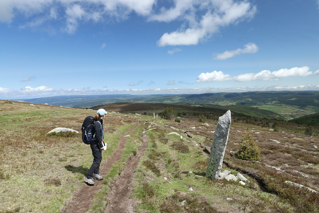
Stevenson had never hiked before he set out with Modestine, and his journal captures both the comedy of that inexperience and his growing fascination with the Cévennes and its Protestant history. The GR70 was developed to follow his 1878 route as closely as modern roads and paths allow, and between Le Pont-de-Montvert and Florac it deliberately departs from Stevenson's own river-hugging path to climb over the mountains instead. Reading a stage's worth of Travels with a Donkey each evening, alongside the guidebook's own stage-by-stage notes on Stevenson's journey, is one of the simplest ways to connect the modern walk to its literary origins.
Plan your walk with the Cicerone guidebook
The Trekking the Robert Louis Stevenson Trail guidebook by Nike Werstroh and Jacint Mig contains everything you need to plan and complete the route, from Le-Puy-en-Velay to Alès.
- Stage-by-stage route descriptions across 12 stages, with clear mapping and elevation profiles for every day
- 1:50,000 mapping included for every stage, supporting both traditional and digital navigation
- Free downloadable GPX files for all stages
- A short account of Stevenson's own journey woven into each stage description
- Comprehensive accommodation and campsite listings in the appendices, including gîtes, auberges and chambres d'hôtes
- Practical advice on when to walk, what to take, language and food and supplies
- A French–English glossary for walkers with limited French
Available as a printed guidebook (£18.95) or digital eBook (£18.95) from Cicerone. The route is also available as a Cicerone app guide.
Trekking the Robert Louis Stevenson Trail
The GR70 through the Cevennes/Massif Central
£18.95
Guidebook to the GR70 through France's Velay and Cévennes regions, which follows in the footsteps of author Stevenson and his faithful donkey, Modestine. At 272km, this long-distance trail from Le Puy to Ales is ideal for people new to walking holidays, and promises an interesting journey with an historical and literary flavour.
More informationAbout Nike Werstroh and Jacint Mig, guidebook authors:
Nike and Jacint met many years ago on a long coach journey as they both travelled into the unknown to build a new life in a different country. It wasn't long before they became inseparable. Travelling quickly emerged as their favourite activity: they had their first walking holiday in Madeira in 2008 and now wherever they go they try to find the best trails. Nike went to journalism school and Jacint is a keen photographer. They really enjoy walking in the mountains and would happily spend every day on the trails. When they followed Robert Louis Stevenson's footsteps through the Cévennes they were mesmerised by the diverse scenery. With their guidebooks and photos they want share their passion for walking with others.