Trekking in Austria's Hohe Tauern: a complete planning guide
The Hohe Tauern National Park is the largest national park in continental Europe, a vast wilderness of glaciated 3000m peaks centred on the Grossglockner, Austria's highest mountain at 3798m. Trekking in Austria's Hohe Tauern guides four classic hut-to-hut treks of 7 to 9 days through the Reichen, Venediger and Grossglockner groups, ranging from 61km to 99km, with optional excursions onto neighbouring summits and glaciers along the way. (Last updated: July 2026 · Guidebook edition: 2nd edition, January 2024)
Trekking in Austria's Hohe Tauern, quick facts:
- Location: Hohe Tauern National Park, Eastern Alps, Austria
- Treks covered: 4 main hut-to-hut routes, plus 2 further suggested itineraries
- Distance: Reichen Group Rucksack Route 61.4km; Venediger Group Rucksack Route 68.2km; Venediger Glacier Tour 77.5km; Glockner Rucksack Route 99.1km
- Duration:7–9 days per trek
- Start points: Zillergründl Stausee reservoir (Reichen); Streden or Krimml (Venediger); Lucknerhaus, Kals (Glockner)
- High point: the Grossglockner summit excursion, 3798m, Austria's highest peak
- Difficulty: Moderate to strenuous; the Venediger Glacier Tour and several summit excursions require glacier travel skills
- Terrain: high mountain passes, glacier approaches, alpine ridges and rocky trails, with sections of fixed cable
- Waymark: blue, red and black colour-coded trail grading, in line with Alpenverein signposting
- Accommodation: Austrian and German Alpine Club mountain huts (ÖAV/DAV), plus a handful of private and CAI-run huts
- Best season: mid-June to late September
- Guidebook:Trekking in Austria's Hohe Tauern, Allan Hartley, 2nd edition (2024)
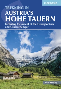
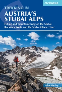
Trekking in Austria's Hohe Tauern
Including the ascent of the Grossglockner and Grossvenediger
£18.95
Guide to four hut-to-hut treks of 7–9 days in the Hohe Tauern National Park, covering the Reichen, Venediger and Glockner groups, plus suggestions for two further treks. With optional excursions to climb neighbouring peaks – including Austria's highest peak, the Gross Glockner – some of which call for mountaineering skills and glacier crossings.
More information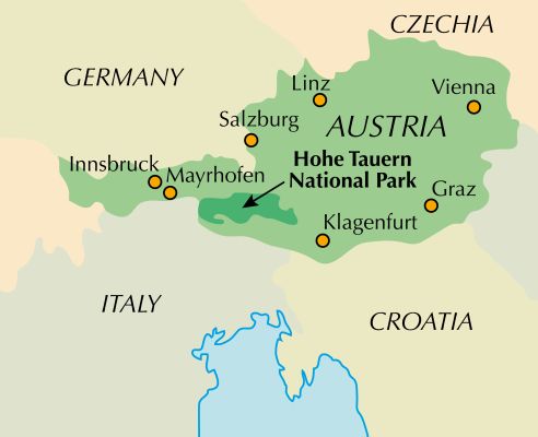
What is Trekking in Austria's Hohe Tauern?
Trekking in Austria's Hohe Tauern is a guidebook to four multi-day hut-to-hut treks through the Hohe Tauern National Park, an 1800km² wilderness that spans the Austrian provinces of Tirol, Salzburg and Kärnten. It is built around three mountain groups: the lesser-known Reichen Group to the west, the heavily glaciated Venediger Group, and the Grossglockner Group, home to Austria's highest peak. Each trek links a chain of traditional Alpine Club huts, allowing walkers to move through high mountain terrain for a week or more without returning to the valley to resupply.
The national park is now recognised as a world conservation area, ranking alongside Yosemite, the Serengeti and the Galápagos, and it contains the largest concentration of 3000m peaks in the Eastern Alps. Where the Western Alps can feel crowded and commercialised, the Hohe Tauern offers the same scale of glacier and summit scenery with a quieter, more traditional hut culture behind it.
What sets this guidebook apart is its flexibility. The four treks can be walked independently, but they also link together: an experienced party could trek from Mayrhofen in the Zillertal, across the Reichen Group and Venediger Group, to finish with an ascent of the Grossglockner, all within a two-week holiday. For those with less time, the five-day Glockner Loop offers a shorter route to the summit.
This planning guide answers the most common questions walkers have before setting out. For complete stage-by-stage route descriptions and mapping, see the Cicerone Trekking in Austria's Hohe Tauern guidebook.
How long are the Hohe Tauern treks?
The four treks range from 61km over 6–7 days to 99km over 9 days, and none needs to be combined with another to make a complete holiday.
| Trek | Distance | Stages | Duration |
|---|---|---|---|
| Reichen Group Hut-to-Hut Rucksack Route | 61.4km | 7 (plus alternative 7A) | 6–7 days |
| Venediger Group Hut-to-Hut Rucksack Route | 68.2km | 7 | 7 days |
| Venediger Glacier Tour | 77.5km | 8 | 8 days |
| Glockner Rucksack Route | 99.1km | 9 (plus alternatives 1A and 6A) | 9 days |
The Glockner Rucksack Route is the longest and most varied of the four, taking in an optional ascent of the Grossglockner itself and stages that range from a gentle 3–3½ hours to a demanding 10–11 hour day from Salm Hut to Glocknerhaus. The Venediger Glacier Tour is the most technical, since it crosses the Obersulzbachkees and other glaciers on the way to the summit of the Grossvenediger and requires competent glacier travel skills.
Who is trekking in the Hohe Tauern suitable for?
These treks suit walkers who already have some mountain experience and are comfortable carrying a loaded rucksack for six to seven hours a day. Paths are well waymarked and signposted throughout, and no special equipment is needed for the three rucksack routes unless walkers plan to cross glaciers or attempt an optional summit.
The guidebook is candid that this is not a beginner's introduction to the Alps in the gentlest sense: while first-time Alpine visitors and family groups are well catered for, aspiring alpinists should not underestimate the Hohe Tauern in comparison with the higher, more famous ranges of the Western Alps. Several stages involve sustained steep ground, fixed cables and short scrambling sections, and the author notes that his own daughter completed the full Venediger Rucksack Route and Glacier Tour, including several peak ascents, at the age of 15, provided the party is fit and happy to be in the mountains for long days.
How difficult are the Hohe Tauern treks?
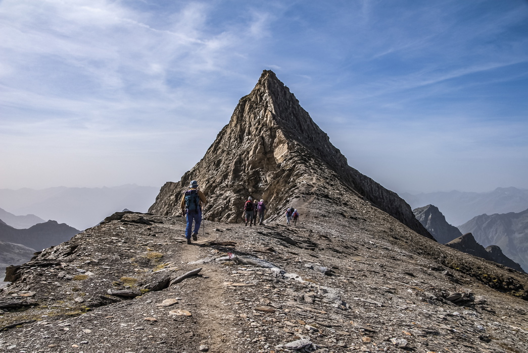
Cicerone grades the majority of these routes as red and black mountain trails under the Alpenverein's colour-coded system, meaning narrow paths with steep sections, fixed cables and short scrambling, requiring alpine experience, good physical condition and a head for heights. Approach sections on wider valley tracks are graded blue.
- Optional peak ascents range from Facile (F), such as the Keeskogel, with no significant difficulties, to Peu Difficile (PD), such as the Reichenspitze and the Grossglockner itself, which involve short but non-sustained technical sections
- The Venediger Glacier Tour is the only trek that mandates glacier travel and crevasse-rescue competence throughout
- The Glockner Rucksack Route's Stage 4, from Glocknerhaus to the village of Fusch, is the single longest day on any of the four treks at 10–11 hours
Can I walk a shorter section?
Yes. Each of the four treks is designed to be walked in full, but several practical shorter options exist:
- The Glockner Loop links seven huts around the Grossglockner in around five days without needing to cross a glacier, making it a popular choice for walkers short on time who still want to climb Austria's highest peak
- The early stages of the Venediger Rucksack Route, as far as the Bonn-Matreier Hut, make a good multi-day introduction for less experienced parties or those trekking with children
- Link stages connecting the three mountain groups allow experienced trekkers to extend any of the standard treks into a longer traverse of the national park, covered separately in the guidebook's "Across the Hohe Tauern National Park" section
When is the best time to walk in the Hohe Tauern?
The Alpine summer season runs from mid-June to late September, matching the opening dates of the mountain huts.
- June: Early season. Old snow often lingers on north-facing slopes such as the Rainbachscharte, Zopatscharte and Löbbentörl, so this is not the best time for a first visit
- July: Warmer, with the winter snow receding, though huts and paths are busier
- August: Peak season and the most settled weather, but also the busiest huts, with afternoon thunderstorms common. Many villages hold their traditional Kirchentage church festivals this month, which are worth a visit
- September: Cooler and quieter as the season winds down, with huts far less crowded
The guidebook author's own preference is either mid-July or the first two weeks of September, balancing settled weather against hut crowds.
What accommodation is available?
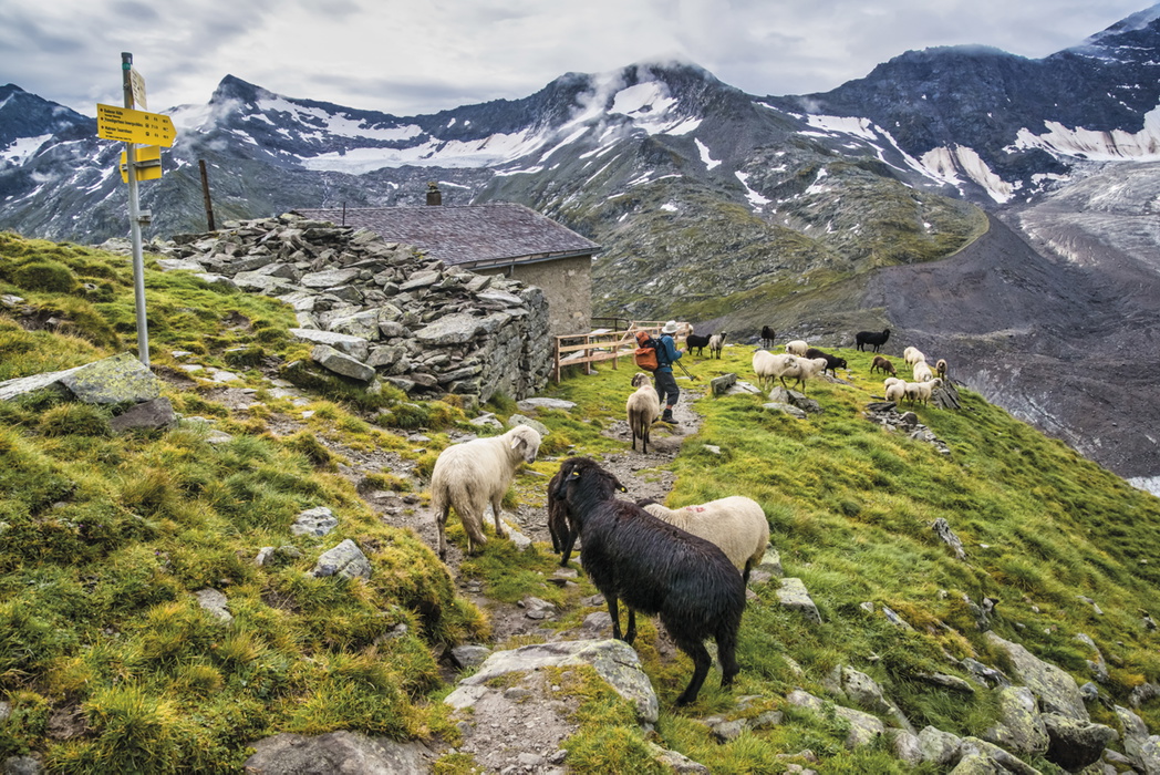
Accommodation on all four treks is based around the traditional Austrian and German Alpine Club hut system (ÖAV and DAV), supplemented by a small number of private huts, an ÖTK hut and huts in South Tirol run by the Club Alpino Italiano. There are 35 ÖAV and DAV huts within the Hohe Tauern, most open from late June to mid-September.
Each hut offers simple dormitory accommodation (Matratzenlager) and a smaller number of private rooms (Bettzimmer), alongside a restaurant serving breakfast, lunch and a substantial evening meal. Half-board typically costs €55–65 per night depending on the hut's category. A sheet sleeping bag (Schlafsack) is compulsory at every hut, and hut shoes are recommended since boots are not permitted beyond the entrance hall.
Membership of the Austrian Alpine Club (ÖAV Alpenverein Britannia, the UK section) is strongly recommended: it brings reduced hut rates, mountain rescue insurance, and reciprocal rights with other alpine clubs including the CAI in South Tirol. It is advisable to reserve accommodation in advance, particularly for groups and during the busy August weeks, and to reconfirm bookings by phone the day before arrival.
For full listings of individual huts, including altitude, ownership and facilities, see the guidebook's comprehensive hut directory.
Should I join the Austrian Alpine Club before I go?
Anyone planning a hut-to-hut tour in the Hohe Tauern benefits from joining the Austrian Alpine Club, and specifically its UK section, ÖAV Alpenverein Britannia, founded in 1948 to foster Anglo-Austrian mountaineering links after the Second World War. Membership brings reduced overnight rates at every ÖAV and DAV hut, mountain rescue insurance, and reciprocal agreements with the alpine clubs of France, Switzerland, Italy and Germany, meaning a British member pays the same reduced rate as a local club member even when a route crosses into South Tirol, as happens at the Birnlücken Hut.
Beyond the practical savings, membership carries a social dimension too. The sense of belonging and welcome at the huts, referred to locally as Gemütlichkeit, is something returning visitors come to value as much as the mountains themselves.
Getting there and back
Most travellers arrive via Innsbruck, Munich or Salzburg, with onward travel by rail or bus depending on which trek is planned.
- For the Reichen Group: take the train to Jenbach, then the narrow-gauge Zillertalbahn to Mayrhofen (around 2 hours total from Innsbruck), with no need to detour via Innsbruck itself
- For the Venediger Group: train to Matrei in Osttirol via the Virgental valley, reached from Innsbruck or via local connections
- For the Grossglockner Group: train to Zell am See or Kitzbühel, then local bus to Kals or other trailheads
- By air: British Airways and Lufthansa operate regular flights from London, Manchester and Birmingham to Munich, Salzburg or Innsbruck, with fast regional rail connections onward
- By road: the Dover–Ostend crossing followed by motorway via Munich and Kufstein reaches Innsbruck in around 15 hours with two drivers
Because the treks are largely linear, it is worth planning where to leave a car, choosing a base town with good rail connections back to the start point. Return journeys from Innsbruck to Munich or Salzburg airports take 2 to 2½ hours by train.
What are the route highlights?
- The summit of the Grossglockner (3798m), Austria's highest peak, reached via an optional excursion on the Glockner Rucksack Route
- The Grossvenediger (3674m), Austria's fourth-highest mountain and the peak with the most connected glaciers in the country
- The Obersulzbachkees glacier, crossed on the Venediger Glacier Tour, where local guides place marker poles to aid route-finding
- The Rosskar Scharte and Löbbentörl passes, and the ridge walk over the Spitzbrett
- The traditional mountain huts themselves, several dating back to the 19th century and among the most characterful in the Alps
Plan your walk with the Cicerone guidebook
The Trekking in Austria's Hohe Tauern guidebook by Allan Hartley contains everything you need to plan and complete any of the four treks, from trailhead to finishing town.
- Full stage-by-stage route descriptions for all four treks, plus alternative stages and variants
- Optional excursions to climb neighbouring summits, including the Grossglockner, Grossvenediger and Grosses Wiesbachhorn
- 1:50,000 scale mapping and elevation profiles throughout
- A comprehensive hut directory covering all 35 huts, with altitude, ownership and contact details
- Practical guidance on transport from Munich, Innsbruck and Salzburg to every trailhead
- A German–English glossary and useful contacts appendix
- Free downloadable GPX tracks for all routes via the reader's Cicerone library account
Available as a printed guidebook (£18.95) or digital eBook (£18.95) via the Cicerone product page.
Trekking in Austria's Hohe Tauern
Including the ascent of the Grossglockner and Grossvenediger
£18.95
Guide to four hut-to-hut treks of 7–9 days in the Hohe Tauern National Park, covering the Reichen, Venediger and Glockner groups, plus suggestions for two further treks. With optional excursions to climb neighbouring peaks – including Austria's highest peak, the Gross Glockner – some of which call for mountaineering skills and glacier crossings.
More informationAbout Allan Hartley, guidebook author:
An engineer by profession, Allan Hartley spent the majority of his working life overseas engaged on major construction projects. Throughout this time, however, he has had a keen interest in mountains and photography since his early teens. He has climbed extensively throughout the Alps and maintains that Austria remains one of mountaineering's best-kept secrets, with its heady mix of superb scenery and top-class huts offering excellent food, better suited to the average mountaineer than the higher mountains to the west. In addition to Austria and the Alps, Allan has climbed across the globe, from East Africa to the Falkland Islands, the greater ranges of Nepal and Pakistan, the lesser-known Zagros Mountains of Iran and the Al Hajar Mountains of the Arabian Peninsula. Allan is a long-term member and past president of the Austrian Alpine Club (UK) – Alpenverein Britannia. He is also a member of the Outdoor Writers and Photographers Guild, a double Associate of the Royal Photographic Society and a holder of the International Mountain Leader Award. His home is on the edge of the Yorkshire Dales.