Trekking in Austria's Zillertal Alps: a complete planning guide
Deep in the Austrian Tirol, the Zillertal is a 50km dead-end valley that opens out into one of the Eastern Alps' great hut-to-hut playgrounds, with over a dozen huts strung across ridges and passes above the resort town of Mayrhofen. This guide covers four classic multi-day treks based from that valley: the 9-day Zillertal Rucksack Route (also known as the Berliner Höhenweg), the 7-day Peter Habeler Runde, the 6-day Olperer Runde and the 7-day Zillertal South Tirol Tour, ranging from 45km to 80km, with optional ascents of peaks including the region's highest, the Hochfeiler (3510m). (Last updated: July 2026 · Guidebook edition: 3rd edition, May 2023)
Trekking in Austria's Zillertal Alps, quick facts:
- Location: Zillertal Alps, Austrian Tirol, bordering the South Tirol (Italy)
- Routes covered: 4 multi-day hut-to-hut treks
- Distance:45km to 80km per trek; daily stages range from around 4km to 13.5km
- Duration:6 to 9 days per trek; daily walking averages 6 to 7 hours
- High point: Optional ascent of the Hochfeiler (3510m), the Zillertal's highest peak
- Difficulty: Moderate to strenuous; red and black mountain trails with some fixed wire ropes; optional peak ascents require mountaineering and glacier skills
- Terrain: Alpine ridges, rocky boulder fields, glacial moraine, high passes and forest approach paths
- Waymark: Red-and-white paint markers and numbered signposts, colour-graded blue, red and black
- Accommodation: Mountain huts (Alpine Club and privately run), mid-June to late September
- Best season: Mid-July to mid-September
- Guidebook:Trekking in Austria's Zillertal Alps by Allan Hartley, 3rd edition (2023), Cicerone Press
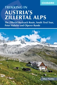
Trekking in Austria's Zillertal Alps
The Zillertal Rucksack Route, South Tirol Tour, Peter Habeler and Olperer Runde
£18.95
Guide to four hut-to-hut treks in the Austrian Tirol: the 9-day Zillertal Rucksack Route/Berliner Hohenweg, the Zillertal South Tirol Tour and the Peter Habeler Tour (both 7 days) and the Olperer Runde Tour (6 days). With optional excursions to climb neighbouring peaks, some of which call for mountaineering skills and glacier crossings.
More information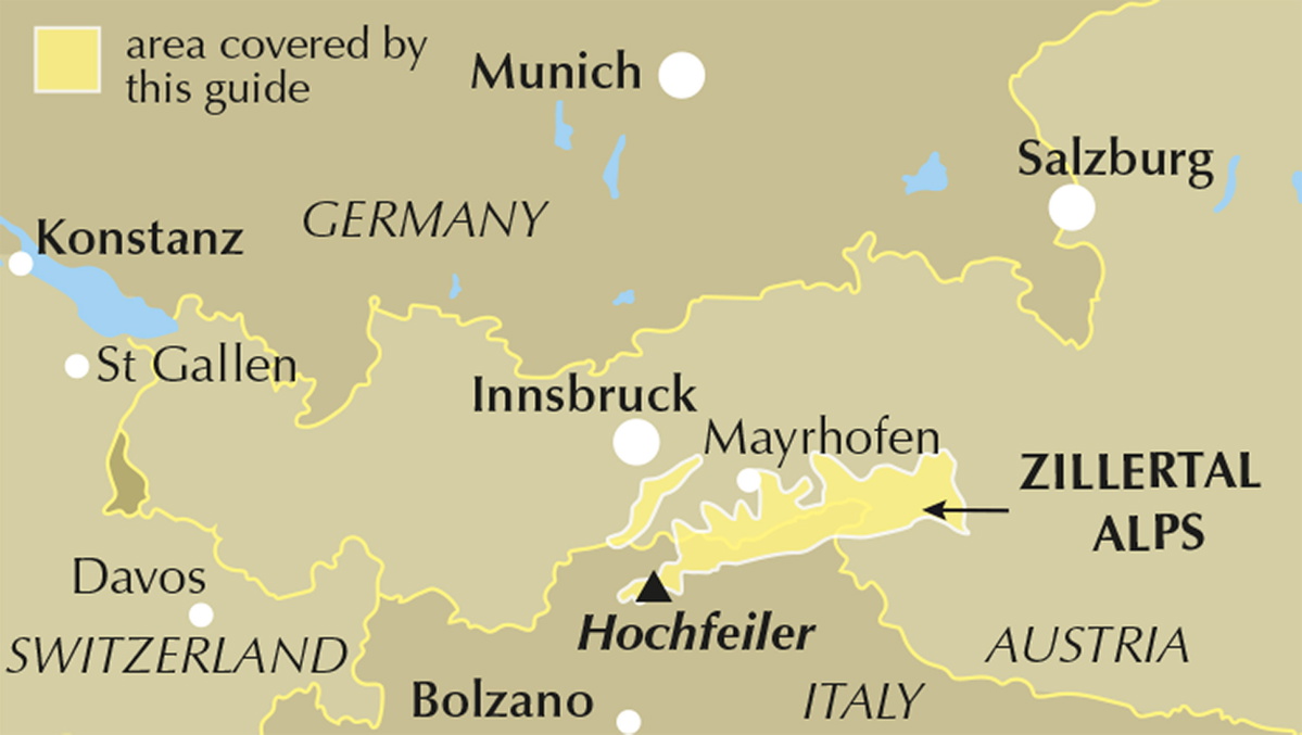
What is the Zillertal Rucksack Route?
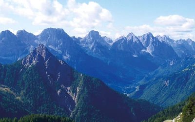
The Zillertal Rucksack Route, also called the Berliner Höhenweg or Zillertaler Runde, is the flagship trek in this guide: a 9-day, roughly 80km traverse that starts at the Karl von Edel Hut above Mayrhofen and links the Kasseler, Greizer, Berliner, Furtschaglhaus, Olperer and Friesenberghaus huts before finishing at the Gams Hut above Ginzling and Finkenberg. Along the way it crosses high passes below more than 40 peaks over 3000m, many carrying permanent snow or glacier ice, with the Hochfeiler, Grosser Möseler and Schwarzenstein forming a near-constant backdrop along the Austria-Italy frontier ridge.
The route can be walked entirely without crossing glaciers or needing technical climbing skills, though it still demands steep ground, late-summer snow crossings and the use of fixed wire ropes on some sections. What sets it apart from many Alpine hut tours is the sheer density of huts along the way: with overnight stops every day, walkers carry far less food and gear than on routes where resupply is scarce, while excursions to summits such as the Grosser Löffler, Olperer and Hoher Riffler let stronger parties turn any stage into a mountaineering day out.
This planning guide answers the most common questions walkers have before setting out. For complete stage-by-stage route descriptions and mapping for all four treks, see the Trekking in Austria's Zillertal Alps guidebook.
How long is the Zillertal Rucksack Route?
The Zillertal Rucksack Route covers 79.5km over 9 stages (with two optional variants), gaining 6445m of ascent and losing 8500m in descent over its 9 days.
| Stage | Distance | Ascent | Time |
|---|---|---|---|
| Mayrhofen to Karl von Edel Hut | 4km | 285m | 3hr |
| Karl von Edel Hut to Kasseler Hut | 12.5km | 750m | 8-10hr |
| Kasseler Hut to Greizer Hut | 9.25km | 750m | 6-7hr |
| Greizer Hut to Berliner Hut | 9km | 1050m | 6-8hr |
| Greizer Hut to Berliner Hut (via Floitenkees glacier/Schwarzenstein Hut) | 12.75km | 1100m | 8–10hr |
| Berliner Hut to Furtschaglhaus | 8km | 1020m | 6–7hr |
| Furtschaglhaus to Olperer Hut | 9.25km | 600m | 5–6hr |
| Furtschaglhaus to Olperer Hut (via Pfitscherjochhaus, 2 days) | 13km + 8.5km | 480m + 580m | 4–5hr + 6hr |
| Olperer Hut to Friesenberghaus | 4km | 290m | 2–3hr |
| Friesenberghaus to Gams Hut | 13.5km | 600m | 10–12hr |
| Gams Hut to Ginzling and Mayrhofen | 7km | negligible | 3hr |
| Gams Hut to Finkenberg and Mayrhofen | 10km | negligible | 2hr |
The toughest single day is Stage 8, Friesenberghaus to Gams Hut, a long 10–12 hour stage with 600m of ascent, and Stage 2, Karl von Edel Hut to Kasseler Hut, which combines 750m of ascent with an 8–10 hour day early in the trip before legs and lungs have adjusted to altitude.
The other three treks at a glance
- Peter Habeler Runde (7 days, 53.5km, 3570m ascent): starts and finishes at Touristenrast Gasthof, running via the Landshuter Europa, Pfitscherjochhaus, Olperer, Friesenberghaus, Tuxerjochhaus and Geraer huts. It shares several huts with the Rucksack Route and can be combined with it.
- Olperer Runde (6 days, 45km, 3120m ascent): a shorter circuit from Touristenrast Gasthof via the Geraer, Olperer, Friesenberghaus and Tuxerjochhaus huts, ideal for walkers with less time who still want a taste of the Olperer massif.
- Zillertal South Tirol Tour (7 days, 61km, 5010m ascent): crosses into Italy's South Tirol via Pfitscherjochhaus, taking in the Hochfeiler, Edelraut, Nevesjoch and Schwarzenstein huts before rejoining the Berliner or Greizer Hut. This is the most demanding of the four, with an optional ascent of the Hochfeiler itself (3510m) from the Hochfeiler Hut.
Who is this guidebook suitable for?
These treks suit walkers who already have some regular mountain activity behind them and are comfortable carrying a touring rucksack of 12–15kg for six to seven hours a day. None of the core routes require crossing glaciers or roped climbing, but all involve sustained steep ground, boulder fields, late-summer snow patches and sections protected by fixed wire ropes, so a good head for heights and surefootedness matter more than raw fitness alone.
Families with older, capable children are well catered for: the author notes children as young as nine or ten have completed much of the Rucksack Route, and huts are generally welcoming to younger walkers. The optional peak ascents, particularly the Hochfeiler and Grosser Möseler, are a different proposition and are aimed squarely at those with glacier travel experience and the right equipment.
How difficult is it?
The Alpenverein grades hut-to-hut paths blue, red or black. Most of the trekking in this guide follows red mountain trails (narrow, with steep sections, fixed wires and short scrambles, requiring alpine experience and mountaineering equipment) with some black mountain trail sections on the harder stages, such as parts of the Zillertal South Tirol Tour. Blue trails are generally limited to valley approach walks.
The optional peak ascents carry standard alpine grades from Facile (F), such as the Hoher Riffler and Peterskoepfl, up to Peu Difficile (PD) for summits like the Grosser Möseler, Olperer and Hochfeiler, which involve short technical sections and glacier travel rather than sustained difficulty.
When is the best time to walk the Zillertal treks?
- Mid-June to early July: huts start to open, but old winter snow can still linger on north-facing slopes such as the Lapenscharte, making early-season crossings harder work.
- July: milder and drier, though huts and trails get busier as the school holidays begin.
- August: peak season, with the most settled weather but the busiest huts; afternoon thunderstorms are common after clear mornings, and villages hold their traditional Kirchentage church festivals.
- September: quieter huts and cooler, often crisper weather as the season winds down; huts close in mid to late September.
The author's own preference is either mid-July or the first two weeks of September, avoiding both the lingering early-season snow and the height of the August crowds.
What accommodation is available?
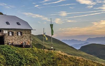
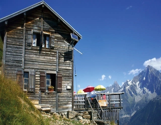
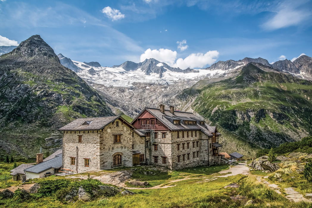
Accommodation on all four treks is almost entirely in mountain huts (more than a dozen feature across the guide), run by the Austrian Alpine Club (OeAV), German Alpine Club (DAV), or, in the South Tirol, the Italian Alpine Club (CAI) and Alpenverein Südtirol (AVS). Huts provide dormitory-style Matratzenlager bedding or a limited number of private Bettzimmer, plus half-board restaurant service; a sheet sleeping bag is compulsory at every hut. Half-board typically costs €55–65 a night, and OeAV Alpenverein Britannia membership brings reduced hut rates as well as mountain rescue insurance.
Booking ahead is strongly recommended, ideally up to six months in advance for group trips, and reconfirming with each hut by phone the day before arrival is standard practice. The guidebook's hut directory gives full contact and facility details for every hut used on the four treks.
Getting there and back
Mayrhofen, the starting point for the Zillertal Rucksack Route, sits at the head of the valley and is reached via the road and rail junction at Jenbach in the Inn valley, roughly an hour and 50km further on by train, bus or car. Jenbach itself is accessible from Munich, Salzburg or Innsbruck airports, with regional trains connecting onward; travellers flying in should generally plan to overnight in Mayrhofen before starting the trek rather than heading straight for a hut.
The Peter Habeler Runde, Olperer Runde and Zillertal South Tirol Tour all start from Touristenrast Gasthof, reached via Innsbruck rather than Mayrhofen, so onward transport planning differs depending on which trek you're doing. For linear routes finishing away from the start point, local Postbus and taxi services around Mayrhofen and Ginzling cover the final leg back to base.
Plan your trek with the Cicerone guidebook
The Trekking in Austria's Zillertal Alps guidebook by Allan Hartley contains everything you need to plan and complete all four treks, from valley trailheads to the high passes of the Austria-Italy frontier.
- Full stage-by-stage descriptions for all four treks: the Zillertal Rucksack Route (9 stages), Peter Habeler Runde (7), Olperer Runde (6) and Zillertal South Tirol Tour (7)
- Clear 1:50,000 mapping, downloadable GPX files and elevation profiles for every stage
- Optional ascents of neighbouring peaks, including the Hochfeiler, Grosser Möseler, Olperer and Berliner Spitze, with distances, ascent/descent and alpine grades
- A comprehensive hut directory covering facilities and season dates for every hut used
- Practical guidance on weather, getting to and from the Zillertal, local transport, kit lists for both walking and glacier travel, and health and safety in a high-mountain environment
- A German–English glossary covering hut etiquette, mountain terminology and ordering food
Available as a printed guidebook (£18.95) or digital eBook (£18.95): Trekking in Austria's Zillertal Alps.
Trekking in Austria's Zillertal Alps
The Zillertal Rucksack Route, South Tirol Tour, Peter Habeler and Olperer Runde
£18.95
Guide to four hut-to-hut treks in the Austrian Tirol: the 9-day Zillertal Rucksack Route/Berliner Hohenweg, the Zillertal South Tirol Tour and the Peter Habeler Tour (both 7 days) and the Olperer Runde Tour (6 days). With optional excursions to climb neighbouring peaks, some of which call for mountaineering skills and glacier crossings.
More informationAbout Allan Hartley, guidebook author:
Allan has had a keen interest in mountains and photography since his early teens. He has climbed extensively throughout the Alps. Allan maintains that Austria remains one of mountaineering's best-kept secrets, with its heady mix of superb scenery and top-class huts offering excellent food, and is better suited to the average mountaineer than the higher mountains to the west.
In addition to Austria and the Alps, Allan has climbed in many locations around the world, including East Africa, the Falkland Islands, the greater ranges of Nepal and Pakistan, the lesser-known Zagros Mountains of Iran and the Al Hajr Mountains of the Arabian Peninsula.
Allan is a long-term member and past president of the Austrian Alpine Club (UK) – Alpenverein Britannia. He is also a member of the Outdoor Writers and Photographers Guild, a double Associate of the Royal Photographic Society and a holder of the International Mountain Leader Award.
His home is on the edge of the Yorkshire Dales.