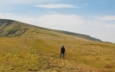
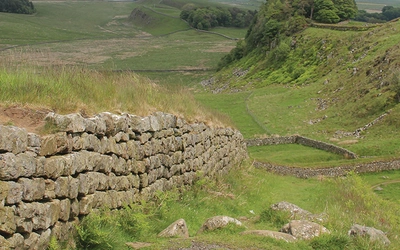
Walking in County Durham: a complete planning guide
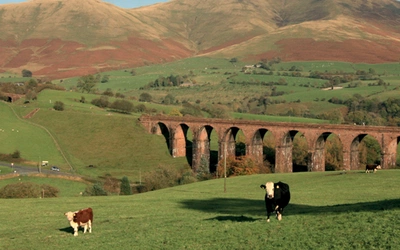
County Durham is, in Paddy Dillon's words, "a land of change": a richly wooded, ancient landscape running from the high Pennines in the west to a low cliff coast in the east, which once concealed a treasure trove of coal and lead and was fought over and settled by wave after wave of invaders. Durham City still carries that history in its trinity of cathedral, castle and university, symbols of the religious, civic and intellectual power once held together by a succession of prince-bishops. This planning guide draws on Dillon's Cicerone guidebook of 40 day walks (5 to 24km / 3 to 15 miles), graded easy to moderate, to help you choose a route and plan the practicalities, from seasons and transport to accommodation. (Last updated: July 2026 · Guidebook edition: 5th edition, October 2022)
Walking in County Durham, quick facts:
- Location: County Durham, North East England, between the Tyne and the Tees
- Total routes: 40 day walks
- Distance range: 5 to 24km (3 to 15 miles) per walk
- Typical duration: 1 to 7 hours per walk
- Difficulty: Easy to moderate, suitable for most walkers including families
- Terrain: Pennine moorland, river valleys, woodland, farmland, coastal cliffs, historic towns and quiet lanes
- Highest point: Mickle Fell, 788m (Walk 28)
- Navigation: Step-by-step route descriptions with 1:50,000 OS mapping; GPX files available to download
- Best season: Year-round, though spring to early autumn is best for the high Pennine moors
- Guidebook:Walking in County Durham, Paddy Dillon, 5th edition (Cicerone, October 2022)
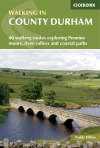
Walking in County Durham
40 walking routes exploring Pennine moors, river valleys and coastal paths
£14.95
Guidebook offering detailed descriptions of 40 day walks across County Durham. Walks range from 5 to 24km and show off the region's history and natural wonders. The terrain covers field paths and open moorlands, from the North Sea to the high Pennines.
More informationWhat is Walking in County Durham?
Walking in County Durham is a Cicerone guidebook of 40 day walks covering the full breadth of the county, from the high Pennines in the west to the North Sea coast in the east. Author Paddy Dillon groups the routes around Durham City and the coalfield villages, the Tees Valley, Upper Teesdale and the Weardale hills, so walkers can base themselves anywhere in the county and find routes within easy reach.
County Durham is less walked than its neighbours, the Lake District and the Yorkshire Dales, yet it offers the same range of upland scenery alongside something they lack: a working history of prince-bishops, lead mining and the birthplace of the railways, all still visible in the landscape. Waterfalls on the Tees and Wear, arctic-alpine plant communities on the "sugar limestone" of Upper Teesdale, and a coastline recovering from a century of coal-spoil dumping give the routes a genuinely varied character within a single, compact county.
Many of the walks link directly to the region's industrial past, from Beamish Museum's reconstructed colliery village to the Killhope lead mining museum, giving the guidebook a stronger heritage focus than most day-walk collections.
This planning guide answers the most common questions walkers have before setting out. For complete stage-by-stage route descriptions and mapping, see the Walking in County Durham guidebook.
How does the walking in County Durham divide up?
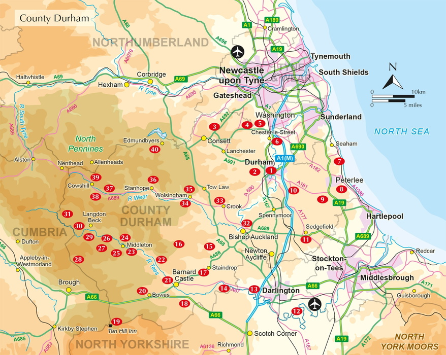
The 40 routes fall into four broad geographic groups, following the shape of the county from the coalfield in the east to the high Pennines in the west.
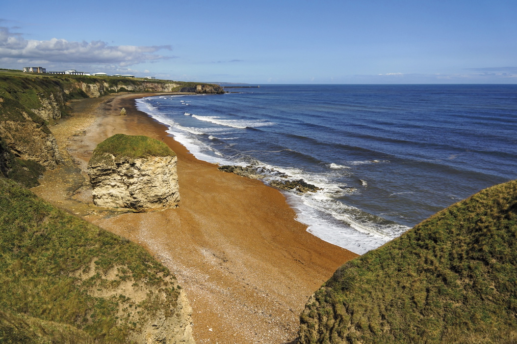
- Durham City and the coalfield (Walks 1 to 11): Durham Cathedral and the River Wear, former pit villages such as Beamish and Causey, and the Durham Heritage Coast at Castle Eden Dene, where reclaimed coal-spoil beaches have been restored under the "Turning the Tide" project.
- Tees Valley and south Durham (Walks 12 to 25): Lower Teesdale around Gainford, Piercebridge and Barnard Castle, plus high moorland outliers such as Tan Hill and Bowes Moor.
- Upper Teesdale (Walks 26 to 31): The high Pennine moors around Middleton-in-Teesdale, including Low Force and High Force, and the arctic-alpine "Teesdale Assemblage" plant communities of Cronkley Fell and Widdybank Fell.
- Weardale and the Wear Valley (Walks 32 to 40): Bishop Auckland, Wolsingham and Stanhope, running up to the lead mining country around Killhope and Allenheads.
| Walk | Distance | Start/Finish | Why it stands out |
|---|---|---|---|
| Durham City and the River Wear | 5km (3 miles) | Durham Cathedral | Passes beneath Durham Cathedral, a UNESCO World Heritage Site, and follows the River Wear through the heart of the city |
| Beamish and Causey | 10km (6¼ miles) | Beamish | Links to Beamish Museum's reconstructed colliery village, one of the region's best-known heritage attractions |
| Castle Eden Dene | 13.5km (8½ miles) | Horden | Passes through one of County Durham's few surviving fragments of ancient "wildwood," on the reclaimed Durham Heritage Coast |
| Barnard Castle and the Tees | 12km (7½ miles) | Barnard Castle | Combines the historic market town, its Norman castle, and the Bowes Museum with riverside paths along the Tees |
| Low Force and High Force | 11.5km (7¼ miles) or 12.5km (7¾ miles) | Bowless Visitor Centre | Reaches High Force, one of England's most powerful waterfalls, formed where the Whin Sill crosses the Tees |
| Cronkley Fell | 11km (7 miles) | Forest-in-Teesdale | Crosses "sugar limestone" grassland supporting rare arctic-alpine plants such as spring gentian |
| Stanhope and Stanhope Dene | 15km (9½ miles) | Stanhope | Explores a wooded Weardale valley close to the Durham Dales Centre, with easy access to local transport |
| Cowshill, Killhope and Allenheads | Cowshill | 17km (10½ miles) or 18.5km (11½ miles) | Passes Killhope, the North of England Lead Mining Museum, and follows the dedicated Lead Mining Trail |
Full distance, ascent and timing data for all 40 walks is given in Appendix A of the guidebook.
Who is Walking in County Durham suitable for?
Most of the 40 routes are well suited to families, casual walkers and those building up to longer days, since the guidebook's overall grading is easy to moderate. Shorter, lower-level walks around Durham City, the coalfield villages and the Tees Valley involve little climbing and stay on well-defined paths, field paths or old railway trackbeds.
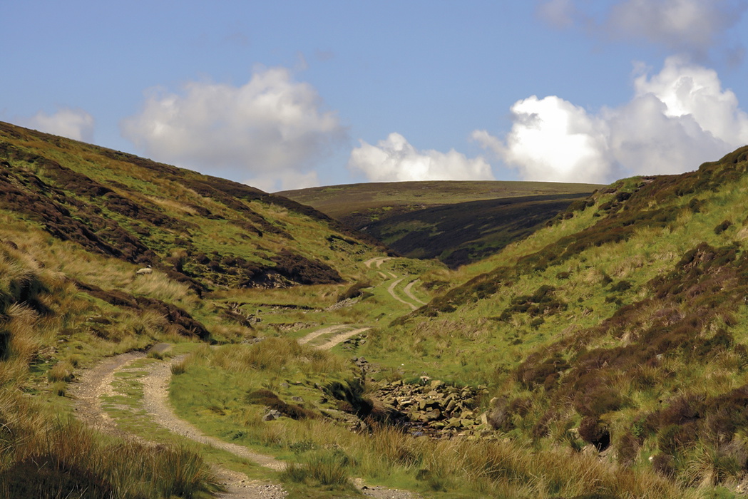
A smaller number of routes are more demanding. Walks onto the high Pennine moors, such as Mickle Fell (Walk 28), Chapelfell Top and Noon Hill (Walk 38), and the Cow Green reservoir routes (Walks 30 and 31), cross remote, largely unfrequented moorland where navigation in poor visibility becomes genuinely difficult. These routes suit walkers who are comfortable navigating on featureless ground and prepared for rapidly changing weather.
How difficult is the walking in County Durham?
The guidebook's overall grading is easy to moderate, with terrain and gradient rather than technical difficulty being the main factor. Lower-level walks in the east and along the Tees Valley are straightforward, following field paths, quiet lanes and disused railway trackbeds with modest ascent.
The hardest walks are those onto the open Pennine moorland in the west, including Mickle Fell (Walk 28, reached only via the Boundary Route by permit), Tan Hill and Sleightholme Moor (Walk 19), and Chapelfell Top and Noon Hill (Walk 38). These involve sustained moorland walking, less clearly defined paths, and greater exposure to wind and mist. Good navigation skills and appropriate clothing are essential on these routes, whatever the season.
When is the best time to walk in County Durham?
- Spring (March to May): A strong season for Upper Teesdale, where the arctic-alpine "Teesdale Assemblage" and spring gentians come into flower on Cronkley Fell and Widdybank Fell.
- Early summer (May to June): Hay meadows in Teesdale and Weardale are at their best before the traditionally late mowing date; black grouse can occasionally be seen displaying on the moors.
- Summer (June to August): The most reliable season for the high Pennine moorland walks, when long daylight hours and settled weather make routes such as Mickle Fell and Chapelfell Top more manageable.
- Autumn (September to October): A quieter shoulder season with good visibility for coastal and Tees Valley routes, before the shorter days of winter make the longer moorland walks harder to complete safely.
- Winter (November to February): Lower-level walks around Durham City, the coalfield and the coast remain enjoyable year-round, but the high Pennine routes should be reserved for clear, settled days, since deep snow and short daylight hours can turn a moorland walk into a serious undertaking.
What accommodation is available?
County Durham's accommodation is concentrated in its market towns and larger villages: Durham City, Barnard Castle, Bishop Auckland and Stanhope all offer a range of B&Bs, guesthouses and hotels, with Durham City having by far the widest choice given its university and cathedral tourism.
Weardale and Upper Teesdale have a thinner spread of accommodation, so walkers tackling several routes in these areas may find it easier to base themselves in a hub town such as Stanhope, Wolsingham or Middleton-in-Teesdale and drive or take the bus out to each walk. The guidebook's Appendix B lists useful contacts, including tourist information centres, for accommodation bookings across the county.
Getting there and around
Durham is served by direct LNER trains from London King's Cross and Edinburgh, and by CrossCountry services from Birmingham, Edinburgh and Glasgow. Newcastle Airport is the more convenient of the two regional airports, with more flights than Teesside International, and DFDS Seaways ferries connect Newcastle with Amsterdam.
Within the county, Northern operates the limited rail network linking Newcastle, Durham, Darlington and the coastal towns of Stockton-on-Tees, Hartlepool, Seaham and Sunderland. Bus coverage is more extensive: Arriva and Go North East cover most of the county between them, with Weardale Travel serving Weardale specifically. Durham County Council publishes a bus map at durham.gov.uk/busmap. The guidebook was researched entirely using public transport, so most walks can be reached without a car, though some rural services have been reduced in recent years and timetables should be checked in advance.
What is County Durham's Land of the Prince-Bishops heritage?
County Durham's subtitle, "the Land of the Prince-Bishops," refers to the succession of bishops who held both religious and civic power over the region for centuries, a history still visible in Durham City's trinity of cathedral, castle and university. The guidebook weaves this heritage through several routes, alongside the physical legacy of the coal and lead mining industries that shaped the county's economy for generations.
Walks such as Beamish and Causey (Walk 4) and Cowshill, Killhope and Allenheads (Walk 39) pass directly through this industrial landscape, from a reconstructed colliery village to the North of England Lead Mining Museum on the dedicated Lead Mining Trail. Former pit villages, spoil heaps reclaimed as woodland, and disused railway trackbeds converted to traffic-free cycleways appear throughout the county, giving walkers a tangible sense of a landscape shaped as much by industry as by geology.
Walking in County Durham
40 walking routes exploring Pennine moors, river valleys and coastal paths
£14.95
Guidebook offering detailed descriptions of 40 day walks across County Durham. Walks range from 5 to 24km and show off the region's history and natural wonders. The terrain covers field paths and open moorlands, from the North Sea to the high Pennines.
More informationPlan your County Durham walks with the Cicerone guidebook
Walking in County Durham by Paddy Dillon contains everything you need to plan and complete all 40 routes, from short strolls around Durham City to full days on the high Pennine moors.
- Detailed route descriptions for 40 day walks, from 5 to 24km (3 to 15 miles)
- Step-by-step directions with 1:50,000 Ordnance Survey mapping extracts
- Appendix A route summary table giving distance, ascent and timing at a glance
- Appendix B of useful contacts, including tourist information centres and transport operators
- Background chapters on the geology, wildlife, mining and railway heritage of the county
- Practical advice on access, rights of way and walking safely on the high Pennine moors
- Downloadable GPX files for use with GPS devices and apps
Available as a printed guidebook (£14.95) or digital eBook.
About Paddy Dillon, guidebook author
Paddy Dillon is a prolific walker and guidebook writer, with over 100 guidebooks to his name and contributions to 40 other titles. He has written for several outdoor magazines and other publications and has appeared on radio and television.
Paddy uses a tablet computer to write as he walks. His descriptions are therefore precise, having been written at the very point at which the reader uses them.
Paddy is an indefatigable long-distance walker who has walked all of Britain's National Trails and several European trails. He has also walked in Nepal, China, Korea and the Rocky Mountains of Canada and the US.
Visit Paddy Dillon's website.