Walking in the West Pennine Moors: a complete planning guide
This planning guide covers everything you need to plan walking on the West Pennine Moors, based on Terry Marsh's 30-walk Cicerone guidebook. Marsh knows this landscape intimately: sombre gritstone moorland, hidden wooded cloughs and reservoir-filled valleys folded between Bolton, Blackburn, Chorley and Darwen, a landscape he describes as almost untouched by time. Here you'll find routes across Rivington, Roddlesworth, Turton and Haslingden Grane, from short valley strolls to full moorland days of 5 to 15km. (Last updated: July 2026 · Guidebook edition: 1st edition, reprinted 2022)
Walking in the West Pennine Moors, quick facts
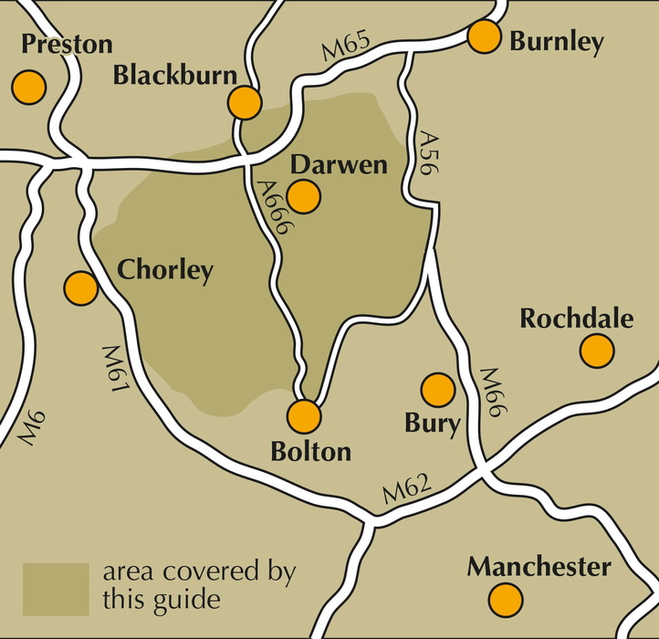
- Location: West Pennine Moors, Lancashire, between Chorley, Bolton, Horwich, Ramsbottom, Haslingden, Oswaldtwistle and Darwen
- Total routes: 30 circular day walks
- Distance range: 5–15km (3–9 miles) per walk
- Typical duration: varies by route, from a couple of hours to a full day depending on distance and terrain
- Difficulty: Easy to moderate; not technically difficult, but the ground can be demanding, especially after rain
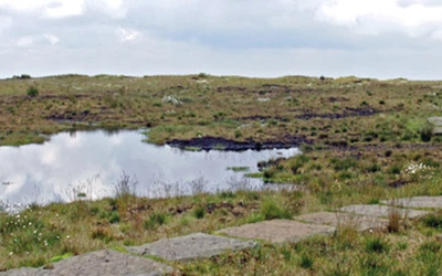
- Terrain: gritstone moorland, blanket bog, wooded cloughs, reservoir shorelines and farmland pasture
- Highest point: Winter Hill, 456m (1496ft)
- Navigation: step-by-step route directions with 1:50,000 OS Landranger Sheets 103 and 109, or the more detailed 1:25,000 OS Explorer Sheet 287
- Best season: year-round, though the moorland can be wet and boggy in all but the driest spells
- Guidebook: Walking on the West Pennine Moors, Terry Marsh, 1st edition (reprinted 2022)
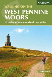
Walking on the West Pennine Moors
30 walks around moorland Lancashire
£12.95
This guidebook describes 30 walks on the West Pennine Moors, around Blackburn, Darwen, Chorley and Bolton, home to some of the most inspiring and exhilarating walking country. The walks range from short, easy rambles to more challenging hikes covering a variety of terrain, all of it easily accessible for day walking.
More informationWhat is Walking on the West Pennine Moors?
Walking on the West Pennine Moors is a Cicerone guidebook by Terry Marsh describing 30 circular day walks across 233km² (90 square miles) of moorland and reservoir country between Chorley, Bolton, Horwich, Ramsbottom, Haslingden, Oswaldtwistle and Darwen. The walks are grouped into four geographic sections: Rivington and Anglezarke, Roddlesworth and Darwen, Turton and Entwistle, and Ramsbottom, Hoddlesden and Haslingden Grane, giving structured coverage of the whole area rather than a scattered selection of routes.
This is gritstone country, dissected by wooded cloughs and marked by skyline landmarks such as Rivington Pike, the Peel Monument on Holcombe Moor and Jubilee Tower (Darwen Tower) on Darwen Moor. Almost the entire area functions as water catchment, and United Utilities, successor to the North West Water Authority, owns around 40 per cent of the land. Unlike Pennine moorland further north, the West Pennine Moors are not managed for grouse shooting, which has spared them the same "access aggravation" seen in areas like the Peak District.
This particular stretch of moorland has a distinctive access history. Long before the well-known 1932 mass trespass at Kinder Scout, the West Pennine Moors saw organised trespasses in the late 1800s, including a gathering of around 10,000 people in 1896, plus court proceedings on Winter Hill and Darwen Moor to keep rights of way open. According to Marsh, the West Pennine Moors were genuinely first in Britain's fight for countryside access, a claim not often credited in more general accounts of the access movement. This planning guide answers the most common questions walkers have before setting out. For complete stage-by-stage route descriptions and mapping, see the Walking on the West Pennine Moors guidebook.
The 30 routes at a glance: how the West Pennine Moors divides
The guidebook's 30 walks are organised into four geographic areas, each centred on its own cluster of reservoirs and moorland blocks:
- Rivington and Anglezarke (Walks 1–12): the best-known corner of the moors, home to Rivington Pike, Winter Hill, Great Hill and Spitler's Edge, Rivington Country Park and the Anglezarke and Yarrow reservoirs
- Roddlesworth and Darwen (Walks 13–17): centred on the wooded Roddlesworth valley and Darwen Tower (Jubilee Tower), above Blackburn and Darwen
- Turton and Entwistle (Walks 18–24): the Turton, Wayoh, Entwistle and Jumbles reservoirs north of Bolton, along with Turton Tower and Longworth Clough
- Ramsbottom, Hoddlesden and Haslingden Grane (Walks 25–30): the remote Grane valley west of Haslingden, plus Holcombe Moor, the Peel Monument, and the Irwell Valley
Each section can be walked independently, and the geographic grouping makes it straightforward to base a series of day walks around a single valley or reservoir cluster.
Eight of the best walks on the West Pennine Moors
| Walk | Distance | Height gain | Why it stands out |
|---|---|---|---|
| Rivington Pike | 5km (3 miles) | 230m (755ft) | The signature summit of the whole area, with the pike tower giving wide views across the Rivington reservoirs and Lever Park |
| Great Hill and Spitler's Edge | 14.5km (9 miles) | 414m (1358ft) | One of the higher, more exposed moorland routes, crossing genuine blanket bog terrain typical of the West Pennine Moors at their wildest |
| Around Anglezarke Reservoir | 11km (7 miles) | 185m (605ft) | A reservoir-shore walk through the valley shaped by Lord Leverhulme's landscaping, including the Rivington Terraced Gardens and the Liverpool Castle folly |
| Tockholes and Darwen Tower | 9km (5½ miles) | 290m (950ft) | Climbs to Jubilee Tower (Darwen Tower) on Darwen Moor, one of the area's key skyline landmarks and a site of historic access disputes |
| Roddlesworth Woodlands and Reservoirs | 6.5km (4 miles) | 125m (410ft) | Passes through the largest wooded clough in the area, including ancient woodland habitat around the Roddlesworth valley |
| Turton and Entwistle Reservoir | 7km (4½ miles) | 132m (435ft) | Takes in Entwistle Reservoir, one of the first reservoirs of its size built in Britain, constructed in the 1830s |
| Holcombe Moor and Peel Hill | 7.4km (4.6 miles) | 211m (692ft) | Climbs to the Peel Monument, a prominent moorland landmark commemorating Sir Robert Peel above the Irwell Valley |
| Haslingden Grane | 5km (3 miles) | 165m (540ft) | Explores a remote, depopulated valley of abandoned farmsteads and packhorse tracks, flanked by steeper valley sides than elsewhere on the moors |
Who is Walking on the West Pennine Moors suitable for?
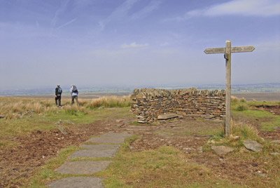
The 30 walks in this guidebook cover a genuine spread of ability levels. Shorter valley walks around the reservoirs at Jumbles, Wayoh and Rivington are well within reach of anyone used to ordinary countryside walking, including families and less experienced navigators, since paths tend to be well used and close to visitor centres. The longer moorland routes, particularly those crossing Great Hill, Winter Hill and the higher blanket bog sections, demand a reasonable level of fitness and confident map and compass skills, since paths shown on the map are not always visible on the ground.
Dog walkers are generally well catered for around the reservoir circuits, though care is needed on higher ground during bird breeding season given the area's importance for moorland species such as golden plover, dunlin and short-eared owl.
How difficult is walking in the West Pennine Moors?
The guidebook rates the walking as easy to moderate, and none of the 30 routes is technically difficult in the way an exposed scramble or Grade 2/3 mountain route would be. The genuine challenge here is underfoot conditions rather than technical terrain: the moors are used as water catchment and are wet, boggy and often muddy outside the driest periods, so route-finding across peat bog and rough grassland requires more care than the modest heights suggest. Winter Hill, at 456m (1496ft), is the high point of the area, and routes crossing its shoulder or Spitler's Edge are the most demanding in the collection.
When is the best time to walk in the West Pennine Moors?
- Spring and autumn: generally the most comfortable seasons underfoot, with drier ground conditions than winter and good visibility for the skyline landmarks
- Summer: long daylight hours suit the longer moorland routes, though the peat can still hold water after rain
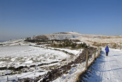
- Winter: walking is possible year-round, but boggy sections become harder going, and short daylight hours limit the longer routes; take extra care and be winter-wise if snow lies on higher ground
- Because the entire area is water catchment, wet and muddy conditions can occur at any time of year, even in what looks like a dry spell elsewhere in Lancashire
What accommodation is available near the West Pennine Moors?
The West Pennine Moors sit within easy reach of Bolton, Blackburn, Chorley, Darwen and Haslingden, all of which offer a full range of accommodation from B&Bs to hotels, making it straightforward to base a series of day walks from any of these towns rather than needing to stay directly on the moors. United Utilities also operates four information centres with refreshment facilities, at Rivington, Jumbles Country Park, Roddlesworth and Clough Head, and Haslingden Grane, useful for breaking up a day's walking. For full details of accommodation options in each valley, see the guidebook's appendix.
Getting to and from the West Pennine Moors
The moors are unusually accessible for an upland area, threaded by valley roads and surrounded by towns on every side. Blackburn and Bolton both have mainline rail stations with regular services from Manchester and Preston, making rail-based day trips straightforward for routes in the Roddlesworth, Darwen and Turton sections. Chorley station serves the Rivington and Anglezarke walks well, and Ramsbottom and Haslingden are both accessible by bus from Bury and Blackburn respectively for the walks around Haslingden Grane. Because the walks are circular, no return transport logistics are needed beyond getting back to your original start point.
What is the access history of the West Pennine Moors?
The West Pennine Moors have a distinctive place in the story of the British right-to-roam movement. Long before the 1932 mass trespass at Kinder Scout, which is usually credited as the founding moment of the access campaign, the West Pennine Moors saw their own organised trespasses in the late 1800s, including a gathering of around 10,000 people in 1896, alongside court proceedings on both Winter Hill and Darwen Moor over the right to keep paths open. Much of the moorland became freely accessible under the right-to-roam provisions of the Countryside and Rights of Way Act 2000, and today the same paths that were once disputed in court form the backbone of the guidebook's 30 walks.
Walking on the West Pennine Moors
30 walks around moorland Lancashire
£12.95
This guidebook describes 30 walks on the West Pennine Moors, around Blackburn, Darwen, Chorley and Bolton, home to some of the most inspiring and exhilarating walking country. The walks range from short, easy rambles to more challenging hikes covering a variety of terrain, all of it easily accessible for day walking.
More informationPlan your West Pennine Moors walks with the Cicerone guidebook
The Cicerone guidebook Walking on the West Pennine Moors by Terry Marsh contains everything you need to plan and complete 30 circular day walks across the area, from the reservoirs of Rivington to the remote Haslingden Grane valley.
- 30 circular day walks organised into four geographic sections
- Step-by-step route descriptions for each walk
- 1:50,000 OS Landranger mapping references (Sheets 103 and 109) and guidance to the more detailed 1:25,000 OS Explorer Sheet 287
- Practical information on distance, ascent, parking, public transport and nearby pubs or cafés
- An Appendix 1 Route Summary Table giving distance and timing at a glance for all 30 walks
- Background on the area's natural history, wildlife and industrial heritage
- A further reading appendix for those wanting to explore the history and geography in more depth
Available as a printed guidebook (£12.95) or digital eBook.
About Terry Marsh, guidebook author
Lancashire-born writer and photographer Dr Terry Marsh specialises in the outdoors and travel. He has been writing guidebooks since the mid 1980s and is the author or revision author/editor of over 100 titles, including the award-winning Cicerone guides to the Coast-to-Coast Path (first published in 1993), The Shropshire Way (1999) and Great Mountain Days in the Pennines (2013).
Terry has a long-standing interest in the Scottish islands, Cumbria and the Lake District and the Yorkshire Dales. Academically, he is an historical geographer holding a Master of Arts degree with Distinction in Lake District Studies and a PhD in Historical Geography. He is a Life Member of the Outdoor Writers and Photographers Guild.