Walking on Arran: a complete planning guide
The Isle of Arran rises proudly from the Firth of Clyde, its jagged northern peaks a tempting challenge and its southern moorlands a quieter reward. Often described as 'Scotland in miniature', Arran packs an extraordinary range of landscapes into a single island: granite mountain ridges, ancient stone circles, raised beaches, deep glens, and a coastline walkable in its entirety via the 110km (68-mile) Arran Coastal Way, one of Scotland's Great Trails. The 45 routes in this guidebook range from a gentle 5km (3-mile) forest trail to a demanding 22.5km (14-mile) mountain day, with every level of walker accounted for in between. (Last updated: May 2026 · Guidebook edition: 4th edition, June 2023)
Walking on Arran, quick facts:
- Location: Isle of Arran, Firth of Clyde, Scotland (plus one walk on neighbouring Holy Isle)
- Total routes: 45 walks — easy forest trails, moderate glen and hill walks, challenging mountain routes, and the full Arran Coastal Way
- Distance range:5km to 22.5km (3 to 14 miles) per walk; Arran Coastal Way 110km (68 miles)
- Typical duration:1hr 30min to 7hr per walk; Arran Coastal Way suits a 7-day itinerary
- Difficulty: All abilities, from easy waymarked trails to strenuous routes with exposed scrambling
- Terrain: Mountain ridges, pathless moorland, glaciated glens, forest tracks, farmland, raised beaches, and coastal paths
- Highest point: Goatfell, 874m (2867ft)
- Navigation: 1:50,000 OS map extracts for every walk; GPX downloads available
- Best season: Year-round; see seasonal notes below
- Guidebook:Walking on Arran by Paddy Dillon, 4th edition (June 2023), available from Cicerone
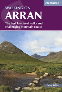
Walking on Arran
The best low level walks and challenging mountain routes, including the Arran Coastal Way
£16.95
The 45 walking routes in this Isle of Arran guidebook range from easy 5km (3 miles) nature trails to long arduous mountain routes with scrambles (up to 22km), providing thorough coverage of Arran, including an ascent of Goatfell, and nearby Holy Isle. Also includes the 110km Arran Coastal Way, one of Scotland's Great Trails.
More information
What is Walking on Arran?
Walking on Arran is a comprehensive collection of 45 walking routes covering the full breadth of the Isle of Arran, from the granite summits of the north to the quieter farmlands and forest tracks of the south, plus a complete route guide for the Arran Coastal Way. The routes range from short, waymarked nature trails suitable for families to serious mountain days involving hands-on scrambling on rocky ridges above Sannox and Glen Rosa.
Arran's landscape is genuinely varied in a way that few British islands can match. The northern half of the island is dominated by a dramatic cluster of mountains, including Goatfell, the Sannox Horseshoe, and the ridges of Glen Rosa, whose character resembles the Scottish Highlands in miniature. The southern half is markedly different: rolling moorland, ancient standing stones at Machrie Moor, coastal headlands, and the tree-fringed Ross road. This contrast, compressed into an island roughly 20 miles long, is what makes Arran so rewarding to explore on foot.
The guidebook has been thoroughly updated across four editions, most recently by Paddy Dillon in 2023, who researched and updated the entire book using local bus services alone. That practical approach shapes the book throughout: routes are designed to work without a car, with bus connections noted at every start and finish point. The book also includes a Gaelic/English glossary and appendices covering useful contacts, accommodation options, and the full route for the Arran Coastal Way. This planning guide answers the most common questions walkers have before setting out. For complete route descriptions and mapping, see the Cicerone Walking on Arran guidebook.
The 45 routes at a glance
The walks divide naturally into three groups by character and location.
Easy and low-level routes (roughly Walks 2, 9, 11, 16, 21) include waymarked forest trails, a visit to the Machrie Moor stone circles (4.5km, 1hr 30min), and the short circuit to Coire-Fhionn Lochan (9km, 3hr). These suit families, less experienced walkers, or anyone looking for a gentler day.
Moderate glen and hill walks (roughly Walks 3–8, 12–15, 19–20, 22, 25–28) range from 10km to 17.5km and typically take 3hr 30min to 5hr 30min. These include the Holy Isle circuit (7km, 2hr 30min), Glenashdale Falls and Giants' Graves (6km, 2hr), and several approaches to the lower northern peaks including Mullach Buidhe and Meall nan Damh.
Mountain and ridge routes (Walks 1, 17–18, 23–24, 29–35) are the most demanding, requiring good fitness, mountain navigation skills, and appropriate equipment. The Glen Sannox Horseshoe (16km, 6hr, 1700m ascent) is the most strenuous route in the book, with the Catacol routes and the Glen Rosa ridges not far behind.
The Arran Coastal Way (Walks 36–45) is presented as a continuous ten-stage long-distance walk with alternatives on several sections. The full route covers approximately 110km (68 miles) and forms a natural week-long itinerary, circling the entire island coastline from Brodick.
A selection of key routes from the summary table:
| Walk | Distance | Total Ascent | Time |
|---|---|---|---|
| Goatfell and Brodick | 16.5km (10¼ miles) | 875m (2870ft) | 5hr |
| Holy Isle from Lamlash | 7km (4½ miles) | 350m (1150ft) | 2hr 30min |
| Machrie Moor Stone Circle | 4.5km (2¾ miles) | 40m (130ft) | 1hr 30min |
| Coire-Fhionn Lochan | 9km (5½ miles) | 660m (2165ft) | 3hr |
| North Glen Sannox Horseshoe | 10.5km (6½ miles) | 910m (2985ft) | 3hr 30min |
| Glen Sannox Horseshoe | 16km (10 miles) | 1700m (5575ft) | 6hr |
| Sannox, Goatfell and Corrie | 11km (7 miles) | 1190m (3905ft) | 4hr |
| Arran Coastal Way (full) | ~110km (68 miles) | Varies | ~7 days |

Who is Walking on Arran suitable for?
The guidebook is designed to serve a very wide range of walkers, and the routes genuinely do cover every ability level. Complete beginners and families are catered for by the easy forest trails and low-level coastal and glen walks, several of which are under 6km and well-waymarked. Moderate walkers will find a substantial middle tier of glen and hill routes, many accessible by bus from Brodick, Lamlash, or Lochranza.
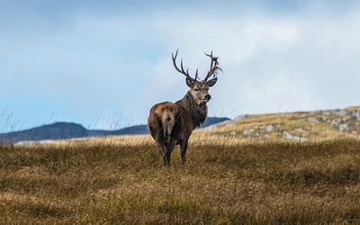
The mountain routes require a higher level of fitness and competence. The ridges above Glen Sannox and Glen Rosa involve sustained ascent, rocky terrain, and sections where hands will be needed on steep ground. Anyone unused to pathless mountain terrain or exposed scrambling should consider building up with the moderate routes first. Walkers with dogs should note that some routes pass through farmland with livestock and that deer-fenced areas on the northern mountains have limited gate access.
How difficult is Walking on Arran?
The guidebook does not use a single published grading scale, but the author groups routes usefully in the introduction: a handful are easy, around a dozen are moderate, and the remainder are strenuous. As a general guide:
- Easy: Waymarked trails, forest circuits, coastal paths with minimal ascent (Walks 2, 9, 11, 16)
- Moderate: Glen and hill routes with ascents typically between 350m and 650m (Walks 4–8, 12–15, 19–20, 22, 25–28)
- Strenuous with scrambling: High mountain routes with ascents from 875m to 1700m, sometimes on pathless or rocky ground (Walks 1, 17–18, 23–24, 29–35)
The Glen Sannox Horseshoe (Walk 30) at 1700m of ascent is the hardest day in the book and should only be attempted in settled weather by experienced hill walkers. Several of the Catacol routes (Walks 22–24) and the Glen Rosa ridges (Walks 33–35) are similarly demanding. The Arran Coastal Way stages (Walks 36–45) are mostly moderate, following coastal paths and tracks with limited ascent, though the mountain alternative for Stage 2 (Walk 37) is a significantly harder proposition.
Can I walk sections of the Arran Coastal Way separately?
Yes, and the bus network makes this straightforward. The Arran Coastal Way is divided into ten stages in the guidebook, each beginning and ending at a village served by Stagecoach West Scotland buses. Walkers who prefer a shorter visit can pick off individual stages or combine two or three into a weekend itinerary. Popular shorter options include Sannox to Lochranza (Walk 38, 16km, 5hr), which takes in the dramatic northern coastline and Hutton's Unconformity, and Whiting Bay to Brodick (Walk 45, 18km, 5hr 30min), which finishes at the ferry terminal. Several stages have both a coastal and an inland alternative, adding variety for those returning to repeat the route.

When is the best time to walk on Arran?
Arran is walkable year-round, but each season has distinct characteristics.
- Spring (April–May): The island is relatively quiet before the summer influx. Days lengthen quickly, wildflowers appear on the lower slopes, and the mountains tend to be clear of snow from April onwards. Midges are not yet a significant presence.
- Summer (June–August): The most popular period, and the most demanding on accommodation and ferries. The island's population can swell from under 5,000 to nearly 15,000 at peak times. The long daylight hours are excellent for the longer mountain routes. Midges can be problematic in still, humid weather, particularly in glens and woodland.
- Deer stalking season (mid-August to mid-October): Stalking takes place on the northern hills, never on Sundays. Walkers should be aware of this when planning routes in the Arran Deer Management area and may wish to contact estate managers in advance for strenuous mountain routes during this period.
- Autumn (September–October): Often the best month for mountain walking. Crowds have thinned, the heather moorlands are in bloom into September, and the light is excellent for photography. River levels can be higher after autumn rain, which is relevant for some of the glen crossings.
- Winter (November–March): The island is quiet and ferry services are reduced. Mountain routes can be serious winter undertakings in cold conditions, requiring full winter kit and navigation skills. Lower-level and coastal walks remain accessible and can be atmospheric on clear winter days.
What accommodation is available on Arran?
Accommodation on Arran is plentiful but can book out rapidly during school holidays and the peak summer season. Booking well in advance is strongly advised for July and August visits.
Budget options include a handful of campsites around the island: Glen Rosa (near Brodick), Cordon (near Lamlash), Kildonan (south-east), Bridgend (near Shiskine), and Lochranza (north-west). There is one youth hostel, at Lochranza, and well-equipped bunkhouses at Brodick, Corrie, Kilmory, and Lamlash. Wild camping is permitted under the Scottish Outdoor Access Code, but campers should be discreet and leave no trace.
Self-catering accounts for the majority of accommodation on the island, ranging from simple cottages to large houses. This is a practical choice for groups or those staying for a week or more.
B&Bs and small hotels are found throughout the island's villages, including Brodick, Lamlash, Whiting Bay, Kildonan, Lagg, Blackwaterfoot, Lochranza, Sannox, and Corrie. The largest hotels on the island are near Brodick. The Brodick iCentre (tel 01770 303774) can assist with accommodation booking, and further options are listed at www.visitarran.com. The guidebook appendix includes a full list of useful contacts.
Getting to and around Arran
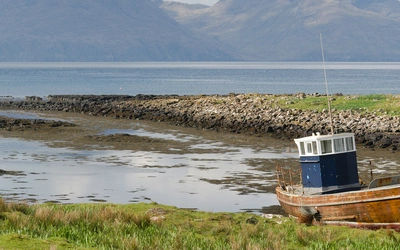
By ferry: Caledonian MacBrayne (tel 0800 0665000, www.calmac.co.uk) operate six to ten sailings per day between Ardrossan Harbour and Brodick, with a crossing time of approximately 55 minutes. A summer-only service runs between Claonaig on the Kintyre peninsula and Lochranza (30 minutes, nine crossings each way per day). Note that harbour works at Ardrossan may require sailings to operate temporarily from Troon; always check in advance.
To Ardrossan: From Glasgow Central, ScotRail trains run directly to Ardrossan Harbour. Rail & Sail tickets covering both train and ferry are available through ScotRail (www.scotrail.co.uk). Glasgow is well connected by long-distance rail, coach, and air, with Glasgow International Airport served from around 100 destinations.
Around the island: Stagecoach West Scotland buses (www.stagecoachbus.com) run around the island from early morning until late at night, serving every starting point in the guidebook with the exception of The Ross road and the short road to Glen Rosa. Arran DayRider and MegaRider tickets offer good-value unlimited travel. Paddy Dillon researched and updated the entire guidebook using local buses alone: a car is genuinely unnecessary for walkers.

What are the highlights of walking on Arran?
- Goatfell (Walk 1): The island's highest summit at 874m, with sweeping views across the Firth of Clyde to the mainland, Kintyre, and Ireland on clear days. Accessible directly from the ferry terminal at Brodick.
- Glen Sannox Horseshoe (Walk 30): The most demanding route in the book, with 1700m of ascent over a dramatic ridge circuit in the northern mountains. One of the finest ridge walks in western Scotland.
- Holy Isle (Walk 6): A short ferry ride from Lamlash leads to a quiet island with a cave once inhabited by the early Christian hermit St Molaise, wild ponies, and expansive views across Lamlash Bay.
- Machrie Moor Stone Circles (Walk 16): An easy 4.5km walk to one of Scotland's most atmospheric prehistoric landscapes, with multiple stone circles set against the backdrop of the northern mountains.
- Hutton's Unconformity (Walks 27 and 38): The site near Lochranza where geologist James Hutton first identified the unconformity that helped establish the modern science of geology in 1787.
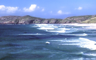
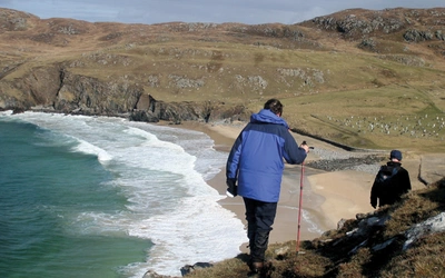
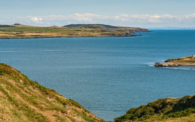
- The Arran Coastal Way: A complete circuit of the island's coastline, covering approximately 110km over ten stages, taking in sea cliffs, raised beaches, fishing villages, ancient dyke swarms, and views across to Kintyre, Bute, and Ailsa Craig.
What is the geology of Arran, and why does it matter for walkers?
The Isle of Arran is widely regarded as one of the most varied geological areas in the British Isles, and the terrain walkers encounter is a direct product of this variety. The granite boss that forms the northern mountains is responsible for the jagged ridges, steep corries, and U-shaped glacial valleys that make Arran's high routes so rewarding and demanding. The smoother, older Dalradian schists and slates, the desert sandstones of the south, and the igneous dykes that cross the southern coastline in dramatic linear walls each shape the landscape walkers pass through.
For those with a specific interest, the Arran Geopark (www.arrangeopark.co.uk) offers short geology walks with downloadable leaflets. Geological exhibitions are housed at the Arran Heritage Museum and at the Lochranza Centre, which runs geology courses. The guidebook provides geological context throughout, helping walkers make sense of what they see underfoot.
Plan your walk with the Cicerone guidebook
The Cicerone Walking on Arran guidebook by Paddy Dillon contains everything you need to plan and complete walking on the island, from gentle forest strolls to the full Arran Coastal Way.
- 45 fully described routes ranging from 5km to 22.5km, covering all parts of the island including the Arran Coastal Way as a continuous ten-stage long-distance route
- 1:50,000 OS map extracts for every walk, with GPX downloads available for all routes
- Detailed public transport information for every start and finish point, reflecting the author's approach of exploring the island entirely by bus
- Comprehensive introduction covering geology, history, land access and deer stalking, island wildlife and plant life, accommodation, food and drink, and emergency services
- A Gaelic/English glossary and appendices with useful contacts including transport operators, accommodation providers, and island organisations
- Notes on linking and extending routes to create multi-day itineraries across the island
- Coverage of seasonal considerations, including deer stalking season (mid-August to mid-October) and midge management
Available as a printed guidebook (£16.95) or digital eBook (£16.95).
Walking on Arran
The best low level walks and challenging mountain routes, including the Arran Coastal Way
£16.95
The 45 walking routes in this Isle of Arran guidebook range from easy 5km (3 miles) nature trails to long arduous mountain routes with scrambles (up to 22km), providing thorough coverage of Arran, including an ascent of Goatfell, and nearby Holy Isle. Also includes the 110km Arran Coastal Way, one of Scotland's Great Trails.
More informationAbout Paddy Dillon, guidebook author:
Paddy Dillon is a prolific walker and guidebook writer, with over 100 guidebooks to his name and contributions to 40 other titles. He has written for several outdoor magazines and other publications and has appeared on radio and television. Paddy uses a tablet computer to write as he walks. His descriptions are therefore precise, having been written at the very point at which the reader uses them. Paddy is an indefatigable long-distance walker who has walked all of Britain's National Trails and several European trails. He has also walked in Nepal, China, Korea and the Rocky Mountains of Canada and the US.