Walking on Uist and Barra: a complete planning guide
This planning guide covers everything you need to know before walking on the Uists and Barra, islands that lie on the very edge of Europe, where the approach by air or sea only sharpens the sense of remoteness, whether it's a plane touching down on the tidal shell sand of Tràigh Mhòr or a ferry watching new islands emerge from the Atlantic swell. Mike Townsend's Walking on Uist and Barra covers 40 day walks across nine linked islands, ranging from 3km to 17km (2 to 11 miles) and taking 1 to 8 hours. (Last updated: July 2026 · Guidebook edition: 2nd edition, January 2023)
Walking on Uist and Barra, quick facts
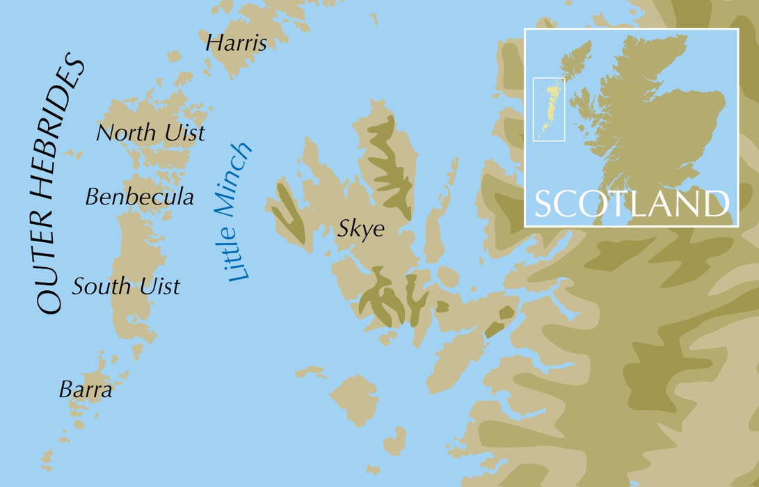
- Location: The Outer Hebrides: Berneray, North Uist, Grimsay, Benbecula, South Uist, Eriskay, Barra, Vatersay and Mingulay
- Total routes: 40 graded day walks
- Distance range: 3–17km (2–11 miles) per walk
- Typical duration: 1–8 hours per walk
- Difficulty: Ranges from easy beach and machair strolls to demanding, pathless hill walks requiring good navigation
- Terrain: Beaches, dunes, cliffs, moorland, freshwater lochs, rugged hills and archaeological sites
- Navigation: 1:50,000 OS map extract provided for every walk; full OS Landranger (Sheets 18, 22, 31) or Explorer (Sheets 452, 453, 454) maps essential
- Best season: Year-round, best April to September for milder weather and long daylight
- Guidebook:Walking on Uist and Barra by Mike Townsend, 2nd edition, January 2023
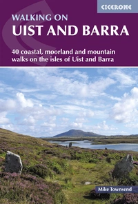
Walking on Uist and Barra
40 coastal, moorland and mountain walks on all the isles of Uist and Barra
£16.95
A guidebook to walking on the Uists and Barra, in the Outer Hebrides - with 40 graded day walks on Berneray, North Uist, Grimsay, Benbecula, South Uist, Eriskay, Barra, Vatersay and Mingulay. Routes range from easy beach walks to mountainous excursions and explore rugged hills, awesome sea cliffs, moorland and lochs.
More informationWhat is Walking on Uist and Barra?
Walking on Uist and Barra is a Cicerone guidebook covering 40 day walks across the Outer Hebridean islands south of the Sound of Harris: Berneray, North Uist, Grimsay, Benbecula, South Uist, Eriskay, Barra, Vatersay and Mingulay. The islands stretch almost 100km between the two Bernerays, and today seven of the main islands are linked by causeway, from Berneray in the north to Eriskay in the south, with Barra connected separately to Vatersay.
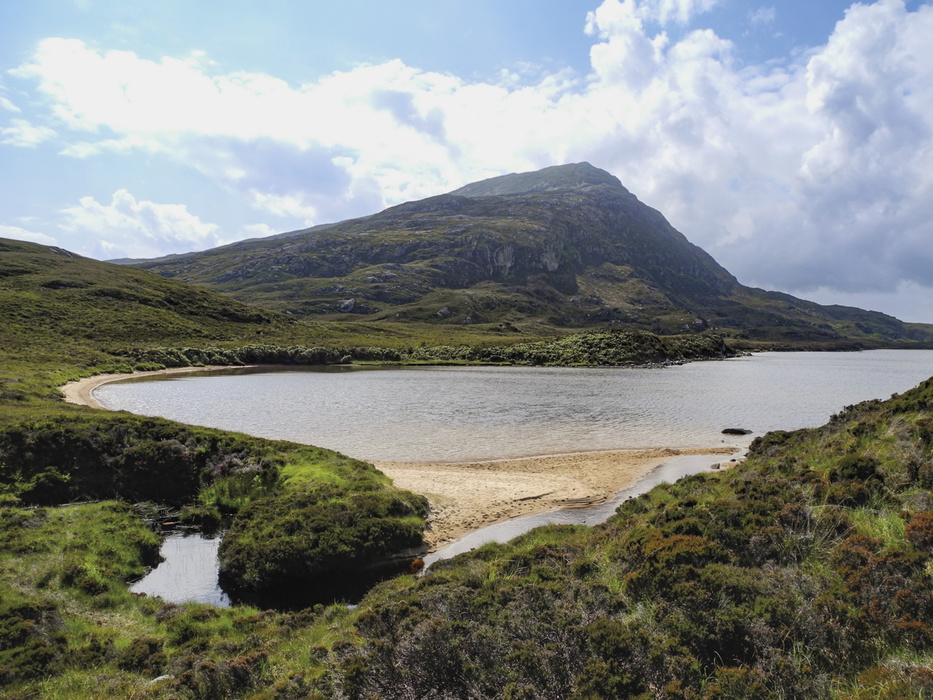
The walking here is defined by contrast: flat, low-lying machair and endless white-sand beaches along the Atlantic shore give way to rugged, mountainous ground in the east, where sea lochs cut deep inland and eagles, both golden and white-tailed, work the hill country. For walkers unfamiliar with the archipelago, the terrain and remoteness have more in common with the Isle of Skye's wilder corners than with a typical lowland day-walking guide, though here the solitude is even more pronounced: this is genuine wild walking, largely free of the crowds found on better-known Munros.
The geology alone is a genuine draw: much of the bedrock is Lewisian gneiss dated at around 3 billion years old, among the oldest rock in Europe, and it shapes everything from the sea cliffs of Mingulay to the natural arches at Rubha Ghriminis. This planning guide answers the most common questions walkers have before setting out. For complete stage-by-stage route descriptions and mapping, see the Walking on Uist and Barra guidebook.
The 40 routes at a glance
The guidebook is organised geographically into four main sections, moving from north to south:
- North Uist (14 walks): the largest section, covering Berneray, Udal, Grimsay, Baleshare and the ascent of Eabhal, plus standing stones and duns around Langais and coastal arches at Scolpaig
- Benbecula (4 walks): shorter, low-level routes including Ruabhal, the island's highest hill at a modest height, and the causeway crossings that link Benbecula to its neighbours
- South Uist (12 walks): the most mountainous section, including the Northern Corries of Thacla, the Beinn Mhòr arête, the Machair Way sections at Tobha Mòr and Aisgernis, and Eriskay
- Barra (10 walks): Barra's central hills and northern peninsula, the Vatersay causeway crossing, and a boat-access walk on the abandoned island of Mingulay
8 routes that highlight the range of the guidebook:
| Walk | Distance (km) | Time (hr) | Why it stands out |
|---|---|---|---|
| Berneray | 12 | 5—6 | A causeway-linked island walk to Berneray's dune-backed west shore, with wide Atlantic views towards the Sound of Harris |
| Scolpaig | 6 | 3 | Follows a line of tectonic faulting to the natural arches at Rubha Ghriminis, carved out where the fault line has eroded faster than the surrounding gneiss |
| Langais | 3.5–6 | 2—3 | Passes Barpa Langais, a Beaker-period chambered cairn, and the Pobull Fhìnn stone circle on the slopes of Beinn Langais, among the oldest structures on the islands |
| Ruabhal | 4 | 2 | Climbs Benbecula's highest hill for panoramic views across the island's patchwork of water, rock and heather, despite its modest height |
| Beinn Mhòr from Taobh a Tuath Loch Aineort | 10 | 4—5 | Crosses the fine arête linking Beinn Mhòr's two summits, with glacially carved corries on the surrounding slopes of Thacla |
| Eriskay | 7 | 3—4 | Follows Bonnie Prince Charlie's route ashore at Coilleag a' Phrionnsa in 1745, past machair where the Sea Bindweed he is said to have brought with him still grows |
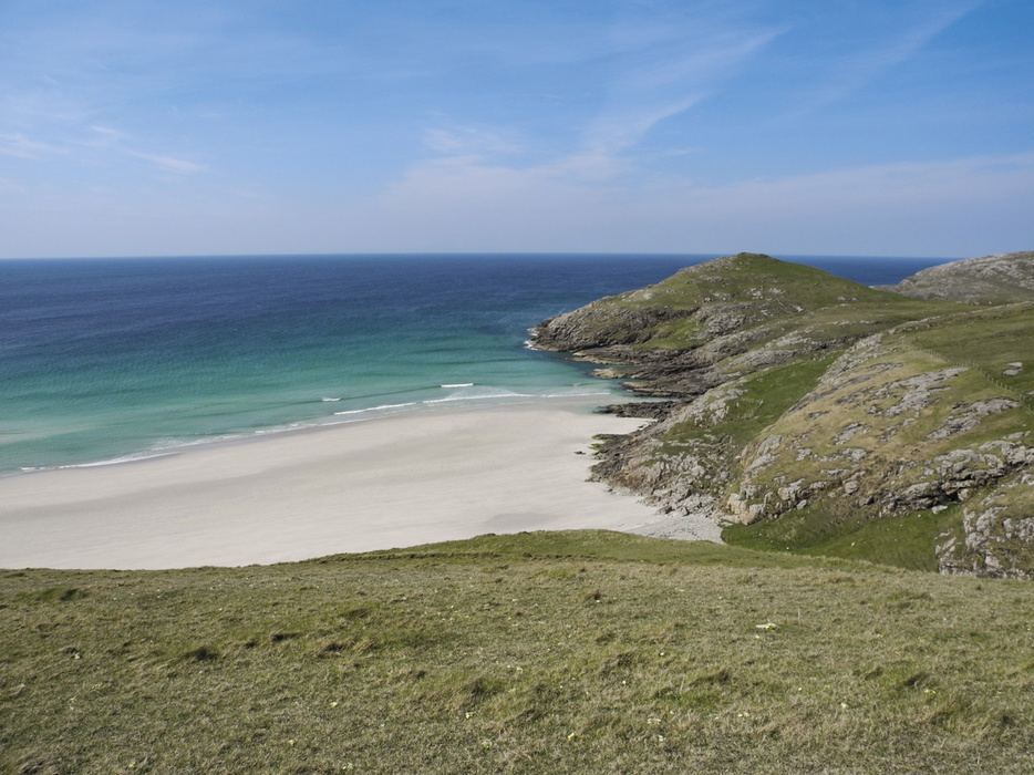
| Vatersay | 7 | 3—4 | Circuits Vatersay's beaches, where cattle-only grazing keeps the machair open for a springtime carpet of primroses |
| Mingulay | 6 | 3 | Reaches the abandoned island of Mingulay by boat hire from Castlebay, where cliff scenery is shaped by the faster erosion of dolerite dykes against the harder gneiss |
Who is Walking on Uist and Barra suitable for?
The 40 walks cater for a wide range of ability and experience. Low-level routes along beaches, dunes and machair are accessible to most walkers, including families, though soft sand and tidal timing still need care. Routes over moorland and into the hills, particularly around Beinn Mhòr, Thacla and Eabhal, are genuinely demanding: the terrain is largely pathless, fences and barbed wire can complicate straight-line navigation, and conditions on exposed hillsides can deteriorate quickly. The guidebook itself stresses that these hill routes require good navigational skills and are not to be underestimated because of their modest heights.
How difficult is it?
Difficulty across the book ranges from easy beach and coastal circuits to challenging pathless hill walks. There is no formal numerical grading system; instead, each walk is described in terms of terrain and navigational demand. The hardest ground is found on the hill routes of South Uist and North Uist, where a map and compass or GPS are essential, mist can make familiar-looking ground disorientating, and it is recommended that parties of at least two walk together and leave a route plan with someone in case of delay.
When is the best time to walk in the Uists and Barra?
- April to September: The kinder weather and long daylight hours make this the main walking season
- May and June: Often the driest and sunniest months, and prime time for machair wildflowers and nesting corncrakes
- Summer: Watch for midges, though they are less troublesome here than on neighbouring Skye or Rum; ticks are more of a year-round concern in long grass and heather
- Any season: The islands reward visitors whatever the weather. Rapidly changing skies and frequent rainbows are part of the experience, and walkers should be prepared for conditions to shift within hours
- Shooting season (October to December): Contact North Uist Estate or Stòras Uibhist before walking in affected areas
- Nesting season (June and July): Take particular care near nesting sites, and keep dogs under control, especially during lambing
What accommodation is available?
Accommodation across the islands includes hotels, guesthouses, bed and breakfasts, self-catering properties, hostels (including thatched blackhouse hostels on Benbecula), bunkhouses and serviced sites for tents, caravans and motorhomes. The main service centres are Castlebay (Barra), Lochboisdale and Daliburgh (South Uist), Balivanich (Benbecula) and Lochmaddy (North Uist), each with tourist information, shops and banking facilities. Booking ahead is strongly advised in summer, particularly on Barra around the Fèis Bharraigh festival in early July. Full accommodation listings by area are given in Appendix D of the guidebook.
Getting there and back
Flights operate daily between Glasgow and Benbecula, and on weekdays to Barra, where planes land on the tidal shell-sand beach at Tràigh Mhòr, said to be the only regular scheduled flight anywhere in the world to do so. There are also flights between Stornoway and Benbecula with a connection to Barra. Loganair operates the Glasgow routes, while Hebridean Air Services runs the Stornoway–Benbecula service.
The main vehicle ferries run from Oban (to Castlebay, Barra, and Lochboisdale, South Uist, around 5 hours) and from Uig on Skye (to Lochmaddy, North Uist, under 2 hours), both operated by Caledonian MacBrayne. Inter-island ferries connect Harris to Berneray and Barra to Eriskay. An Island Hopscotch ticket is worth considering for multi-island itineraries, and advance booking is recommended in peak season. Within the islands, a regular bus service runs from Berneray to Eriskay connecting with the ferries, plus a Barra circular service linking the airport and Eriskay ferry. Car hire and bicycle hire are both available; details are in Appendix D.
What are the route highlights?
- Caisteal Chiosmuil on Barra, the MacNeil stronghold perched on a rocky islet in Bàgh a' Chaisteil
- Grimsay, where white-tailed sea eagles are regularly sighted along the shore
- Udal in North Uist, the site of a Viking fort excavated in the 1960s
- Cille Bharra on Barra, a 9th-century churchyard where a Christian-Nordic runic stone was discovered
Walking on Uist and Barra
40 coastal, moorland and mountain walks on all the isles of Uist and Barra
£16.95
A guidebook to walking on the Uists and Barra, in the Outer Hebrides - with 40 graded day walks on Berneray, North Uist, Grimsay, Benbecula, South Uist, Eriskay, Barra, Vatersay and Mingulay. Routes range from easy beach walks to mountainous excursions and explore rugged hills, awesome sea cliffs, moorland and lochs.
More informationPlan your Uist and Barra walks with the Cicerone guidebook
The Walking on Uist and Barra guidebook by Mike Townsend contains everything you need to plan and complete these 40 routes, from Berneray in the north to Mingulay in the south.
- Step-by-step route descriptions for all 40 walks, graded by difficulty
- A 1:50,000 OS map extract for every route
- A route summary table (Appendix B) giving distance, ascent and timing at a glance
- A glossary of Gaelic and Norse place-name terms (Appendix A)
- Practical information on transport, accommodation and facilities (Appendix D)
- Guidance on access, safety and seasonal considerations specific to the islands
- Suggestions for further reading (Appendix C)
Available as a printed guidebook (£16.95) or digital eBook.
About Mike Townsend, guidebook author
Mike Townsend's love of hills and wild places began when he spent teenage walking holidays in the Lake District and Snowdonia. Later, at Edinburgh University, his horizons expanded north to the Scottish Highlands, and in 1969 he first glimpsed the Isles of Uist and Barra from the Cuillin of Skye. His interest in mountaineering then took him further afield, to the Alps and Greenland.
After graduating in Geology, he was self-employed as a freelance mineralogist through much of the 70s, and this occupation involved extensive travel and occasional mountaineering, principally in South America and Australasia.
Mike moved to the Outer Hebrides in 1980 to work as a Geography teacher on Barra, and relocated to Uist in 1988 to teach on the Isle of Benbecula. He has spent many prolonged periods since then, and even more since his retirement in 2010, exploring the hills and coastlines of the islands, particularly the more remote and unfrequented areas.