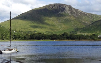
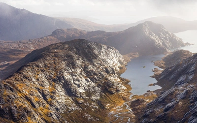
Walking on Harris and Lewis: a complete planning guide
Getting to Harris and Lewis costs more, and takes longer, than a flight to the guaranteed warmth of southern Europe, and once you're there the weather is unlikely to cooperate for long. Gales come around every third day in winter, and the other days are simply windy. But if you're a dedicated walker tired of crowded hills elsewhere, this is a place you need to go. Richard Barrett's guidebook covers 30 graded day walks across both islands, from 4 to 22km (3 to 14 miles) and 1 to 8 hours, and on most of them you won't see another walker all day. This guide covers everything you need to plan a trip, from choosing your walks to getting there and finding somewhere to stay. (Last updated: July 2026 · Guidebook edition: 3rd edition, updated February 2026)
Walking on Harris and Lewis, quick facts:
- Location: Isle of Harris and Isle of Lewis, Outer Hebrides, Scotland
- Total routes: 30 graded day walks, plus additional route information for St Kilda, Berneray and the Shiant Islands
- Distance range: 4 to 22km (3 to 14 miles) per walk
- Typical duration: 1 to 8 hours
- Difficulty: Easy to moderate, with a number of demanding hill days in the Harris hills; suitable for a range of walking abilities
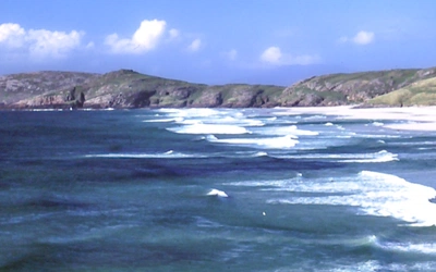
- Terrain: White-sand beaches, rugged Atlantic cliffs, open peat moorland, sea lochs and rocky hills
- Highest point: An Cliseam, 799m, the highest peak in the Outer Hebrides
- Navigation: 1:50,000 OS mapping and detailed route descriptions in the guidebook; OS Explorer 1:25,000 maps recommended for the higher, more remote routes
- Best season: Late spring to early autumn (May to September), though weather can be unpredictable year-round
- Guidebook: Walking on Harris and Lewis by Richard Barrett, 3rd edition (2022), Cicerone Press
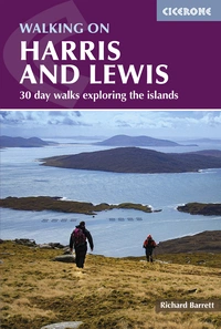
Walking on Harris and Lewis
30 day walks exploring the islands
£16.95
Guidebook to 30 day walks on the Isles of Harris and Lewis, in Scotland's Outer Hebrides. Walks range from 2 to 14 miles; combining all-day routes in the high hills to short, lower-level walks that visit the world-famous heritage sites. Routes include the An Cliseam horseshoe, the stone circles of Calanais and the Butt of Lewis lighthouse.
More informationWhat is Walking on Harris and Lewis?
Walking on Harris and Lewis is Richard Barrett's guide to 30 day walks across a landmass that, despite appearing as a single island on the map, splits itself firmly in two. Lewis people talk about going to Harris as though crossing a border, and for centuries the mountains between them did roughly the job a border does: the sea, not the road, was how you got about. The guidebook follows the same division, with separate sections for each island's walks.
Much of Lewis is black peat bog scattered with lochans, and the interior of South Harris is so bare and lunar that it once stood in for the surface of Jupiter in a 1968 science fiction film. Disembark at Uig after a week out here and even Skye, for all its own remoteness, will feel busy and thoroughly geared up for tourists. That contrast, more than any single view or summit, is what the book is really selling: a kind of solitude that has become hard to find anywhere else in Britain.
The guide's scope goes beyond the two main islands. It includes route information for St Kilda, Berneray and the Shiant Islands, and Appendix D lists every Marilyn on Harris, Lewis and St Kilda, a level of completeness most walking guides don't bother with.
This planning guide answers the most common questions walkers have before setting out. For complete route descriptions and mapping, see the Cicerone Walking on Harris and Lewis guidebook.
How do the 30 walks divide across Harris and Lewis?
The guidebook is organised geographically into two main sections, reflecting the genuinely distinct character of each island, plus a short section on the wider islands.
- Harris (Walks 1 to 15): the more mountainous of the two islands, with routes including the classic An Cliseam Horseshoe, Beinn Dhubh, Tiorga Mòr and the coastal walks around Ceapabhal and Toe Head in the far south-west.
- Lewis (Walks 16 to 30): lower-lying and dominated by peat moorland, with routes to the Calanais Standing Stones, the Gearrannan Blackhouses, Beinn Mhòr and the lighthouse walk around the Butt of Lewis, alongside the higher hills of Mealaisbhal and Griomabhal in Uig.
- Walks on St Kilda and other islands: shorter additional route information covering St Kilda, Berneray and the Shiant Islands, for walkers extending their trip beyond the two main islands.
| Walk | Distance (km) | Ascent (m) | Time (hrs) |
|---|---|---|---|
| An Cliseam Horseshoe from Àird a' Mhulaidh | 13.5 | 1065 | 6 - 7 |
| Ceapabhal and Toe Head | 14 | 612 | 4.5 - 5 |
| Roineabhal from Roghadal | 8 | 490 | 3 - 3.5 |
| Mealaisbhal, Cracabhal and Laibheal a Tuath | 15 | 1068 | 5 - 6 |
| Calanais Standing Stones | 4 | negligible | 1 - 2 |
| Dun Chàrlabhaigh and the Gearrannan Blackhouses | 18 | 488 | 5 - 6 |
| West Side Coastal Path | 18 | 536 | 6 |
| Around the Butt of Lewis | 11 | 113 | 3 - 3.5 |
Who is Walking on Harris and Lewis suitable for?
The 30 walks in this guide span a wide range of ability, from short, low-level routes to full days in remote, pathless terrain.
- Beginners and families are well catered for on the shorter heritage and coastal walks, such as Calanais Standing Stones, the Gearrannan Blackhouses and the Butt of Lewis, most of which follow reasonably clear ground with modest ascent.
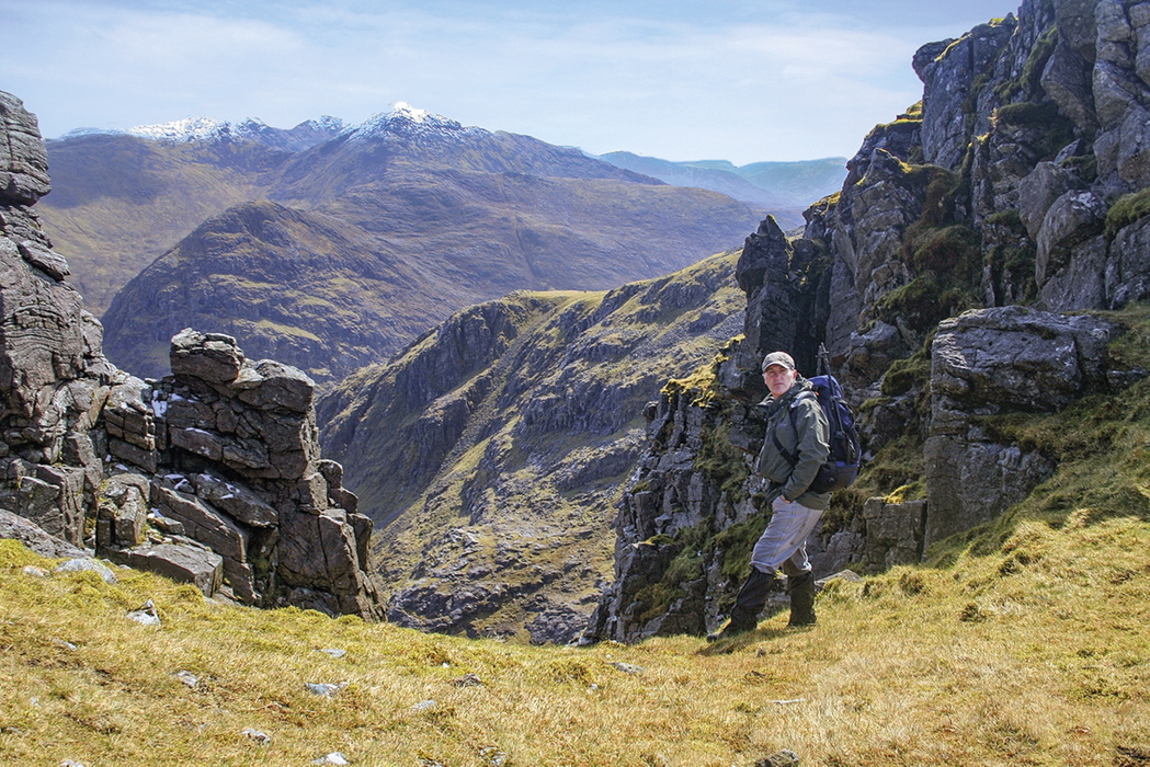
- Experienced hillwalkers will find the real substance of the book in the Harris hills, where routes like the An Cliseam Horseshoe, Tiorga Mòr and the Stulabhal, Tèileasbhal and Uisgneabhal Mòr traverse involve pathless, often boggy terrain and sustained navigation.
- Peak-baggers are specifically catered for through Appendix D, a full list of the Marilyns on Harris, Lewis and St Kilda.
- Dog walkers should note that several routes cross ground used for deer stalking (1 July to 20 October) and grouse shooting (12 August to 10 December), when local estates should be contacted in advance
How difficult is walking on Harris and Lewis?
Difficulty varies enormously across the 30 walks, from straightforward heritage rambles to sustained hill days.
The higher hill routes are genuinely demanding: much of the terrain has few marked footpaths, the ground is frequently waterlogged peat bog even on the summit plateaus, and mist can make navigation difficult even for experienced parties. The author notes that even with two GPS devices, his own party once lost an hour finding a way off the summit of Uisgneabhal Mòr in poor visibility, a fair illustration of how quickly conditions can turn.
At the other end of the scale, the coastal and heritage walks, including Calanais and the Butt of Lewis, are straightforward and well suited to less experienced walkers. Anyone unfamiliar with walking in this kind of wild, pathless country is advised to start with one of the lower-level routes to judge their own pace before attempting the higher hills.
When is the best time to walk on Harris and Lewis?
- Late spring (April to May): milder weather and long daylight hours, ahead of peak midge season.
- Summer (June to August): the most reliable weather window, but also midge season (see below), and the peak period for accommodation demand.
- Early autumn (September): often the best window of the year, with settled spells, fewer midges and quieter trails, though deer stalking (from 1 July) and grouse shooting (from 12 August) are both underway on some estates.
- Winter: gales are common, with the guidebook noting that during the darkest months there can be gales every third day and a stiff wind on the others. Not recommended for the higher hill routes.
- Midges: present from May to September, swarming at dawn and dusk. Cover up, carry repellent, and avoid pitching a tent on damp, sheltered ground.
What accommodation is available on Harris and Lewis?
Both islands offer hotels, guest houses, B&Bs, hostels and self-catering accommodation, alongside a small number of campsites with facilities at Stornoway and North Shawbost on Lewis and Liceasto on Harris. Wild camping is also permitted under Scotland's access rights, for small numbers of people using lightweight tents, for up to three or four nights in one spot.
Accommodation is limited relative to demand, and even campsites can fill up in peak season, so booking ahead is strongly advised, particularly for July and August. Self-catering is often the more economical option for larger groups.
For a full accommodation listing, see the guidebook's "Where to stay" section.
Getting to and around Harris and Lewis
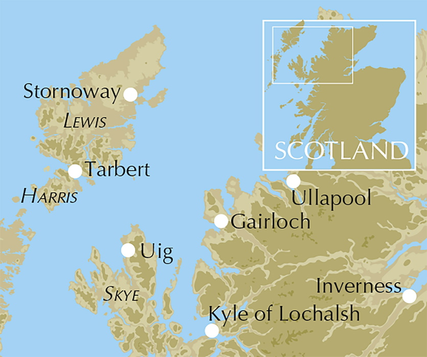
By air: Loganair operates scheduled flights into Stornoway from Edinburgh, Glasgow, Inverness and Benbecula, connecting with national and international flights.
By sea: CalMac runs daily ferries from Ullapool to Stornoway (2hr 30min), from Uig on Skye to Tarbert (1hr 40min), and from Berneray in North Uist to Leverburgh (1hr). Vehicle reservations are recommended in summer; foot passengers do not need to book.
By rail: The rail network does not reach the islands directly, but connecting bus services link Inverness station to the Ullapool ferry terminal, and Kyle of Lochalsh station to the Uig ferry terminal on Skye.
By car: There are around 320km (200 miles) of road across Harris and Lewis. Fuel stations are limited to a handful of villages, including Stornoway, Tarbert and Leverburgh, and fuel typically costs more than on the mainland, so plan fuel stops carefully for the more remote routes.
By bus and cycle: A public bus network connects most villages and can be useful even for drivers needing to reach the start of a linear walk. Bicycles travel free on the ferries and can also be hired in Stornoway and Leverburgh.
What are the route highlights in Walking on Harris and Lewis?
- An Cliseam Horseshoe, the guidebook's signature hill day in the Harris hills
- Calanais Standing Stones, one of the islands' world-famous heritage sites
- Around the Butt of Lewis, a lighthouse walk at the island's northernmost tip
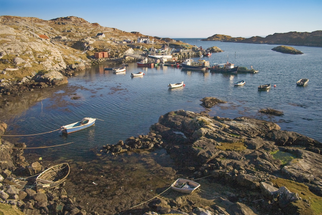
- Ceapabhal and Toe Head, combining machair, beaches and coastal views in South Harris
- Dun Chàrlabhaigh and the Gearrannan Blackhouses, pairing an ancient broch with a restored crofting village [verification needed: Iron Age dating]
- Appendix D's full Marilyn list for Harris, Lewis and St Kilda, a useful resource beyond the core 30 walks
Why does Roineabhal matter to walkers on Harris?
Roineabhal, above Roghadal in South Harris, is made of anorthosite, a rare, near-white igneous rock composed almost entirely of feldspar. During the Second World War a quarry here supplied much of the UK's feldspar for porcelain electrical insulators, though the venture proved short-lived.
Far more significant was a proposal, first tabled in 1974, to develop Roineabhal into a coastal superquarry extracting ten million tonnes of aggregate a year for 60 years. The resulting public inquiry became one of the longest and most complex planning cases in Scottish history, running to 83 days of evidence before the developers withdrew in 2004. Had it gone ahead, almost a third of the mountain would have been removed. Walkers climbing Roineabhal today are, in effect, walking a hill that came close to disappearing entirely.
Walking on Harris and Lewis
30 day walks exploring the islands
£16.95
Guidebook to 30 day walks on the Isles of Harris and Lewis, in Scotland's Outer Hebrides. Walks range from 2 to 14 miles; combining all-day routes in the high hills to short, lower-level walks that visit the world-famous heritage sites. Routes include the An Cliseam horseshoe, the stone circles of Calanais and the Butt of Lewis lighthouse.
More informationPlan your walk with the Cicerone guidebook
The Walking on Harris and Lewis guidebook by Richard Barrett contains everything you need to plan and complete these 30 day walks, from the Harris hills to the Lewis coast.
- 30 graded walks across both islands, with routes suited to beginners through to experienced hillwalkers
- Clear, step-by-step route descriptions for every walk
- 1:50,000 Ordnance Survey mapping to support navigation across moorland, cliffs, beaches and upland ground
- Refreshment information for each walk, covering cafés, local facilities and post-walk options
- Highlights of historical, cultural and geological points of interest, including Calanais and other archaeological sites
- Additional route information for St Kilda, Berneray and the Shiant Islands
- Appendix A: Route Summary Table, Appendix B: Gaelic Language, Appendix C: Further Reading
- Appendix D: a full list of the Marilyns on Harris, Lewis and St Kilda
Available as a printed guidebook (£16.95) or digital eBook.
About Richard Barrett, guidebook author
Richard Barrett spent his working life as a professional marketer, but still found time for climbing, winter mountaineering and sea kayaking. He first visited the Harris hills as a teenager and became a regular visitor. He lived in North Harris for a number of years, where he and his wife ran a guest house and, although now a city-dweller, he still makes frequent forays to the Hebrides, reconnecting with the wilderness and catching up with old friends.