Walking on Jura, Islay and Colonsay: complete planning guide
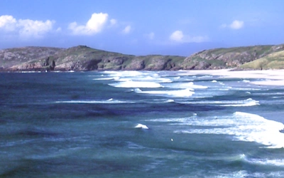
Tucked away off the Kintyre peninsula, some 80km (50 miles) west of Glasgow as the crow flies, Jura, Islay and Colonsay sit apart from the routes that draw most walkers north to Skye and the Highlands, despite offering, in the author's words, some of the finest and most challenging walking to be found anywhere in the British Isles. Their scree-clad mountains, peat-dark lochans and quartzite sea cliffs bring a real sense of remoteness, and wildlife including eagles, wild goats, seals and otters are often more in evidence than other walkers. This planning guide draws on Peter Edwards' Cicerone guidebook covering l 23 routes across the Southern Hebrides, from day walks of 7 to 25km (4 to 16 miles) up to the 89km (55 mile), five-day backpacking trek along Jura's remote west coast, with practical advice on difficulty, seasons, transport and accommodation for planning your own trip. (Last updated: July 2026 · Guidebook edition: Third edition, August 2019)
Walking on Jura, Islay and Colonsay, quick facts
- Location: Jura, Islay and Colonsay, Southern Hebrides, Argyll, Scotland (also covering Scarba and Oronsay)
- Total routes: 23 walks: 22 day walks plus a 5-day, 89km (55 mile) coastal backpacking trek
- Distance range: 7–25km (4–16 miles) for day walks; 89km (55 miles) over 5 days for the Jura west coast trek
- Typical duration: most day walks run 3–8 hours; the west coast trek is a 3–5 day undertaking
- Difficulty: Moderate to Challenging. Jura and Scarba's hill and coastal routes require fitness, self-reliance and strong navigation; Islay and Colonsay are generally more accessible but still demand competent map and compass skills
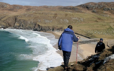
- Terrain: pathless quartzite mountains, peat bog and lochan-studded moorland, rugged sea cliffs, raised beaches and sandy bays
- Highest point: Beinn an Oir, 785m (the highest of the Paps of Jura)
- Navigation: almost no waymarks or paths; OS Explorer 1:25,000 sheets 355, 353, 352 and 354, used alongside OS Landranger 1:50,000 sheets 60 and 61, are essential
- Best season: spring and autumn, though walkable year-round
- Guidebook:Walking on Jura, Islay and Colonsay by Peter Edwards, 3rd edition (August 2019), Cicerone Press
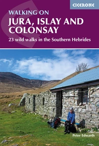
Walking on Jura, Islay and Colonsay
23 wild walks in the Southern Hebrides
£14.95
Guidebook to Jura, Scarba, Islay and Colonsay in the Hebrides, describing 22 walks plus a 5-day 89km trek along Jura's remote west coast. The routes range from 6.5 to 25km and cover rough - and often pathless - terrain suitable for fit, competent walkers. Even the coastal walks offer challenges.
More informationWhat is Walking on Jura, Islay and Colonsay?
Walking on Jura, Islay and Colonsay is a Cicerone guidebook to 23 walks and treks across three of the Southern Hebrides' islands, along with neighbouring Scarba and Oronsay. Written by Peter Edwards, who has lived in the Hebrides since moving north from the south of England in 2006, the book covers everything from short coastal rambles to a multi-day wilderness backpacking route: the traverse of Jura's uninhabited west coast.
Jura is austere and largely pathless, its interior a vast expanse of treeless moorland and scree-strewn mountain given over almost entirely to red deer and raptors; with only around 200 inhabitants, the author notes it as one of the least populous areas of the British Isles, confined to a narrow fertile strip along the east coast. Islay is lower-lying, more fertile and better served by roads, with dramatic Atlantic-facing cliffs, internationally important birdlife and nine whisky distilleries to reward a hard day's walking. Colonsay distils the wild beauty of its larger neighbours into a compact, tranquil package, where a short walk from almost any point on the island brings you to seabird cliffs, dune-backed bays or fine views back across the Firth of Lorn to Jura and Islay.
This scale of wilderness, so close to the Scottish mainland, is the guidebook's main draw. The centrepiece west coast walk on Jura, arguably one of the finest wilderness backpacking routes in Scotland, crosses ground with no paths, no waymarks and, for long stretches, no mobile signal, through country that has changed little since the island's mesolithic hunter-gatherers first arrived around 7000BC. This planning guide answers the most common questions walkers have before setting out. For complete stage-by-stage route descriptions and mapping, see the Cicerone Walking on Jura, Islay and Colonsay guidebook.
The 23 routes at a glance
The book's 23 routes are grouped by island, with an overview map and dedicated introduction covering history, geology, wildlife, accommodation and access for each.
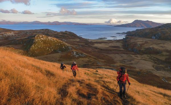
- Jura (10 routes, Walks 1–10): day walks to the Gulf of Corryvreckan, Glengarrisdale and the island's northern hills, alongside a round of the three Paps of Jura, an ascent of Glas Bheinn and Dubh Bheinn, and the five-day, 89km west coast trek that forms the book's centrepiece.
- Scarba (1 route, Walk 11): the ascent of Cruach Scarba, a small-island summit rising between the tidal races of the Gulf of Corryvreckan and the Grey Dog.
- Islay (7 routes, Walks 12–18): coastal and hill routes taking in the Rhuvaal lighthouse and north-west coast, the Sound of Islay, Beinn Bheigier, the Oa peninsula's cliffs, and the beaches of Sanaigmore, Kilchiaran and Ardnave Point.
- Colonsay (5 routes, Walks 19–23): walks around Oronsay, the south and north Colonsay coasts, and the sandy bays of Kiloran and Balnahard.
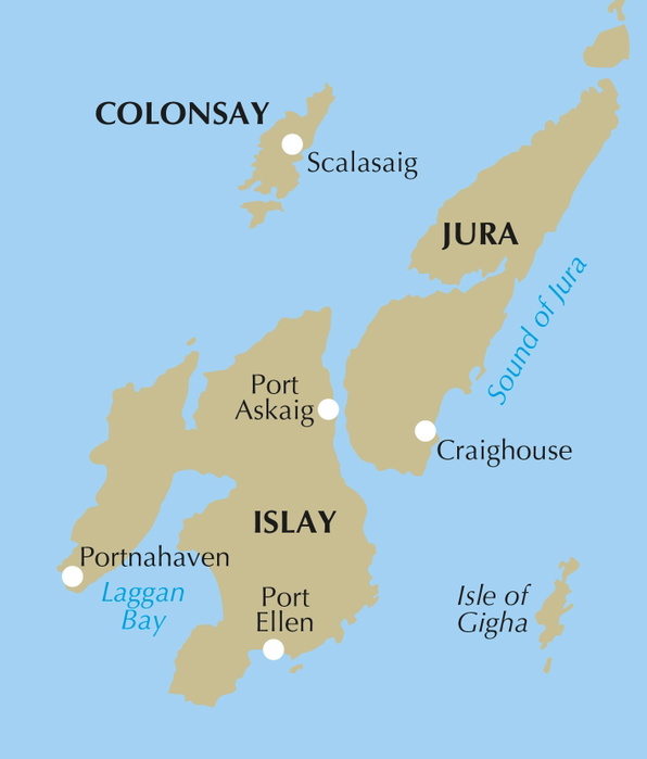
The west coast Jura trek is the centrepiece of the book: a three-to-five day traverse described stage by stage from Ardlussa or Kinuachdrachd in the north to Feolin Ferry in the south, via Glengarrisdale, Shian Bay, Cruib Lodge and Glenbatrick Bay.
Here are eight routes from the guidebook:
| Walk | Distance | Time | Why it stands out |
|---|---|---|---|
| The Gulf of Corryvreckan (Walk 1) | 21.5km (13½ miles) return | 5—6hr | Passes close to one of the area's powerful tidal races, in territory frequented by a resident pair of white-tailed eagles |
| The west coast walk (Walk 3) | 89km over 5 days | 3—5 days | The guidebook's centrepiece: a pathless, multi-day traverse the author rates as one of Scotland's finest wilderness backpacking routes |
| The Paps of Jura (Walk 8) | 17km (11 miles) | 8—9hr | A round of Jura's three quartzite peaks involving around 1500m of ascent, rated a hillwalking classic despite Beinn an Oir falling just short of Munro height at 785m |
| Cruach Scarba (Walk 11) | 10.5km (6½ miles); Alternative: 9.7km (6 miles) | 4—5hr | A boat-accessed hill day on Scarba, between the tidal races of Corryvreckan and the Grey Dog |
| Rhuvaal and the north-west coast (Walk 12) | 20km (12½ miles); variant 25km (15½ miles) | 7—8hr | A remote route along the Sound of Islay to Rhuvaal Lighthouse on Islay's wild north-west coast |
| The Oa peninsula (Walk 16) | Port Ellen to Kintra 25km (15½ miles); to Mull of Oa 16km (10 miles) | 8–9hr; to Mull of Oa 5—6hr | Explores Islay's dramatic Atlantic-facing cliffs and clifftop history |
| Around Oronsay (Walk 19) | 11km (7 miles) | 3 –3½hr | A tide-dependent crossing to Colonsay's sister island, linked to St Columba's arrival in the Hebrides |
| Lower Kilchattan to Kiloran Bay (Walk 21) | 8km (5 miles); return 16 km (10 miles); via B8086 13km (8¼ miles) | 2½–3hr; return 5–6hr; via B8086 4–4½hr | Passes seabird cliffs near Lower Kilchattan before reaching Kiloran, one of the author's superlative sandy bays |
Who is this guidebook suitable for?
This is a book for fit, experienced walkers who are comfortable navigating pathless terrain. Jura's terrain is described in the introduction as largely pathless and "definitely not for the unfit or faint-hearted," and the west coast trek, the Paps of Jura round and the ascent of Cruach Scarba should only be attempted by walkers with strong navigational skills and a good level of self-reliance. Islay and Colonsay are more accessible, with road access to many coastal and clifftop routes, but still require competent map and compass use rather than reliance on waymarks, since there are almost none on any of the 23 routes.
How difficult are the walks?
The guidebook doesn't apply a numbered grading scale across the 23 routes; instead, difficulty is described route by route in each information box, with particular routes flagged as suitable only for fit, experienced walkers with strong navigational skills. The hardest routes in the book are:
- The west coast of Jura trek: a demanding, multi-day wilderness route with no paths, difficult river crossings after rain, and long stretches without any prospect of rescue or resupply
- The Paps of Jura: a round of Beinn an Oir (785m), Beinn Shiantaidh and Beinn a' Chaolais involving around 1500m of ascent over rough, scree-covered ground
- Cruach Scarba: a demanding ascent on the small island of Scarba, requiring a boat crossing to reach the start
- The traverse of Jura's northern hills, from Glengarrisdale to Cruib: described as "a rollercoaster route over unremittingly rough terrain"
By contrast, most of the day walks on Islay and Colonsay, while still requiring fitness and navigational competence, are more moderate undertakings, with several accessible directly from public roads.
Can I walk a shorter section of the west coast Jura trek?
Yes. The full trek runs from Ardlussa or Kinuachdrachd in the north to Feolin Ferry in the south across five stages (Glengarrisdale, Shian Bay, Cruib Lodge, Glenbatrick Bay and Feolin Ferry), but several access points make shorter itineraries practical:
Water taxi to Kinuachdrachd: Farsain Cruises operates from Craobh Haven Marina to Kinuachdrachd, cutting out the 15km (9 mile) walk in from Ardlussa and allowing an afternoon's walking on day one.
Water taxi to Glengarrisdale: a direct drop-off partway down the coast, useful for a shorter two-to-three day itinerary focused on the wilder northern half of the route.
Glenbatrick Bay to the A846 via Glen Batrick (Day 5A): an inland alternative finish that avoids the final leg to Feolin Ferry, useful if road transport has been arranged at Glen Batrick.
Sandy Campbell's Venture West Boat Charters, operating out of Crinan Harbour, offers a similar service and can also drop walkers at Ruantallain or Scarba. Advance booking is essential for all water taxi options.
When is the best time to walk on Jura, Islay and Colonsay?
- Spring and autumn offer a reliable combination of weather, daylight and manageable midge activity
- Summer brings the longest days but also the worst midges, along with bracken growth that can make some paths harder to follow
- Winter is wet, wild and short on daylight, and should only be considered by experienced parties equipped for full winter conditions on Jura's higher ground
- Deer stalking season runs through the autumn on Jura and Islay; walkers should check estate contacts before setting out, particularly for routes crossing the Jura hinterland
What accommodation is available?
Accommodation is sparse and varies significantly by island:
- Jura: Craighouse is the island's only real settlement, with a hotel, bar, shop, restaurant and whisky distillery. Beyond Craighouse, accommodation on the west coast trek is limited to bothies (Glengarrisdale and Cruib Lodge among them) and wild camping
- Islay: offers, in the author's words, all the comforts of civilisation, with hotels, B&Bs, two well-situated campsites and a youth hostel, alongside numerous pubs and restaurants
- Colonsay: limited accommodation on the island itself, with wild camping an option; overnight parking for backpackers has historically been difficult to arrange, so this should be checked directly with the ferry operator or local contacts before travelling.
Wild camping is permitted under the Scottish Outdoor Access Code across all three islands, provided it follows the usual principles: small numbers, short stays, distance from buildings and farmed land, and leaving no trace.
Getting there and back
To Jura: most walkers travel via Islay and the short Port Askaig–Feolin ferry crossing, though a seasonal RIB service also runs between Tayvallich and Craighouse (late April to end September), and water taxis serve Kinuachdrachd, Glengarrisdale and Ardlussa directly from Craobh Haven or Crinan
To Islay: Caledonian MacBrayne ferries run from Kennacraig to Port Askaig (2hr) or Port Ellen (2hr 20min), with up to four crossings daily in summer; Loganair also flies twice daily from Glasgow Airport (35 minutes)
To Colonsay: Caledonian MacBrayne sails from Oban to Scalasaig (2hr 15min), five times weekly in summer, with a separate Wednesday service linking Kennacraig, Port Askaig and Colonsay between April and October; Hebridean Air also flies from Oban
By road from Glasgow: allow 2½–3 hours to Kennacraig for the Islay ferry, or a similar time to Oban for the Colonsay ferry, via Loch Lomond and the A82/A83 or A85
By bus or rail: Scottish Citylink and West Coast Motors serve Kennacraig from Glasgow Buchanan Street; ScotRail and Scottish Citylink both serve Oban
Given the layered ferry and water-taxi logistics involved, particularly for the west coast Jura trek, it's worth building buffer time into any itinerary in case of cancelled sailings or tidal restrictions on the smaller boat services.
Are there any recent route changes to be aware of?
Two safety-related route amendments were issued in April 2025. On the west coast Jura trek, walkers are advised to walk around the lochan at Cairidh Mhor on Day 4 rather than crossing the dam, which is no longer considered safe. On Walk 7 (Ardlussa to Corpach Bay and Am Miadar), two bridges near the start of the route have been lost, and an alternative start via the Lussa River bridge and a track past a large shed is now recommended. Walkers should check the guidebook's free online updates before setting out, since remote routes of this kind are more exposed to changes in bridges, dams and access arrangements than most lowland walks.
What are the route highlights?
- The wild, uninhabited west coast of Jura, described on the product page as one of the British Isles' last great wilderness walks
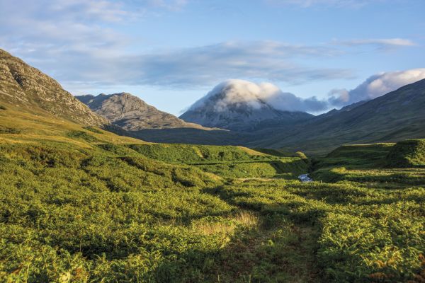
- The Paps of Jura, the quartzite, scree-clad summits that dominate views across the Southern Hebrides and are rated a hillwalking classic
- The Gulf of Corryvreckan, home to a powerful tidal whirlpool and a resident pair of white-tailed eagles
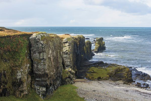
- The dramatic cliffs of the Oa peninsula on Islay, alongside the Sound of Islay route to Rhuvaal Lighthouse
- Colonsay's Kiloran and Balnahard bays, described by the author as superlative sandy bays
Finlaggan on Islay, the medieval seat of the Lords of the Isles
Walking on Jura, Islay and Colonsay
23 wild walks in the Southern Hebrides
£14.95
Guidebook to Jura, Scarba, Islay and Colonsay in the Hebrides, describing 22 walks plus a 5-day 89km trek along Jura's remote west coast. The routes range from 6.5 to 25km and cover rough - and often pathless - terrain suitable for fit, competent walkers. Even the coastal walks offer challenges.
More informationPlan your walk with the Cicerone guidebook
The Walking on Jura, Islay and Colonsay guidebook by Peter Edwards contains everything you need to plan and complete these 23 routes, from short coastal day walks to the multi-day west coast Jura trek.
- 1:50,000 OS mapping included for every walk
- Detailed route descriptions with grid references throughout
- Information boxes for each walk covering distance, ascent, timing and terrain
- Notes on accommodation and public transport for every route
- Guidance on bothies and wild camping across the islands
- Island-by-island introductions covering history, geology and wildlife
- Appendices covering a route summary table, walks on other islands, useful contacts, a glossary and further reading
- Free online updates covering route and access changes since publication
Available as a printed guidebook (£14.95) or digital eBook.
About Peter Edwards, guidebook author
Since moving to Scotland from the south of England in 2006, Peter has developed a passion for the Hebrides. He lives at Rhenigidale on the Isle of Harris with his wife, Fiona, and their Labradors, Dougal and Mara.