Walking the King Charles III England Coast Path: North West — what you need to know
Ange Harker is the author of the Cicerone guidebook to the King Charles III England Coast Path: North West. In her day job, she has been part of Natural England's North West Coastal Access delivery team since 2015. Here she answers the questions she most often hears from walkers: what the path actually is, what 'open' means in practice, where you can walk right now, and what to look out for along the way.
King Charles III England Coast Path: North West — quick facts
- Distance: 590km / 367 miles
- Duration: Around 1 month end-to-end; easily sampled as day walks or shorter sections
- Start: Gretna (Scottish border)
- Finish: Chester (with optional links to the Wales Coast Path)
- Stages: 28 stages, each 13–29km (8–18 miles)
- Terrain: Coastal paths, estuaries, tidal sands, limestone shores, saltmarshes, seaside promenades
- Waymark: National Trail acorn; lilac wash (Coastal Margin) on OS 1:25,000 Explorer maps
- Completion status: Partially open — see below for detail on what is currently accessible
- Navigation: OS 1:50,000 mapping included; downloadable GPX files available
- Best season: Spring and summer for most transport options and daylight; walkable year-round with planning
- Guidebook:Walking the King Charles III England Coast Path: North West by Ange Harker, 1st edition 2025 (printed £17.95 / eBook £17.95)
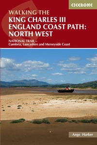
Walking the King Charles III England Coast Path: North West
NATIONAL TRAIL - Cumbria, Lancashire and Merseyside Coast
£17.95
Guidebook to walking the King Charles III England Coast Path: North West National Trail. Between Gretna and Chester, this 590km (367 mile) route explores the Cumbria, Lancashire and Merseyside coast in 27 stages and can be walked in 1 month. Includes 1:50,000 OS mapping.
More information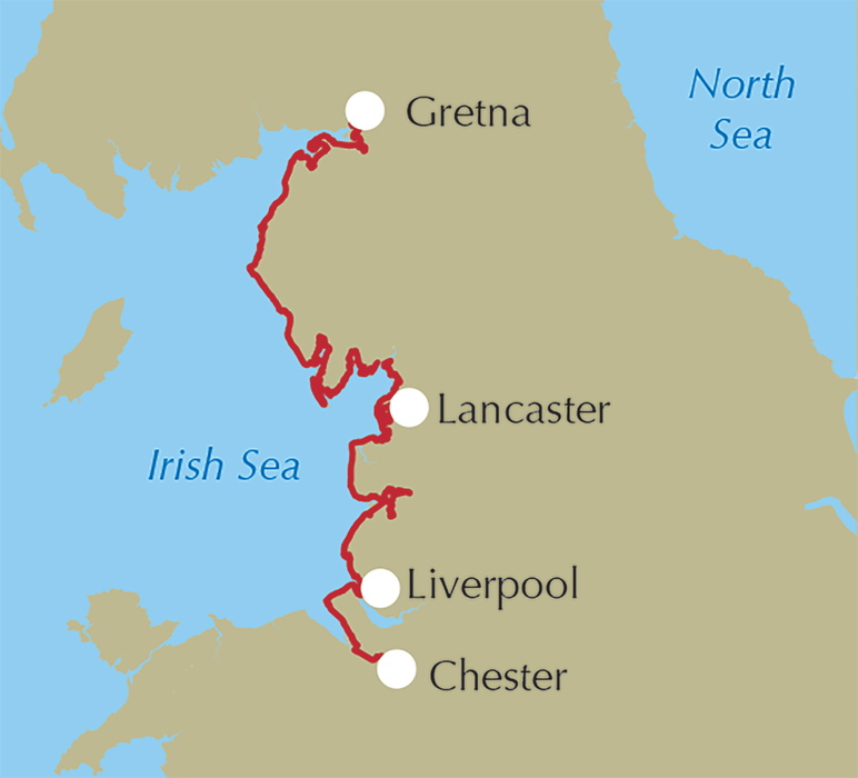
What is the King Charles III England Coast Path?
Since the Marine and Coastal Access Act 2009 came into being, teams around the country at Natural England (the government's advisor on nature, access and landscape) have been working to create the England Coast Path National Trail — or the King Charles III England Coast Path, as it has been known since the 2023 Coronation. Opening in stages, once complete it will be a waymarked 2,700-mile long-distance walking trail around the whole of England, with an associated 'Coastal Margin'.
Is it all open?
In March 2026, King Charles walked along the Seven Sisters cliffs in Sussex as part of a dual celebration: the opening of the Seven Sisters National Nature Reserve as the halfway point in the creation of the King's Series of NNRs, and the launch of a summer of celebrations as the KCIIIECP National Trail enters its final stages of work towards completion. Although some headlines got over-excited and declared the whole trail open, around 80% was open at that time, as the press release made clear. This is anticipated to rise to around 90% by the end of the 2026 celebrations, which are also timed to coincide with the 75th anniversary of the Countryside Code and Natural England's 20th anniversary.
The route has been opening in stages around the country since work began. Eight regional teams share 63 'stretches' between them, with each stretch having its own published proposals report, objections and representations period, Secretary of State approval, and establishment works carried out by the local authorities.
It's important to stress that although there is existing access in many places, legal 'Coastal Access' rights don't apply until a full length is commenced via a statutory instrument. Measures to keep you and wildlife safe, and to create a physically walkable through route, might not be in place until the very end.
However, with completion on its way and so many people already keen to walk the north west coast, it made sense to publish a guidebook sooner rather than later — explaining not only where the route will be, but how to get around the final un-commenced sections in the meantime.
Whilst my Cicerone guidebook is a separate freelance endeavour, I've been lucky to work on the north west Coastal Access team at Natural England since 2015, so I can be confident that the information in the book is as accurate as it can be.
What are 'Coastal Access' and the 'Coastal Margin'?
The trail comes with an associated Coastal Margin: the strip of land between the trail and the sea (and inland in some circumstances) which is automatically mapped with a lilac wash on Ordnance Survey 1:25,000 Explorer maps. This is essentially Open Access (like the yellow wash) but with some tweaks to the details. As with Open Access mapping, there are always automatic exceptions (for example, buildings and their curtilage), and discretionary restrictions and exclusions can apply. Your actual Coastal Access rights apply to what is left, sometimes called the 'spreading room'. The nature and complexity of the coast means that exceptions and exclusions are more commonplace than on the hills, especially in estuarine habitats where hidden hazards to you and your dog, and the risk of disturbance to wildlife, mean that Coastal Access rights are often necessarily excluded.
Where can I go in my area?
For information on open stretches, visit www.nationaltrail.co.uk. This covers all National Trails including the KCIIIECP and the newly designated Coast to Coast Path National Trail, and features helpful interactive maps and GPX downloads.
To check progress on all stretches in your area, visit www.gov.uk/englandcoastpath. Note that 'Stage 5: Open' refers to a stage in the administrative process of getting a stretch open, not to its physical completion on the ground.
To find out where you can go within the Coastal Margin, visit www.openaccess.naturalengland.org.uk, search for your area of interest, set the dates to a full year to catch any seasonal variations, and check the PDF maps listed for details. Signage will usually be in place on the ground to reinforce this, and may include seasonal diversions on the route itself. There are also a number of land types which are automatically excepted from Coastal Access rights — see gov.uk guidance on open access land for more information.
How can I help wildlife?
The first port of call is always the Countryside Code. Different habitats have different nuances, so please always follow local advice, especially around dogs, which will be tailored to the needs of the wildlife where you are.
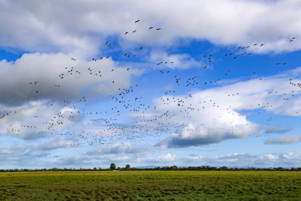
The biggest risks to wildlife on the north west coast are disturbance to birds, and damage to rare natterjack toads, 50% of which live on the Cumbrian coast with a good number more around the Sefton and Wirral dunes.
In summer, birds nest in places you wouldn't expect and almost certainly won't be able to see: on the ground in grasslands, salt marshes, beaches and shingle. Eggs and chicks can quickly go cold or be taken by predators if a parent is scared off a nest. Some chicks and nests are so well camouflaged you wouldn't even know if you'd stood on one. In winter, our beaches and marshes are feeding and resting grounds for hundreds of thousands of migrating birds who need to conserve every calorie they can in the cold. Just the presence of a person and dog can raise anxiety levels, costing valuable energy. Keeping dogs close and avoiding shores two hours either side of high tide are some of the best and simplest ways to help.
Natterjack toads breed in 'ephemeral' shallow ponds, puddles and even ruts in paths, and are already at the mercy of climate change as the hydrology of many sites is rapidly changing. The additional challenges of accidental squashing, dogs stirring up silt and suffocating spawn, disease transmission, and some flea treatments are things we individually have the power to address by watching our footing and keeping dogs out of shallow pools and puddles.
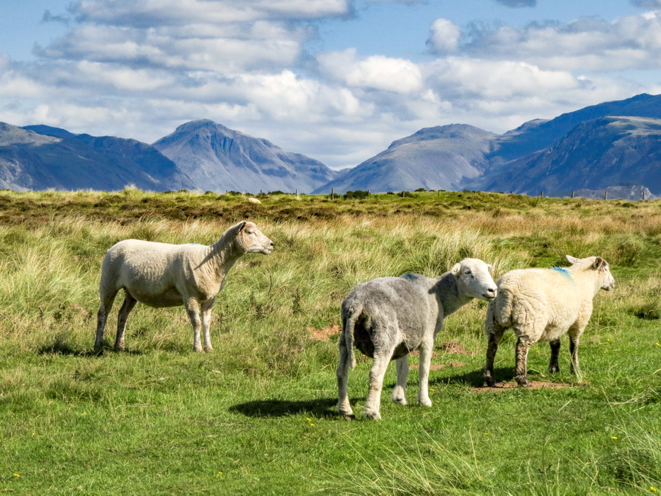
What's true for wildlife and nature reserves is true for farm animals too: you can't always see where they're going to be, a dog doesn't need to set chase to raise anxiety levels, and there's always a level of human stress behind the scenes for the person managing the land, be it a farmer or reserve manager.
The north west section
Both my guidebook and the Natural England team I work on cover the north west coast of England, from Gretna on the Scottish border to the Welsh border on the Dee marshes. The book also includes optional links to Chester and the Wales Coast Path, set up by the Wales Coast Path team at Natural Resources Wales.
Highlights
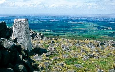
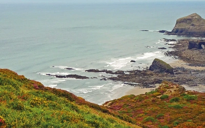
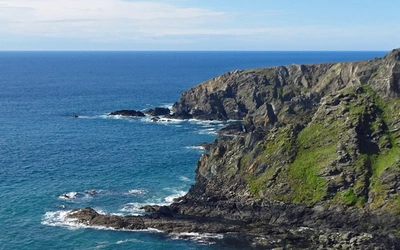
It's almost impossible to select the best bits — the north west coast is beautiful in so many ways. Some of my personal favourites are:
- The sweeping skies of the Solway Firth and Solway Coast National Landscape above Grune Point
- The cliffs and historic docks of Maryport and Whitehaven
- The views up the Duddon Estuary from Askam-in-Furness and Millom
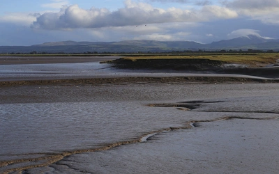
- The sweeping sands of Morecambe Bay, all the way from Barrow in Cumbria to Fleetwood in Lancashire
- The limestone cliffs and shores of the Arnside and Silverdale National Landscape
- The classic seaside experience of Blackpool
- The wild saltmarshes of the Ribble Estuary
- The Sefton dunes from Southport to Crosby
- The arts and music culture of Liverpool
- The Wirral peninsula's views to north Wales
What's open on the north west section?
The following stretches are currently open:
- Gretna (Scottish border) to Kirkandrews on Eden, Solway Firth
- Brownrigg, Solway Firth to Green Road, Duddon Estuary
- Walney Island, Barrow-in-Furness
- Tarleton, Lancashire to Burton Marsh (Welsh border)
Keep your eyes peeled for news: the stunning Furness peninsula in south Cumbria is likely to be the next stretch to open.
For areas not on the list above, the guidebook explains where access already exists and how to connect the rest.
How else can I check for diversions and updates?
The National Trails website includes an interactive map showing gaps and diversions on the open stretches.
Some specific locations to be aware of in the north west are listed below, along with key considerations for walking the not-yet-open stretches in Cumbria and Lancashire.
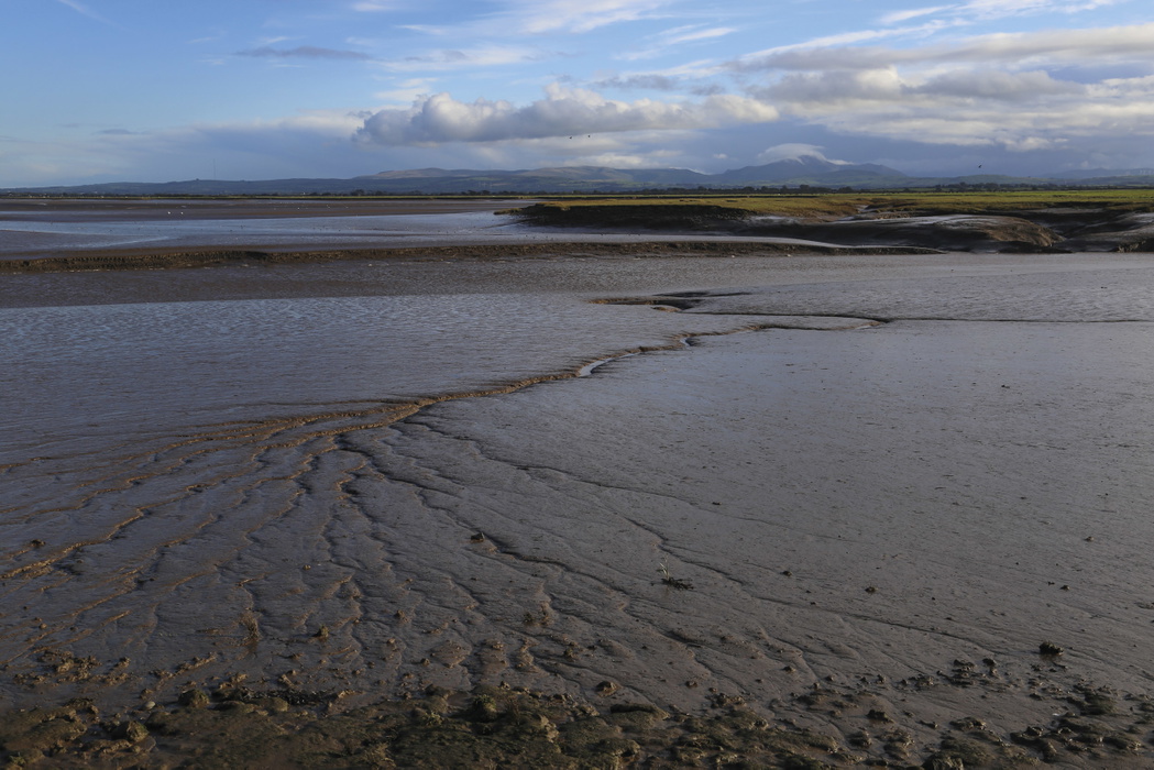
Estuary crossings
There are places where a train, bus or ferry should be used to cross estuaries, in the absence of connecting routes that meet National Trail or Coastal Access legislation standards.
- The Irt Estuary, north of Ravenglass, does not have a safe foot crossing. Use existing rights of way to cross the river at Drigg Holme packhorse bridge, or take the train from Drigg to Ravenglass if this is flooded.
- The Esk Estuary, south of Ravenglass, should not be crossed using the A595 north of Muncaster Castle and over the bridge — it's not safe. Use existing rights of way to Muncaster Castle, then take the X7 bus to Waberthwaite and find your way to the southern point of the Esk viaduct to resume your journey.
- Elsewhere, you'll need to take the train across the Duddon and Kent estuaries, and the ferry across the Wyre and Mersey.
Until the next stretches open
When the Furness peninsula opens, this will resolve the issue of walking on a dual carriageway on the former Cumbria Coastal Way (CCW) route, although it can be affected by a railway underpass that floods after heavy rain. Elsewhere, the CCW route over Cartmel Fell should still be followed until the KCIIIECP opens between Greenodd and Cark, likely in 2027.
In Lancashire, existing rights of way and the A59 (with care) can be used around the River Douglas until a connection is formalised. Other areas to be aware of are Middleton and Overton, south of Heysham, where access isn't fully connected yet and existing rights of way and highways need to be used (the Lancashire Coastal Way bypasses the peninsulas here entirely). Expect progress in 2027, along with the Cockerham to Pilling area. Elsewhere, existing access means you can essentially walk the route even if improvement works are still underway, with completion due late 2026 in the Blackpool and Ribble area.
Where should I report problems?
You can report issues on the trail directly to the council responsible for maintaining countryside access in that area, and also via the National Trails website.
Any more tips for walking the north west section?
The beauty of the north west coast is its adaptability. Good public transport links, including coastal railways, mean you can tailor your days out to your requirements, making it a great route for sampling in shorter day walks and sightseeing trips, or getting a taster of long-distance walking. Do check timetables in advance: summer is usually better, as more seasonal transport services are running and you'll have more daylight. Some areas can be explored from a single base on the coastal rail lines, so more affordable accommodation can be found in towns such as Whitehaven or Southport for a multi-day stay. Of course, elsewhere you're more likely to be supporting local businesses, which helps the local economy and the trail's long-term adaptability in turn.
The remoteness of some areas, especially on the Solway Firth bordering Scotland, in west Cumbria and around Morecambe Bay, also means that challenging long-distance walks in more rugged landscapes — high cliffs, marshes and limestone pavements with vast open views of the Irish Sea and the northern English fells — are a key attraction for more experienced walkers.
Plan ahead, take your camera and binoculars, dress for all weathers, and enjoy.
Walking the King Charles III England Coast Path: North West
NATIONAL TRAIL - Cumbria, Lancashire and Merseyside Coast
£17.95
Guidebook to walking the King Charles III England Coast Path: North West National Trail. Between Gretna and Chester, this 590km (367 mile) route explores the Cumbria, Lancashire and Merseyside coast in 27 stages and can be walked in 1 month. Includes 1:50,000 OS mapping.
More information