Why I wrote Via Ferratas of the French Alps

Cicerone author Richard Miller tells us about how to came to write the guidebook to Via Ferratas of the French Alps and what he loves about the area. Like so many Cicerone authors, frustrated by the lack of information available on an area, he soon found out that the only way have all the information needed to plan a trip was to write the book himself.

In 2004 I visited the Dolomites, with a copy of the Cicerone guidebook to the via ferratas in hand. I had a brilliant trip and found the activity to be an ideal balance of walking and climbing.
On subsequent trips, I tried a few of the routes in the French Alps on my return journey, but the lack of a thorough, up-to-date, source of information on French via ferratas made visiting them needlessly complex and time-consuming to research.
So the plan to produce a book to the best via ferratas of the French Alps was hatched. Plus, writing the book gave me the perfect excuse for exploring the wide variety of landscapes, flora and wildlife that exist in the area.
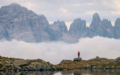
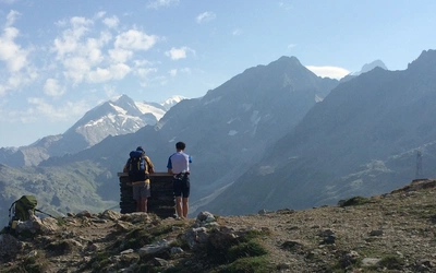
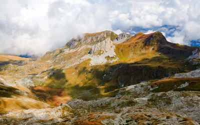
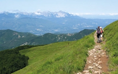
The sheer beauty and variety of the French Alps are compelling reasons to visit and explore some of the most spectacular scenery in Europe. Much visited for winter sports and mountaineering (and a favourite destination for skiers) the region also offers great opportunities for summer mountaineering activity, hill walking and now via ferratas. Experienced users of via ferratas, looking for a new region to explore, will find plenty of inspiration in this book. Alternatively, if you are planning a holiday in the area and want to try your hand at something different, the easier routes described here will provide a sound introduction to this increasingly popular activity.
Modern via ferratas originate in the Italian Dolomites and were first created in the late 19th century to assist early tourists with mountaineering ascents by replacing ropes with fixed cables and metal rungs. The system was then adopted in World War I to allow the conduct of warfare from the mountaintops by Italian and Austrian troops. In more recent times they have been rediscovered by Italian mountaineering enthusiasts and, in the late 1980s, the first routes were constructed in France.
The via ferratas of the Italian Dolomites can be quite different from the French routes. The former tend to be fixed mountaineering paths, most similar to summer mountaineering routes, whereas the latter are more likely to be sports routes, closer to scrambling or rock climbing. French via ferratas often seek out the steepest and most vertigo-inducing terrain, requiring a reasonable level of fitness and a decent head for heights.
While some of these routes may challenge even experienced rock climbers the majority should be within the reach of any strong hillwalker. The quality of the fixed protection found on the routes, in the form of cables, rungs and other more exotic elements, is normally very high. This standard is maintained by regular checks carried out under the direction of the local authority and ensures that, if properly used, you should have a safe and enjoyable excursion.
Bon courage!
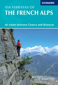
Via Ferratas of the French Alps
66 routes between Geneva and Briancon
£18.95
This guidebook covers 66 varied via ferratas in the French Alps. The routes are spread over six areas: Geneva and the Northern Alps, Chambéry, Tarentaise and Maurienne valleys, Grenoble and Briançon, amid the Mont Blanc, Vanoise and Queyras ranges. Difficulty ranges from easy, protected routes through to exposed, technical challenges.
More informationThe routes are divided into six chapters, each representing a distinct geographic area. However, this division is highly arbitrary and you should combine routes from different areas based on whatever criteria suits you best.
GENEVA AND THE NORTHERN ALPS
The area covered in this chapter encompasses the Chablais, Haute-Giffre, Bornes, Aravis and Beaufortain ranges within the Alps as well as the southern end of the Jura Massif, which is a separate range from the Alps. These ranges are more accessible than some of those of higher altitude to the east and south, and have a relatively long summer season. The 12 via ferratas described are spread out over a fairly wide area, so allow plenty of travel time if you intend to visit several of them. The routes are fairly representative of French via ferratas, being quite varied in both style and difficulty.
CHAMBÉRY
The small city of Chambéry, scenically located in a wide valley between two mountain ranges, is the capital of the Savoie department. The city centre is interesting historically, having been the capital of the Duchy of Savoy, which covered much of the western Alps until its annexation by France in 1860. All bar one of the routes in this chapter are situated fairly close to Chambéry, so it makes sense to set up a base in or near the city. There is a good range of accommodation within the city, but if you wish to camp you will need to head a little way out of it, to Le-Bourget-du-Lac, Aix-les-Bains or Lac d’Aiguebelette.
TARENTAISE
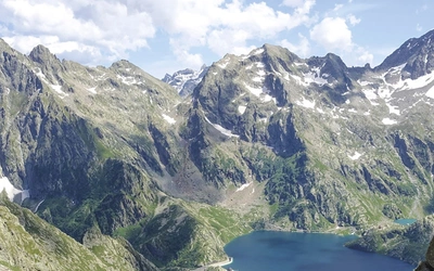
The Tarentaise Valley encompasses the upper reaches of the River Isère, from Moûtiers in the west to Val-d’Isère at its eastern extremity. All the routes in this chapter are situated just to the south of the valley, within the northern half of the Vanoise Massif, on the edge of the Vanoise National Park. This national park covers more than 50,000ha and boasts many extensively glaciated peaks. At a height of 3855m, Grande Casse is the tallest of these mountains and the highest point in France outside of the Mont Blanc and Écrins massifs.
The area is home to several world-famous ski resorts, some of which have constructed via ferratas to attract summer visitors. These include the highest route in the book (Route 22) as well as one of the most challenging (Route 27).
Most of the routes in this chapter are situated at a relatively high altitude and, depending on the weather, may be open only during the summer. With one notable exception (Route 27), all these via ferratas are sports routes and do not involve large amounts of rock contact. A number of the lower-grade routes are specifically designed for beginners.
MAURIENNE
The majority of routes in this chapter are located along the course of the valley of the River Arc. This valley is traditionally divided into two sectors, the Basse-Maurienne and the Haute-Maurienne. The former is relatively built-up and industrial and the latter, which borders the southern boundary of the Vanoise National Park, is sparsely populated and highly scenic. In addition to the Vanoise Massif, the surrounding mountains consist of the Mont-Cenis, Cerces and Arves ranges, which include many of the higher glaciated peaks of the Alps.
GRENOBLE
Grenoble is the largest city in the region and, closely hemmed in by mountains, is known as the capital of the Alps. With a population of 160,000 and a metropolitan area of 18 square kilometres, Grenoble has a decidedly big city feel. Most visitors to the Alps will probably prefer to treat Grenoble as a starting point rather than as a place to base themselves. If you do wish to spend some time here, there are plenty of tourist attractions, with La Bastille (see Route 41), being perhaps the most worthwhile.
Only one via ferrata is located in Grenoble itself, with one other to the north on the edge of the Chartreuse Massif. The remainder are situated to the east, in the region known as L’Oisans, which consists of the valley of the River Romanche and its tributaries. This marvellously scenic corridor runs between the Belledonne, Grandes Rousses and Arves massifs to the north and the Taillefer and Écrins massifs to the south. This latter mountain range contains some of the most impressive peaks and most famous mountaineering routes in the French Alps.
BRIANÇON
Briançon is the highest city in the European Union, although not the highest in the Alps – Davos, in Switzerland, has that honour. The small city is crammed between the Écrins, Cerces and Queyras mountain ranges at the confluence of the Durance and Guisane rivers. It is very much dominated by a number of fortifications, the most prominent of which protects the atmospheric old town. The more modern lower town has a variety of shops and cafés as well as the train and bus stations.
Briançon has no airport of its own. The most direct access to the city from the UK is via Turin airport (in Italy). From Turin, head west along the A32 motorway to Oulx and then south on the S24/N94 over the Col de Montgenèvre. Note that this route passes through the Susa Valley, which contains a number of fine Italian via ferratas. Alternatively, Briançon can be reached from Grenoble or the Maurienne via the D1091 and Col du Lautaret. If coming from the south, from Marseille or Nice for example, take the N94 along the Durance Valley. The only rail link with the city also comes from the south along the same valley. There is one long-distance bus to Briançon from Marseille via Gap. If travelling by car allow plenty of time for getting around Briançon, as it suffers from bad traffic jams during the summer.