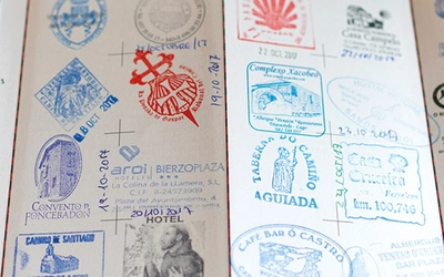
Highlights of the Camino del Norte

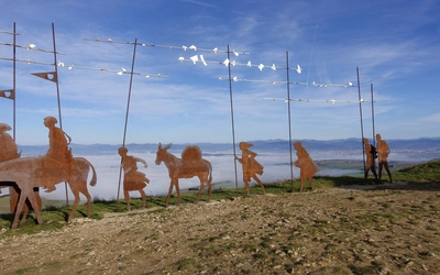
Spain’s Camino del Norte, a branch of the Camino de Santiago, offers stunning Iberian coastal and inland scenery. While some pilgrims find the inland pavement sections less appealing, the Norte preserves much of its historic medieval route, navigating around modern infrastructure and river crossings. Compared to other Camino routes, the Norte stands out for its wealth of alternative paths, offering flexible options for those willing to venture further. Here are five of Dave Whitson's highlights from multiple journeys along the coast.
The Camino del Norte and Camino Primitivo
To Santiago de Compostela and Finisterre from Irun or Oviedo
£18.95
Guidebook to walking the Camino del Norte and Camino Primitivo pilgrim routes to Santiago de Compostela in northwest Spain. The 820km Camino del Norte from Irún via Bilbao and Santander takes around 5 weeks to complete. The 355km Camino Primitivo takes about 2 weeks. Includes the Camino Finisterre from Santiago to the coast.
More information
Essential facts:
What? Popular variant of the Camino de Santiago pilgrimage
Where? Northern Spain
Start point? Irún
End point? Santiago de Compostela (via Bilbao and Santander) or Finisterre
Distance? 820km
Completion time? 5 weeks
Why this route? Passing through the Spanish regions of the Basque Country, Cantabria, Asturias, and Galicia, the northern caminos are popular enough to offer sufficient facilities, clear routes, and a community of pilgrims, without suffering the overcrowding of the Camino Frances.

Scenic Start from Irún to San Sebastián
The first stage of the Camino del Norte, linking Irún and San Sebastián, is one of the most marvellous walks on any pilgrimage. The sweeping views of the Bidasoa Valley begin at the Santuario de Guadalupe, just 4.5km from Irún, and then become ever more dramatic as you climb steeply up the ‘Alpinist’ track. However, instead of savouring those coastal vistas from a distance, it’s possible to engage them far more directly.
Head to neighbouring Hondarribia from Irún, giving yourself some time to enjoy the walled old town before descending to the waterfront. After passing a pair of ports, red/white waymarks for a GR appear and will continue to guide you through the rest of this walk. After passing the Higuer lighthouse and adjacent camping, you’re unlikely to see more than a handful of people over your 7km of pristine coastal walking. While largely returned to a state of nature today, sections of this were inhabited in the past, including the Roman port of Artzu, where very limited remains survive. At Cabo Bioznar, the route turns inland and a significant ascent follows, leading you back to the Camino del Norte, shortly after the ruined Fort of San Enrique. This is a much longer walk than the official route, spanning roughly 26km between Irún and Pasajes de San Juan, but it will get your pilgrimage off to a very memorable start!

Basque Coast Geopark's Geological Marvels
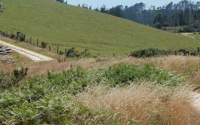
For most pilgrims on the Camino del Norte, the third stage involves a walk between Zarautz and Deba. It’s a beautiful jaunt through the Basque Country, with lovely seaside villages like Getaria and Zumaia sprinkled between rolling hills. From Zumaia, the official route winds inland, gently ascending towards the unremarkable village of Itziar, before gradually and then suddenly dropping into Deba. It’s a pleasant walk, to be sure, but it bypasses some of the most dramatic scenery of the Norte. Indeed, in this case the GR alternative is so clearly superior that we have made it the recommended approach in the Camino del Norte guidebook.
To follow this track, watch for red/white stripes calling for a right turn immediately before the village of Elorriaga. An enjoyable descent leads through a small pine copse and into the Basque Coast Geopark—a geological wonderland preserving 60 million years of history in its sedimentary rock layers, known as Flysch formations. Unlike most scenic detours, this route is actually marginally shorter than the official track (a whole 300m!), though it is certainly more strenuous.

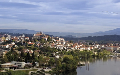
Beaches and Coastal Scenery Near Santander
Walking in and out of major cities on pilgrimage is rarely a pleasure. Urban sprawl means kilometre-after-kilometre of industrial districts and suburban neighbourhoods, sometimes interesting but always paved. Those drawn to pilgrimage for more aesthetic reasons are thus sometimes inclined to bypass the 14km-walk between Santander and Boo de Piélagos, taking the handy FEVE train instead.
Regardless of whether pilgrims walk or train through the official route, they risk missing the most beautiful parts of Santander and its surrounding countryside, all of which calls for a much more expansive sweep around the peninsula. While completely lacking waymarks, it is possible to follow a coastal route that wraps all the way around from the ferry dock in Santander to the Playa de Valdearenas, before cutting inland to Boo. This makes for a long day, spanning 32km. Still, it is filled with highlights—sunrise on the Playa del Sardinero in Santander, lunch at the Playa de la Virgen del Mar, with its iconic Bambara Tavern, perhaps an adventurous run out to the Isla del Castro if the tide accommodates, and then a final sandy splurge at Valdearenas.

Cueva del Pindal and Monastic Ruins
The neighbouring towns of Unquera and Colombres, separated by the Río Deva and marking the border between Cantabria and Asturias, are nice enough stops. The former is a handy place to resupply, while the latter has some lovely examples of Indianos-style architecture. For many pilgrims, though, this is a section passed through quickly, marked by a lot of pavement and too-close proximity to the N-634 highway.
However, a memorable detour lurks just across the Deva, before making the climb to Colombres. Instead, turn right just after crossing the bridge and watch for the GR’s red/white stripes soon after. While this 9km-loop doesn’t get you off-road as much as you might like, and it adds 6km to your day’s walk, it offers a notable payoff. The trail begins as you near the northern coast; soon after, the ruined church of Santa María de Tina, once part of a more extensive monastic complex, lurks in a densely-wooded grove. Continue westward to another shrine, devoted to San Emeterio, before following waymarks to the Cueva del Pindal. While overshadowed by more famous prehistoric caves in Santillana del Mar and Ribadesella, this is another opportunity to see ancient art—provided that you make your reservation in advance! Even if you lack a reservation, or the inclination to descend, it’s worth making the detour to the entrance, in order to admire the cave’s setting, overlooking a sheer cliff face above the bay.

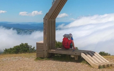
Asturian Views from Soto de Luiña to Cadavedo
When I first walked the stage linking Soto de Luiña and Cadavedo, I was intrigued by a waymark that pointed in two different directions shortly outside of Soto. The ever-loyal scallop shell that was labelled ‘Camino’ called for a left turn, while an accompanying scallop pointed straight ahead for a route marked ‘Ballotas'. Very insistent spray paint, however, exhorted pilgrims to take the direct approach. My Spanish guidebook reinforced that message. The local Amigos organisation hammered this home, explaining that the ‘Camino’ approach was overgrown, neglected, and almost certain to end in tears. I followed the ‘Ballotas’ approach. I don’t know if that indicates a character flaw or some newfound maturity.
In the years since then, though, significant work has been done to recover the ‘Camino’ route and I enjoyed it for the first time in 2016. I will be back! The walk begins with an extended ascent, continuing uphill almost constantly for the first 13km. All told, it’s not an exorbitant climb by any means, ascending to roughly 650m from near sea level, and the total elevation gain isn’t radically different from the ‘Ballotas’ approach. But it is constant, with another small peak always lurking behind what you thought was surely, definitely the last one. The reward for your exertions, though, is exceptional, as it feels like you can see the full length and width of Asturias from the top.
The Camino del Norte and Camino Primitivo
To Santiago de Compostela and Finisterre from Irun or Oviedo
£18.95
Guidebook to walking the Camino del Norte and Camino Primitivo pilgrim routes to Santiago de Compostela in northwest Spain. The 820km Camino del Norte from Irún via Bilbao and Santander takes around 5 weeks to complete. The 355km Camino Primitivo takes about 2 weeks. Includes the Camino Finisterre from Santiago to the coast.
More information